![](/images/other/stat-length.png)
![Excursión Senderismo Trilla - 66 TRILLA - ANSIGNAN aqueduc romain - ballade en Fenouillédes - Photo](https://media.geolcdn.com/t/1900/400/ext.pjpeg?maxdim=2&url=https%3A%2F%2Fservices.sitytrail.com%2FGeolivesWS%2FDownloadMedia.ashx%3FTrailID%3D468189%26Media%3D20150904183642.jpg)
66 TRILLA - ANSIGNAN aqueduc romain - ballade en Fenouillédes
jeff66
Usuario
![Longitud](/images/other/stat-length.png)
![Altitud máxima](https://static1.geolcdn.com/siteimages/upload/files/1508320355ic_sort_altitude_max_24dp.png)
![Desnivel positivo](https://static1.geolcdn.com/siteimages/upload/files/1508320355ic_sort_den_pos_24dp.png)
![Km-Effort](/images/other/stat-length.png)
![Altitud mínima](https://static1.geolcdn.com/siteimages/upload/files/1508320355ic_sort_altitude_min_24dp.png)
![Desnivel negativo](https://static1.geolcdn.com/siteimages/upload/files/1508320355ic_sort_den_neg_24dp.png)
![Boucle](https://static1.geolcdn.com/siteimages/upload/files/16400158638029165_repeat_loop_refresh_sync_direction_icon.png)
![Senderismo](https://static1.geolcdn.com/sitytour/trail-icons/101.png)
3h49
Dificultad : Difícil
![Escanee este código QR para abrir la excursión en la aplicación SityTrail](https://capi.geolives.com/qq0zvz2zws4bq2lad0pu/sitytour/trails/468189/qr.png?size=200)
Aplicación GPS de excursión GRATIS
A propósito
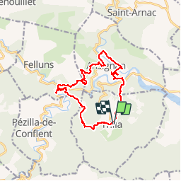
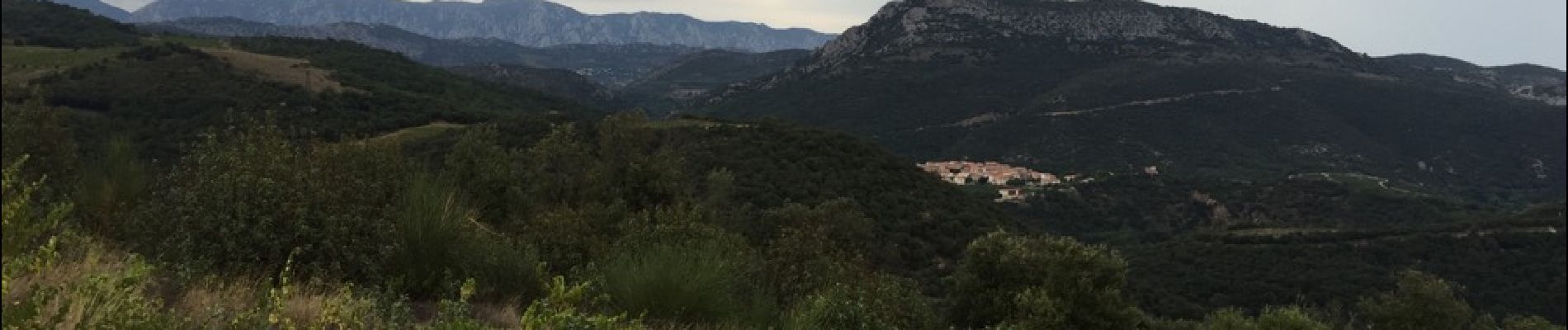
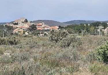
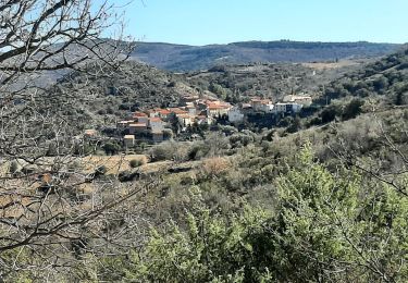
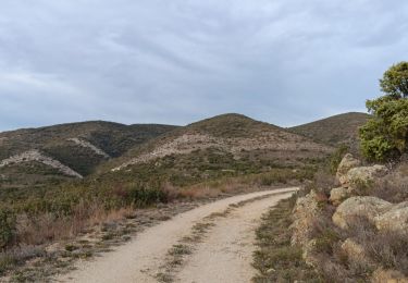
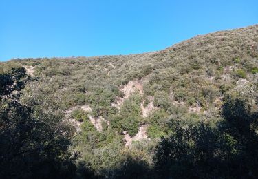
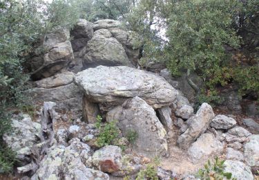
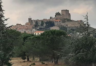
Ruta Senderismo de 17,6 km a descubrir en Occitania, Pirineos Orientales, Trilla. Esta ruta ha sido propuesta por jeff66.
Descripción
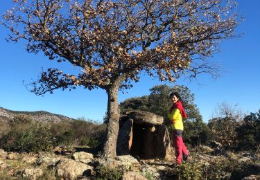
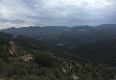
66 TRILLA - place de l'église et de la mairie, anc. Cave coop. - balisage sang et or - la llèbre - Sentier descendant en sous-bois - pont sur la Desix, puis D9 - La payssère de la Figuerasse - ANSIGNAN - piste DFCI F53 - Coudomines - l'AGLY - Sentier des oiseaux - la guarrigue de Roque - aqueduc romain - cave Coop - babaloo café - piste DFCI F52 - vue sur TRILLA - Les Albas - D619 - rivière la Desix Camounxio - Roc de terre Blanco - TRILLA - place de la cité, rues de la fontaine, du Pabat, des troènes, du lavoir, mairie
Localización
Comentarios
Excursiones cerca
![Excursión Senderismo Caramany - CARAMANY 66 - balcons retenue sur l'Agly - Photo](https://media.geolcdn.com/t/375/260/ext.jpg?maxdim=2&url=https%3A%2F%2Fstatic1.geolcdn.com%2Fsiteimages%2Fupload%2Ffiles%2F1553511878bg_sport_marche.png)
![Senderismo Senderismo](https://static1.geolcdn.com/sitytour/trail-icons/101.png)
Senderismo
![](/images/other/stat-length.png)
![](https://static1.geolcdn.com/siteimages/upload/files/16400158638029165_repeat_loop_refresh_sync_direction_icon.png)
![Excursión Senderismo Montalba-le-Château - Montauban le château corral grandes or - Photo](https://media.geolcdn.com/t/375/260/4e0c3970-675f-4ac8-9536-c3e289d07d9a.jpg&format=jpg&maxdim=2)
![Senderismo Senderismo](https://static1.geolcdn.com/sitytour/trail-icons/101.png)
Senderismo
![](/images/other/stat-length.png)
![](https://static1.geolcdn.com/siteimages/upload/files/16400158638029165_repeat_loop_refresh_sync_direction_icon.png)
![Excursión Senderismo Caramany - caramany - Photo](https://media.geolcdn.com/t/375/260/a6e7a0ea-152c-4eff-9a23-91b03d26cf6d.jpg&format=jpg&maxdim=2)
![Senderismo Senderismo](https://static1.geolcdn.com/sitytour/trail-icons/101.png)
Senderismo
![](/images/other/stat-length.png)
![](https://static1.geolcdn.com/siteimages/upload/files/16400158638029165_repeat_loop_refresh_sync_direction_icon.png)
![Excursión Senderismo Trévillach - Séquière depuis le col des Auzines - Photo](https://media.geolcdn.com/t/375/260/39e63d62-b4cc-4561-86e2-4b8e2910e465.jpg&format=jpg&maxdim=2)
![Senderismo Senderismo](https://static1.geolcdn.com/sitytour/trail-icons/101.png)
Senderismo
![](/images/other/stat-length.png)
![](https://static1.geolcdn.com/siteimages/upload/files/16400158638029165_repeat_loop_refresh_sync_direction_icon.png)
![Excursión Senderismo Ansignan - sentier des dolmens en fenouillèdes - Photo](https://media.geolcdn.com/t/375/260/0846838b-f16b-4aa4-86fe-00f3a15fd2d6.jpg&format=jpg&maxdim=2)
![Senderismo Senderismo](https://static1.geolcdn.com/sitytour/trail-icons/101.png)
Senderismo
![](/images/other/stat-length.png)
![](https://static1.geolcdn.com/siteimages/upload/files/16400158638029165_repeat_loop_refresh_sync_direction_icon.png)
![Excursión Senderismo Feilluns - track - Photo](https://media.geolcdn.com/t/375/260/64946339-3878-4e98-9375-f37dd795d67a.jpg&format=jpg&maxdim=2)
![Senderismo Senderismo](https://static1.geolcdn.com/sitytour/trail-icons/101.png)
Senderismo
![](/images/other/stat-length.png)
![](https://static1.geolcdn.com/siteimages/upload/files/16400158638029165_repeat_loop_refresh_sync_direction_icon.png)
![Excursión Senderismo Montalba-le-Château - montant a - Photo](https://media.geolcdn.com/t/375/260/bab4a258-ec8b-477d-a8cf-388a6f2cb82a.jpg&format=jpg&maxdim=2)
![Senderismo Senderismo](https://static1.geolcdn.com/sitytour/trail-icons/101.png)
Senderismo
![](/images/other/stat-length.png)
![](https://static1.geolcdn.com/siteimages/upload/files/16400158638029165_repeat_loop_refresh_sync_direction_icon.png)
![Excursión Senderismo Ansignan - 20230105 Ansignan - Photo](https://media.geolcdn.com/t/375/260/488937c0-a91f-49ed-8a64-a7a477dcda83.jpg&format=jpg&maxdim=2)
![Senderismo Senderismo](https://static1.geolcdn.com/sitytour/trail-icons/101.png)
Senderismo
![](/images/other/stat-length.png)
![](https://static1.geolcdn.com/siteimages/upload/files/16400158638029165_repeat_loop_refresh_sync_direction_icon.png)
![Excursión Senderismo Lansac - 66 LANSAC - boucle, tour et Roc de LANSAC - Photo](https://media.geolcdn.com/t/375/260/ext.jpg?maxdim=2&url=https%3A%2F%2Fservices.sitytrail.com%2FGeolivesWS%2FDownloadMedia.ashx%3FTrailID%3D477866%26Media%3D20151001151431.jpg)
![Senderismo Senderismo](https://static1.geolcdn.com/sitytour/trail-icons/101.png)
Senderismo
![](/images/other/stat-length.png)
![](https://static1.geolcdn.com/siteimages/upload/files/16400158638029165_repeat_loop_refresh_sync_direction_icon.png)
Simple,efficace à conseiller.