![](/images/other/stat-length.png)
![Excursión Senderismo Melleville - Melleville, Gomare - Photo](https://media.geolcdn.com/t/1900/400/ext.pjpeg?maxdim=2&url=https%3A%2F%2Fservices.sitytrail.com%2FGeolivesWS%2FDownloadMedia.ashx%3FTrailID%3D452418%26Media%3Dfix__20150731170057.jpg)
Melleville, Gomare
Brindille
Usuario
![Longitud](/images/other/stat-length.png)
Longitud
13,7 km
![Altitud máxima](https://static1.geolcdn.com/siteimages/upload/files/1508320355ic_sort_altitude_max_24dp.png)
Altitud máxima
172 m
![Desnivel positivo](https://static1.geolcdn.com/siteimages/upload/files/1508320355ic_sort_den_pos_24dp.png)
Desnivel positivo
257 m
![Km-Effort](/images/other/stat-length.png)
Km-Effort
17,1 km
![Altitud mínima](https://static1.geolcdn.com/siteimages/upload/files/1508320355ic_sort_altitude_min_24dp.png)
Altitud mínima
46 m
![Desnivel negativo](https://static1.geolcdn.com/siteimages/upload/files/1508320355ic_sort_den_neg_24dp.png)
Desnivel negativo
256 m
![Boucle](https://static1.geolcdn.com/siteimages/upload/files/16400158638029165_repeat_loop_refresh_sync_direction_icon.png)
Boucle
Sí
Fecha de creación :
2016-03-09 00:00:00.0
Última modificación :
2022-07-15 15:51:25.567
![Senderismo](https://static1.geolcdn.com/sitytour/trail-icons/101.png)
3h17
Dificultad : Desconocido
![Escanee este código QR para abrir la excursión en la aplicación SityTrail](https://capi.geolives.com/qq0zvz2zws4bq2lad0pu/sitytour/trails/452418/qr.png?size=200)
Aplicación GPS de excursión GRATIS
A propósito
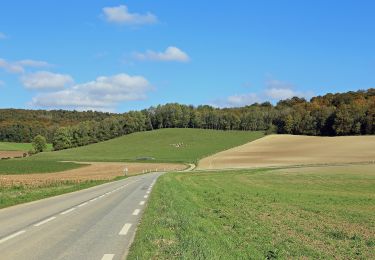
Ruta Senderismo de 13,7 km a descubrir en Normandía, Sena-Marítimo, Melleville. Esta ruta ha sido propuesta por Brindille.
Descripción
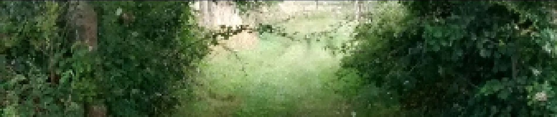
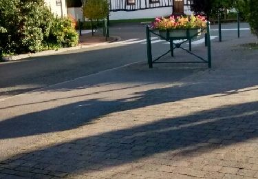
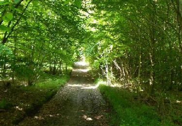
Départ de la place de l'église de Melleville, laisser l'église derrière et traverser la place en direction de la petite route qui mène à Millebosc
Localización
País:
France
Región :
Normandía
Departamento/provincia :
Sena-Marítimo
Municipio :
Melleville
Localidad:
Unknown
Salida:(Dec)
Salida:(UTM)
390483 ; 5534958 (31U) N.
Comentarios
Excursiones cerca
![Excursión A pie Grandcourt - A la Découverte de la Forêt d'Eu - Photo](https://media.geolcdn.com/t/375/260/a6eb9e3b-96ab-4ee5-b8c7-c252cb811991.jpeg&format=jpg&maxdim=2)
![A pie A pie](https://static1.geolcdn.com/sitytour/trail-icons/100.png)
A la Découverte de la Forêt d'Eu
A pie
Fácil
Grandcourt,
Normandía,
Sena-Marítimo,
France
![](/images/other/stat-length.png)
9,3 km | 12,2 km-effort
2h 45min
![](https://static1.geolcdn.com/siteimages/upload/files/16400158638029165_repeat_loop_refresh_sync_direction_icon.png)
No
![Excursión Senderismo Monchy-sur-Eu - hêtre des princes II - Photo](https://media.geolcdn.com/t/375/260/ext.jpg?maxdim=2&url=https%3A%2F%2Fservices.sitytrail.com%2FGeolivesWS%2FDownloadMedia.ashx%3FTrailID%3D488083%26Media%3Dfix__20151031170306.jpg)
![Senderismo Senderismo](https://static1.geolcdn.com/sitytour/trail-icons/101.png)
hêtre des princes II
Senderismo
Fácil
Monchy-sur-Eu,
Normandía,
Sena-Marítimo,
France
![](/images/other/stat-length.png)
9,3 km | 12,1 km-effort
2h 34min
![](https://static1.geolcdn.com/siteimages/upload/files/16400158638029165_repeat_loop_refresh_sync_direction_icon.png)
Sí
![Excursión Senderismo Longroy - longroy - Photo](https://media.geolcdn.com/t/375/260/ext.jpg?maxdim=2&url=https%3A%2F%2Fservices.sitytrail.com%2FGeolivesWS%2FDownloadMedia.ashx%3FTrailID%3D473480%26Media%3Dfix__20150919181325.jpg)
![Senderismo Senderismo](https://static1.geolcdn.com/sitytour/trail-icons/101.png)
longroy
Senderismo
Fácil
Longroy,
Normandía,
Sena-Marítimo,
France
![](/images/other/stat-length.png)
10,3 km | 12,7 km-effort
2h 38min
![](https://static1.geolcdn.com/siteimages/upload/files/16400158638029165_repeat_loop_refresh_sync_direction_icon.png)
No
![Excursión Senderismo Monchy-sur-Eu - poteau hêtre des princes 2 - Photo](https://media.geolcdn.com/t/375/260/ext.jpg?maxdim=2&url=https%3A%2F%2Fservices.sitytrail.com%2FGeolivesWS%2FDownloadMedia.ashx%3FTrailID%3D468401%26Media%3Dfix__20150905162721.jpg)
![Senderismo Senderismo](https://static1.geolcdn.com/sitytour/trail-icons/101.png)
poteau hêtre des princes 2
Senderismo
Fácil
Monchy-sur-Eu,
Normandía,
Sena-Marítimo,
France
![](/images/other/stat-length.png)
6,8 km | 8,3 km-effort
2h 2min
![](https://static1.geolcdn.com/siteimages/upload/files/16400158638029165_repeat_loop_refresh_sync_direction_icon.png)
Sí
![Excursión Senderismo Monchy-sur-Eu - poteau hêtre des princes 2 - Photo](https://media.geolcdn.com/t/375/260/ext.jpg?maxdim=2&url=https%3A%2F%2Fservices.sitytrail.com%2FGeolivesWS%2FDownloadMedia.ashx%3FTrailID%3D468389%26Media%3Dfix__20150905162721.jpg)
![Senderismo Senderismo](https://static1.geolcdn.com/sitytour/trail-icons/101.png)
poteau hêtre des princes 2
Senderismo
Fácil
Monchy-sur-Eu,
Normandía,
Sena-Marítimo,
France
![](/images/other/stat-length.png)
6,8 km | 8,3 km-effort
2h 2min
![](https://static1.geolcdn.com/siteimages/upload/files/16400158638029165_repeat_loop_refresh_sync_direction_icon.png)
Sí
![Excursión Senderismo Melleville - Melleville, Gomare - Photo](https://media.geolcdn.com/t/375/260/ext.jpg?maxdim=2&url=https%3A%2F%2Fservices.sitytrail.com%2FGeolivesWS%2FDownloadMedia.ashx%3FTrailID%3D452425%26Media%3Dfix__20150731182734.jpg)
![Senderismo Senderismo](https://static1.geolcdn.com/sitytour/trail-icons/101.png)
Melleville, Gomare
Senderismo
Muy fácil
Melleville,
Normandía,
Sena-Marítimo,
France
![](/images/other/stat-length.png)
12,6 km | 15,3 km-effort
3h 17min
![](https://static1.geolcdn.com/siteimages/upload/files/16400158638029165_repeat_loop_refresh_sync_direction_icon.png)
Sí
![Excursión Caballo Dancourt - Circuit de la bonne Entente (N°2) - Dancourt - Photo](https://media.geolcdn.com/t/375/260/ext.jpg?maxdim=2&url=https%3A%2F%2Fservices.sitytrail.com%2FGeolivesWS%2FDownloadMedia.ashx%3FTrailID%3D215062%26Media%3D15634_5.jpg)
![Caballo Caballo](https://static1.geolcdn.com/sitytour/trail-icons/300.png)
Circuit de la bonne Entente (N°2) - Dancourt
Caballo
Fácil
Dancourt,
Normandía,
Sena-Marítimo,
France
![](/images/other/stat-length.png)
3,6 km | 4,5 km-effort
34min
![](https://static1.geolcdn.com/siteimages/upload/files/16400158638029165_repeat_loop_refresh_sync_direction_icon.png)
Sí
![Excursión Bici de montaña Dancourt - Circuit de la bonne Entente (N°2) - Dancourt - Photo](https://media.geolcdn.com/t/375/260/ext.jpg?maxdim=2&url=https%3A%2F%2Fservices.sitytrail.com%2FGeolivesWS%2FDownloadMedia.ashx%3FTrailID%3D215061%26Media%3D15634_5.jpg)
![Bici de montaña Bici de montaña](https://static1.geolcdn.com/sitytour/trail-icons/202.png)
Circuit de la bonne Entente (N°2) - Dancourt
Bici de montaña
Fácil
Dancourt,
Normandía,
Sena-Marítimo,
France
![](/images/other/stat-length.png)
3,6 km | 4,5 km-effort
19min
![](https://static1.geolcdn.com/siteimages/upload/files/16400158638029165_repeat_loop_refresh_sync_direction_icon.png)
Sí
![Excursión Senderismo Dancourt - Circuit de la bonne Entente (N°2) - Dancourt - Photo](https://media.geolcdn.com/t/375/260/ext.jpg?maxdim=2&url=https%3A%2F%2Fservices.sitytrail.com%2FGeolivesWS%2FDownloadMedia.ashx%3FTrailID%3D215060%26Media%3D15634_5.jpg)
![Senderismo Senderismo](https://static1.geolcdn.com/sitytour/trail-icons/101.png)
Circuit de la bonne Entente (N°2) - Dancourt
Senderismo
Fácil
Dancourt,
Normandía,
Sena-Marítimo,
France
![](/images/other/stat-length.png)
3,6 km | 4,5 km-effort
55min
![](https://static1.geolcdn.com/siteimages/upload/files/16400158638029165_repeat_loop_refresh_sync_direction_icon.png)
Sí