![](/images/other/stat-length.png)
![Excursión A pie Unknown - Od Knina do Brezovca - Photo](https://media.geolcdn.com/t/1900/400/093a6e50-0cba-4ea6-8f57-cdfc99edf942.jpeg&format=pjpeg&maxdim=2)
Od Knina do Brezovca
SityTrail - itinéraires balisés pédestres
Tous les sentiers balisés d’Europe GUIDE+
![Longitud](/images/other/stat-length.png)
![Altitud máxima](https://static1.geolcdn.com/siteimages/upload/files/1508320355ic_sort_altitude_max_24dp.png)
![Desnivel positivo](https://static1.geolcdn.com/siteimages/upload/files/1508320355ic_sort_den_pos_24dp.png)
![Km-Effort](/images/other/stat-length.png)
![Altitud mínima](https://static1.geolcdn.com/siteimages/upload/files/1508320355ic_sort_altitude_min_24dp.png)
![Desnivel negativo](https://static1.geolcdn.com/siteimages/upload/files/1508320355ic_sort_den_neg_24dp.png)
![Boucle](https://static1.geolcdn.com/siteimages/upload/files/16400158638029165_repeat_loop_refresh_sync_direction_icon.png)
![A pie](https://static1.geolcdn.com/sitytour/trail-icons/100.png)
5h59
Dificultad : Medio
![Escanee este código QR para abrir la excursión en la aplicación SityTrail](https://capi.geolives.com/qq0zvz2zws4bq2lad0pu/sitytour/trails/4346149/qr.png?size=200)
Aplicación GPS de excursión GRATIS
A propósito
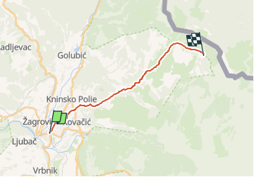
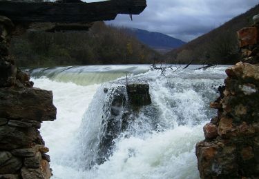
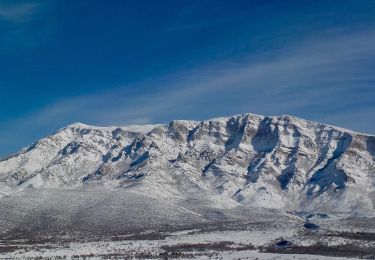
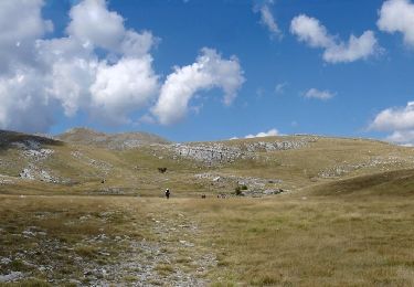
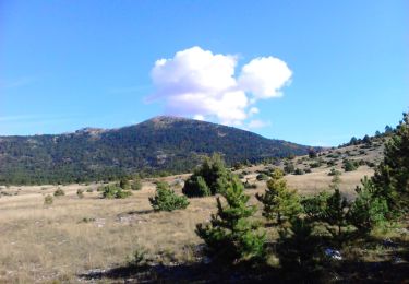
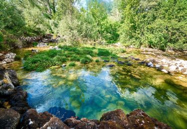
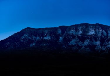
Ruta A pie de 16,3 km a descubrir en Desconocido, Šibensko-kninska županija. Esta ruta ha sido propuesta por SityTrail - itinéraires balisés pédestres.
Descripción
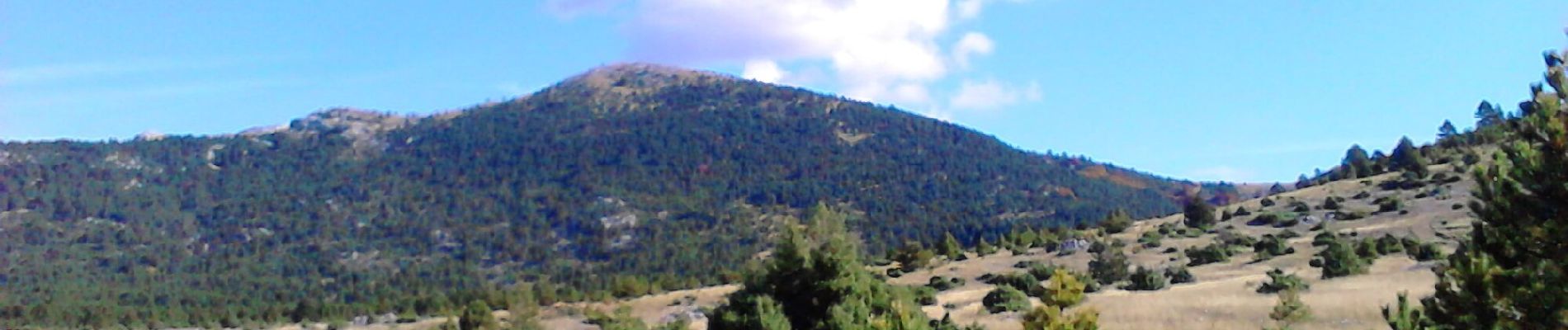
Dinara is the highest mountain in Croatia, and one of the most picturesque mountains in Dalmatia and in the Dalmatian hinterland. Even though it is not particularly high – not even exceeding the 2000-meter mark – it still represents one of the most impressive Croatian mountains with its shape ...
Sitio web: https://trail.viadinarica.com/tour/hiking/15967323/
Localización
Comentarios
Excursiones cerca
![Excursión A pie - Poučno-pješačka staza: Stinice – Roški slap – Oziđana pećina - Photo](https://media.geolcdn.com/t/375/260/b6990a43-e1bf-4ef4-a38f-bc0e9b07e7fa.jpeg&format=jpg&maxdim=2)
![A pie A pie](https://static1.geolcdn.com/sitytour/trail-icons/100.png)
A pie
![](/images/other/stat-length.png)
![](https://static1.geolcdn.com/siteimages/upload/files/16400158638029165_repeat_loop_refresh_sync_direction_icon.png)
![Excursión A pie - Put preko vrha Dinare - Photo](https://media.geolcdn.com/t/375/260/d761895b-49a7-4b3b-8818-06c288ba4289.jpeg&format=jpg&maxdim=2)
![A pie A pie](https://static1.geolcdn.com/sitytour/trail-icons/100.png)
A pie
![](/images/other/stat-length.png)
![](https://static1.geolcdn.com/siteimages/upload/files/16400158638029165_repeat_loop_refresh_sync_direction_icon.png)
![Excursión A pie - yogurt staza Mirkovići-Dinara - Photo](https://media.geolcdn.com/t/375/260/29a1aecf-36fc-498e-8743-c859be60c896.jpeg&format=jpg&maxdim=2)
![A pie A pie](https://static1.geolcdn.com/sitytour/trail-icons/100.png)
A pie
![](/images/other/stat-length.png)
![](https://static1.geolcdn.com/siteimages/upload/files/16400158638029165_repeat_loop_refresh_sync_direction_icon.png)
![Excursión A pie - planinarska staza Mirkovići - Brezovac - Photo](https://media.geolcdn.com/t/375/260/6a972028-7138-496c-8b39-a194eaf01a7d.jpeg&format=jpg&maxdim=2)
![A pie A pie](https://static1.geolcdn.com/sitytour/trail-icons/100.png)
A pie
![](/images/other/stat-length.png)
![](https://static1.geolcdn.com/siteimages/upload/files/16400158638029165_repeat_loop_refresh_sync_direction_icon.png)
![Excursión A pie - Glavaš-Dinara_brezovac - Photo](https://media.geolcdn.com/t/375/260/70028265-24e3-4592-9650-7b9a1d72b553.jpeg&format=jpg&maxdim=2)
![A pie A pie](https://static1.geolcdn.com/sitytour/trail-icons/100.png)
A pie
![](/images/other/stat-length.png)
![](https://static1.geolcdn.com/siteimages/upload/files/16400158638029165_repeat_loop_refresh_sync_direction_icon.png)
![Excursión A pie - Guge-Brezovac - Photo](https://media.geolcdn.com/t/375/260/093a6e50-0cba-4ea6-8f57-cdfc99edf942.jpeg&format=jpg&maxdim=2)
![A pie A pie](https://static1.geolcdn.com/sitytour/trail-icons/100.png)
A pie
![](/images/other/stat-length.png)
![](https://static1.geolcdn.com/siteimages/upload/files/16400158638029165_repeat_loop_refresh_sync_direction_icon.png)
![Excursión A pie - Cetina put Oluje - Photo](https://media.geolcdn.com/t/375/260/92a1d8af-a831-4030-94fd-b4e7c791cd61.jpeg&format=jpg&maxdim=2)
![A pie A pie](https://static1.geolcdn.com/sitytour/trail-icons/100.png)
A pie
![](/images/other/stat-length.png)
![](https://static1.geolcdn.com/siteimages/upload/files/16400158638029165_repeat_loop_refresh_sync_direction_icon.png)
![Excursión A pie - Glavaš-Dinara - Photo](https://media.geolcdn.com/t/375/260/b5ccdf9b-e704-4365-8026-b13b6609237c.jpeg&format=jpg&maxdim=2)
![A pie A pie](https://static1.geolcdn.com/sitytour/trail-icons/100.png)
A pie
![](/images/other/stat-length.png)
![](https://static1.geolcdn.com/siteimages/upload/files/16400158638029165_repeat_loop_refresh_sync_direction_icon.png)
![Excursión A pie - Martinove košare-Leurdovac-Dinara - Photo](https://media.geolcdn.com/t/375/260/b5ccdf9b-e704-4365-8026-b13b6609237c.jpeg&format=jpg&maxdim=2)
![A pie A pie](https://static1.geolcdn.com/sitytour/trail-icons/100.png)
A pie
![](/images/other/stat-length.png)
![](https://static1.geolcdn.com/siteimages/upload/files/16400158638029165_repeat_loop_refresh_sync_direction_icon.png)