![](/images/other/stat-length.png)
![Excursión A pie Unknown - Južni Velebit I - do Šugarske dulibe - Photo](https://media.geolcdn.com/t/1900/400/e581856c-b489-4638-92cc-7c47b1c2e94e.jpeg&format=pjpeg&maxdim=2)
Južni Velebit I - do Šugarske dulibe
SityTrail - itinéraires balisés pédestres
Tous les sentiers balisés d’Europe GUIDE+
![Longitud](/images/other/stat-length.png)
![Altitud máxima](https://static1.geolcdn.com/siteimages/upload/files/1508320355ic_sort_altitude_max_24dp.png)
![Desnivel positivo](https://static1.geolcdn.com/siteimages/upload/files/1508320355ic_sort_den_pos_24dp.png)
![Km-Effort](/images/other/stat-length.png)
![Altitud mínima](https://static1.geolcdn.com/siteimages/upload/files/1508320355ic_sort_altitude_min_24dp.png)
![Desnivel negativo](https://static1.geolcdn.com/siteimages/upload/files/1508320355ic_sort_den_neg_24dp.png)
![Boucle](https://static1.geolcdn.com/siteimages/upload/files/16400158638029165_repeat_loop_refresh_sync_direction_icon.png)
![A pie](https://static1.geolcdn.com/sitytour/trail-icons/100.png)
6h08
Dificultad : Medio
![Escanee este código QR para abrir la excursión en la aplicación SityTrail](https://capi.geolives.com/qq0zvz2zws4bq2lad0pu/sitytour/trails/4346141/qr.png?size=200)
Aplicación GPS de excursión GRATIS
A propósito
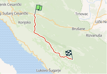
Ruta A pie de 14 km a descubrir en Desconocido, Ličko-senjska županija. Esta ruta ha sido propuesta por SityTrail - itinéraires balisés pédestres.
Descripción
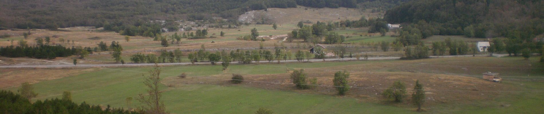
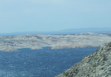
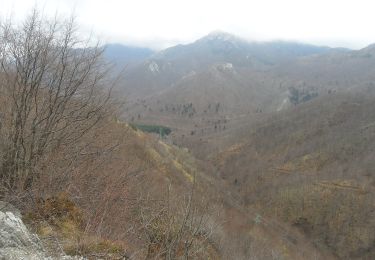
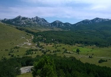
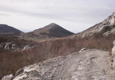
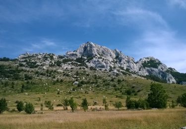
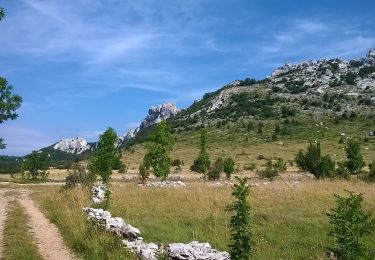
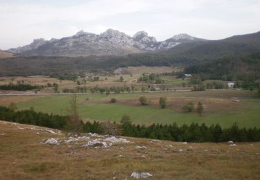
Even though Velebit is at its narrowest in its southern section, this is also the area of its highest peaks. When viewed from the Zagreb-Split Motorway or from the peak of the hill of Zir, southern Velebit leaves a special impression, as it resembles an immense wall from that side. The littoral ...
Sitio web: https://trail.viadinarica.com/tour/hiking/15966510/
Localización
Comentarios
Excursiones cerca
![Excursión A pie - Dabarska Kosa - Photo](https://media.geolcdn.com/t/375/260/935528d5-1608-4982-8fa2-359bf773c124.jpeg&format=jpg&maxdim=2)
![A pie A pie](https://static1.geolcdn.com/sitytour/trail-icons/100.png)
A pie
![](/images/other/stat-length.png)
![](https://static1.geolcdn.com/siteimages/upload/files/16400158638029165_repeat_loop_refresh_sync_direction_icon.png)
![Excursión A pie - Piskovita kosica - Baške oštarije - Photo](https://media.geolcdn.com/t/375/260/83e9b1cb-79f3-42b0-bea4-9f53368bf386.jpeg&format=jpg&maxdim=2)
![A pie A pie](https://static1.geolcdn.com/sitytour/trail-icons/100.png)
A pie
![](/images/other/stat-length.png)
![](https://static1.geolcdn.com/siteimages/upload/files/16400158638029165_repeat_loop_refresh_sync_direction_icon.png)
![Excursión A pie - Cesta za Karlobag - Konjsko - Jurkove doline - Photo](https://media.geolcdn.com/t/375/260/b747053d-9837-44f1-930e-6197a8d10224.jpeg&format=jpg&maxdim=2)
![A pie A pie](https://static1.geolcdn.com/sitytour/trail-icons/100.png)
A pie
![](/images/other/stat-length.png)
![](https://static1.geolcdn.com/siteimages/upload/files/16400158638029165_repeat_loop_refresh_sync_direction_icon.png)
![Excursión A pie - Ljubičko brdo iz Baških Oštarija - Photo](https://media.geolcdn.com/t/375/260/d4effd8c-c83b-4447-ba99-a051c4be96c1.jpeg&format=jpg&maxdim=2)
![A pie A pie](https://static1.geolcdn.com/sitytour/trail-icons/100.png)
A pie
![](/images/other/stat-length.png)
![](https://static1.geolcdn.com/siteimages/upload/files/16400158638029165_repeat_loop_refresh_sync_direction_icon.png)
![Excursión A pie - Ravni dabar do Alaginca preko Crnog dabra - Photo](https://media.geolcdn.com/t/375/260/44308a08-29b0-4c7d-91b3-8b16213eb85c.jpeg&format=jpg&maxdim=2)
![A pie A pie](https://static1.geolcdn.com/sitytour/trail-icons/100.png)
A pie
![](/images/other/stat-length.png)
![](https://static1.geolcdn.com/siteimages/upload/files/16400158638029165_repeat_loop_refresh_sync_direction_icon.png)
![Excursión A pie - Kiza od Baških Oštarija - Photo](https://media.geolcdn.com/t/375/260/d4effd8c-c83b-4447-ba99-a051c4be96c1.jpeg&format=jpg&maxdim=2)
![A pie A pie](https://static1.geolcdn.com/sitytour/trail-icons/100.png)
A pie
![](/images/other/stat-length.png)
![](https://static1.geolcdn.com/siteimages/upload/files/16400158638029165_repeat_loop_refresh_sync_direction_icon.png)
![Excursión A pie - Grebenski put kroz Dabarske kukove - Photo](https://media.geolcdn.com/t/375/260/6078a130-33f5-43a0-ba0a-a1b94e9a4dfb.jpeg&format=jpg&maxdim=2)
![A pie A pie](https://static1.geolcdn.com/sitytour/trail-icons/100.png)
A pie
![](/images/other/stat-length.png)
![](https://static1.geolcdn.com/siteimages/upload/files/16400158638029165_repeat_loop_refresh_sync_direction_icon.png)
![Excursión A pie - Ždrilo - Sadikovac - Photo](https://media.geolcdn.com/t/375/260/83e9b1cb-79f3-42b0-bea4-9f53368bf386.jpeg&format=jpg&maxdim=2)
![A pie A pie](https://static1.geolcdn.com/sitytour/trail-icons/100.png)
A pie
![](/images/other/stat-length.png)
![](https://static1.geolcdn.com/siteimages/upload/files/16400158638029165_repeat_loop_refresh_sync_direction_icon.png)
![Excursión A pie - Baške Oštarije - Veliki Sadikovac - Photo](https://media.geolcdn.com/t/375/260/e581856c-b489-4638-92cc-7c47b1c2e94e.jpeg&format=jpg&maxdim=2)
![A pie A pie](https://static1.geolcdn.com/sitytour/trail-icons/100.png)
A pie
![](/images/other/stat-length.png)
![](https://static1.geolcdn.com/siteimages/upload/files/16400158638029165_repeat_loop_refresh_sync_direction_icon.png)