![](/images/other/stat-length.png)
![Excursión A pie Sohland an der Spree - CZ-This is originaly german learning path, not czech. It has german and czech text on the infotables. - Photo](https://media.geolcdn.com/t/1900/400/ca963332-302c-4d27-8da8-131868543ed8.jpeg&format=pjpeg&maxdim=2)
CZ-This is originaly german learning path, not czech. It has german and czech text on the infotables.
SityTrail - itinéraires balisés pédestres
Tous les sentiers balisés d’Europe GUIDE+
![Longitud](/images/other/stat-length.png)
Longitud
7,3 km
![Altitud máxima](https://static1.geolcdn.com/siteimages/upload/files/1508320355ic_sort_altitude_max_24dp.png)
Altitud máxima
492 m
![Desnivel positivo](https://static1.geolcdn.com/siteimages/upload/files/1508320355ic_sort_den_pos_24dp.png)
Desnivel positivo
296 m
![Km-Effort](/images/other/stat-length.png)
Km-Effort
10,7 km
![Altitud mínima](https://static1.geolcdn.com/siteimages/upload/files/1508320355ic_sort_altitude_min_24dp.png)
Altitud mínima
328 m
![Desnivel negativo](https://static1.geolcdn.com/siteimages/upload/files/1508320355ic_sort_den_neg_24dp.png)
Desnivel negativo
145 m
![Boucle](https://static1.geolcdn.com/siteimages/upload/files/16400158638029165_repeat_loop_refresh_sync_direction_icon.png)
Boucle
No
Baliza
Fecha de creación :
2025-02-07 06:30:50.937
Última modificación :
2025-02-07 06:30:50.937
![A pie](https://static1.geolcdn.com/sitytour/trail-icons/100.png)
2h26
Dificultad : Fácil
![Escanee este código QR para abrir la excursión en la aplicación SityTrail](https://capi.geolives.com/qq0zvz2zws4bq2lad0pu/sitytour/trails/4344773/qr.png?size=200)
Aplicación GPS de excursión GRATIS
A propósito
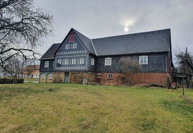
Ruta A pie de 7,3 km a descubrir en Sajonia, Bautzen, Sohland an der Spree. Esta ruta ha sido propuesta por SityTrail - itinéraires balisés pédestres.
Descripción
This is originaly german learning path, not czech. It has german and czech text on the infotables.
Localización
País:
Germany
Región :
Sajonia
Departamento/provincia :
Bautzen
Municipio :
Sohland an der Spree
Localidad:
Unknown
Salida:(Dec)
Salida:(UTM)
460993 ; 5653745 (33U) N.
Comentarios
Excursiones cerca
![Excursión A pie Šluknov - NS Šluknov - Rožany - Královka - Photo](https://media.geolcdn.com/t/375/260/b1e44d18-3351-4729-9b7f-d48e8ddfd66f.jpeg&format=jpg&maxdim=2)
![A pie A pie](https://static1.geolcdn.com/sitytour/trail-icons/100.png)
NS Šluknov - Rožany - Královka
A pie
Fácil
Šluknov,
Severozápad,
Ústecký kraj,
Czech Republic
![](/images/other/stat-length.png)
3,9 km | 5,3 km-effort
1h 11min
![](https://static1.geolcdn.com/siteimages/upload/files/16400158638029165_repeat_loop_refresh_sync_direction_icon.png)
Sí
![Excursión A pie Oppach - Ringweg Oppach - Photo](https://media.geolcdn.com/t/375/260/053b6930-a7d4-443c-9fa6-42322a688a02.jpeg&format=jpg&maxdim=2)
![A pie A pie](https://static1.geolcdn.com/sitytour/trail-icons/100.png)
![Excursión A pie Sohland an der Spree - LG-Sohland-Ringweg - Photo](https://media.geolcdn.com/t/375/260/f6e36369-7661-4ce4-a6e5-5dd5c36e6ce4.jpeg&format=jpg&maxdim=2)
![A pie A pie](https://static1.geolcdn.com/sitytour/trail-icons/100.png)
LG-Sohland-Ringweg
A pie
Fácil
Sohland an der Spree,
Sajonia,
Bautzen,
Germany
![](/images/other/stat-length.png)
6,7 km | 9,2 km-effort
2h 4min
![](https://static1.geolcdn.com/siteimages/upload/files/16400158638029165_repeat_loop_refresh_sync_direction_icon.png)
No
![Excursión A pie Sohland an der Spree - Planetenweg - Photo](https://media.geolcdn.com/t/375/260/f6e36369-7661-4ce4-a6e5-5dd5c36e6ce4.jpeg&format=jpg&maxdim=2)
![A pie A pie](https://static1.geolcdn.com/sitytour/trail-icons/100.png)
Planetenweg
A pie
Fácil
Sohland an der Spree,
Sajonia,
Bautzen,
Germany
![](/images/other/stat-length.png)
4,3 km | 6 km-effort
1h 22min
![](https://static1.geolcdn.com/siteimages/upload/files/16400158638029165_repeat_loop_refresh_sync_direction_icon.png)
No