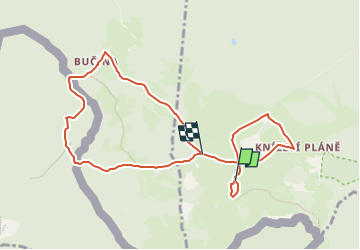
![](/images/other/stat-length.png)
![Excursión A pie Borová Lada - CZ-Trauermantel · Babočka osiková - Photo](https://media.geolcdn.com/t/1900/400/c5ee714b-967c-486f-9b90-dba96a0d5712.jpeg&format=pjpeg&maxdim=2)
CZ-Trauermantel · Babočka osiková
SityTrail - itinéraires balisés pédestres
Tous les sentiers balisés d’Europe GUIDE+
![Longitud](/images/other/stat-length.png)
![Altitud máxima](https://static1.geolcdn.com/siteimages/upload/files/1508320355ic_sort_altitude_max_24dp.png)
![Desnivel positivo](https://static1.geolcdn.com/siteimages/upload/files/1508320355ic_sort_den_pos_24dp.png)
![Km-Effort](/images/other/stat-length.png)
![Altitud mínima](https://static1.geolcdn.com/siteimages/upload/files/1508320355ic_sort_altitude_min_24dp.png)
![Desnivel negativo](https://static1.geolcdn.com/siteimages/upload/files/1508320355ic_sort_den_neg_24dp.png)
![Boucle](https://static1.geolcdn.com/siteimages/upload/files/16400158638029165_repeat_loop_refresh_sync_direction_icon.png)
![A pie](https://static1.geolcdn.com/sitytour/trail-icons/100.png)
2h46
Dificultad : Fácil
![Escanee este código QR para abrir la excursión en la aplicación SityTrail](https://capi.geolives.com/qq0zvz2zws4bq2lad0pu/sitytour/trails/4344654/qr.png?size=200)
Aplicación GPS de excursión GRATIS
A propósito
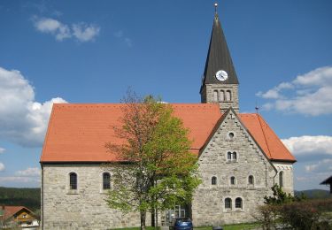
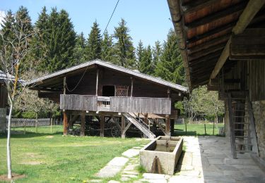
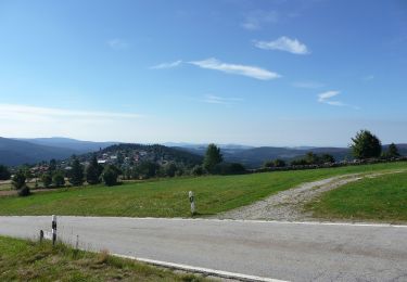
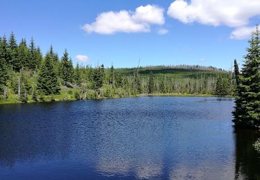
Ruta A pie de 9 km a descubrir en Jihozápad, Jihočeský kraj, Borová Lada. Esta ruta ha sido propuesta por SityTrail - itinéraires balisés pédestres.
Descripción
Ruta creada por Nationalpark Bayerischer Wald · Národní park Šumava.
Símbolo: Tiersymbol und zweisprachiger Schriftzug in schwarz auf gelbem, quadratischen Grund mit grünem, diagonal fallendem Querstrich
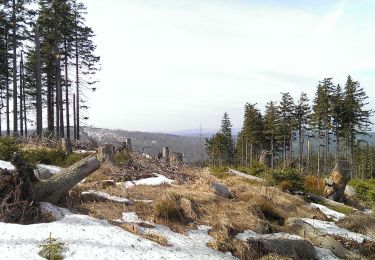
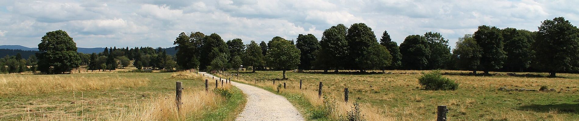
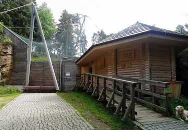
Localización
Comentarios
Excursiones cerca
![Excursión A pie Kvilda - CZ-Baummarder · Kuna lesní - Photo](https://media.geolcdn.com/t/375/260/ce1fb3d4-0ece-41cd-a22e-19d3aa036119.jpeg&format=jpg&maxdim=2)
![A pie A pie](https://static1.geolcdn.com/sitytour/trail-icons/100.png)
A pie
![](/images/other/stat-length.png)
![](https://static1.geolcdn.com/siteimages/upload/files/16400158638029165_repeat_loop_refresh_sync_direction_icon.png)
![Excursión A pie Borová Lada - Naučná stezka Les - Photo](https://media.geolcdn.com/t/375/260/d537cf2b-9633-478c-a41a-9e36ff5f8e3e.jpeg&format=jpg&maxdim=2)
![A pie A pie](https://static1.geolcdn.com/sitytour/trail-icons/100.png)
A pie
![](/images/other/stat-length.png)
![](https://static1.geolcdn.com/siteimages/upload/files/16400158638029165_repeat_loop_refresh_sync_direction_icon.png)
![Excursión A pie Mauth - Schnecke (Rundweg Finsterau) - Photo](https://media.geolcdn.com/t/375/260/3a25b2fc-d75f-4ca3-aba2-7646b3467e09.jpeg&format=jpg&maxdim=2)
![A pie A pie](https://static1.geolcdn.com/sitytour/trail-icons/100.png)
A pie
![](/images/other/stat-length.png)
![](https://static1.geolcdn.com/siteimages/upload/files/16400158638029165_repeat_loop_refresh_sync_direction_icon.png)
![Excursión A pie Mauth - Waldschaf · Šumavská ovce - Photo](https://media.geolcdn.com/t/375/260/ff9f8655-8064-4101-b1ee-a4a761ddf57d.jpeg&format=jpg&maxdim=2)
![A pie A pie](https://static1.geolcdn.com/sitytour/trail-icons/100.png)
A pie
![](/images/other/stat-length.png)
![](https://static1.geolcdn.com/siteimages/upload/files/16400158638029165_repeat_loop_refresh_sync_direction_icon.png)
![Excursión A pie Mauther Forst - Birkhuhn - Photo](https://media.geolcdn.com/t/375/260/bae98332-a917-4bf0-82fd-9594dcf2769e.jpeg&format=jpg&maxdim=2)
![A pie A pie](https://static1.geolcdn.com/sitytour/trail-icons/100.png)
A pie
![](/images/other/stat-length.png)
![](https://static1.geolcdn.com/siteimages/upload/files/16400158638029165_repeat_loop_refresh_sync_direction_icon.png)
![Excursión A pie Mauther Forst - Sperlingskauz - Photo](https://media.geolcdn.com/t/375/260/1e41820a-4406-4315-8608-4043f43ffef3.jpeg&format=jpg&maxdim=2)
![A pie A pie](https://static1.geolcdn.com/sitytour/trail-icons/100.png)
A pie
![](/images/other/stat-length.png)
![](https://static1.geolcdn.com/siteimages/upload/files/16400158638029165_repeat_loop_refresh_sync_direction_icon.png)
![Excursión A pie Mauth - Wachtelkönig · Chřástal polní - Photo](https://media.geolcdn.com/t/375/260/3a25b2fc-d75f-4ca3-aba2-7646b3467e09.jpeg&format=jpg&maxdim=2)
![A pie A pie](https://static1.geolcdn.com/sitytour/trail-icons/100.png)
A pie
![](/images/other/stat-length.png)
![](https://static1.geolcdn.com/siteimages/upload/files/16400158638029165_repeat_loop_refresh_sync_direction_icon.png)