![](/images/other/stat-length.png)
![Excursión A pie Plzeň - Sigmondova okružní naučná stezka - Photo](https://media.geolcdn.com/t/1900/400/781fdee0-37fe-4640-9de5-eeaac1f1fda2.jpeg&format=pjpeg&maxdim=2)
Sigmondova okružní naučná stezka
SityTrail - itinéraires balisés pédestres
Tous les sentiers balisés d’Europe GUIDE+
![Longitud](/images/other/stat-length.png)
Longitud
7,1 km
![Altitud máxima](https://static1.geolcdn.com/siteimages/upload/files/1508320355ic_sort_altitude_max_24dp.png)
Altitud máxima
393 m
![Desnivel positivo](https://static1.geolcdn.com/siteimages/upload/files/1508320355ic_sort_den_pos_24dp.png)
Desnivel positivo
109 m
![Km-Effort](/images/other/stat-length.png)
Km-Effort
8,6 km
![Altitud mínima](https://static1.geolcdn.com/siteimages/upload/files/1508320355ic_sort_altitude_min_24dp.png)
Altitud mínima
340 m
![Desnivel negativo](https://static1.geolcdn.com/siteimages/upload/files/1508320355ic_sort_den_neg_24dp.png)
Desnivel negativo
106 m
![Boucle](https://static1.geolcdn.com/siteimages/upload/files/16400158638029165_repeat_loop_refresh_sync_direction_icon.png)
Boucle
Sí
Baliza
Fecha de creación :
2025-02-06 19:00:53.035
Última modificación :
2025-02-06 19:00:53.035
![A pie](https://static1.geolcdn.com/sitytour/trail-icons/100.png)
1h57
Dificultad : Fácil
![Escanee este código QR para abrir la excursión en la aplicación SityTrail](https://capi.geolives.com/qq0zvz2zws4bq2lad0pu/sitytour/trails/4343912/qr.png?size=200)
Aplicación GPS de excursión GRATIS
A propósito
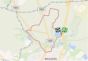
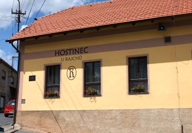
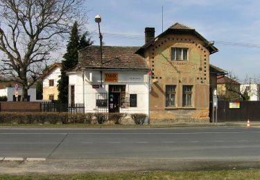
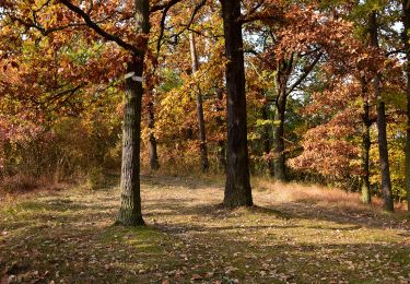
Ruta A pie de 7,1 km a descubrir en Jihozápad, Plzeňský kraj, Plzeň. Esta ruta ha sido propuesta por SityTrail - itinéraires balisés pédestres.
Descripción
Ruta creada por cz:KČT.
Značena žlutým pásovým značením
Localización
País:
Czech Republic
Región :
Jihozápad
Departamento/provincia :
Plzeňský kraj
Municipio :
Plzeň
Localidad:
Unknown
Salida:(Dec)
Salida:(UTM)
383636 ; 5516513 (33U) N.
Comentarios
Excursiones cerca
![Excursión A pie Přívětice - [Ž] Na Kramářské - Radeč západ - Photo](https://media.geolcdn.com/t/375/260/0c2b8328-b17d-4cb4-860a-465cc95b241f.jpeg&format=jpg&maxdim=2)
![A pie A pie](https://static1.geolcdn.com/sitytour/trail-icons/100.png)
[Ž] Na Kramářské - Radeč západ
A pie
Fácil
Přívětice,
Jihozápad,
Plzeňský kraj,
Czech Republic
![](/images/other/stat-length.png)
3,1 km | 3,8 km-effort
52min
![](https://static1.geolcdn.com/siteimages/upload/files/16400158638029165_repeat_loop_refresh_sync_direction_icon.png)
No
![Excursión A pie Chrást - Naučná stezka Chrást - Photo](https://media.geolcdn.com/t/375/260/2d94c3d4-6192-4d3a-a905-f806b8213e86.jpeg&format=jpg&maxdim=2)
![A pie A pie](https://static1.geolcdn.com/sitytour/trail-icons/100.png)
Naučná stezka Chrást
A pie
Fácil
Chrást,
Jihozápad,
Plzeňský kraj,
Czech Republic
![](/images/other/stat-length.png)
7,8 km | 9,3 km-effort
2h 6min
![](https://static1.geolcdn.com/siteimages/upload/files/16400158638029165_repeat_loop_refresh_sync_direction_icon.png)
Sí
![Excursión A pie Šťáhlavy - Naučná stezka Okolo Kozlu - Photo](https://media.geolcdn.com/t/375/260/6ab8b0a3-a73f-4f06-abb5-727e8ac683f0.jpeg&format=jpg&maxdim=2)
![A pie A pie](https://static1.geolcdn.com/sitytour/trail-icons/100.png)
Naučná stezka Okolo Kozlu
A pie
Fácil
Šťáhlavy,
Jihozápad,
Plzeňský kraj,
Czech Republic
![](/images/other/stat-length.png)
3,3 km | 4,4 km-effort
59min
![](https://static1.geolcdn.com/siteimages/upload/files/16400158638029165_repeat_loop_refresh_sync_direction_icon.png)
Sí
![Excursión A pie Plasy - NS Ludvíka Očenáška - Photo](https://media.geolcdn.com/t/375/260/896bf5cf-f443-487e-be76-ba92d469daf4.jpeg&format=jpg&maxdim=2)
![A pie A pie](https://static1.geolcdn.com/sitytour/trail-icons/100.png)
NS Ludvíka Očenáška
A pie
Fácil
Plasy,
Jihozápad,
Plzeňský kraj,
Czech Republic
![](/images/other/stat-length.png)
12,6 km | 16,6 km-effort
3h 46min
![](https://static1.geolcdn.com/siteimages/upload/files/16400158638029165_repeat_loop_refresh_sync_direction_icon.png)
No
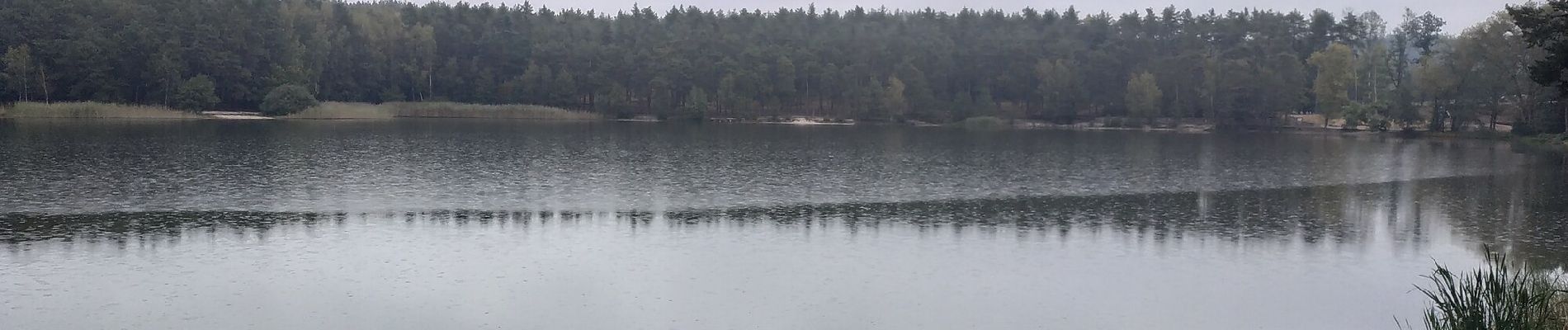
![Excursión A pie Hradec - [Z] Hradec - Vytůň - Photo](https://media.geolcdn.com/t/375/260/36372a90-b81a-4a71-9876-a3bf9f884ffe.jpeg&format=jpg&maxdim=2)
![A pie A pie](https://static1.geolcdn.com/sitytour/trail-icons/100.png)
[Z] Hradec - Vytůň
A pie
Fácil
Hradec,
Jihozápad,
Plzeňský kraj,
Czech Republic
![](/images/other/stat-length.png)
11,8 km | 15,7 km-effort
3h 33min
![](https://static1.geolcdn.com/siteimages/upload/files/16400158638029165_repeat_loop_refresh_sync_direction_icon.png)
No
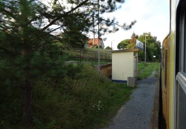
![Excursión A pie Stod - [Ž] Stod - Vytůň - Photo](https://media.geolcdn.com/t/375/260/5f465939-ef20-4d07-aeae-d7b7b507e19b.jpeg&format=jpg&maxdim=2)
![A pie A pie](https://static1.geolcdn.com/sitytour/trail-icons/100.png)
[Ž] Stod - Vytůň
A pie
Fácil
Stod,
Jihozápad,
Plzeňský kraj,
Czech Republic
![](/images/other/stat-length.png)
3,7 km | 4 km-effort
55min
![](https://static1.geolcdn.com/siteimages/upload/files/16400158638029165_repeat_loop_refresh_sync_direction_icon.png)
No
![Excursión A pie Radnice - CZ-6612 - Photo](https://media.geolcdn.com/t/375/260/0a97671e-d95d-49b0-ad70-fd0b477aaa9b.jpeg&format=jpg&maxdim=2)
![A pie A pie](https://static1.geolcdn.com/sitytour/trail-icons/100.png)
CZ-6612
A pie
Medio
Radnice,
Jihozápad,
Plzeňský kraj,
Czech Republic
![](/images/other/stat-length.png)
23 km | 29 km-effort
6h 29min
![](https://static1.geolcdn.com/siteimages/upload/files/16400158638029165_repeat_loop_refresh_sync_direction_icon.png)
No
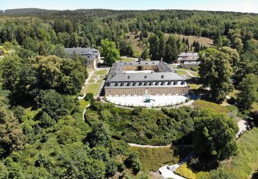
![Excursión A pie Nebílovy - [Z] Štěnovice - Nebílovy - Photo](https://media.geolcdn.com/t/375/260/78153f03-0394-41af-a8cb-63376f17de15.jpeg&format=jpg&maxdim=2)
![A pie A pie](https://static1.geolcdn.com/sitytour/trail-icons/100.png)
[Z] Štěnovice - Nebílovy
A pie
Fácil
Nebílovy,
Jihozápad,
Plzeňský kraj,
Czech Republic
![](/images/other/stat-length.png)
10,3 km | 13,9 km-effort
3h 10min
![](https://static1.geolcdn.com/siteimages/upload/files/16400158638029165_repeat_loop_refresh_sync_direction_icon.png)
No
![Excursión A pie Plasy - Okružní NS Plasy - Photo](https://media.geolcdn.com/t/375/260/ea17131c-7e62-4380-9b72-c66161169eb4.jpeg&format=jpg&maxdim=2)
![A pie A pie](https://static1.geolcdn.com/sitytour/trail-icons/100.png)
Okružní NS Plasy
A pie
Fácil
Plasy,
Jihozápad,
Plzeňský kraj,
Czech Republic
![](/images/other/stat-length.png)
4,4 km | 4,9 km-effort
1h 6min
![](https://static1.geolcdn.com/siteimages/upload/files/16400158638029165_repeat_loop_refresh_sync_direction_icon.png)
Sí