![](/images/other/stat-length.png)
![Excursión Senderismo Saint-Georges-sur-Fontaine - Saint-Georges-sur-Fontaine - Saint-André-sur-Cailly - GD - Photo](https://media.geolcdn.com/t/1900/400/ext.pjpeg?maxdim=2&url=https%3A%2F%2Fstatic1.geolcdn.com%2Fsiteimages%2Fupload%2Ffiles%2F1553511878bg_sport_marche.png)
Saint-Georges-sur-Fontaine - Saint-André-sur-Cailly - GD
philippe76
Usuario
![Longitud](/images/other/stat-length.png)
Longitud
9,8 km
![Altitud máxima](https://static1.geolcdn.com/siteimages/upload/files/1508320355ic_sort_altitude_max_24dp.png)
Altitud máxima
166 m
![Desnivel positivo](https://static1.geolcdn.com/siteimages/upload/files/1508320355ic_sort_den_pos_24dp.png)
Desnivel positivo
162 m
![Km-Effort](/images/other/stat-length.png)
Km-Effort
11,9 km
![Altitud mínima](https://static1.geolcdn.com/siteimages/upload/files/1508320355ic_sort_altitude_min_24dp.png)
Altitud mínima
88 m
![Desnivel negativo](https://static1.geolcdn.com/siteimages/upload/files/1508320355ic_sort_den_neg_24dp.png)
Desnivel negativo
164 m
![Boucle](https://static1.geolcdn.com/siteimages/upload/files/16400158638029165_repeat_loop_refresh_sync_direction_icon.png)
Boucle
No
Fecha de creación :
2025-01-03 13:49:29.983
Última modificación :
2025-01-03 14:00:07.092
![Senderismo](https://static1.geolcdn.com/sitytour/trail-icons/101.png)
2h42
Dificultad : Medio
![Escanee este código QR para abrir la excursión en la aplicación SityTrail](https://capi.geolives.com/qq0zvz2zws4bq2lad0pu/sitytour/trails/4309609/qr.png?size=200)
Aplicación GPS de excursión GRATIS
A propósito
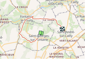
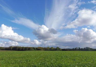
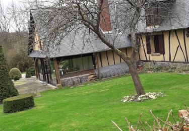
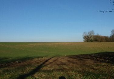
Ruta Senderismo de 9,8 km a descubrir en Normandía, Sena-Marítimo, Saint-Georges-sur-Fontaine. Esta ruta ha sido propuesta por philippe76.
Descripción
Départ à la mairie de Saint-Georges-sur-Fontaine, passer par Fontaine-Le-Bourg, et arrivée à la mairie de Saint-André-sur-Cailly.
Localización
País:
France
Región :
Normandía
Departamento/provincia :
Sena-Marítimo
Municipio :
Saint-Georges-sur-Fontaine
Localidad:
Unknown
Salida:(Dec)
Salida:(UTM)
368234 ; 5489499 (31U) N.
Comentarios
Excursiones cerca
![Excursión Senderismo Quincampoix - 076-29-Quincampoix 10km -496-626 - Photo](https://media.geolcdn.com/t/375/260/77288098-4062-4eec-991a-4ccce3a169cf.jpg&format=jpg&maxdim=2)
![Senderismo Senderismo](https://static1.geolcdn.com/sitytour/trail-icons/101.png)
076-29-Quincampoix 10km -496-626
Senderismo
Fácil
(1)
Quincampoix,
Normandía,
Sena-Marítimo,
France
![](/images/other/stat-length.png)
9,9 km | 11,2 km-effort
2h 28min
![](https://static1.geolcdn.com/siteimages/upload/files/16400158638029165_repeat_loop_refresh_sync_direction_icon.png)
Sí
![Senderismo Senderismo](https://static1.geolcdn.com/sitytour/trail-icons/101.png)
20240504-Le Grand Tendos
Senderismo
Medio
Fontaine-le-Bourg,
Normandía,
Sena-Marítimo,
France
![](/images/other/stat-length.png)
12,9 km | 16,3 km-effort
3h 50min
![](https://static1.geolcdn.com/siteimages/upload/files/16400158638029165_repeat_loop_refresh_sync_direction_icon.png)
Sí
![Senderismo Senderismo](https://static1.geolcdn.com/sitytour/trail-icons/101.png)
20231123-St Geotges sur Fontaine
Senderismo
Medio
Saint-Georges-sur-Fontaine,
Normandía,
Sena-Marítimo,
France
![](/images/other/stat-length.png)
11 km | 12,8 km-effort
3h 4min
![](https://static1.geolcdn.com/siteimages/upload/files/16400158638029165_repeat_loop_refresh_sync_direction_icon.png)
Sí
![Excursión Senderismo Bosc-Guérard-Saint-Adrien - Bosc Guerard - Photo](https://media.geolcdn.com/t/375/260/ext.jpg?maxdim=2&url=https%3A%2F%2Fstatic1.geolcdn.com%2Fsiteimages%2Fupload%2Ffiles%2F1553511878bg_sport_marche.png)
![Senderismo Senderismo](https://static1.geolcdn.com/sitytour/trail-icons/101.png)
Bosc Guerard
Senderismo
(1)
Bosc-Guérard-Saint-Adrien,
Normandía,
Sena-Marítimo,
France
![](/images/other/stat-length.png)
9,4 km | 11,5 km-effort
Desconocido
![](https://static1.geolcdn.com/siteimages/upload/files/16400158638029165_repeat_loop_refresh_sync_direction_icon.png)
Sí
![Senderismo Senderismo](https://static1.geolcdn.com/sitytour/trail-icons/101.png)
20221015-St Geirges sur Fontaine
Senderismo
Medio
Saint-Georges-sur-Fontaine,
Normandía,
Sena-Marítimo,
France
![](/images/other/stat-length.png)
11,1 km | 12,9 km-effort
3h 3min
![](https://static1.geolcdn.com/siteimages/upload/files/16400158638029165_repeat_loop_refresh_sync_direction_icon.png)
Sí
![Senderismo Senderismo](https://static1.geolcdn.com/sitytour/trail-icons/101.png)
20210805-fontaine-le-bourg
Senderismo
Muy fácil
Fontaine-le-Bourg,
Normandía,
Sena-Marítimo,
France
![](/images/other/stat-length.png)
21 km | 26 km-effort
Desconocido
![](https://static1.geolcdn.com/siteimages/upload/files/16400158638029165_repeat_loop_refresh_sync_direction_icon.png)
Sí
![Senderismo Senderismo](https://static1.geolcdn.com/sitytour/trail-icons/101.png)
20201013-Bosc Guérard St Adrien
Senderismo
Medio
Bosc-Guérard-Saint-Adrien,
Normandía,
Sena-Marítimo,
France
![](/images/other/stat-length.png)
13,7 km | 17,3 km-effort
3h 45min
![](https://static1.geolcdn.com/siteimages/upload/files/16400158638029165_repeat_loop_refresh_sync_direction_icon.png)
Sí
![Excursión Senderismo Mont-Cauvaire - Mont-Cauvaire - Photo](https://media.geolcdn.com/t/375/260/bd296392-1a61-493a-853e-d8f6d4e5e2ee.jpg&format=jpg&maxdim=2)
![Senderismo Senderismo](https://static1.geolcdn.com/sitytour/trail-icons/101.png)
Mont-Cauvaire
Senderismo
Medio
Mont-Cauvaire,
Normandía,
Sena-Marítimo,
France
![](/images/other/stat-length.png)
6,3 km | 7,8 km-effort
3h 8min
![](https://static1.geolcdn.com/siteimages/upload/files/16400158638029165_repeat_loop_refresh_sync_direction_icon.png)
Sí
![Excursión Senderismo Saint-Georges-sur-Fontaine - 20150207 St Georges sur fontaine - Photo](https://media.geolcdn.com/t/375/260/ext.jpg?maxdim=2&url=https%3A%2F%2Fservices.sitytrail.com%2FGeolivesWS%2FDownloadMedia.ashx%3FTrailID%3D384193%26Media%3Dfix__20150207162004.jpg)
![Senderismo Senderismo](https://static1.geolcdn.com/sitytour/trail-icons/101.png)
20150207 St Georges sur fontaine
Senderismo
Fácil
(1)
Saint-Georges-sur-Fontaine,
Normandía,
Sena-Marítimo,
France
![](/images/other/stat-length.png)
13,1 km | 15,1 km-effort
3h 19min
![](https://static1.geolcdn.com/siteimages/upload/files/16400158638029165_repeat_loop_refresh_sync_direction_icon.png)
Sí