![](/images/other/stat-length.png)
![Excursión Senderismo Chinon - Chinon Azay le rideau - Photo](https://media.geolcdn.com/t/1900/400/ext.pjpeg?maxdim=2&url=https%3A%2F%2Fstatic1.geolcdn.com%2Fsiteimages%2Fupload%2Ffiles%2F1553511878bg_sport_marche.png)
Chinon Azay le rideau
franquitosse
Usuario
![Longitud](/images/other/stat-length.png)
Longitud
28 km
![Altitud máxima](https://static1.geolcdn.com/siteimages/upload/files/1508320355ic_sort_altitude_max_24dp.png)
Altitud máxima
130 m
![Desnivel positivo](https://static1.geolcdn.com/siteimages/upload/files/1508320355ic_sort_den_pos_24dp.png)
Desnivel positivo
449 m
![Km-Effort](/images/other/stat-length.png)
Km-Effort
34 km
![Altitud mínima](https://static1.geolcdn.com/siteimages/upload/files/1508320355ic_sort_altitude_min_24dp.png)
Altitud mínima
34 m
![Desnivel negativo](https://static1.geolcdn.com/siteimages/upload/files/1508320355ic_sort_den_neg_24dp.png)
Desnivel negativo
433 m
![Boucle](https://static1.geolcdn.com/siteimages/upload/files/16400158638029165_repeat_loop_refresh_sync_direction_icon.png)
Boucle
No
Fecha de creación :
2015-05-29 00:00:00.0
Última modificación :
2015-05-29 00:00:00.0
![Senderismo](https://static1.geolcdn.com/sitytour/trail-icons/101.png)
7h18
Dificultad : Medio
![Escanee este código QR para abrir la excursión en la aplicación SityTrail](https://capi.geolives.com/qq0zvz2zws4bq2lad0pu/sitytour/trails/426501/qr.png?size=200)
Aplicación GPS de excursión GRATIS
A propósito
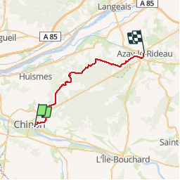
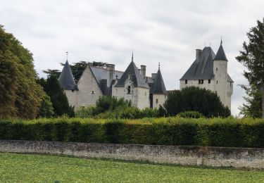
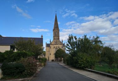
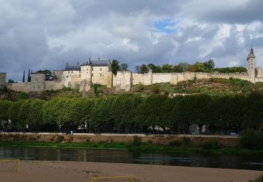
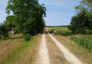
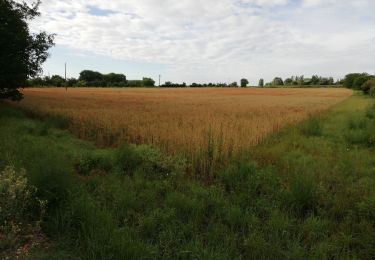
Ruta Senderismo de 28 km a descubrir en Centro, Indre y Loira, Chinon. Esta ruta ha sido propuesta por franquitosse.
Descripción
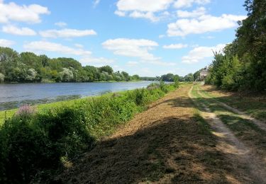
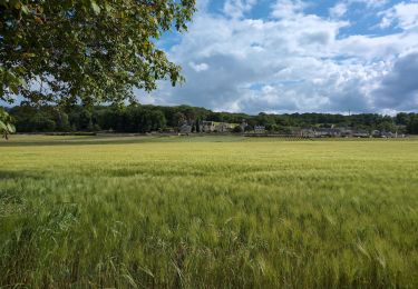
Prendre le train à Azay le rideau pour Chinon. De la gare rejoindre le GR3. Randonnée au coeur de la forêt chinonaise. Voilà un bon bol d'air pure !!!
Localización
País:
France
Región :
Centro
Departamento/provincia :
Indre y Loira
Municipio :
Chinon
Localidad:
Unknown
Salida:(Dec)
Salida:(UTM)
291698 ; 5227026 (31T) N.
Comentarios
Excursiones cerca
![Excursión Senderismo Rivière - Rivière (s Chinon) - 13km 115m 3h10 - 2017 07 14 - Photo](https://media.geolcdn.com/t/375/260/3257858e-a22b-438d-bbd4-cdccba4b7589.jpg&format=jpg&maxdim=2)
![Senderismo Senderismo](https://static1.geolcdn.com/sitytour/trail-icons/101.png)
Rivière (s Chinon) - 13km 115m 3h10 - 2017 07 14
Senderismo
Fácil
(1)
Rivière,
Centro,
Indre y Loira,
France
![](/images/other/stat-length.png)
13,1 km | 14,7 km-effort
3h 10min
![](https://static1.geolcdn.com/siteimages/upload/files/16400158638029165_repeat_loop_refresh_sync_direction_icon.png)
Sí
![Excursión Senderismo Anché - Anché - Château du Rivau - 17.3km 170m 3h50 (1h05) - 2024 08 18 - Photo](https://media.geolcdn.com/t/375/260/23b85bd8-32e4-4592-a2ae-f4bb358ec8a0.jpg&format=jpg&maxdim=2)
![Senderismo Senderismo](https://static1.geolcdn.com/sitytour/trail-icons/101.png)
Anché - Château du Rivau - 17.3km 170m 3h50 (1h05) - 2024 08 18
Senderismo
Fácil
Anché,
Centro,
Indre y Loira,
France
![](/images/other/stat-length.png)
17,3 km | 19,6 km-effort
3h 50min
![](https://static1.geolcdn.com/siteimages/upload/files/16400158638029165_repeat_loop_refresh_sync_direction_icon.png)
Sí
![Excursión Senderismo Chinon - Parilly - Zig zag Ligré - 24.4km 330m 5h30 (50mn) - 2024 05 24 - Photo](https://media.geolcdn.com/t/375/260/35fa2308-066d-4120-b6d6-7b0ed77a89ee.jpg&format=jpg&maxdim=2)
![Senderismo Senderismo](https://static1.geolcdn.com/sitytour/trail-icons/101.png)
Parilly - Zig zag Ligré - 24.4km 330m 5h30 (50mn) - 2024 05 24
Senderismo
Fácil
Chinon,
Centro,
Indre y Loira,
France
![](/images/other/stat-length.png)
24 km | 29 km-effort
5h 30min
![](https://static1.geolcdn.com/siteimages/upload/files/16400158638029165_repeat_loop_refresh_sync_direction_icon.png)
Sí
![Excursión Senderismo Chinon - Chinon - Zig zag Cravant-les-Côteaux GR48 GR3 - 22.4km 415m 5h05 (1h) - 2024 05 10 - Photo](https://media.geolcdn.com/t/375/260/ae5fec4c-f818-4ccd-8591-57df5497ff4a.jpg&format=jpg&maxdim=2)
![Senderismo Senderismo](https://static1.geolcdn.com/sitytour/trail-icons/101.png)
Chinon - Zig zag Cravant-les-Côteaux GR48 GR3 - 22.4km 415m 5h05 (1h) - 2024 ...
Senderismo
Medio
Chinon,
Centro,
Indre y Loira,
France
![](/images/other/stat-length.png)
22 km | 28 km-effort
5h 5min
![](https://static1.geolcdn.com/siteimages/upload/files/16400158638029165_repeat_loop_refresh_sync_direction_icon.png)
Sí
![Excursión Senderismo Cinais - Cinais - Chinon GR3 Thizay - 25.2km 315m 5h50 (25mn) - 2022 10 02 - Photo](https://media.geolcdn.com/t/375/260/b2fc4d1d-41aa-476c-acd1-894076d5905e.jpg&format=jpg&maxdim=2)
![Senderismo Senderismo](https://static1.geolcdn.com/sitytour/trail-icons/101.png)
Cinais - Chinon GR3 Thizay - 25.2km 315m 5h50 (25mn) - 2022 10 02
Senderismo
Fácil
Cinais,
Centro,
Indre y Loira,
France
![](/images/other/stat-length.png)
25 km | 29 km-effort
5h 50min
![](https://static1.geolcdn.com/siteimages/upload/files/16400158638029165_repeat_loop_refresh_sync_direction_icon.png)
Sí
![Excursión Senderismo Chinon - Chinon - Circuit Entre Puys du Chinonais et Vienne avec variante - 17.4km 240m 4h00 (25mn) - 2022 09 09 - Photo](https://media.geolcdn.com/t/375/260/6b30d929-af33-42af-8a5e-4de88435f728.jpg&format=jpg&maxdim=2)
![Senderismo Senderismo](https://static1.geolcdn.com/sitytour/trail-icons/101.png)
Chinon - Circuit Entre Puys du Chinonais et Vienne avec variante - 17.4km 240...
Senderismo
Medio
Chinon,
Centro,
Indre y Loira,
France
![](/images/other/stat-length.png)
17,4 km | 21 km-effort
4h 0min
![](https://static1.geolcdn.com/siteimages/upload/files/16400158638029165_repeat_loop_refresh_sync_direction_icon.png)
Sí
![Excursión Senderismo Huismes - Huismes - les Fontaines d'Ozon GR3 - 15.9km 170m 3h35 - 2022 07 17 - Photo](https://media.geolcdn.com/t/375/260/1ba8f622-118c-4f2d-842d-ac374ba0c8ec.jpg&format=jpg&maxdim=2)
![Senderismo Senderismo](https://static1.geolcdn.com/sitytour/trail-icons/101.png)
Huismes - les Fontaines d'Ozon GR3 - 15.9km 170m 3h35 - 2022 07 17
Senderismo
Fácil
Huismes,
Centro,
Indre y Loira,
France
![](/images/other/stat-length.png)
15,9 km | 18,2 km-effort
3h 35min
![](https://static1.geolcdn.com/siteimages/upload/files/16400158638029165_repeat_loop_refresh_sync_direction_icon.png)
Sí
![Excursión Senderismo Beaumont-en-Véron - INDRE ET LOIRE: BEAUMONT EN VERON - Photo](https://media.geolcdn.com/t/375/260/ext.jpg?maxdim=2&url=https%3A%2F%2Fstatic1.geolcdn.com%2Fsiteimages%2Fupload%2Ffiles%2F1553511878bg_sport_marche.png)
![Senderismo Senderismo](https://static1.geolcdn.com/sitytour/trail-icons/101.png)
INDRE ET LOIRE: BEAUMONT EN VERON
Senderismo
Fácil
(1)
Beaumont-en-Véron,
Centro,
Indre y Loira,
France
![](/images/other/stat-length.png)
10 km | 11,2 km-effort
2h 30min
![](https://static1.geolcdn.com/siteimages/upload/files/16400158638029165_repeat_loop_refresh_sync_direction_icon.png)
Sí
![Excursión Bici de montaña Ligré - 37-vtt-Ligré-richelieu-35km-juin21 - Photo](https://media.geolcdn.com/t/375/260/b9f1163a-b921-4512-a6e8-fd3e42de5b5f.jpg&format=jpg&maxdim=2)
![Bici de montaña Bici de montaña](https://static1.geolcdn.com/sitytour/trail-icons/202.png)
37-vtt-Ligré-richelieu-35km-juin21
Bici de montaña
Fácil
Ligré,
Centro,
Indre y Loira,
France
![](/images/other/stat-length.png)
35 km | 37 km-effort
2h 35min
![](https://static1.geolcdn.com/siteimages/upload/files/16400158638029165_repeat_loop_refresh_sync_direction_icon.png)
Sí