![](/images/other/stat-length.png)
![Excursión Senderismo Vesoul - parcours des femmes de combats entre vesoul et NAVENNE - Photo](https://media.geolcdn.com/t/1900/400/ext.pjpeg?maxdim=2&url=https%3A%2F%2Fservices.sitytrail.com%2FGeolivesWS%2FDownloadMedia.ashx%3FTrailID%3D420538%26Media%3D20150514115056.jpg)
parcours des femmes de combats entre vesoul et NAVENNE
nicolasdresse
Usuario
![Longitud](/images/other/stat-length.png)
Longitud
8,8 km
![Altitud máxima](https://static1.geolcdn.com/siteimages/upload/files/1508320355ic_sort_altitude_max_24dp.png)
Altitud máxima
295 m
![Desnivel positivo](https://static1.geolcdn.com/siteimages/upload/files/1508320355ic_sort_den_pos_24dp.png)
Desnivel positivo
131 m
![Km-Effort](/images/other/stat-length.png)
Km-Effort
10,6 km
![Altitud mínima](https://static1.geolcdn.com/siteimages/upload/files/1508320355ic_sort_altitude_min_24dp.png)
Altitud mínima
216 m
![Desnivel negativo](https://static1.geolcdn.com/siteimages/upload/files/1508320355ic_sort_den_neg_24dp.png)
Desnivel negativo
130 m
![Boucle](https://static1.geolcdn.com/siteimages/upload/files/16400158638029165_repeat_loop_refresh_sync_direction_icon.png)
Boucle
Sí
Fecha de creación :
2018-09-29 20:52:33.239
Última modificación :
2018-09-29 20:52:33.265
![Senderismo](https://static1.geolcdn.com/sitytour/trail-icons/101.png)
2h25
Dificultad : Fácil
![Escanee este código QR para abrir la excursión en la aplicación SityTrail](https://capi.geolives.com/qq0zvz2zws4bq2lad0pu/sitytour/trails/420538/qr.png?size=200)
Aplicación GPS de excursión GRATIS
A propósito
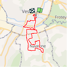
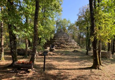
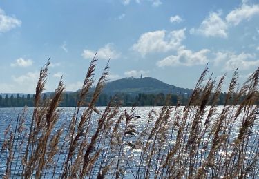
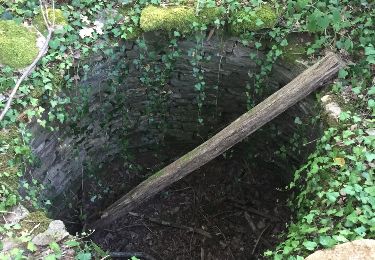
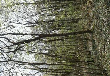
Ruta Senderismo de 8,8 km a descubrir en Borgoña-Franco Condado, Alto Saona, Vesoul. Esta ruta ha sido propuesta por nicolasdresse.
Descripción
Parcours depuis le centre de vesoul vers les 4 sapins, retour par l arrière du CRF de NAVENNE
Localización
País:
France
Región :
Borgoña-Franco Condado
Departamento/provincia :
Alto Saona
Municipio :
Vesoul
Localidad:
Unknown
Salida:(Dec)
Salida:(UTM)
286729 ; 5278123 (32T) N.
Comentarios
Excursiones cerca
![Excursión Senderismo Échenoz-la-Méline - falaise échenoz 2 2012-04-01 16h37m40 - Photo](https://media.geolcdn.com/t/375/260/ext.jpg?maxdim=2&url=https%3A%2F%2Fservices.sitytrail.com%2FGeolivesWS%2FDownloadMedia.ashx%3FTrailID%3D119434%26Media%3D20120401162315.jpeg)
![Senderismo Senderismo](https://static1.geolcdn.com/sitytour/trail-icons/101.png)
falaise échenoz 2 2012-04-01 16h37m40
Senderismo
Fácil
(1)
Échenoz-la-Méline,
Borgoña-Franco Condado,
Alto Saona,
France
![](/images/other/stat-length.png)
3,4 km | 4,2 km-effort
49min
![](https://static1.geolcdn.com/siteimages/upload/files/16400158638029165_repeat_loop_refresh_sync_direction_icon.png)
Sí
![Excursión Marcha nórdica Colombier - colombier - Photo](https://media.geolcdn.com/t/375/260/464599f6-703d-4ef8-9b20-e4a0ed84f3a6.jpg&format=jpg&maxdim=2)
![Marcha nórdica Marcha nórdica](https://static1.geolcdn.com/sitytour/trail-icons/102.png)
colombier
Marcha nórdica
Muy fácil
Colombier,
Borgoña-Franco Condado,
Alto Saona,
France
![](/images/other/stat-length.png)
22 km | 28 km-effort
4h 31min
![](https://static1.geolcdn.com/siteimages/upload/files/16400158638029165_repeat_loop_refresh_sync_direction_icon.png)
Sí
![Excursión Senderismo Quincey - quincey marche - Photo](https://media.geolcdn.com/t/375/260/ext.jpg?maxdim=2&url=https%3A%2F%2Fstatic1.geolcdn.com%2Fsiteimages%2Fupload%2Ffiles%2F1553511878bg_sport_marche.png)
![Senderismo Senderismo](https://static1.geolcdn.com/sitytour/trail-icons/101.png)
quincey marche
Senderismo
Muy fácil
(1)
Quincey,
Borgoña-Franco Condado,
Alto Saona,
France
![](/images/other/stat-length.png)
6,8 km | 8,4 km-effort
2h 6min
![](https://static1.geolcdn.com/siteimages/upload/files/16400158638029165_repeat_loop_refresh_sync_direction_icon.png)
Sí
![Excursión Senderismo Villers-le-Sec - Pierre qui vire Madone Dampvaley - Photo](https://media.geolcdn.com/t/375/260/757577cb-dfd3-4256-9b9e-b212b2dbb7df.jpg&format=jpg&maxdim=2)
![Senderismo Senderismo](https://static1.geolcdn.com/sitytour/trail-icons/101.png)
Pierre qui vire Madone Dampvaley
Senderismo
Villers-le-Sec,
Borgoña-Franco Condado,
Alto Saona,
France
![](/images/other/stat-length.png)
12,4 km | 15,4 km-effort
2h 44min
![](https://static1.geolcdn.com/siteimages/upload/files/16400158638029165_repeat_loop_refresh_sync_direction_icon.png)
No
![Excursión Senderismo Vaivre-et-Montoille - Lac de vaivre Vesoul 7000 - Photo](https://media.geolcdn.com/t/375/260/79eb4552-e19c-4149-ac56-1930661e5b4f.jpg&format=jpg&maxdim=2)
![Senderismo Senderismo](https://static1.geolcdn.com/sitytour/trail-icons/101.png)
Lac de vaivre Vesoul 7000
Senderismo
Vaivre-et-Montoille,
Borgoña-Franco Condado,
Alto Saona,
France
![](/images/other/stat-length.png)
4,6 km | 5 km-effort
1h 53min
![](https://static1.geolcdn.com/siteimages/upload/files/16400158638029165_repeat_loop_refresh_sync_direction_icon.png)
Sí
![Excursión Senderismo Échenoz-la-Méline - des breuleux aux bois de la côte - Photo](https://media.geolcdn.com/t/375/260/ext.jpg?maxdim=2&url=https%3A%2F%2Fservices.sitytrail.com%2FGeolivesWS%2FDownloadMedia.ashx%3FTrailID%3D453303%26Media%3D20150802184238.jpg)
![Senderismo Senderismo](https://static1.geolcdn.com/sitytour/trail-icons/101.png)
des breuleux aux bois de la côte
Senderismo
Fácil
Échenoz-la-Méline,
Borgoña-Franco Condado,
Alto Saona,
France
![](/images/other/stat-length.png)
6 km | 8 km-effort
1h 52min
![](https://static1.geolcdn.com/siteimages/upload/files/16400158638029165_repeat_loop_refresh_sync_direction_icon.png)
Sí
![Excursión Senderismo Échenoz-la-Méline - cita navenne 2012-04-03 11h42m42 - Photo](https://media.geolcdn.com/t/375/260/ext.jpg?maxdim=2&url=https%3A%2F%2Fservices.sitytrail.com%2FGeolivesWS%2FDownloadMedia.ashx%3FTrailID%3D119748%26Media%3D20120403113112.jpeg)
![Senderismo Senderismo](https://static1.geolcdn.com/sitytour/trail-icons/101.png)
cita navenne 2012-04-03 11h42m42
Senderismo
Fácil
Échenoz-la-Méline,
Borgoña-Franco Condado,
Alto Saona,
France
![](/images/other/stat-length.png)
8,8 km | 10,5 km-effort
1h 15min
![](https://static1.geolcdn.com/siteimages/upload/files/16400158638029165_repeat_loop_refresh_sync_direction_icon.png)
No
![Excursión Senderismo Échenoz-la-Méline - circuit falaise échenoz 2012-03-31 18h25m30 - Photo](https://media.geolcdn.com/t/375/260/ext.jpg?maxdim=2&url=https%3A%2F%2Fservices.sitytrail.com%2FGeolivesWS%2FDownloadMedia.ashx%3FTrailID%3D119253%26Media%3D20120331182457.jpeg)
![Senderismo Senderismo](https://static1.geolcdn.com/sitytour/trail-icons/101.png)
circuit falaise échenoz 2012-03-31 18h25m30
Senderismo
Fácil
Échenoz-la-Méline,
Borgoña-Franco Condado,
Alto Saona,
France
![](/images/other/stat-length.png)
5,5 km | 7,1 km-effort
1h 22min
![](https://static1.geolcdn.com/siteimages/upload/files/16400158638029165_repeat_loop_refresh_sync_direction_icon.png)
Sí
![Excursión Senderismo Colombe-lès-Vesoul - Colombe-damplavey-thumulus-colombe - Photo](https://media.geolcdn.com/t/375/260/f4e03238-10d6-407e-8319-26dc89eb4e23.jpg&format=jpg&maxdim=2)
![Senderismo Senderismo](https://static1.geolcdn.com/sitytour/trail-icons/101.png)
Colombe-damplavey-thumulus-colombe
Senderismo
Difícil
Colombe-lès-Vesoul,
Borgoña-Franco Condado,
Alto Saona,
France
![](/images/other/stat-length.png)
10,1 km | 13 km-effort
3h 7min
![](https://static1.geolcdn.com/siteimages/upload/files/16400158638029165_repeat_loop_refresh_sync_direction_icon.png)
No