![](/images/other/stat-length.png)
![Excursión Senderismo Guérande - Guérande_Careil - Photo](https://media.geolcdn.com/t/1900/400/ext.pjpeg?maxdim=2&url=https%3A%2F%2Fservices.sitytrail.com%2FGeolivesWS%2FDownloadMedia.ashx%3FTrailID%3D415908%26Media%3D52a60e6b-5068-4f71-b8f3-923b38638fa7.jpg)
Guérande_Careil
neoroll44
Usuario
![Longitud](/images/other/stat-length.png)
Longitud
13,5 km
![Altitud máxima](https://static1.geolcdn.com/siteimages/upload/files/1508320355ic_sort_altitude_max_24dp.png)
Altitud máxima
59 m
![Desnivel positivo](https://static1.geolcdn.com/siteimages/upload/files/1508320355ic_sort_den_pos_24dp.png)
Desnivel positivo
98 m
![Km-Effort](/images/other/stat-length.png)
Km-Effort
14,8 km
![Altitud mínima](https://static1.geolcdn.com/siteimages/upload/files/1508320355ic_sort_altitude_min_24dp.png)
Altitud mínima
-1 m
![Desnivel negativo](https://static1.geolcdn.com/siteimages/upload/files/1508320355ic_sort_den_neg_24dp.png)
Desnivel negativo
97 m
![Boucle](https://static1.geolcdn.com/siteimages/upload/files/16400158638029165_repeat_loop_refresh_sync_direction_icon.png)
Boucle
Sí
Fecha de creación :
2015-05-03 00:00:00.0
Última modificación :
2015-05-03 00:00:00.0
![Senderismo](https://static1.geolcdn.com/sitytour/trail-icons/101.png)
4h00
Dificultad : Medio
![Escanee este código QR para abrir la excursión en la aplicación SityTrail](https://capi.geolives.com/qq0zvz2zws4bq2lad0pu/sitytour/trails/415908/qr.png?size=200)
Aplicación GPS de excursión GRATIS
A propósito
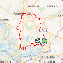
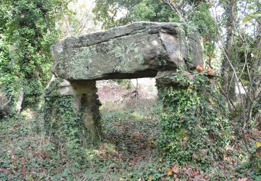
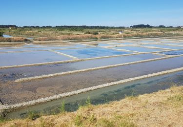
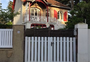
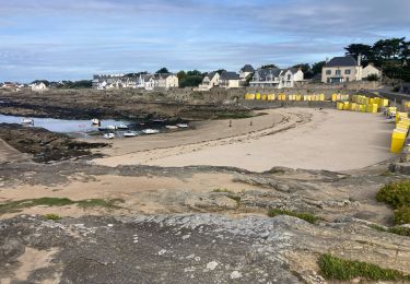
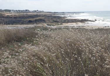
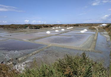
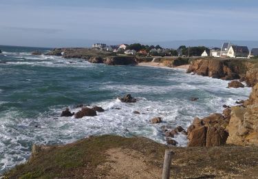
Ruta Senderismo de 13,5 km a descubrir en Países del Loira, Loira-Atlántico, Guérande. Esta ruta ha sido propuesta por neoroll44.
Descripción
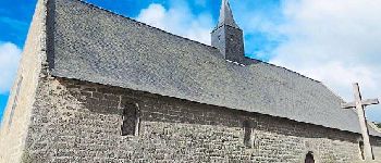
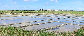
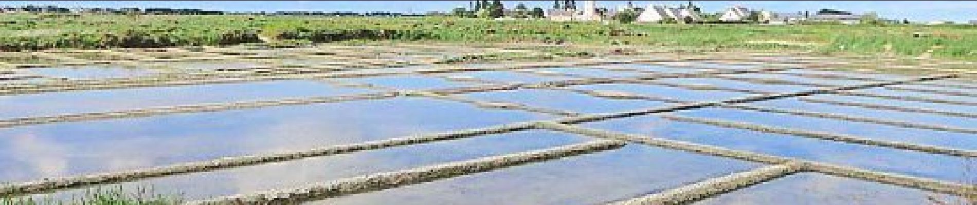
Depuis la chapelle de Careil, gagnez la vieille ville de Guérande par la piste cyclable et revenez par les marais salants de Saillé.
Localización
País:
France
Región :
Países del Loira
Departamento/provincia :
Loira-Atlántico
Municipio :
Guérande
Localidad:
Unknown
Salida:(Dec)
Salida:(UTM)
545088 ; 5238311 (30T) N.
Comentarios
Excursiones cerca
![Excursión Senderismo Guérande - De Guérande à La Turballe par les marais - Photo](https://media.geolcdn.com/t/375/260/ext.jpg?maxdim=2&url=https%3A%2F%2Fstatic1.geolcdn.com%2Fsiteimages%2Fupload%2Ffiles%2F1553511878bg_sport_marche.png)
![Senderismo Senderismo](https://static1.geolcdn.com/sitytour/trail-icons/101.png)
De Guérande à La Turballe par les marais
Senderismo
Difícil
(1)
Guérande,
Países del Loira,
Loira-Atlántico,
France
![](/images/other/stat-length.png)
22 km | 24 km-effort
6h 40min
![](https://static1.geolcdn.com/siteimages/upload/files/16400158638029165_repeat_loop_refresh_sync_direction_icon.png)
Sí
![Excursión A pie La Baule-Escoublac - La petite marchande - Photo](https://media.geolcdn.com/t/375/260/b24b4250-06ce-4584-9aac-6ea2632f3c33.jpeg&format=jpg&maxdim=2)
![A pie A pie](https://static1.geolcdn.com/sitytour/trail-icons/100.png)
La petite marchande
A pie
Fácil
La Baule-Escoublac,
Países del Loira,
Loira-Atlántico,
France
![](/images/other/stat-length.png)
10,3 km | 11,4 km-effort
2h 35min
![](https://static1.geolcdn.com/siteimages/upload/files/16400158638029165_repeat_loop_refresh_sync_direction_icon.png)
Sí
![Excursión Senderismo Guérande - Guerande La Turballe et retour - Photo](https://media.geolcdn.com/t/375/260/18c14a3c-15ca-4d7c-a32e-6898f74dab5a.jpg&format=jpg&maxdim=2)
![Senderismo Senderismo](https://static1.geolcdn.com/sitytour/trail-icons/101.png)
Guerande La Turballe et retour
Senderismo
Muy fácil
Guérande,
Países del Loira,
Loira-Atlántico,
France
![](/images/other/stat-length.png)
22 km | 24 km-effort
4h 42min
![](https://static1.geolcdn.com/siteimages/upload/files/16400158638029165_repeat_loop_refresh_sync_direction_icon.png)
Sí
![Excursión Senderismo La Baule-Escoublac - gare de Pornichet - Photo](https://media.geolcdn.com/t/375/260/ext.jpg?maxdim=2&url=https%3A%2F%2Fservices.sitytrail.com%2FGeolivesWS%2FDownloadMedia.ashx%3FTrailID%3D993054%26Media%3D20180624205634.jpg)
![Senderismo Senderismo](https://static1.geolcdn.com/sitytour/trail-icons/101.png)
gare de Pornichet
Senderismo
Muy fácil
La Baule-Escoublac,
Países del Loira,
Loira-Atlántico,
France
![](/images/other/stat-length.png)
6,1 km | 6,9 km-effort
1h 25min
![](https://static1.geolcdn.com/siteimages/upload/files/16400158638029165_repeat_loop_refresh_sync_direction_icon.png)
Sí
![Excursión Ruta Le Pouliguen - Plage de Nau-bout de Batz(18.5K 80D+) - Photo](https://media.geolcdn.com/t/375/260/6e876028-a079-49ae-b59a-7dbf260e65a6.jpg&format=jpg&maxdim=2)
![Ruta Ruta](https://static1.geolcdn.com/sitytour/trail-icons/104.png)
Plage de Nau-bout de Batz(18.5K 80D+)
Ruta
Medio
Le Pouliguen,
Países del Loira,
Loira-Atlántico,
France
![](/images/other/stat-length.png)
18,7 km | 20 km-effort
2h 19min
![](https://static1.geolcdn.com/siteimages/upload/files/16400158638029165_repeat_loop_refresh_sync_direction_icon.png)
Sí
![Excursión Senderismo Batz-sur-Mer - batz sur mer - Photo](https://media.geolcdn.com/t/375/260/3dd8e1cb-5e84-415d-9c6f-ae9534d5eb1e.jpg&format=jpg&maxdim=2)
![Senderismo Senderismo](https://static1.geolcdn.com/sitytour/trail-icons/101.png)
batz sur mer
Senderismo
Medio
Batz-sur-Mer,
Países del Loira,
Loira-Atlántico,
France
![](/images/other/stat-length.png)
7,8 km | 8,5 km-effort
2h 47min
![](https://static1.geolcdn.com/siteimages/upload/files/16400158638029165_repeat_loop_refresh_sync_direction_icon.png)
Sí
![Excursión Bicicleta híbrida Guérande - 2023-07-25 Marais salants de Guérande - Photo](https://media.geolcdn.com/t/375/260/0a56980d-e337-4fe5-a1ee-9b7bab486125.jpg&format=jpg&maxdim=2)
![Bicicleta híbrida Bicicleta híbrida](https://static1.geolcdn.com/sitytour/trail-icons/203.png)
2023-07-25 Marais salants de Guérande
Bicicleta híbrida
Difícil
Guérande,
Países del Loira,
Loira-Atlántico,
France
![](/images/other/stat-length.png)
32 km | 33 km-effort
2h 9min
![](https://static1.geolcdn.com/siteimages/upload/files/16400158638029165_repeat_loop_refresh_sync_direction_icon.png)
Sí
![Excursión Bici de montaña Guérande - Le Croisic - Photo](https://media.geolcdn.com/t/375/260/3c586856-2120-4198-84d3-f552da8ad210.jpg&format=jpg&maxdim=2)
![Bici de montaña Bici de montaña](https://static1.geolcdn.com/sitytour/trail-icons/202.png)
Le Croisic
Bici de montaña
Fácil
Guérande,
Países del Loira,
Loira-Atlántico,
France
![](/images/other/stat-length.png)
30 km | 32 km-effort
2h 59min
![](https://static1.geolcdn.com/siteimages/upload/files/16400158638029165_repeat_loop_refresh_sync_direction_icon.png)
Sí
![Excursión Senderismo La Baule-Escoublac - gare La Baule Escoubac - Photo](https://media.geolcdn.com/t/375/260/ext.jpg?maxdim=2&url=https%3A%2F%2Fservices.sitytrail.com%2FGeolivesWS%2FDownloadMedia.ashx%3FTrailID%3D994300%26Media%3D20180626202507.jpg)
![Senderismo Senderismo](https://static1.geolcdn.com/sitytour/trail-icons/101.png)
gare La Baule Escoubac
Senderismo
Muy fácil
La Baule-Escoublac,
Países del Loira,
Loira-Atlántico,
France
![](/images/other/stat-length.png)
5,1 km | 5,7 km-effort
1h 2min
![](https://static1.geolcdn.com/siteimages/upload/files/16400158638029165_repeat_loop_refresh_sync_direction_icon.png)
Sí