![](/images/other/stat-length.png)
![Excursión Senderismo Riec-sur-Bélon - SityTrail - GR34 Riec-sur-Bélon á Pont-Aven 18 840m +128m-19653380 - Photo](https://media.geolcdn.com/t/1900/400/ext.pjpeg?maxdim=2&url=https%3A%2F%2Fstatic1.geolcdn.com%2Fsiteimages%2Fupload%2Ffiles%2F1553511878bg_sport_marche.png)
SityTrail - GR34 Riec-sur-Bélon á Pont-Aven 18 840m +128m-19653380
DanielROLLET
Usuario
![Longitud](/images/other/stat-length.png)
![Altitud máxima](https://static1.geolcdn.com/siteimages/upload/files/1508320355ic_sort_altitude_max_24dp.png)
![Desnivel positivo](https://static1.geolcdn.com/siteimages/upload/files/1508320355ic_sort_den_pos_24dp.png)
![Km-Effort](/images/other/stat-length.png)
![Altitud mínima](https://static1.geolcdn.com/siteimages/upload/files/1508320355ic_sort_altitude_min_24dp.png)
![Desnivel negativo](https://static1.geolcdn.com/siteimages/upload/files/1508320355ic_sort_den_neg_24dp.png)
![Boucle](https://static1.geolcdn.com/siteimages/upload/files/16400158638029165_repeat_loop_refresh_sync_direction_icon.png)
![Senderismo](https://static1.geolcdn.com/sitytour/trail-icons/101.png)
6h35
Dificultad : Difícil
![Escanee este código QR para abrir la excursión en la aplicación SityTrail](https://capi.geolives.com/qq0zvz2zws4bq2lad0pu/sitytour/trails/4156033/qr.png?size=200)
Aplicación GPS de excursión GRATIS
A propósito
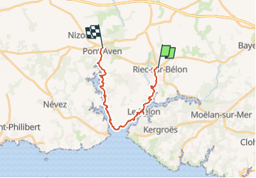
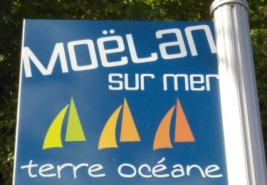
Ruta Senderismo de 17,8 km a descubrir en Bretaña, Finisterre, Riec-sur-Bélon. Esta ruta ha sido propuesta por DanielROLLET.
Descripción
2024 08 08 Beau temps doux
Départ 8h35 ch hôtes "La Maison qui ronronne" Riec-sur-Bélon à 8h35/arrivée 15h10 ch hôtes "Ile d'Art" à Pont-Aven (durée 6h35)
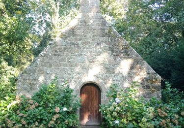
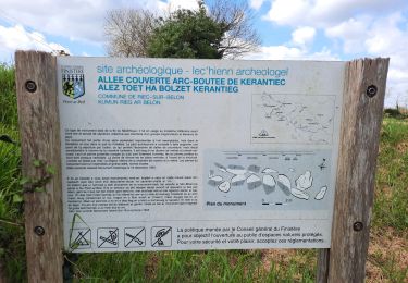
Problème de modification de balisage à Rosbraz (aussitôt le port) et à la chapelle de Tremor. (Rien compris perte de temps importante) modifications faites sur des sentiers non cartographiés, donc difficiles à se recaler.
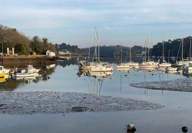
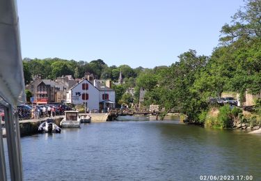
Pause sur le port de Rosbraz.
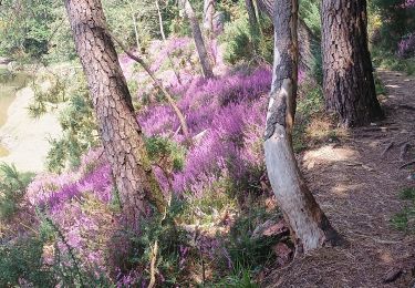
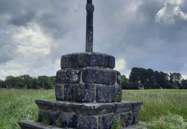
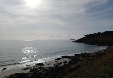
Parcours très agréable (et mémoriel!)
Localización
Comentarios
Excursiones cerca
![Excursión Senderismo Moëlan-sur-Mer - Belon 16 km - Photo](https://media.geolcdn.com/t/375/260/8216e2e0-afdb-49ef-bc45-06fb5d915a7a.jpg&format=jpg&maxdim=2)
![Senderismo Senderismo](https://static1.geolcdn.com/sitytour/trail-icons/101.png)
Senderismo
![](/images/other/stat-length.png)
![](https://static1.geolcdn.com/siteimages/upload/files/16400158638029165_repeat_loop_refresh_sync_direction_icon.png)
![Excursión Senderismo Névez - NEVEZ - Photo](https://media.geolcdn.com/t/375/260/bd180922-a9c6-4019-8a83-8e814349c428.jpg&format=jpg&maxdim=2)
![Senderismo Senderismo](https://static1.geolcdn.com/sitytour/trail-icons/101.png)
![Excursión Senderismo Névez - Le Heant - Photo](https://media.geolcdn.com/t/375/260/2350e410-5d82-4b7f-8685-3c9377a45f94.jpg&format=jpg&maxdim=2)
![Senderismo Senderismo](https://static1.geolcdn.com/sitytour/trail-icons/101.png)
![Excursión Senderismo Pont-Aven - Pont Aven boucle via chapelle St Mathieu/Nevez/Le Henan/Penanros - Photo](https://media.geolcdn.com/t/375/260/ba467620-8015-4227-8ddd-4f5ffdaa645a.jpg&format=jpg&maxdim=2)
![Senderismo Senderismo](https://static1.geolcdn.com/sitytour/trail-icons/101.png)
Senderismo
![](/images/other/stat-length.png)
![](https://static1.geolcdn.com/siteimages/upload/files/16400158638029165_repeat_loop_refresh_sync_direction_icon.png)
![Excursión Senderismo Pont-Aven - BOUCLE PONT AVEN / ROSBRAS / RIEC / PONT AVEN - Photo](https://media.geolcdn.com/t/375/260/3f5e3006-9711-4211-97d4-1e94fd2a584d.jpg&format=jpg&maxdim=2)
![Senderismo Senderismo](https://static1.geolcdn.com/sitytour/trail-icons/101.png)
Senderismo
![](/images/other/stat-length.png)
![](https://static1.geolcdn.com/siteimages/upload/files/16400158638029165_repeat_loop_refresh_sync_direction_icon.png)
![Excursión Senderismo Névez - NEVEZ - Photo](https://media.geolcdn.com/t/375/260/f96a5c93-27bb-45a4-9758-032ea0ee3857.jpg&format=jpg&maxdim=2)
![Senderismo Senderismo](https://static1.geolcdn.com/sitytour/trail-icons/101.png)
![Excursión Barco a motor Pont-Aven - Pont Aven -Belon - Photo](https://media.geolcdn.com/t/375/260/4492da03-0527-4861-b7fa-e8f008ae7260.jpg&format=jpg&maxdim=2)
![Barco a motor Barco a motor](https://static1.geolcdn.com/sitytour/trail-icons/701.png)
Barco a motor
![](/images/other/stat-length.png)
![](https://static1.geolcdn.com/siteimages/upload/files/16400158638029165_repeat_loop_refresh_sync_direction_icon.png)
![Excursión Senderismo Moëlan-sur-Mer - MOËLAN sur MER - Photo](https://media.geolcdn.com/t/375/260/50c1b4de-5d6a-4ed2-b104-4b49e23459a5.jpg&format=jpg&maxdim=2)
![Senderismo Senderismo](https://static1.geolcdn.com/sitytour/trail-icons/101.png)
Senderismo
![](/images/other/stat-length.png)
![](https://static1.geolcdn.com/siteimages/upload/files/16400158638029165_repeat_loop_refresh_sync_direction_icon.png)
![Excursión Senderismo Moëlan-sur-Mer - Belon 5,6 km - Photo](https://media.geolcdn.com/t/375/260/8ab5e063-1a65-4f04-9262-32fd932aab57.jpg&format=jpg&maxdim=2)
![Senderismo Senderismo](https://static1.geolcdn.com/sitytour/trail-icons/101.png)
Senderismo
![](/images/other/stat-length.png)
![](https://static1.geolcdn.com/siteimages/upload/files/16400158638029165_repeat_loop_refresh_sync_direction_icon.png)