![](/images/other/stat-length.png)
![Excursión Paseo ecuestre Saint-Jacques-d'Ambur - ECURIE D'AMBUR / TIXERONT VILLAGE 20 KMS - Photo](https://media.geolcdn.com/t/1900/400/ext.pjpeg?maxdim=2&url=https%3A%2F%2Fstatic1.geolcdn.com%2Fsiteimages%2Fupload%2Ffiles%2F1524743154cheval.jpg)
ECURIE D'AMBUR / TIXERONT VILLAGE 20 KMS
Gérard TIXERONT
Usuario GUIDE
![Longitud](/images/other/stat-length.png)
![Altitud máxima](https://static1.geolcdn.com/siteimages/upload/files/1508320355ic_sort_altitude_max_24dp.png)
![Desnivel positivo](https://static1.geolcdn.com/siteimages/upload/files/1508320355ic_sort_den_pos_24dp.png)
![Km-Effort](/images/other/stat-length.png)
![Altitud mínima](https://static1.geolcdn.com/siteimages/upload/files/1508320355ic_sort_altitude_min_24dp.png)
![Desnivel negativo](https://static1.geolcdn.com/siteimages/upload/files/1508320355ic_sort_den_neg_24dp.png)
![Boucle](https://static1.geolcdn.com/siteimages/upload/files/16400158638029165_repeat_loop_refresh_sync_direction_icon.png)
![Paseo ecuestre](https://static1.geolcdn.com/sitytour/trail-icons/301.png)
3h08
Dificultad : Medio
![Escanee este código QR para abrir la excursión en la aplicación SityTrail](https://capi.geolives.com/qq0zvz2zws4bq2lad0pu/sitytour/trails/4155516/qr.png?size=200)
Aplicación GPS de excursión GRATIS
A propósito
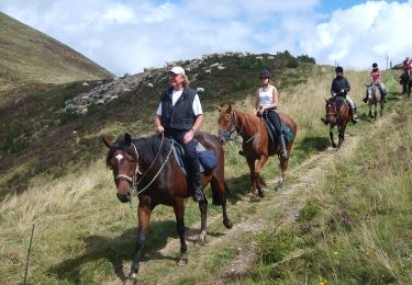
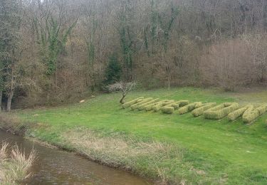
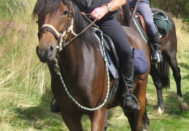
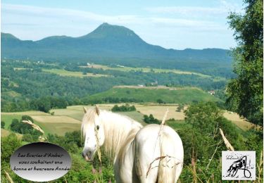
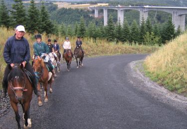
Ruta Paseo ecuestre de 18,5 km a descubrir en Auvergne-Rhône-Alpes, Puy-de-Dôme, Saint-Jacques-d'Ambur. Esta ruta ha sido propuesta por Gérard TIXERONT.
Descripción
Rando facile 20 kms environ. Nombreuses piste de galops ... Au village de Tixeront possibilité d'Héberger les chevaux au prés ou en box au foin et Aliments , barre d'attache , abreuvage . Prévision d'un futur Gîte
Localización
Comentarios
Excursiones cerca
![Paseo ecuestre Paseo ecuestre](https://static1.geolcdn.com/sitytour/trail-icons/301.png)
Paseo ecuestre
![](/images/other/stat-length.png)
![](https://static1.geolcdn.com/siteimages/upload/files/16400158638029165_repeat_loop_refresh_sync_direction_icon.png)
![Excursión A pie Saint-Jacques-d'Ambur - La Chazotte et les Sapins de Martineche - Photo](https://media.geolcdn.com/t/375/260/b1d91e9c-0a23-4e21-8eff-66a7c5d0369e.jpeg&format=jpg&maxdim=2)
![A pie A pie](https://static1.geolcdn.com/sitytour/trail-icons/100.png)
A pie
![](/images/other/stat-length.png)
![](https://static1.geolcdn.com/siteimages/upload/files/16400158638029165_repeat_loop_refresh_sync_direction_icon.png)
![Excursión A pie Montfermy - Foret Domaniale de la Chartreuse - Photo](https://media.geolcdn.com/t/375/260/f8cfcc7d-f272-48ec-89ad-33d1f7e7ce75.jpeg&format=jpg&maxdim=2)
![A pie A pie](https://static1.geolcdn.com/sitytour/trail-icons/100.png)
A pie
![](/images/other/stat-length.png)
![](https://static1.geolcdn.com/siteimages/upload/files/16400158638029165_repeat_loop_refresh_sync_direction_icon.png)
![Excursión A pie Chapdes-Beaufort - Sur les Pas des Chartreux - Photo](https://media.geolcdn.com/t/375/260/6a67584d-6d2a-4686-9980-b00966620a6c.jpeg&format=jpg&maxdim=2)
![A pie A pie](https://static1.geolcdn.com/sitytour/trail-icons/100.png)
A pie
![](/images/other/stat-length.png)
![](https://static1.geolcdn.com/siteimages/upload/files/16400158638029165_repeat_loop_refresh_sync_direction_icon.png)
![Excursión Senderismo Miremont - Miremont - Photo](https://media.geolcdn.com/t/375/260/0dac0637-e167-46bc-9034-d8c1e64a5534.jpg&format=jpg&maxdim=2)
![Senderismo Senderismo](https://static1.geolcdn.com/sitytour/trail-icons/101.png)
Senderismo
![](/images/other/stat-length.png)
![](https://static1.geolcdn.com/siteimages/upload/files/16400158638029165_repeat_loop_refresh_sync_direction_icon.png)
![Excursión Paseo ecuestre Saint-Jacques-d'Ambur - St JACQUES D'AMBUR / PONTAUMUR / ST JACQUES - Photo](https://media.geolcdn.com/t/375/260/720fba68-32de-48f4-82dd-6eb03edb21f8.jpg&format=jpg&maxdim=2)
![Paseo ecuestre Paseo ecuestre](https://static1.geolcdn.com/sitytour/trail-icons/301.png)
Paseo ecuestre
![](/images/other/stat-length.png)
![](https://static1.geolcdn.com/siteimages/upload/files/16400158638029165_repeat_loop_refresh_sync_direction_icon.png)
![Paseo ecuestre Paseo ecuestre](https://static1.geolcdn.com/sitytour/trail-icons/301.png)
Paseo ecuestre
![](/images/other/stat-length.png)
![](https://static1.geolcdn.com/siteimages/upload/files/16400158638029165_repeat_loop_refresh_sync_direction_icon.png)
![Excursión Paseo ecuestre Saint-Jacques-d'Ambur - ST JACQUES / LE ROCHER DU SOLDAT / ST JACQUES 32 KMS - Photo](https://media.geolcdn.com/t/375/260/d6b0eb37-e064-47bf-bdd4-3b51f5b7a603.jpg&format=jpg&maxdim=2)
![Paseo ecuestre Paseo ecuestre](https://static1.geolcdn.com/sitytour/trail-icons/301.png)
Paseo ecuestre
![](/images/other/stat-length.png)
![](https://static1.geolcdn.com/siteimages/upload/files/16400158638029165_repeat_loop_refresh_sync_direction_icon.png)
![Paseo ecuestre Paseo ecuestre](https://static1.geolcdn.com/sitytour/trail-icons/301.png)
Paseo ecuestre
![](/images/other/stat-length.png)
![](https://static1.geolcdn.com/siteimages/upload/files/16400158638029165_repeat_loop_refresh_sync_direction_icon.png)