


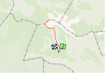

3,2 km | 5,1 km-effort


Usuario


Aplicación GPS de excursión GRATIS
 SityTrail
IGN / Institutos geográficos
SityTrail World
El mundo es suyo
Ruta Senderismo de 4,7 km a descubrir en Occitania, Altos-Pirineos, Beyrède-Jumet-Camous. Esta ruta ha sido propuesta por rogerpoirier.
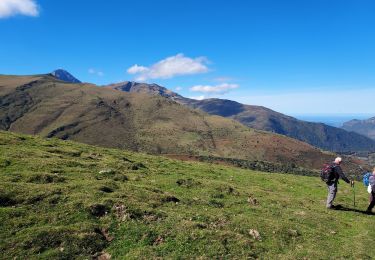
Un panorama immensesur toutes les Pyrénées, et la plaine, Pau, Tarbes, Lannemezan etc...

Senderismo

Senderismo

Senderismo

A pie
Senderismo
Senderismo

Raquetas de nieve
Senderismo
Senderismo