![](/images/other/stat-length.png)
![Excursión Senderismo Soisy-sur-École - Soisy-sur-Ecole - La Padole - Photo](https://media.geolcdn.com/t/1900/400/e0b59d1d-d278-418e-8315-35a11382f879.jpg&format=pjpeg&maxdim=2)
Soisy-sur-Ecole - La Padole
guydu41
Usuario
![Longitud](/images/other/stat-length.png)
![Altitud máxima](https://static1.geolcdn.com/siteimages/upload/files/1508320355ic_sort_altitude_max_24dp.png)
![Desnivel positivo](https://static1.geolcdn.com/siteimages/upload/files/1508320355ic_sort_den_pos_24dp.png)
![Km-Effort](/images/other/stat-length.png)
![Altitud mínima](https://static1.geolcdn.com/siteimages/upload/files/1508320355ic_sort_altitude_min_24dp.png)
![Desnivel negativo](https://static1.geolcdn.com/siteimages/upload/files/1508320355ic_sort_den_neg_24dp.png)
![Boucle](https://static1.geolcdn.com/siteimages/upload/files/16400158638029165_repeat_loop_refresh_sync_direction_icon.png)
![Senderismo](https://static1.geolcdn.com/sitytour/trail-icons/101.png)
2h01
Dificultad : Medio
![Escanee este código QR para abrir la excursión en la aplicación SityTrail](https://capi.geolives.com/qq0zvz2zws4bq2lad0pu/sitytour/trails/4128205/qr.png?size=200)
Aplicación GPS de excursión GRATIS
A propósito
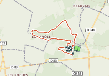
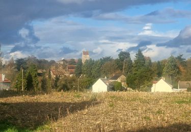
Ruta Senderismo de 7,3 km a descubrir en Isla de Francia, Essonne, Soisy-sur-École. Esta ruta ha sido propuesta por guydu41.
Descripción
Ce petit parcours démarre depuis le parking champêtre "la Padôle" accessible depuis la D83 à 3,5 km à l'Ouest de Soisy-sur-Ecole 91840.
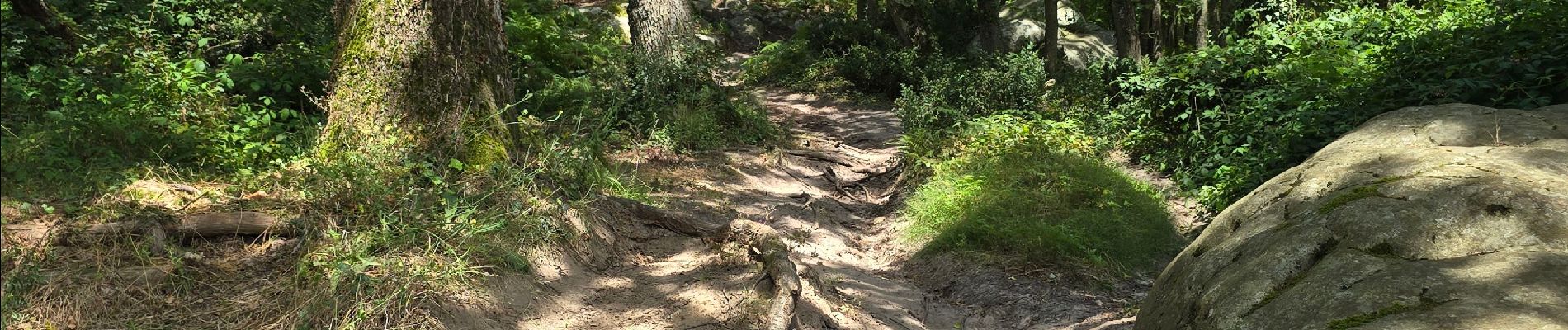
Le parking à la lisière d'un bois est situé au pied d'un chaos rocheux qu'il faudra "gravir".
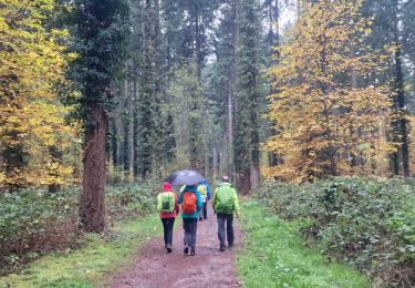
Il emprunte de nombreux sentiers tortueux et chemins dans les bois.
En sortie du bois "les Réages Tortus", il faudra marcher pendant une cinquantaine de mètres le long d'un champ avant de retrouver le sentier rentrant à nouveau dans le bois.
Localización
Comentarios
Excursiones cerca
![Excursión A pie Saint-Germain-sur-École - Boucle Soisy Sur Ecole - Photo](https://media.geolcdn.com/t/375/260/191519f5-31af-4b92-abf3-6dc57900b32f.jpg&format=jpg&maxdim=2)
![A pie A pie](https://static1.geolcdn.com/sitytour/trail-icons/100.png)
A pie
![](/images/other/stat-length.png)
![](https://static1.geolcdn.com/siteimages/upload/files/16400158638029165_repeat_loop_refresh_sync_direction_icon.png)
![Excursión Senderismo Champcueil - JC 51 - 18,4 km - 320m - Champcueil, Les Grands Avaux - 23 km Effort - Photo](https://media.geolcdn.com/t/375/260/489ffccc-38be-45b9-b302-6ec46034b0a7.jpg&format=jpg&maxdim=2)
![Senderismo Senderismo](https://static1.geolcdn.com/sitytour/trail-icons/101.png)
Senderismo
![](/images/other/stat-length.png)
![](https://static1.geolcdn.com/siteimages/upload/files/16400158638029165_repeat_loop_refresh_sync_direction_icon.png)
![Excursión Senderismo Saint-Germain-sur-École - Boucle soisy version definitif - Photo](https://media.geolcdn.com/t/375/260/393daa89-85e9-457d-aec1-026a61438d59.jpg&format=jpg&maxdim=2)
![Senderismo Senderismo](https://static1.geolcdn.com/sitytour/trail-icons/101.png)
Senderismo
![](/images/other/stat-length.png)
![](https://static1.geolcdn.com/siteimages/upload/files/16400158638029165_repeat_loop_refresh_sync_direction_icon.png)
![Excursión A pie Champcueil - Boucle Beauvais 28 km - Photo](https://media.geolcdn.com/t/375/260/e36d05bc-8349-4259-9130-b9f8c6d20d01.jpg&format=jpg&maxdim=2)
![A pie A pie](https://static1.geolcdn.com/sitytour/trail-icons/100.png)
A pie
![](/images/other/stat-length.png)
![](https://static1.geolcdn.com/siteimages/upload/files/16400158638029165_repeat_loop_refresh_sync_direction_icon.png)
![Excursión Senderismo Champcueil - Boucle Champcueil - Photo](https://media.geolcdn.com/t/375/260/7fb1af8d-34a9-45ce-aaee-3ffb4d1f1fed.jpg&format=jpg&maxdim=2)
![Senderismo Senderismo](https://static1.geolcdn.com/sitytour/trail-icons/101.png)
Senderismo
![](/images/other/stat-length.png)
![](https://static1.geolcdn.com/siteimages/upload/files/16400158638029165_repeat_loop_refresh_sync_direction_icon.png)
![Excursión Senderismo Saint-Germain-sur-École - Autour de Soisy sur Ecole - Boucle 30 km - Photo](https://media.geolcdn.com/t/375/260/42a45b0a-7dbc-4142-a18c-2c21a7c16f7f.jpg&format=jpg&maxdim=2)
![Senderismo Senderismo](https://static1.geolcdn.com/sitytour/trail-icons/101.png)
Senderismo
![](/images/other/stat-length.png)
![](https://static1.geolcdn.com/siteimages/upload/files/16400158638029165_repeat_loop_refresh_sync_direction_icon.png)
![Excursión A pie Champcueil - Balade entre Brie de Gâtinais - Photo](https://media.geolcdn.com/t/375/260/b0136ac0-b10f-482a-a588-87ed1c582c80.jpeg&format=jpg&maxdim=2)
![A pie A pie](https://static1.geolcdn.com/sitytour/trail-icons/100.png)
A pie
![](/images/other/stat-length.png)
![](https://static1.geolcdn.com/siteimages/upload/files/16400158638029165_repeat_loop_refresh_sync_direction_icon.png)
![Excursión Senderismo Champcueil - Grands Avaux - Tertre blanc (Nainville) - fait - Photo](https://media.geolcdn.com/t/375/260/ext.jpg?maxdim=2&url=https%3A%2F%2Fstatic1.geolcdn.com%2Fsiteimages%2Fupload%2Ffiles%2F1553511878bg_sport_marche.png)
![Senderismo Senderismo](https://static1.geolcdn.com/sitytour/trail-icons/101.png)
Senderismo
![](/images/other/stat-length.png)
![](https://static1.geolcdn.com/siteimages/upload/files/16400158638029165_repeat_loop_refresh_sync_direction_icon.png)
![Excursión Senderismo Mondeville - Boucle mondeville par videlles - Photo](https://media.geolcdn.com/t/375/260/ext.jpg?maxdim=2&url=https%3A%2F%2Fstatic1.geolcdn.com%2Fsiteimages%2Fupload%2Ffiles%2F1553511878bg_sport_marche.png)
![Senderismo Senderismo](https://static1.geolcdn.com/sitytour/trail-icons/101.png)
Senderismo
![](/images/other/stat-length.png)
![](https://static1.geolcdn.com/siteimages/upload/files/16400158638029165_repeat_loop_refresh_sync_direction_icon.png)