


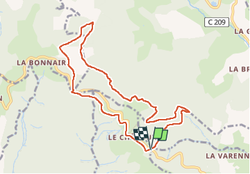

17,8 km | 27 km-effort


Usuario


Aplicación GPS de excursión GRATIS
 SityTrail
IGN / Institutos geográficos
SityTrail World
El mundo es suyo
Ruta Senderismo de 9,7 km a descubrir en Auvergne-Rhône-Alpes, Ródano, Sainte-Paule. Esta ruta ha sido propuesta por Thomasdanielle.
D/A : Parking Col du chêne
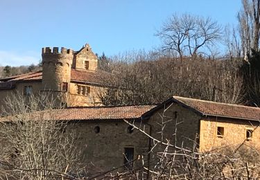
Attention : il faut prévoir des bonnes chaussures les chemins sont très pierreux mais bien ombragés

Senderismo

Senderismo

Senderismo
Senderismo
Senderismo
Senderismo

Senderismo

Senderismo
Senderismo