![](/images/other/stat-length.png)
![Excursión Senderismo Merelbeke - Merelbeke - Munte - Photo](https://media.geolcdn.com/t/1900/400/ext.pjpeg?maxdim=2&url=https%3A%2F%2Fservices.sitytrail.com%2FGeolivesWS%2FDownloadMedia.ashx%3FTrailID%3D412565%26Media%3D20150426130900.jpg)
Merelbeke - Munte
mavbelgium
Usuario
![Longitud](/images/other/stat-length.png)
Longitud
23 km
![Altitud máxima](https://static1.geolcdn.com/siteimages/upload/files/1508320355ic_sort_altitude_max_24dp.png)
Altitud máxima
52 m
![Desnivel positivo](https://static1.geolcdn.com/siteimages/upload/files/1508320355ic_sort_den_pos_24dp.png)
Desnivel positivo
138 m
![Km-Effort](/images/other/stat-length.png)
Km-Effort
24 km
![Altitud mínima](https://static1.geolcdn.com/siteimages/upload/files/1508320355ic_sort_altitude_min_24dp.png)
Altitud mínima
8 m
![Desnivel negativo](https://static1.geolcdn.com/siteimages/upload/files/1508320355ic_sort_den_neg_24dp.png)
Desnivel negativo
140 m
![Boucle](https://static1.geolcdn.com/siteimages/upload/files/16400158638029165_repeat_loop_refresh_sync_direction_icon.png)
Boucle
Sí
Fecha de creación :
2015-04-26 00:00:00.0
Última modificación :
2015-04-26 00:00:00.0
![Senderismo](https://static1.geolcdn.com/sitytour/trail-icons/101.png)
4h08
Dificultad : Medio
![Escanee este código QR para abrir la excursión en la aplicación SityTrail](https://capi.geolives.com/qq0zvz2zws4bq2lad0pu/sitytour/trails/412565/qr.png?size=200)
Aplicación GPS de excursión GRATIS
A propósito
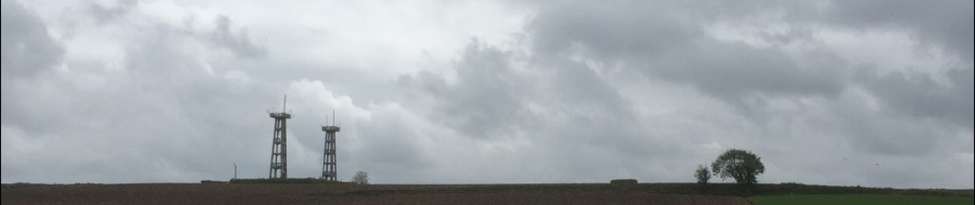
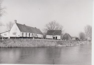
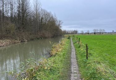
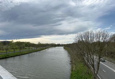
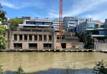
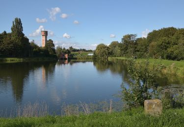
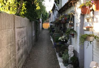
Ruta Senderismo de 23 km a descubrir en Flandes, Provincia de Flandes Oriental, Merelbeke. Esta ruta ha sido propuesta por mavbelgium.
Descripción
Via leuke paden en wegels door de mooie dorpen rond Merelbeke (Lemberge/Bottelare/Munte/Melsen/Schelderode).. Aanrader!!
Localización
País:
Belgium
Región :
Flandes
Departamento/provincia :
Provincia de Flandes Oriental
Municipio :
Merelbeke
Localidad:
Merelbeke
Salida:(Dec)
Salida:(UTM)
552218 ; 5648932 (31U) N.
Comentarios
Excursiones cerca
![Excursión A pie De Pinte - Natuurbeleefpad Magische Meersen - Photo](https://media.geolcdn.com/t/375/260/e12c85a9-8b45-443b-b7ca-d708034adbc9.jpeg&format=jpg&maxdim=2)
![A pie A pie](https://static1.geolcdn.com/sitytour/trail-icons/100.png)
Natuurbeleefpad Magische Meersen
A pie
Fácil
De Pinte,
Flandes,
Provincia de Flandes Oriental,
Belgium
![](/images/other/stat-length.png)
4,3 km | 4,7 km-effort
1h 3min
![](https://static1.geolcdn.com/siteimages/upload/files/16400158638029165_repeat_loop_refresh_sync_direction_icon.png)
Sí
![Excursión A pie De Pinte - Doornhammekeroute - Photo](https://media.geolcdn.com/t/375/260/e12c85a9-8b45-443b-b7ca-d708034adbc9.jpeg&format=jpg&maxdim=2)
![A pie A pie](https://static1.geolcdn.com/sitytour/trail-icons/100.png)
Doornhammekeroute
A pie
Fácil
De Pinte,
Flandes,
Provincia de Flandes Oriental,
Belgium
![](/images/other/stat-length.png)
9,8 km | 10,6 km-effort
2h 25min
![](https://static1.geolcdn.com/siteimages/upload/files/16400158638029165_repeat_loop_refresh_sync_direction_icon.png)
No
![Excursión A pie De Pinte - Doornhammekeroute (verlenging) - Photo](https://media.geolcdn.com/t/375/260/e12c85a9-8b45-443b-b7ca-d708034adbc9.jpeg&format=jpg&maxdim=2)
![A pie A pie](https://static1.geolcdn.com/sitytour/trail-icons/100.png)
Doornhammekeroute (verlenging)
A pie
Fácil
De Pinte,
Flandes,
Provincia de Flandes Oriental,
Belgium
![](/images/other/stat-length.png)
4,4 km | 4,8 km-effort
1h 4min
![](https://static1.geolcdn.com/siteimages/upload/files/16400158638029165_repeat_loop_refresh_sync_direction_icon.png)
No
![Excursión Senderismo Oosterzele - Oosterzele Bunker - 12 km RT - Photo](https://media.geolcdn.com/t/375/260/ext.jpg?maxdim=2&url=https%3A%2F%2Fstatic1.geolcdn.com%2Fsiteimages%2Fupload%2Ffiles%2F1553511878bg_sport_marche.png)
![Senderismo Senderismo](https://static1.geolcdn.com/sitytour/trail-icons/101.png)
Oosterzele Bunker - 12 km RT
Senderismo
Muy fácil
(2)
Oosterzele,
Flandes,
Provincia de Flandes Oriental,
Belgium
![](/images/other/stat-length.png)
12,1 km | 13,4 km-effort
Desconocido
![](https://static1.geolcdn.com/siteimages/upload/files/16400158638029165_repeat_loop_refresh_sync_direction_icon.png)
Sí
![Excursión Senderismo Melle - Gontrode Munkzwalm 25 km - Photo](https://media.geolcdn.com/t/375/260/467e94e0-3b43-4cca-be16-d6b647696c57.jpg&format=jpg&maxdim=2)
![Senderismo Senderismo](https://static1.geolcdn.com/sitytour/trail-icons/101.png)
Gontrode Munkzwalm 25 km
Senderismo
Medio
Melle,
Flandes,
Provincia de Flandes Oriental,
Belgium
![](/images/other/stat-length.png)
25 km | 28 km-effort
7h 21min
![](https://static1.geolcdn.com/siteimages/upload/files/16400158638029165_repeat_loop_refresh_sync_direction_icon.png)
No
![Excursión Senderismo Gante - Gent expo Musée Gand centre 14 km - Photo](https://media.geolcdn.com/t/375/260/22ddf3b2-7a66-4155-8a19-5a85eb52811e.jpg&format=jpg&maxdim=2)
![Senderismo Senderismo](https://static1.geolcdn.com/sitytour/trail-icons/101.png)
Gent expo Musée Gand centre 14 km
Senderismo
Difícil
Gante,
Flandes,
Provincia de Flandes Oriental,
Belgium
![](/images/other/stat-length.png)
14,2 km | 15,8 km-effort
3h 35min
![](https://static1.geolcdn.com/siteimages/upload/files/16400158638029165_repeat_loop_refresh_sync_direction_icon.png)
Sí
![Excursión Senderismo Gante - Gand 10 km - Photo](https://media.geolcdn.com/t/375/260/ad1b8cb7-76c6-496a-a285-a566bb0c3dba.jpg&format=jpg&maxdim=2)
![Senderismo Senderismo](https://static1.geolcdn.com/sitytour/trail-icons/101.png)
Gand 10 km
Senderismo
Fácil
Gante,
Flandes,
Provincia de Flandes Oriental,
Belgium
![](/images/other/stat-length.png)
10,1 km | 11,4 km-effort
3h 49min
![](https://static1.geolcdn.com/siteimages/upload/files/16400158638029165_repeat_loop_refresh_sync_direction_icon.png)
Sí
![Excursión A pie Melle - Gondepad - Photo](https://media.geolcdn.com/t/375/260/ef009975-a7e3-4038-8920-11131e00a757.jpeg&format=jpg&maxdim=2)
![A pie A pie](https://static1.geolcdn.com/sitytour/trail-icons/100.png)
Gondepad
A pie
Fácil
Melle,
Flandes,
Provincia de Flandes Oriental,
Belgium
![](/images/other/stat-length.png)
3,3 km | 3,5 km-effort
48min
![](https://static1.geolcdn.com/siteimages/upload/files/16400158638029165_repeat_loop_refresh_sync_direction_icon.png)
No
![Excursión Senderismo Merelbeke - Bottelare Munte Baaigem en terug - Photo](https://media.geolcdn.com/t/375/260/ext.jpg?maxdim=2&url=https%3A%2F%2Fservices.sitytrail.com%2FGeolivesWS%2FDownloadMedia.ashx%3FTrailID%3D850360%26Media%3D20170521201903.jpg)
![Senderismo Senderismo](https://static1.geolcdn.com/sitytour/trail-icons/101.png)
Bottelare Munte Baaigem en terug
Senderismo
Fácil
Merelbeke,
Flandes,
Provincia de Flandes Oriental,
Belgium
![](/images/other/stat-length.png)
21 km | 23 km-effort
4h 2min
![](https://static1.geolcdn.com/siteimages/upload/files/16400158638029165_repeat_loop_refresh_sync_direction_icon.png)
No