![](/images/other/stat-length.png)
![Excursión Senderismo Bellême - de belleme a l'etang de la herse - Photo](https://media.geolcdn.com/t/1900/400/cf5fb921-4c5a-49a3-9ce7-3714cc541daf.jpg&format=pjpeg&maxdim=2)
de belleme a l'etang de la herse
darkpapa
Usuario
![Longitud](/images/other/stat-length.png)
Longitud
11 km
![Altitud máxima](https://static1.geolcdn.com/siteimages/upload/files/1508320355ic_sort_altitude_max_24dp.png)
Altitud máxima
257 m
![Desnivel positivo](https://static1.geolcdn.com/siteimages/upload/files/1508320355ic_sort_den_pos_24dp.png)
Desnivel positivo
219 m
![Km-Effort](/images/other/stat-length.png)
Km-Effort
13,9 km
![Altitud mínima](https://static1.geolcdn.com/siteimages/upload/files/1508320355ic_sort_altitude_min_24dp.png)
Altitud mínima
164 m
![Desnivel negativo](https://static1.geolcdn.com/siteimages/upload/files/1508320355ic_sort_den_neg_24dp.png)
Desnivel negativo
219 m
![Boucle](https://static1.geolcdn.com/siteimages/upload/files/16400158638029165_repeat_loop_refresh_sync_direction_icon.png)
Boucle
Sí
Fecha de creación :
2024-06-25 12:34:02.376
Última modificación :
2025-01-23 09:30:28.996
![Senderismo](https://static1.geolcdn.com/sitytour/trail-icons/101.png)
3h10
Dificultad : Fácil
![Escanee este código QR para abrir la excursión en la aplicación SityTrail](https://capi.geolives.com/qq0zvz2zws4bq2lad0pu/sitytour/trails/4102758/qr.png?size=200)
Aplicación GPS de excursión GRATIS
A propósito
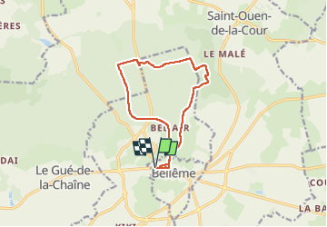
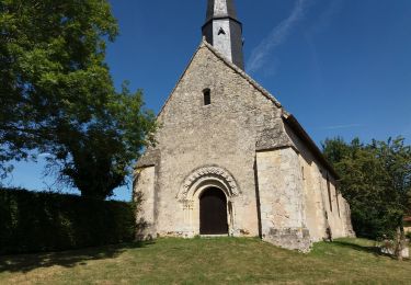
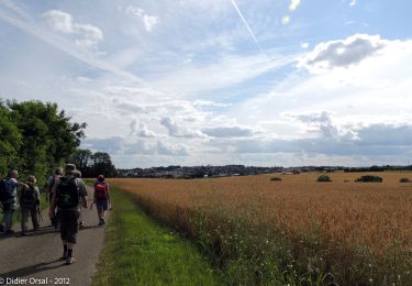
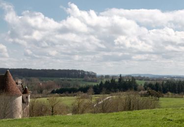
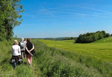
Ruta Senderismo de 11 km a descubrir en Normandía, Orne, Bellême. Esta ruta ha sido propuesta por darkpapa.
Descripción
départ et retour place général Leclerc notre point de depart etant le restaurant la dinette gourmande
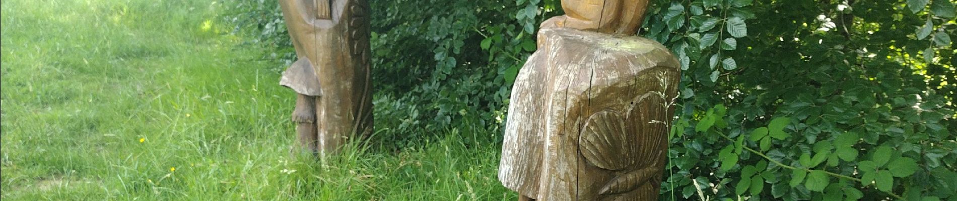
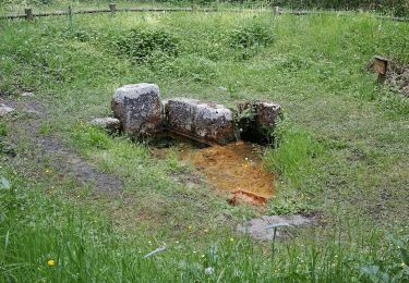
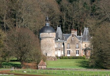
a voir au grès du parcours les sculptures bois
Localización
País:
France
Región :
Normandía
Departamento/provincia :
Orne
Municipio :
Bellême
Localidad:
Unknown
Salida:(Dec)
Salida:(UTM)
319035 ; 5361072 (31U) N.
Comentarios
Excursiones cerca
![Excursión Senderismo Belforêt-en-Perche - Chêne séculaire - Bellême - Photo](https://media.geolcdn.com/t/375/260/ext.jpg?maxdim=2&url=https%3A%2F%2Fservices.sitytrail.com%2FGeolivesWS%2FDownloadMedia.ashx%3FTrailID%3D111658%26Media%3D7896_2.jpg)
![Senderismo Senderismo](https://static1.geolcdn.com/sitytour/trail-icons/101.png)
Chêne séculaire - Bellême
Senderismo
Medio
(2)
Belforêt-en-Perche,
Normandía,
Orne,
France
![](/images/other/stat-length.png)
9,3 km | 11,8 km-effort
3h 30min
![](https://static1.geolcdn.com/siteimages/upload/files/16400158638029165_repeat_loop_refresh_sync_direction_icon.png)
Sí
![Excursión Bici de montaña Bellême - La Bell'Rando 2005 - Photo](https://media.geolcdn.com/t/375/260/ext.jpg?maxdim=2&url=https%3A%2F%2Fservices.sitytrail.com%2FGeolivesWS%2FDownloadMedia.ashx%3FTrailID%3D101083%26Media%3D573_2.jpg)
![Bici de montaña Bici de montaña](https://static1.geolcdn.com/sitytour/trail-icons/202.png)
La Bell'Rando 2005
Bici de montaña
Muy difícil
(1)
Bellême,
Normandía,
Orne,
France
![](/images/other/stat-length.png)
50 km | 64 km-effort
3h 15min
![](https://static1.geolcdn.com/siteimages/upload/files/16400158638029165_repeat_loop_refresh_sync_direction_icon.png)
Sí
![Excursión A pie Saint-Martin-du-Vieux-Bellême - Chêne séculaire - Photo](https://media.geolcdn.com/t/375/260/1e7dc81d-cfa6-49bd-86cc-f4a86c5edf07.jpeg&format=jpg&maxdim=2)
![A pie A pie](https://static1.geolcdn.com/sitytour/trail-icons/100.png)
Chêne séculaire
A pie
Fácil
Saint-Martin-du-Vieux-Bellême,
Normandía,
Orne,
France
![](/images/other/stat-length.png)
9,2 km | 11,8 km-effort
2h 40min
![](https://static1.geolcdn.com/siteimages/upload/files/16400158638029165_repeat_loop_refresh_sync_direction_icon.png)
No
![Excursión Bici eléctrica Bellême - circuit des vallées bellemoises - Photo](https://media.geolcdn.com/t/375/260/8942d37a-44b6-4034-87b6-86b0b9a49d8c.jpg&format=jpg&maxdim=2)
![Bici eléctrica Bici eléctrica](https://static1.geolcdn.com/sitytour/trail-icons/205.png)
circuit des vallées bellemoises
Bici eléctrica
Fácil
Bellême,
Normandía,
Orne,
France
![](/images/other/stat-length.png)
44 km | 52 km-effort
4h 48min
![](https://static1.geolcdn.com/siteimages/upload/files/16400158638029165_repeat_loop_refresh_sync_direction_icon.png)
Sí
![Excursión Senderismo Bellême - Bellême - Mortagne-au-Perche 23 km - Photo](https://media.geolcdn.com/t/375/260/648b0c04-c9f6-4954-a7eb-873b2f717454.jpg&format=jpg&maxdim=2)
![Senderismo Senderismo](https://static1.geolcdn.com/sitytour/trail-icons/101.png)
Bellême - Mortagne-au-Perche 23 km
Senderismo
Muy difícil
Bellême,
Normandía,
Orne,
France
![](/images/other/stat-length.png)
23 km | 27 km-effort
6h 17min
![](https://static1.geolcdn.com/siteimages/upload/files/16400158638029165_repeat_loop_refresh_sync_direction_icon.png)
No
![Excursión Senderismo Bellême - Bellême - Nocé/Courboyer 17 km - Photo](https://media.geolcdn.com/t/375/260/0a669ee2-665f-435c-8b9c-5b0346d2e0a4.jpg&format=jpg&maxdim=2)
![Senderismo Senderismo](https://static1.geolcdn.com/sitytour/trail-icons/101.png)
Bellême - Nocé/Courboyer 17 km
Senderismo
Fácil
Bellême,
Normandía,
Orne,
France
![](/images/other/stat-length.png)
16,6 km | 20 km-effort
3h 24min
![](https://static1.geolcdn.com/siteimages/upload/files/16400158638029165_repeat_loop_refresh_sync_direction_icon.png)
No
![Excursión Senderismo Bellême - Traversées Percheronnes Bellême - Gémages 15,4 Km - Photo](https://media.geolcdn.com/t/375/260/23f7282d-ffa3-4b2e-a94a-5dc4af001232.jpg&format=jpg&maxdim=2)
![Senderismo Senderismo](https://static1.geolcdn.com/sitytour/trail-icons/101.png)
Traversées Percheronnes Bellême - Gémages 15,4 Km
Senderismo
Medio
Bellême,
Normandía,
Orne,
France
![](/images/other/stat-length.png)
15,4 km | 17,6 km-effort
4h 2min
![](https://static1.geolcdn.com/siteimages/upload/files/16400158638029165_repeat_loop_refresh_sync_direction_icon.png)
No
![Excursión Senderismo Bellême - Bellême - La Perrière 12 km - Photo](https://media.geolcdn.com/t/375/260/b423f935-0a19-479d-aaad-bc5a9bf55dc8.jpg&format=jpg&maxdim=2)
![Senderismo Senderismo](https://static1.geolcdn.com/sitytour/trail-icons/101.png)
Bellême - La Perrière 12 km
Senderismo
Medio
Bellême,
Normandía,
Orne,
France
![](/images/other/stat-length.png)
12,1 km | 15,4 km-effort
3h 20min
![](https://static1.geolcdn.com/siteimages/upload/files/16400158638029165_repeat_loop_refresh_sync_direction_icon.png)
No
![Excursión Senderismo Bellême - Bellême - Mauves-sur-Huisne 14 km - Photo](https://media.geolcdn.com/t/375/260/bd52a7c3-ac84-428f-b134-e425824892a0.jpg&format=jpg&maxdim=2)
![Senderismo Senderismo](https://static1.geolcdn.com/sitytour/trail-icons/101.png)
Bellême - Mauves-sur-Huisne 14 km
Senderismo
Fácil
Bellême,
Normandía,
Orne,
France
![](/images/other/stat-length.png)
13,8 km | 16,5 km-effort
5h 40min
![](https://static1.geolcdn.com/siteimages/upload/files/16400158638029165_repeat_loop_refresh_sync_direction_icon.png)
No