Excursión Senderismo Oberstdorf - Nebelhorn - Photo
 Geert H.
Geert H.

Usuario

© OpenStreetMap contributors
Longitud
Longitud
12,6 km
Altitud máxima
Altitud máxima
2210 m
Desnivel positivo
Desnivel positivo
217 m
Km-Effort
Km-Effort  
20 km
Altitud mínima
Altitud mínima
812 m
Desnivel negativo
Desnivel negativo
1586 m
Boucle
Boucle
No
Fecha de creación :
2024-06-18 10:43:26.572
Última modificación :
2024-06-22 07:46:24.39

(0 Opinión)

Senderismo
Senderismo
2h18
Dificultad : Medio

Escanee este código QR para abrir la excursión en la aplicación SityTrail

Aplicación GPS de excursión GRATIS

Logo SityTrail SityTrail

IGN / Institutos geográficos

Descargar SityTrail en App Store Descargar SityTrail en Google Play

Logo SityTrail SityTrail World

El mundo es suyo

Descargar SityTrail en App Store Descargar SityTrail en Google Play Descargar SityTrail en Huawei AppGallery

A propósito

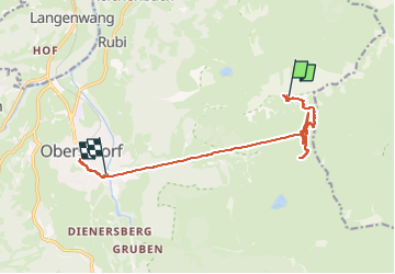
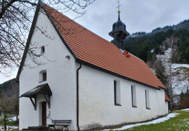
Ruta Senderismo de 12,6 km a descubrir en Baviera, Landkreis Oberallgäu, Oberstdorf. Esta ruta ha sido propuesta por Geert H..

Descripción

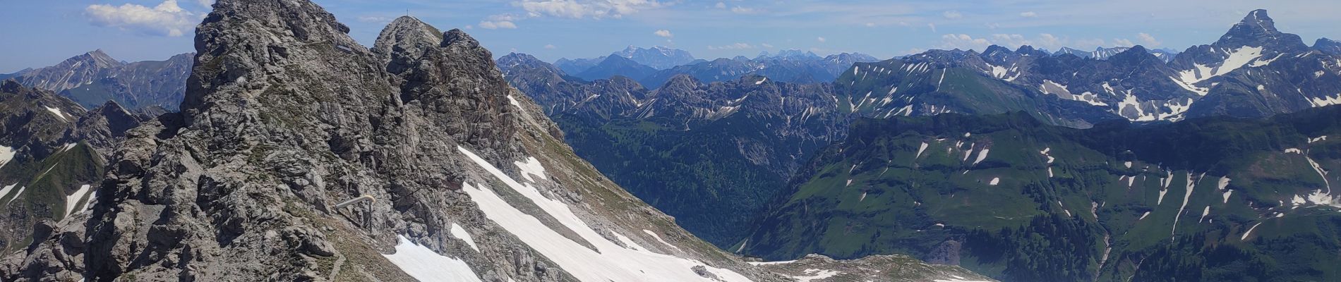
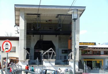
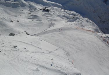
Went up to the top of the Nebelhorn by cable car and came back on foot to the Höfatsblick mountain station. Walke around and back down to Oberstdorf to see a little bit of the town.

Perfil altimétrico

Fotos

Localización

País:
Germany
Región :
Baviera
Departamento/provincia :
Landkreis Oberallgäu
Municipio :
Oberstdorf
Localidad:
Unknown
Salida:(UTM)
601282 ; 5252933 (32T) N.

Excursiones cerca

Excursión A pie Oberstdorf - B - Winterwanderung ins Stillachtal - Photo
A pie
GUIDE+

A pie

Fácil
Oberstdorf, Baviera, Landkreis Oberallgäu, Germany
4,4 km | 6,2 km-effort
1h 24min
No
Excursión A pie Oberstdorf - D - Gerstruben - ein Bergdorf im Winter - Photo
A pie
GUIDE+

A pie

Fácil
Oberstdorf, Baviera, Landkreis Oberallgäu, Germany
3,2 km | 3,9 km-effort
52min
No
Excursión A pie Oberstdorf - O - Winterwanderung ins Oytal - Photo
A pie
GUIDE+

A pie

Fácil
Oberstdorf, Baviera, Landkreis Oberallgäu, Germany
4,9 km | 5,7 km-effort
1h 17min
No
Excursión A pie Oberstdorf - G - Winterwanderung zur Gaisalpe - Photo
A pie
GUIDE+

A pie

Fácil
Oberstdorf, Baviera, Landkreis Oberallgäu, Germany
4,6 km | 6,2 km-effort
1h 24min
No
Excursión A pie Oberstdorf - Ru - Im Winter zur Schöllanger Burgkirche - Photo
A pie
GUIDE+

A pie

Fácil
Oberstdorf, Baviera, Landkreis Oberallgäu, Germany
3,6 km | 4,4 km-effort
59min
No
Excursión A pie Oberstdorf - Hindelanger Klettersteig - Photo
A pie
GUIDE+

A pie

Fácil
Oberstdorf, Baviera, Landkreis Oberallgäu, Germany
6,7 km | 13,1 km-effort
2h 58min
No
Excursión A pie Oberstdorf - M - Über den Moorweiher ins Trettachtal - Photo
A pie
GUIDE+

A pie

Fácil
Oberstdorf, Baviera, Landkreis Oberallgäu, Germany
6,7 km | 8,4 km-effort
1h 54min
No
Excursión A pie Oberstdorf - H - Vom Schönblick nach Hochleite - Photo
A pie
GUIDE+

A pie

Fácil
Oberstdorf, Baviera, Landkreis Oberallgäu, Germany
9,5 km | 17,2 km-effort
3h 54min
No
Excursión Bicicleta Fischen im Allgäu - f-duitsland-trettachtal-langs-de-iller - Photo
Bicicleta
gpstracks

Bicicleta

Muy fácil
Fischen im Allgäu, Baviera, Landkreis Oberallgäu, Germany
30 km | 35 km-effort
Desconocido


Cerrar
Mis suscripciones