![](/images/other/stat-length.png)
![Excursión Senderismo Nouzilly - Nouzilly - Circuit des Orchidées - Photo](https://media.geolcdn.com/t/1900/400/a94eac27-6f2f-438f-99a8-49504ab468e3.jpg&format=pjpeg&maxdim=2)
Nouzilly - Circuit des Orchidées
guydu41
Usuario
![Longitud](/images/other/stat-length.png)
![Altitud máxima](https://static1.geolcdn.com/siteimages/upload/files/1508320355ic_sort_altitude_max_24dp.png)
![Desnivel positivo](https://static1.geolcdn.com/siteimages/upload/files/1508320355ic_sort_den_pos_24dp.png)
![Km-Effort](/images/other/stat-length.png)
![Altitud mínima](https://static1.geolcdn.com/siteimages/upload/files/1508320355ic_sort_altitude_min_24dp.png)
![Desnivel negativo](https://static1.geolcdn.com/siteimages/upload/files/1508320355ic_sort_den_neg_24dp.png)
![Boucle](https://static1.geolcdn.com/siteimages/upload/files/16400158638029165_repeat_loop_refresh_sync_direction_icon.png)
![Senderismo](https://static1.geolcdn.com/sitytour/trail-icons/101.png)
5h54
Dificultad : Difícil
![Escanee este código QR para abrir la excursión en la aplicación SityTrail](https://capi.geolives.com/qq0zvz2zws4bq2lad0pu/sitytour/trails/4085039/qr.png?size=200)
Aplicación GPS de excursión GRATIS
A propósito
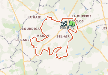
Ruta Senderismo de 21 km a descubrir en Centro, Indre y Loira, Nouzilly. Esta ruta ha sido propuesta por guydu41.
Descripción
Circuit PR balisé Jaune de 21 km à parcourir dans le sens horaire.
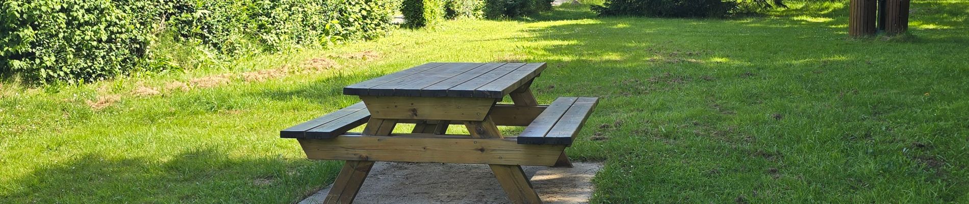
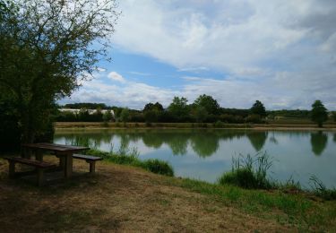
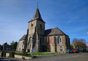
Il démarre depuis le parking jouxtant un plan d’eau, Allée de la Panouse à Nouzilly, 37380.
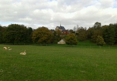
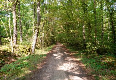
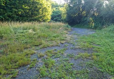
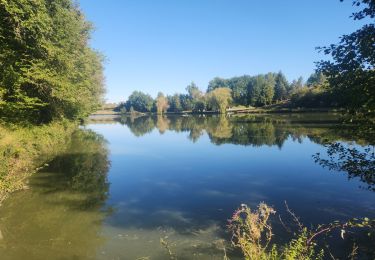
Il emprunte de nombreux chemins et sentiers boisés, longe des étangs, permet de voir de belles demeures et passe à proximité de nombreuses cavités.
A 5,8 km du point de départ, en fond de vallée, on peut voir plusieurs cavités troglodytes abandonnées.
Remarque : Il est possible de grimper légèrement sur le coteau pour en explorer une profondément encaissée, en toute prudence.
A 6,4 km au lieu-dit "les Prés de la Patouille", des passerelles en bois permettent l’exploration d’une zone forestière alluviale et inondable.
A 7,4 km le circuit passe à côté d’une masse rocheuse comportant plusieurs grottes inutilisées.
Idem à 10,7 km
A 11 km à droite de l'étang en dessous du Moulin de Berton, on peut voir depuis le chemin dans un bois un bloc rocheux comportant une ancienne habitation troglodyte abandonnée composée de plusieurs pièces qu'il est possible d'explorer en faisant attention (bois privé non clôturé).
A 20 km, le circuit traverse un parc ; "les Marronniers".
En fin de parcours, on peut voir un lavoir.
Note : Personnellement, je trouve ce circuit nature exceptionnel par la diversité des chemins et sentiers empruntés et la découverte de ces très vieilles habitations creusées dans la roche.
Localización
Comentarios
Excursiones cerca
![Excursión Senderismo Cerelles - Cerelles - Photo](https://media.geolcdn.com/t/375/260/ext.jpg?maxdim=2&url=https%3A%2F%2Fservices.sitytrail.com%2FGeolivesWS%2FDownloadMedia.ashx%3FTrailID%3D231250%26Media%3Dfix__20131106141542.jpg)
![Senderismo Senderismo](https://static1.geolcdn.com/sitytour/trail-icons/101.png)
Senderismo
![](/images/other/stat-length.png)
![](https://static1.geolcdn.com/siteimages/upload/files/16400158638029165_repeat_loop_refresh_sync_direction_icon.png)
![Excursión Senderismo Monnaie - Monnaie - 4.3km 33m 1h05 - 2023 07 26 - Photo](https://media.geolcdn.com/t/375/260/e63dbb26-070f-44c2-b6bb-6676aa2a7839.jpg&format=jpg&maxdim=2)
![Senderismo Senderismo](https://static1.geolcdn.com/sitytour/trail-icons/101.png)
Senderismo
![](/images/other/stat-length.png)
![](https://static1.geolcdn.com/siteimages/upload/files/16400158638029165_repeat_loop_refresh_sync_direction_icon.png)
![Excursión Senderismo Nouzilly - Nouzilly - Circuit des Orchidées - 22.4km 375m 5h10 - 2022 04 10 - Photo](https://media.geolcdn.com/t/375/260/f369628d-ef19-453f-82e0-3cfc95192175.jpg&format=jpg&maxdim=2)
![Senderismo Senderismo](https://static1.geolcdn.com/sitytour/trail-icons/101.png)
Senderismo
![](/images/other/stat-length.png)
![](https://static1.geolcdn.com/siteimages/upload/files/16400158638029165_repeat_loop_refresh_sync_direction_icon.png)
![Excursión Senderismo Cerelles - Cérelles - Circuits 2 puis 1 - 18.9km 255m 4h05 - 2020 09 11 - Photo](https://media.geolcdn.com/t/375/260/2967519f-5900-49cf-b0ee-522e62c44bc9.jpg&format=jpg&maxdim=2)
![Senderismo Senderismo](https://static1.geolcdn.com/sitytour/trail-icons/101.png)
Senderismo
![](/images/other/stat-length.png)
![](https://static1.geolcdn.com/siteimages/upload/files/16400158638029165_repeat_loop_refresh_sync_direction_icon.png)
![Excursión Senderismo Nouzilly - Nouzilly - Cavités troglodytes - Photo](https://media.geolcdn.com/t/375/260/7f01b6f5-4bf2-4f68-8524-f8ef3b2952f7.jpg&format=jpg&maxdim=2)
![Senderismo Senderismo](https://static1.geolcdn.com/sitytour/trail-icons/101.png)
Senderismo
![](/images/other/stat-length.png)
![](https://static1.geolcdn.com/siteimages/upload/files/16400158638029165_repeat_loop_refresh_sync_direction_icon.png)
![Excursión Senderismo Cerelles - Cerelles-10,5 km-Le 05 Février 2015-Auteur tintin37 - Photo](https://media.geolcdn.com/t/375/260/ext.jpg?maxdim=2&url=https%3A%2F%2Fstatic1.geolcdn.com%2Fsiteimages%2Fupload%2Ffiles%2F1553511878bg_sport_marche.png)
![Senderismo Senderismo](https://static1.geolcdn.com/sitytour/trail-icons/101.png)
Senderismo
![](/images/other/stat-length.png)
![](https://static1.geolcdn.com/siteimages/upload/files/16400158638029165_repeat_loop_refresh_sync_direction_icon.png)
![Excursión Senderismo Rouziers-de-Touraine - 2022.09.22-8.3km-Rouziers de Touraine - Photo](https://media.geolcdn.com/t/375/260/180d9b93-133e-4b36-b79a-af66091ab44a.jpg&format=jpg&maxdim=2)
![Senderismo Senderismo](https://static1.geolcdn.com/sitytour/trail-icons/101.png)
Senderismo
![](/images/other/stat-length.png)
![](https://static1.geolcdn.com/siteimages/upload/files/16400158638029165_repeat_loop_refresh_sync_direction_icon.png)
![Excursión Senderismo Monnaie - Monnaie - 19ème rando St-Valentin - 17.8km 155m 3h30 - 2006 02 06 - Photo](https://media.geolcdn.com/t/375/260/ext.jpg?maxdim=2&url=https%3A%2F%2Fstatic1.geolcdn.com%2Fsiteimages%2Fupload%2Ffiles%2F1553511878bg_sport_marche.png)
![Senderismo Senderismo](https://static1.geolcdn.com/sitytour/trail-icons/101.png)
Senderismo
![](/images/other/stat-length.png)
![](https://static1.geolcdn.com/siteimages/upload/files/16400158638029165_repeat_loop_refresh_sync_direction_icon.png)
![Excursión Senderismo Nouzilly - 2021.11.07-10,5km-Nouzilly - Photo](https://media.geolcdn.com/t/375/260/16f1d1f6-e8fc-45ba-b2c5-cec52dd5729a.jpg&format=jpg&maxdim=2)
![Senderismo Senderismo](https://static1.geolcdn.com/sitytour/trail-icons/101.png)
Senderismo
![](/images/other/stat-length.png)
![](https://static1.geolcdn.com/siteimages/upload/files/16400158638029165_repeat_loop_refresh_sync_direction_icon.png)