![](/images/other/stat-length.png)
![Excursión Senderismo Ferrières-sur-Sichon - Grotte des fées y cascade - Photo](https://media.geolcdn.com/t/1900/400/ext.pjpeg?maxdim=2&url=https%3A%2F%2Fmedia.geolcdn.com%2Ff%2Fef8e8d52-f895-455d-a25d-963d7668436d.jpg)
Grotte des fées y cascade
nadd73
Usuario
![Longitud](/images/other/stat-length.png)
Longitud
5,1 km
![Altitud máxima](https://static1.geolcdn.com/siteimages/upload/files/1508320355ic_sort_altitude_max_24dp.png)
Altitud máxima
593 m
![Desnivel positivo](https://static1.geolcdn.com/siteimages/upload/files/1508320355ic_sort_den_pos_24dp.png)
Desnivel positivo
116 m
![Km-Effort](/images/other/stat-length.png)
Km-Effort
6,7 km
![Altitud mínima](https://static1.geolcdn.com/siteimages/upload/files/1508320355ic_sort_altitude_min_24dp.png)
Altitud mínima
531 m
![Desnivel negativo](https://static1.geolcdn.com/siteimages/upload/files/1508320355ic_sort_den_neg_24dp.png)
Desnivel negativo
120 m
![Boucle](https://static1.geolcdn.com/siteimages/upload/files/16400158638029165_repeat_loop_refresh_sync_direction_icon.png)
Boucle
Sí
Fecha de creación :
2024-06-05 15:42:33.887
Última modificación :
2024-06-05 17:06:57.0
![Senderismo](https://static1.geolcdn.com/sitytour/trail-icons/101.png)
1h15
Dificultad : Muy fácil
![Escanee este código QR para abrir la excursión en la aplicación SityTrail](https://capi.geolives.com/qq0zvz2zws4bq2lad0pu/sitytour/trails/4080911/qr.png?size=200)
Aplicación GPS de excursión GRATIS
A propósito
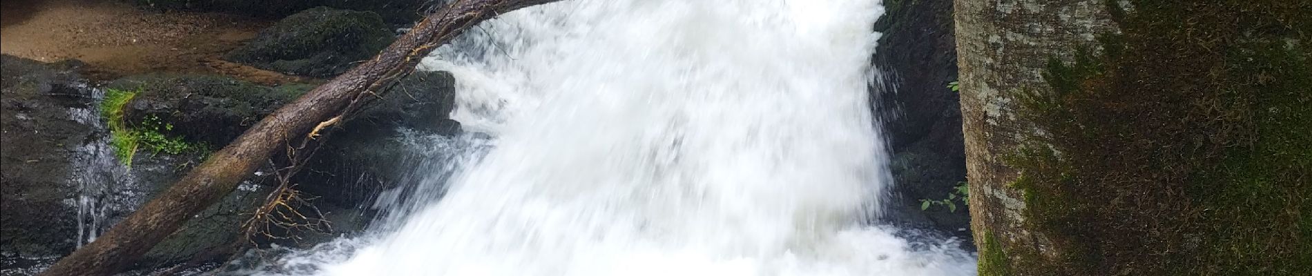
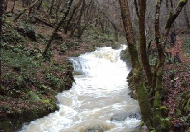
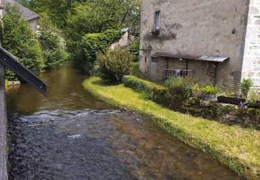
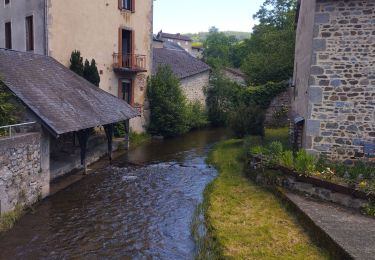
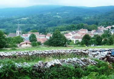
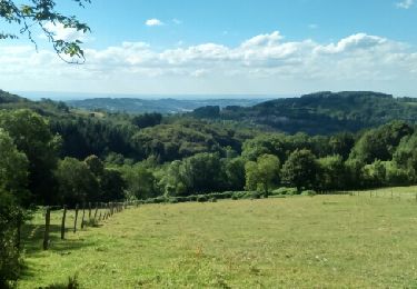
Ruta Senderismo de 5,1 km a descubrir en Auvergne-Rhône-Alpes, Allier, Ferrières-sur-Sichon. Esta ruta ha sido propuesta por nadd73.
Descripción
Attention par où je suis montée n'est pas recommandée car beaucoup de végétation.
grande partie sur la route.
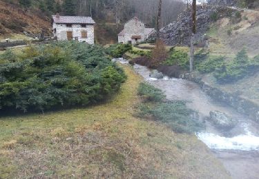
Prévoir une lampe et demander la clé à la maison de la vallée du Siphon
Localización
País:
France
Región :
Auvergne-Rhône-Alpes
Departamento/provincia :
Allier
Municipio :
Ferrières-sur-Sichon
Localidad:
Unknown
Salida:(Dec)
Salida:(UTM)
550069 ; 5097010 (31T) N.
Comentarios
Excursiones cerca
![Excursión Senderismo Ferrières-sur-Sichon - Balade autour de Ferrières sur Sichon - Photo](https://media.geolcdn.com/t/375/260/ext.jpg?maxdim=2&url=https%3A%2F%2Fservices.sitytrail.com%2FGeolivesWS%2FDownloadMedia.ashx%3FTrailID%3D107641%26Media%3D12629_1.jpg)
![Senderismo Senderismo](https://static1.geolcdn.com/sitytour/trail-icons/101.png)
Balade autour de Ferrières sur Sichon
Senderismo
Medio
(1)
Ferrières-sur-Sichon,
Auvergne-Rhône-Alpes,
Allier,
France
![](/images/other/stat-length.png)
7,4 km | 10,8 km-effort
2h 15min
![](https://static1.geolcdn.com/siteimages/upload/files/16400158638029165_repeat_loop_refresh_sync_direction_icon.png)
Sí
![Excursión Otra actividad Lachaux - Rez de.Sol - Photo](https://media.geolcdn.com/t/375/260/ext.jpg?maxdim=2&url=https%3A%2F%2Fstatic1.geolcdn.com%2Fsiteimages%2Fupload%2Ffiles%2F1545311037marcheuse_200dpi.jpg)
![Otra actividad Otra actividad](https://static1.geolcdn.com/sitytour/trail-icons/900.png)
Rez de.Sol
Otra actividad
Muy fácil
(1)
Lachaux,
Auvergne-Rhône-Alpes,
Puy-de-Dôme,
France
![](/images/other/stat-length.png)
22 km | 31 km-effort
8h 23min
![](https://static1.geolcdn.com/siteimages/upload/files/16400158638029165_repeat_loop_refresh_sync_direction_icon.png)
Sí
![Excursión Senderismo Ferrières-sur-Sichon - Arboretum - Photo](https://media.geolcdn.com/t/375/260/ext.jpg?maxdim=2&url=https%3A%2F%2Fmedia.geolcdn.com%2Ff%2Ffe93d646-9efb-43e9-aec5-f16b1537551d.jpg)
![Senderismo Senderismo](https://static1.geolcdn.com/sitytour/trail-icons/101.png)
Arboretum
Senderismo
Muy fácil
Ferrières-sur-Sichon,
Auvergne-Rhône-Alpes,
Allier,
France
![](/images/other/stat-length.png)
3 km | 4,5 km-effort
1h 2min
![](https://static1.geolcdn.com/siteimages/upload/files/16400158638029165_repeat_loop_refresh_sync_direction_icon.png)
No
![Excursión Ruta Ferrières-sur-Sichon - circuit du moulin neuf - Photo](https://media.geolcdn.com/t/375/260/ext.jpg?maxdim=2&url=https%3A%2F%2Fmedia.geolcdn.com%2Ff%2Fbeb3bba3-aa51-4c33-bd90-480ca60c9eae.jpg)
![Ruta Ruta](https://static1.geolcdn.com/sitytour/trail-icons/104.png)
circuit du moulin neuf
Ruta
Fácil
Ferrières-sur-Sichon,
Auvergne-Rhône-Alpes,
Allier,
France
![](/images/other/stat-length.png)
12,3 km | 17,8 km-effort
1h 15min
![](https://static1.geolcdn.com/siteimages/upload/files/16400158638029165_repeat_loop_refresh_sync_direction_icon.png)
Sí
![Excursión Bici de montaña La Guillermie - Les Moulins au creux des vallées du Terrasson et du Theux - La Guillermie - Photo](https://media.geolcdn.com/t/375/260/ext.jpg?maxdim=2&url=https%3A%2F%2Fservices.sitytrail.com%2FGeolivesWS%2FDownloadMedia.ashx%3FTrailID%3D316921%26Media%3D16023_6.jpg)
![Bici de montaña Bici de montaña](https://static1.geolcdn.com/sitytour/trail-icons/202.png)
Les Moulins au creux des vallées du Terrasson et du Theux - La Guillermie
Bici de montaña
Muy difícil
La Guillermie,
Auvergne-Rhône-Alpes,
Allier,
France
![](/images/other/stat-length.png)
42 km | 61 km-effort
4h 15min
![](https://static1.geolcdn.com/siteimages/upload/files/16400158638029165_repeat_loop_refresh_sync_direction_icon.png)
Sí
![Excursión Senderismo Lachaux - Autour du Rez de Sol - Lachaux - Photo](https://media.geolcdn.com/t/375/260/ext.jpg?maxdim=2&url=https%3A%2F%2Fservices.sitytrail.com%2FGeolivesWS%2FDownloadMedia.ashx%3FTrailID%3D106774%26Media%3D11454_2.jpg)
![Senderismo Senderismo](https://static1.geolcdn.com/sitytour/trail-icons/101.png)
Autour du Rez de Sol - Lachaux
Senderismo
Difícil
Lachaux,
Auvergne-Rhône-Alpes,
Puy-de-Dôme,
France
![](/images/other/stat-length.png)
10,9 km | 17 km-effort
3h 0min
![](https://static1.geolcdn.com/siteimages/upload/files/16400158638029165_repeat_loop_refresh_sync_direction_icon.png)
Sí
![Excursión Otra actividad Lachaux - lachaux - Photo](https://media.geolcdn.com/t/375/260/ext.jpg?maxdim=2&url=https%3A%2F%2Fservices.sitytrail.com%2FGeolivesWS%2FDownloadMedia.ashx%3FTrailID%3D709002%26Media%3Dfix__20170305105526.jpg)
![Otra actividad Otra actividad](https://static1.geolcdn.com/sitytour/trail-icons/900.png)
lachaux
Otra actividad
Muy fácil
Lachaux,
Auvergne-Rhône-Alpes,
Puy-de-Dôme,
France
![](/images/other/stat-length.png)
21 km | 30 km-effort
5h 37min
![](https://static1.geolcdn.com/siteimages/upload/files/16400158638029165_repeat_loop_refresh_sync_direction_icon.png)
Sí
![Excursión Senderismo Lachaux - Lachaux_Rez_Sol_1 - Photo](https://media.geolcdn.com/t/375/260/ext.jpg?maxdim=2&url=https%3A%2F%2Fmedia.geolcdn.com%2Ff%2Fd91026ac-2082-48f3-ad1b-b3605c53342c.jpg)
![Senderismo Senderismo](https://static1.geolcdn.com/sitytour/trail-icons/101.png)
Lachaux_Rez_Sol_1
Senderismo
Medio
Lachaux,
Auvergne-Rhône-Alpes,
Puy-de-Dôme,
France
![](/images/other/stat-length.png)
10,7 km | 16,8 km-effort
3h 28min
![](https://static1.geolcdn.com/siteimages/upload/files/16400158638029165_repeat_loop_refresh_sync_direction_icon.png)
Sí
![Excursión Senderismo La Guillermie - La guillermie - les couteliers / le rocher des Cheirs - Photo](https://media.geolcdn.com/t/375/260/ext.jpg?maxdim=2&url=https%3A%2F%2Fservices.sitytrail.com%2FGeolivesWS%2FDownloadMedia.ashx%3FTrailID%3D605824%26Media%3Dfix__20160729172653.jpg)
![Senderismo Senderismo](https://static1.geolcdn.com/sitytour/trail-icons/101.png)
La guillermie - les couteliers / le rocher des Cheirs
Senderismo
Medio
La Guillermie,
Auvergne-Rhône-Alpes,
Allier,
France
![](/images/other/stat-length.png)
12,6 km | 18,6 km-effort
4h 4min
![](https://static1.geolcdn.com/siteimages/upload/files/16400158638029165_repeat_loop_refresh_sync_direction_icon.png)
Sí