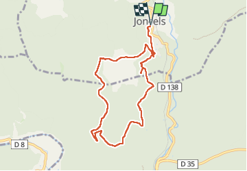
![](/images/other/stat-length.png)
![Excursión Marcha nórdica Joncels - RANDONNÉE JONCELS CIRCUIT ARCHÉOLOGIQUE - Photo](https://media.geolcdn.com/t/1900/400/0eb6a312-d62e-40e4-973b-25f789da995e.png&format=pjpeg&maxdim=2)
RANDONNÉE JONCELS CIRCUIT ARCHÉOLOGIQUE
mdauzat
Usuario
![Longitud](/images/other/stat-length.png)
![Altitud máxima](https://static1.geolcdn.com/siteimages/upload/files/1508320355ic_sort_altitude_max_24dp.png)
![Desnivel positivo](https://static1.geolcdn.com/siteimages/upload/files/1508320355ic_sort_den_pos_24dp.png)
![Km-Effort](/images/other/stat-length.png)
![Altitud mínima](https://static1.geolcdn.com/siteimages/upload/files/1508320355ic_sort_altitude_min_24dp.png)
![Desnivel negativo](https://static1.geolcdn.com/siteimages/upload/files/1508320355ic_sort_den_neg_24dp.png)
![Boucle](https://static1.geolcdn.com/siteimages/upload/files/16400158638029165_repeat_loop_refresh_sync_direction_icon.png)
![Marcha nórdica](https://static1.geolcdn.com/sitytour/trail-icons/102.png)
2h20
Dificultad : Fácil
![Escanee este código QR para abrir la excursión en la aplicación SityTrail](https://capi.geolives.com/qq0zvz2zws4bq2lad0pu/sitytour/trails/4066996/qr.png?size=200)
Aplicación GPS de excursión GRATIS
A propósito
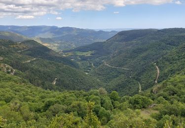
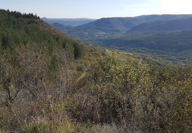
Ruta Marcha nórdica de 8,9 km a descubrir en Occitania, Hérault, Joncels. Esta ruta ha sido propuesta por mdauzat.
Descripción
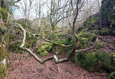
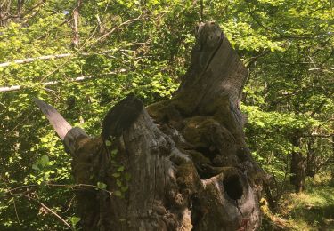
De vallons en crêtes, cette escapade vous immerge, entre chênes et pins, au cœur de la forêt communale sur les traces d’une époque, où, jadis, légendes et traditions se mêlèrent. Curiosités naturelles, œuvres sculptées, des blocs de grès, massifs et imposants, dissimulés dans la végétation, vous plongent dans ce folklore légendaire !
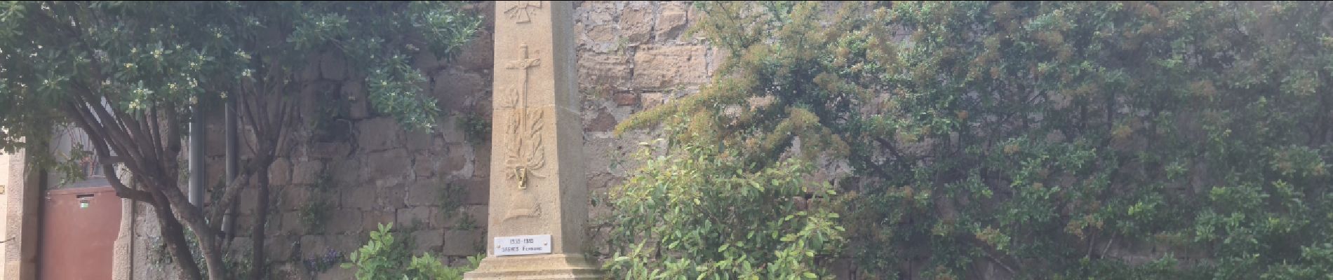
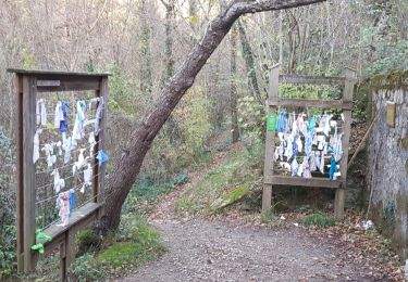
Localización
Comentarios
Excursiones cerca
![Excursión Senderismo Lunas - RANDONNEE DE LAVAL DE NIZE - Photo](https://media.geolcdn.com/t/375/260/a871bb29-ae4b-4227-a102-498b734b8914.jpg&format=jpg&maxdim=2)
![Senderismo Senderismo](https://static1.geolcdn.com/sitytour/trail-icons/101.png)
Senderismo
![](/images/other/stat-length.png)
![](https://static1.geolcdn.com/siteimages/upload/files/16400158638029165_repeat_loop_refresh_sync_direction_icon.png)
![Excursión Senderismo Les Plans - Forêt domaniale d'Escandorgue par Roqueredonde et l'Engayresque - Photo](https://media.geolcdn.com/t/375/260/c203cd03-9ac1-4e05-8a4c-6b4e6f9317be.jpg&format=jpg&maxdim=2)
![Senderismo Senderismo](https://static1.geolcdn.com/sitytour/trail-icons/101.png)
Senderismo
![](/images/other/stat-length.png)
![](https://static1.geolcdn.com/siteimages/upload/files/16400158638029165_repeat_loop_refresh_sync_direction_icon.png)
![Excursión Senderismo Le Bousquet-d'Orb - Bousquet d orb - Photo](https://media.geolcdn.com/t/375/260/ext.jpg?maxdim=2&url=https%3A%2F%2Fstatic1.geolcdn.com%2Fsiteimages%2Fupload%2Ffiles%2F1553511878bg_sport_marche.png)
![Senderismo Senderismo](https://static1.geolcdn.com/sitytour/trail-icons/101.png)
Senderismo
![](/images/other/stat-length.png)
![](https://static1.geolcdn.com/siteimages/upload/files/16400158638029165_repeat_loop_refresh_sync_direction_icon.png)
![Excursión Senderismo Lavalette - Laval de Nize - Photo](https://media.geolcdn.com/t/375/260/ext.jpg?maxdim=2&url=https%3A%2F%2Fstatic1.geolcdn.com%2Fsiteimages%2Fupload%2Ffiles%2F1553511878bg_sport_marche.png)
![Senderismo Senderismo](https://static1.geolcdn.com/sitytour/trail-icons/101.png)
Senderismo
![](/images/other/stat-length.png)
![](https://static1.geolcdn.com/siteimages/upload/files/16400158638029165_repeat_loop_refresh_sync_direction_icon.png)
![Excursión Senderismo Les Plans - La boucle des boutisses - Photo](https://media.geolcdn.com/t/375/260/c6f71489-8e25-42eb-bfcc-c19f3e3099d6.jpg&format=jpg&maxdim=2)
![Senderismo Senderismo](https://static1.geolcdn.com/sitytour/trail-icons/101.png)
Senderismo
![](/images/other/stat-length.png)
![](https://static1.geolcdn.com/siteimages/upload/files/16400158638029165_repeat_loop_refresh_sync_direction_icon.png)
![Excursión Senderismo Les Plans - Forêt et cirque de Labeil - Photo](https://media.geolcdn.com/t/375/260/21b3d7b0-35ee-491f-98e6-53e535349997.jpg&format=jpg&maxdim=2)
![Senderismo Senderismo](https://static1.geolcdn.com/sitytour/trail-icons/101.png)
Senderismo
![](/images/other/stat-length.png)
![](https://static1.geolcdn.com/siteimages/upload/files/16400158638029165_repeat_loop_refresh_sync_direction_icon.png)
![Excursión Senderismo Lunas - Minas - Photo](https://media.geolcdn.com/t/375/260/973aced9-2f4c-49f6-8497-38a7aa10afcc.jpg&format=jpg&maxdim=2)
![Senderismo Senderismo](https://static1.geolcdn.com/sitytour/trail-icons/101.png)
![Excursión Senderismo Lunas - Les pins de Lunas - Photo](https://media.geolcdn.com/t/375/260/9a20561d-f40b-4f22-addf-c2ec1b9698f2.jpg&format=jpg&maxdim=2)
![Senderismo Senderismo](https://static1.geolcdn.com/sitytour/trail-icons/101.png)
Senderismo
![](/images/other/stat-length.png)
![](https://static1.geolcdn.com/siteimages/upload/files/16400158638029165_repeat_loop_refresh_sync_direction_icon.png)
![Marcha nórdica Marcha nórdica](https://static1.geolcdn.com/sitytour/trail-icons/102.png)
Marcha nórdica
![](/images/other/stat-length.png)
![](https://static1.geolcdn.com/siteimages/upload/files/16400158638029165_repeat_loop_refresh_sync_direction_icon.png)