


24 km | 30 km-effort


Randonnez sur et autour des GR ® wallons (Sentiers de Grande Randonnée). PRO


Aplicación GPS de excursión GRATIS
 SityTrail
IGN / Institutos geográficos
SityTrail World
El mundo es suyo
Ruta Senderismo de 10,2 km a descubrir en Valonia, Luxemburgo, Durbuy. Esta ruta ha sido propuesta por GR Rando.
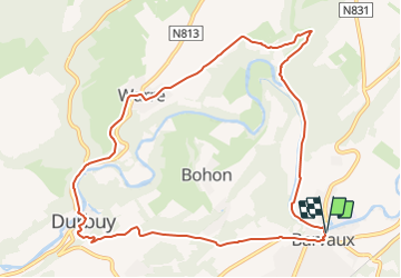
Au fil de l'Ourthe : Barvaux
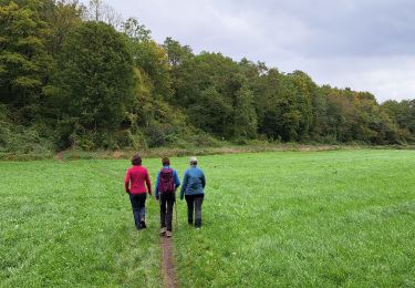
Dans quel type de paysage randonnons-nous ?
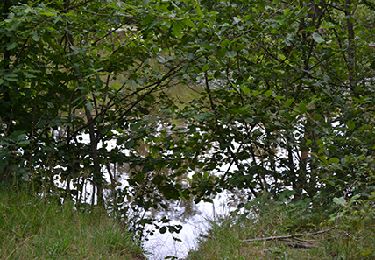
La plus grande partie de cette rando va se dérouler, soit en suivant la berge de l’Ourthe, dans le fond de la vallée donc, soit en la surplombant, via Warre et Durbuy. Puis ce sera la redescente jusqu’à Barvaux.
Où démarrons-nous ?
Au parking en bordure de l’Ourthe, non loin de l’église de Barvaux (carte Michelin n° 534, pli R/20).
Comment y arriver ?
À Barvaux, sur la N86, prendre, en face de l’église, la rue qui traverse l’Ourthe (en direction de « Hamoir - Tohogne »). À l’entrée de cette rue, à droite, se trouve ce grand parking.
Combien de kilomètres ?
10 km. Aucun raccourci n’est prévu.
Quelle difficulté ?
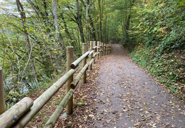
Aucune. À la sortie de Durbuy, un sentier en escaliers est un peu ardu.
Sur quel GR randonnons-nous ?
Pendant plus de 7 kilomètres, nous confierons nos pas au GR 57 (« Vallée de l’Ourthe et sentier du Nord »).
Quelle est la carte IGN de référence ?
Cartes IGN au 1:20 000, 55/1-2 « Durbuy - Érezée » et 49/5-6 « Hamoir - Ferrières ».
Que découvrons-nous aujourd’hui ?
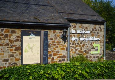
Chaque été, sur plus de onze hectares, un nouveau dédale est conçu dans le « Labyrinthe de Barvaux ». Nous essayerons de ne pas perdre le nord dans toutes ses allées. À Durbuy, nous pourrons admirer le travail des sculpteurs de buis dans le « Jardin des Topiaires ». Et pour conclure cette belle journée, une descente en kayak vous tenterait peut-être ?
Transports en commun ?
La gare de Barvaux, à 500 mètres de l’église, est située sur la ligne 43 Herstal - Jemelle. En semaine, un train s’y arrête, dans chaque sens, toutes les heures. Les jours fériés et le week-end, seulement toutes les deux heures.

Senderismo
Senderismo

Senderismo
Senderismo

Senderismo
Bicicleta
Senderismo
Senderismo
Belle balade, sauf la première partie (goudron-ravel). Ce n’est pas facile. Passage à Durbuy interrompu pour cause des chutes d’arbres
beau paysage , traversée et vue " aérienne " de durbuy et barvaux, une réserve naturelle . bonne chaussures recommandée pour deux montée assez vivifiantes.
Tr?s belle balade avec des endroits surprenant de beaut?s.