![](/images/other/stat-length.png)
![Excursión Senderismo Wolschwiller - Reco Rando CLAS du 09/05/2024 - Photo](https://media.geolcdn.com/t/1900/400/ext.pjpeg?maxdim=2&url=https%3A%2F%2Fmedia.geolcdn.com%2Ff%2F6f8403e2-0fdd-411f-9b5c-bc30211abac6.jpg)
Reco Rando CLAS du 09/05/2024
boubou68
Usuario
![Longitud](/images/other/stat-length.png)
Longitud
18,9 km
![Altitud máxima](https://static1.geolcdn.com/siteimages/upload/files/1508320355ic_sort_altitude_max_24dp.png)
Altitud máxima
828 m
![Desnivel positivo](https://static1.geolcdn.com/siteimages/upload/files/1508320355ic_sort_den_pos_24dp.png)
Desnivel positivo
709 m
![Km-Effort](/images/other/stat-length.png)
Km-Effort
28 km
![Altitud mínima](https://static1.geolcdn.com/siteimages/upload/files/1508320355ic_sort_altitude_min_24dp.png)
Altitud mínima
398 m
![Desnivel negativo](https://static1.geolcdn.com/siteimages/upload/files/1508320355ic_sort_den_neg_24dp.png)
Desnivel negativo
706 m
![Boucle](https://static1.geolcdn.com/siteimages/upload/files/16400158638029165_repeat_loop_refresh_sync_direction_icon.png)
Boucle
Sí
Fecha de creación :
2024-04-30 06:02:00.638
Última modificación :
2024-04-30 11:45:26.094
![Senderismo](https://static1.geolcdn.com/sitytour/trail-icons/101.png)
3h54
Dificultad : Muy difícil
![Escanee este código QR para abrir la excursión en la aplicación SityTrail](https://capi.geolives.com/qq0zvz2zws4bq2lad0pu/sitytour/trails/4034743/qr.png?size=200)
Aplicación GPS de excursión GRATIS
A propósito
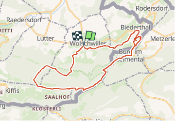
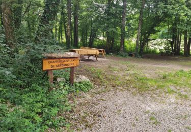
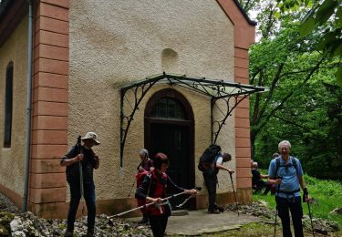
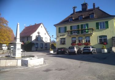
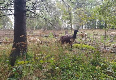
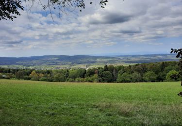
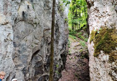
Ruta Senderismo de 18,9 km a descubrir en Gran Este, Alto Rin, Wolschwiller. Esta ruta ha sido propuesta por boubou68.
Descripción
Très belle rando....variante incluse qui mérite une nouvelle trace pour le canyon de Biederthal
Localización
País:
France
Región :
Gran Este
Departamento/provincia :
Alto Rin
Municipio :
Wolschwiller
Localidad:
Unknown
Salida:(Dec)
Salida:(UTM)
380061 ; 5257712 (32T) N.
Comentarios
Excursiones cerca
![Excursión Senderismo Biederthal - JD 15/20 Pedibus Biederthal - Photo](https://media.geolcdn.com/t/375/260/ext.jpg?maxdim=2&url=https%3A%2F%2Fmedia.geolcdn.com%2Ff%2F0e1deb4c-d0cf-4f51-a238-4ec2c883b15c.jpg)
![Senderismo Senderismo](https://static1.geolcdn.com/sitytour/trail-icons/101.png)
JD 15/20 Pedibus Biederthal
Senderismo
(1)
Biederthal,
Gran Este,
Alto Rin,
France
![](/images/other/stat-length.png)
8,2 km | 11,4 km-effort
2h 33min
![](https://static1.geolcdn.com/siteimages/upload/files/16400158638029165_repeat_loop_refresh_sync_direction_icon.png)
Sí
![Excursión Senderismo Wolschwiller - Rando CLAS du 09/05/202..par PBo - Photo](https://media.geolcdn.com/t/375/260/ext.jpg?maxdim=2&url=https%3A%2F%2Fmedia.geolcdn.com%2Ff%2F05829a5d-75d0-4f1b-a952-281cc59b84c3.jpg)
![Senderismo Senderismo](https://static1.geolcdn.com/sitytour/trail-icons/101.png)
Rando CLAS du 09/05/202..par PBo
Senderismo
Muy difícil
Wolschwiller,
Gran Este,
Alto Rin,
France
![](/images/other/stat-length.png)
20 km | 30 km-effort
4h 24min
![](https://static1.geolcdn.com/siteimages/upload/files/16400158638029165_repeat_loop_refresh_sync_direction_icon.png)
Sí
![Excursión Senderismo Wolschwiller - Le sentier des douaniers - Wolschwiller - Photo](https://media.geolcdn.com/t/375/260/ext.jpg?maxdim=2&url=https%3A%2F%2Fmedia.geolcdn.com%2Ff%2F0d080b06-f312-4f06-9433-5eb14ecc4ec1.jpg)
![Senderismo Senderismo](https://static1.geolcdn.com/sitytour/trail-icons/101.png)
Le sentier des douaniers - Wolschwiller
Senderismo
Medio
(1)
Wolschwiller,
Gran Este,
Alto Rin,
France
![](/images/other/stat-length.png)
12,2 km | 18,1 km-effort
3h 30min
![](https://static1.geolcdn.com/siteimages/upload/files/16400158638029165_repeat_loop_refresh_sync_direction_icon.png)
Sí
![Excursión Senderismo Lutter - rdpr 20200929 lutter - Photo](https://media.geolcdn.com/t/375/260/ext.jpg?maxdim=2&url=https%3A%2F%2Fmedia.geolcdn.com%2Ff%2F8f73fb70-88e8-4a1e-a7c4-1dbe7b82e7ac.jpg)
![Senderismo Senderismo](https://static1.geolcdn.com/sitytour/trail-icons/101.png)
rdpr 20200929 lutter
Senderismo
Difícil
Lutter,
Gran Este,
Alto Rin,
France
![](/images/other/stat-length.png)
15,8 km | 23 km-effort
4h 52min
![](https://static1.geolcdn.com/siteimages/upload/files/16400158638029165_repeat_loop_refresh_sync_direction_icon.png)
Sí
![Excursión Senderismo Wolschwiller - wolschwiller - Photo](https://media.geolcdn.com/t/375/260/ext.jpg?maxdim=2&url=https%3A%2F%2Fmedia.geolcdn.com%2Ff%2F1f0cb837-9d36-4518-bba1-d3300cbfa60d.jpg)
![Senderismo Senderismo](https://static1.geolcdn.com/sitytour/trail-icons/101.png)
wolschwiller
Senderismo
Fácil
Wolschwiller,
Gran Este,
Alto Rin,
France
![](/images/other/stat-length.png)
7,3 km | 12,7 km-effort
4h 15min
![](https://static1.geolcdn.com/siteimages/upload/files/16400158638029165_repeat_loop_refresh_sync_direction_icon.png)
No
![Excursión Caballo Bouxwiller - Bouxwiller Doubs Franche Montagne - Photo](https://media.geolcdn.com/t/375/260/ext.jpg?maxdim=2&url=https%3A%2F%2Fstatic1.geolcdn.com%2Fsiteimages%2Fupload%2Ffiles%2F1524743154cheval.jpg)
![Caballo Caballo](https://static1.geolcdn.com/sitytour/trail-icons/300.png)
Bouxwiller Doubs Franche Montagne
Caballo
Difícil
(1)
Bouxwiller,
Gran Este,
Alto Rin,
France
![](/images/other/stat-length.png)
104 km | 146 km-effort
18h 22min
![](https://static1.geolcdn.com/siteimages/upload/files/16400158638029165_repeat_loop_refresh_sync_direction_icon.png)
No
![Excursión Senderismo Oltingue - randonnée au départ d'Oltingue chapelle St Martin - Photo](https://media.geolcdn.com/t/375/260/ext.jpg?maxdim=2&url=https%3A%2F%2Fmedia.geolcdn.com%2Ff%2Fda5da79b-7c2e-4a8e-960a-b17a962b5942.jpg)
![Senderismo Senderismo](https://static1.geolcdn.com/sitytour/trail-icons/101.png)
randonnée au départ d'Oltingue chapelle St Martin
Senderismo
Difícil
Oltingue,
Gran Este,
Alto Rin,
France
![](/images/other/stat-length.png)
13,4 km | 18,2 km-effort
3h 25min
![](https://static1.geolcdn.com/siteimages/upload/files/16400158638029165_repeat_loop_refresh_sync_direction_icon.png)
Sí
![Excursión Paseo ecuestre Kiffis - Circuit Sundgau - Kiffis - Hegenheim Opt02 - Photo](https://media.geolcdn.com/t/375/260/ext.jpg?maxdim=2&url=https%3A%2F%2Fmedia.geolcdn.com%2Ff%2F4065a843-eaff-4030-bd7d-37bfc99819b7.jpg)
![Paseo ecuestre Paseo ecuestre](https://static1.geolcdn.com/sitytour/trail-icons/301.png)
Circuit Sundgau - Kiffis - Hegenheim Opt02
Paseo ecuestre
Difícil
Kiffis,
Gran Este,
Alto Rin,
France
![](/images/other/stat-length.png)
26 km | 34 km-effort
4h 7min
![](https://static1.geolcdn.com/siteimages/upload/files/16400158638029165_repeat_loop_refresh_sync_direction_icon.png)
No
![Excursión Paseo ecuestre Kiffis - Circuit Sundgau - Kiffis - Hegenheim Opt01 par Oltingue - Photo](https://media.geolcdn.com/t/375/260/ext.jpg?maxdim=2&url=https%3A%2F%2Fmedia.geolcdn.com%2Ff%2F9bdf5053-119c-48c6-a45d-e2cc3cb42b09.jpg)
![Paseo ecuestre Paseo ecuestre](https://static1.geolcdn.com/sitytour/trail-icons/301.png)
Circuit Sundgau - Kiffis - Hegenheim Opt01 par Oltingue
Paseo ecuestre
Medio
Kiffis,
Gran Este,
Alto Rin,
France
![](/images/other/stat-length.png)
27 km | 33 km-effort
4h 4min
![](https://static1.geolcdn.com/siteimages/upload/files/16400158638029165_repeat_loop_refresh_sync_direction_icon.png)
No