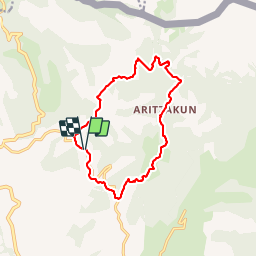
![](/images/other/stat-length.png)
![Excursión Senderismo Baztán - Baztan vallée Aritzakun PR NA 6 - Photo](https://media.geolcdn.com/t/1900/400/ext.pjpeg?maxdim=2&url=https%3A%2F%2Fservices.sitytrail.com%2FGeolivesWS%2FDownloadMedia.ashx%3FTrailID%3D402986%26Media%3Dfix__20150402155929.jpg)
Baztan vallée Aritzakun PR NA 6
DECHAMPD
Usuario
![Longitud](/images/other/stat-length.png)
![Altitud máxima](https://static1.geolcdn.com/siteimages/upload/files/1508320355ic_sort_altitude_max_24dp.png)
![Desnivel positivo](https://static1.geolcdn.com/siteimages/upload/files/1508320355ic_sort_den_pos_24dp.png)
![Km-Effort](/images/other/stat-length.png)
![Altitud mínima](https://static1.geolcdn.com/siteimages/upload/files/1508320355ic_sort_altitude_min_24dp.png)
![Desnivel negativo](https://static1.geolcdn.com/siteimages/upload/files/1508320355ic_sort_den_neg_24dp.png)
![Boucle](https://static1.geolcdn.com/siteimages/upload/files/16400158638029165_repeat_loop_refresh_sync_direction_icon.png)
![Senderismo](https://static1.geolcdn.com/sitytour/trail-icons/101.png)
5h06
Dificultad : Muy difícil
![Escanee este código QR para abrir la excursión en la aplicación SityTrail](https://capi.geolives.com/qq0zvz2zws4bq2lad0pu/sitytour/trails/402986/qr.png?size=200)
Aplicación GPS de excursión GRATIS
A propósito
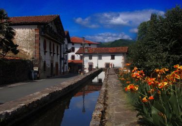
Ruta Senderismo de 14,2 km a descubrir en Navarra, Desconocido, Baztán. Esta ruta ha sido propuesta por DECHAMPD.
Descripción
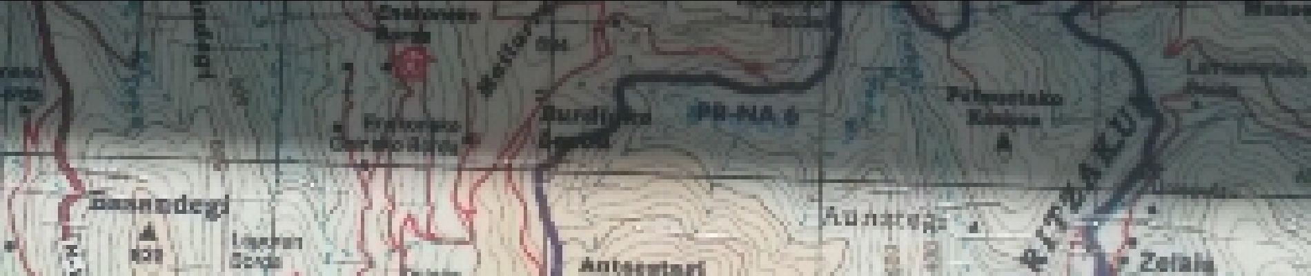
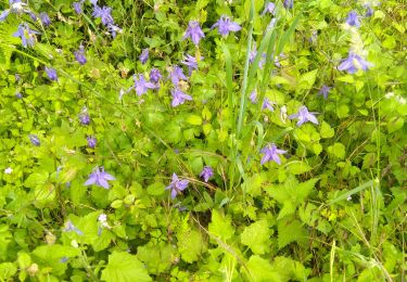
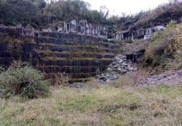
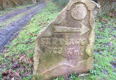
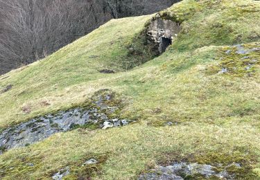
Boucle balisée "Ver Ruta 2" PR NA 6 qui traverse la vallée Aritzakun. L'une des attractions de la vallée se trouve dans les rochers des réserves naturelles uniques de Itsusiko Harria. C'est, un coin très tranquille, boisé avec un ensemble de mégalithes dispersés autour de la vallée et aussi les restes d'un site minier romain.
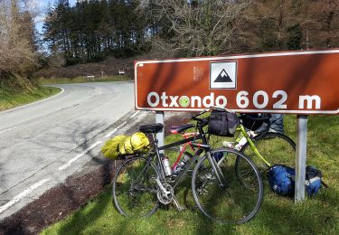
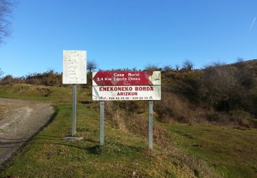
Depuis Orradreren borda, Urlegi, Bagdi, Otzagazteluko, minetako zokoa, Aritzakun, Inabideko borda, Antsestegito. sans oublier nous terminerons la boucle par la route Napoléon.
Localización
Comentarios
Excursiones cerca
![Excursión Senderismo Urdax - urdax - Photo](https://media.geolcdn.com/t/375/260/eb9329a6-8a81-4e34-9565-1e6fabf40cde.jpg&format=jpg&maxdim=2)
![Senderismo Senderismo](https://static1.geolcdn.com/sitytour/trail-icons/101.png)
![Excursión A pie Urdax - SL-NA 15 Otsondottiki - Photo](https://media.geolcdn.com/t/375/260/52f4bcee-e0a0-4b91-9588-fad8a39e9c22.jpeg&format=jpg&maxdim=2)
![A pie A pie](https://static1.geolcdn.com/sitytour/trail-icons/100.png)
A pie
![](/images/other/stat-length.png)
![](https://static1.geolcdn.com/siteimages/upload/files/16400158638029165_repeat_loop_refresh_sync_direction_icon.png)
![Excursión A pie Baztán - SL-NA 14 Vuelta a Azkar - Photo](https://media.geolcdn.com/t/375/260/35dd0ce1-14a9-48e7-90fb-900f8c18165c.jpeg&format=jpg&maxdim=2)
![A pie A pie](https://static1.geolcdn.com/sitytour/trail-icons/100.png)
A pie
![](/images/other/stat-length.png)
![](https://static1.geolcdn.com/siteimages/upload/files/16400158638029165_repeat_loop_refresh_sync_direction_icon.png)
![Excursión A pie Urdax - SL-NA 17 Rincón de Axular - Photo](https://media.geolcdn.com/t/375/260/4ea81041-0789-4918-a312-4afe472a85c1.jpeg&format=jpg&maxdim=2)
![A pie A pie](https://static1.geolcdn.com/sitytour/trail-icons/100.png)
A pie
![](/images/other/stat-length.png)
![](https://static1.geolcdn.com/siteimages/upload/files/16400158638029165_repeat_loop_refresh_sync_direction_icon.png)
![Excursión Senderismo Urdax - Urdax Lizartzu circuit des bunkers - Photo](https://media.geolcdn.com/t/375/260/ext.jpg?maxdim=2&url=https%3A%2F%2Fservices.sitytrail.com%2FGeolivesWS%2FDownloadMedia.ashx%3FTrailID%3D892962%26Media%3Dc7436390-fb72-4d0d-9b84-00caadd8f947.jpg)
![Senderismo Senderismo](https://static1.geolcdn.com/sitytour/trail-icons/101.png)
Senderismo
![](/images/other/stat-length.png)
![](https://static1.geolcdn.com/siteimages/upload/files/16400158638029165_repeat_loop_refresh_sync_direction_icon.png)
![Excursión Senderismo Urdax - Boucle au sud d'Urdax - Photo](https://media.geolcdn.com/t/375/260/ext.jpg?maxdim=2&url=https%3A%2F%2Fservices.sitytrail.com%2FGeolivesWS%2FDownloadMedia.ashx%3FTrailID%3D896614%26Media%3D91fefb7a-2db5-4c01-9cb7-918d34f0cda3.jpg)
![Senderismo Senderismo](https://static1.geolcdn.com/sitytour/trail-icons/101.png)
Senderismo
![](/images/other/stat-length.png)
![](https://static1.geolcdn.com/siteimages/upload/files/16400158638029165_repeat_loop_refresh_sync_direction_icon.png)
![Excursión Senderismo Baztán - MAILARRETA OTSONDO Frontières en béton dans le massif du Gorramendi 300m. - Photo](https://media.geolcdn.com/t/375/260/8b1035fc-8a50-4048-9924-4944066be27d.jpg&format=jpg&maxdim=2)
![Senderismo Senderismo](https://static1.geolcdn.com/sitytour/trail-icons/101.png)
Senderismo
![](/images/other/stat-length.png)
![](https://static1.geolcdn.com/siteimages/upload/files/16400158638029165_repeat_loop_refresh_sync_direction_icon.png)
![Excursión Senderismo Baztán - MAILARRETA OTSONDO Frontières en béton dans le massif du Gorramendi - Photo](https://media.geolcdn.com/t/375/260/ext.jpg?maxdim=2&url=https%3A%2F%2Fservices.sitytrail.com%2FGeolivesWS%2FDownloadMedia.ashx%3FTrailID%3D526426%26Media%3Dfix__20160208095835.jpg)
![Senderismo Senderismo](https://static1.geolcdn.com/sitytour/trail-icons/101.png)
Senderismo
![](/images/other/stat-length.png)
![](https://static1.geolcdn.com/siteimages/upload/files/16400158638029165_repeat_loop_refresh_sync_direction_icon.png)
![Excursión A pie Urdax - urdax - Photo](https://media.geolcdn.com/t/375/260/82188c64-6e8c-4f63-a051-a505306623e0.jpg&format=jpg&maxdim=2)
![A pie A pie](https://static1.geolcdn.com/sitytour/trail-icons/100.png)
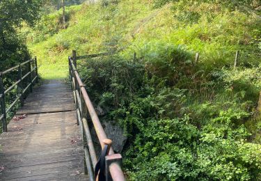
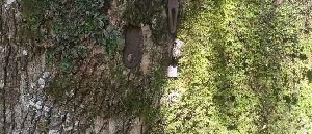
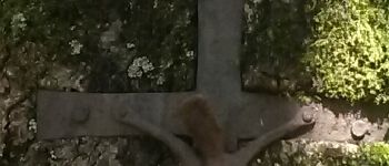
Rando à éviter l'été et l'automne. Sentiers non entrenus. Jolie rando par ailleurs.