![](/images/other/stat-length.png)
![Excursión Senderismo Furmeyer - Le Fays via Furmeyer - Photo](https://media.geolcdn.com/t/1900/400/f727fb9f-67ca-4908-bf2c-371b978ea73e.jpg&format=pjpeg&maxdim=2)
Le Fays via Furmeyer
PapouBertrand
Usuario
![Longitud](/images/other/stat-length.png)
Longitud
11,3 km
![Altitud máxima](https://static1.geolcdn.com/siteimages/upload/files/1508320355ic_sort_altitude_max_24dp.png)
Altitud máxima
1657 m
![Desnivel positivo](https://static1.geolcdn.com/siteimages/upload/files/1508320355ic_sort_den_pos_24dp.png)
Desnivel positivo
785 m
![Km-Effort](/images/other/stat-length.png)
Km-Effort
22 km
![Altitud mínima](https://static1.geolcdn.com/siteimages/upload/files/1508320355ic_sort_altitude_min_24dp.png)
Altitud mínima
940 m
![Desnivel negativo](https://static1.geolcdn.com/siteimages/upload/files/1508320355ic_sort_den_neg_24dp.png)
Desnivel negativo
786 m
![Boucle](https://static1.geolcdn.com/siteimages/upload/files/16400158638029165_repeat_loop_refresh_sync_direction_icon.png)
Boucle
Sí
Fecha de creación :
2024-04-23 07:14:02.601
Última modificación :
2024-05-18 17:25:45.48
![Senderismo](https://static1.geolcdn.com/sitytour/trail-icons/101.png)
4h57
Dificultad : Muy difícil
![Escanee este código QR para abrir la excursión en la aplicación SityTrail](https://capi.geolives.com/qq0zvz2zws4bq2lad0pu/sitytour/trails/4026886/qr.png?size=200)
Aplicación GPS de excursión GRATIS
A propósito
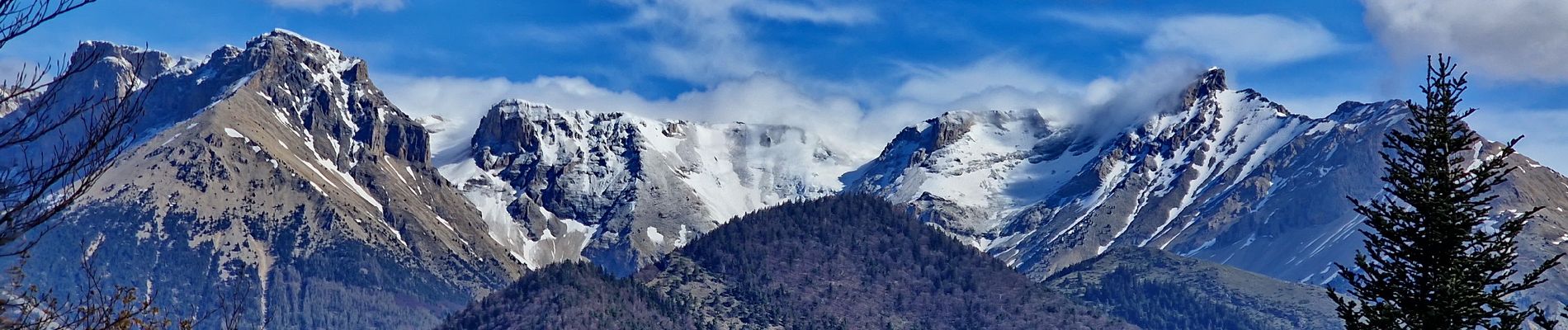
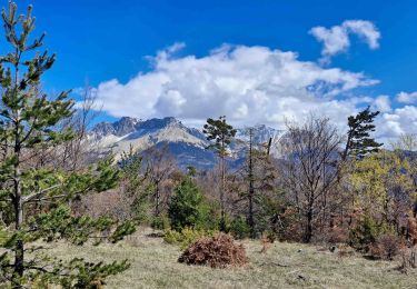
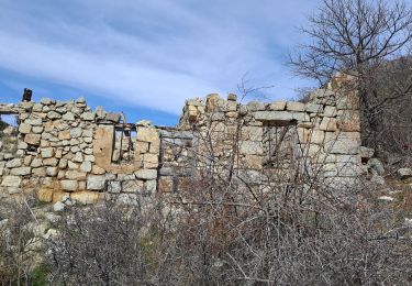
Ruta Senderismo de 11,3 km a descubrir en Provenza-Alpes-Costa Azul, Altos Alpes, Furmeyer. Esta ruta ha sido propuesta por PapouBertrand.
Descripción
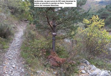
Belle rando mais attention, GPS indispensable, descente très raide, très peu marquée et très peu fréquentée avec beaucoup de bois mort dans un environnement broussailleux.
Localización
País:
France
Región :
Provenza-Alpes-Costa Azul
Departamento/provincia :
Altos Alpes
Municipio :
Furmeyer
Localidad:
Unknown
Salida:(Dec)
Salida:(UTM)
728238 ; 4935889 (31T) N.
Comentarios
Excursiones cerca
![Excursión Senderismo Montmaur - Montmaur Le Terrail - Photo](https://media.geolcdn.com/t/375/260/cf7c7087-0021-4399-a05e-062d9e564785.jpg&format=jpg&maxdim=2)
![Senderismo Senderismo](https://static1.geolcdn.com/sitytour/trail-icons/101.png)
Montmaur Le Terrail
Senderismo
Fácil
(1)
Montmaur,
Provenza-Alpes-Costa Azul,
Altos Alpes,
France
![](/images/other/stat-length.png)
5,3 km | 6,2 km-effort
1h 22min
![](https://static1.geolcdn.com/siteimages/upload/files/16400158638029165_repeat_loop_refresh_sync_direction_icon.png)
Sí
![Excursión Senderismo Veynes - Charajaille - Photo](https://media.geolcdn.com/t/375/260/5bb4b28d-a657-442c-b20e-962c61a2ca83.jpg&format=jpg&maxdim=2)
![Senderismo Senderismo](https://static1.geolcdn.com/sitytour/trail-icons/101.png)
Charajaille
Senderismo
Difícil
(1)
Veynes,
Provenza-Alpes-Costa Azul,
Altos Alpes,
France
![](/images/other/stat-length.png)
8,1 km | 16,2 km-effort
3h 41min
![](https://static1.geolcdn.com/siteimages/upload/files/16400158638029165_repeat_loop_refresh_sync_direction_icon.png)
Sí
![Excursión Senderismo Veynes - R06 glaise - Photo](https://media.geolcdn.com/t/375/260/ext.jpg?maxdim=2&url=https%3A%2F%2Fservices.sitytrail.com%2FGeolivesWS%2FDownloadMedia.ashx%3FTrailID%3D890857%26Media%3D2a45252a-ca22-4b16-aa40-6da618d5732f.jpg)
![Senderismo Senderismo](https://static1.geolcdn.com/sitytour/trail-icons/101.png)
R06 glaise
Senderismo
Fácil
(1)
Veynes,
Provenza-Alpes-Costa Azul,
Altos Alpes,
France
![](/images/other/stat-length.png)
9,1 km | 14,9 km-effort
3h 4min
![](https://static1.geolcdn.com/siteimages/upload/files/16400158638029165_repeat_loop_refresh_sync_direction_icon.png)
Sí
![Excursión Senderismo Veynes - R03 oule depuis veynes - Photo](https://media.geolcdn.com/t/375/260/ext.jpg?maxdim=2&url=https%3A%2F%2Fservices.sitytrail.com%2FGeolivesWS%2FDownloadMedia.ashx%3FTrailID%3D890852%26Media%3D3709ef2a-ba1f-490f-aebf-27c5143e6802.jpg)
![Senderismo Senderismo](https://static1.geolcdn.com/sitytour/trail-icons/101.png)
R03 oule depuis veynes
Senderismo
Difícil
(4)
Veynes,
Provenza-Alpes-Costa Azul,
Altos Alpes,
France
![](/images/other/stat-length.png)
7,1 km | 17,2 km-effort
3h 24min
![](https://static1.geolcdn.com/siteimages/upload/files/16400158638029165_repeat_loop_refresh_sync_direction_icon.png)
Sí
![Excursión Bici de montaña Châteauneuf-d'Oze - ceuse9 avril 2012 - Photo](https://media.geolcdn.com/t/375/260/ext.jpg?maxdim=2&url=https%3A%2F%2Fstatic1.geolcdn.com%2Fsiteimages%2Fupload%2Ffiles%2F1524743154velo.jpg)
![Bici de montaña Bici de montaña](https://static1.geolcdn.com/sitytour/trail-icons/202.png)
ceuse9 avril 2012
Bici de montaña
Medio
(2)
Châteauneuf-d'Oze,
Provenza-Alpes-Costa Azul,
Altos Alpes,
France
![](/images/other/stat-length.png)
18,1 km | 26 km-effort
Desconocido
![](https://static1.geolcdn.com/siteimages/upload/files/16400158638029165_repeat_loop_refresh_sync_direction_icon.png)
Sí
![Excursión Senderismo Montmaur - Les Sauvas - Photo](https://media.geolcdn.com/t/375/260/582f0ec6-7334-4548-a448-d517066904e5.jpg&format=jpg&maxdim=2)
![Senderismo Senderismo](https://static1.geolcdn.com/sitytour/trail-icons/101.png)
Les Sauvas
Senderismo
Medio
Montmaur,
Provenza-Alpes-Costa Azul,
Altos Alpes,
France
![](/images/other/stat-length.png)
12,9 km | 21 km-effort
4h 42min
![](https://static1.geolcdn.com/siteimages/upload/files/16400158638029165_repeat_loop_refresh_sync_direction_icon.png)
Sí
![Excursión Senderismo Veynes - Champérus-Oriol - Photo](https://media.geolcdn.com/t/375/260/3448ad69-bec0-42ae-b475-383d33c2ed21.jpg&format=jpg&maxdim=2)
![Senderismo Senderismo](https://static1.geolcdn.com/sitytour/trail-icons/101.png)
Champérus-Oriol
Senderismo
Difícil
Veynes,
Provenza-Alpes-Costa Azul,
Altos Alpes,
France
![](/images/other/stat-length.png)
8 km | 16,6 km-effort
3h 45min
![](https://static1.geolcdn.com/siteimages/upload/files/16400158638029165_repeat_loop_refresh_sync_direction_icon.png)
No
![Excursión Senderismo La Roche-des-Arnauds - Pic Chauve - Photo](https://media.geolcdn.com/t/375/260/40b49010-ec4d-4781-90d9-72d51d0c2e2b.jpg&format=jpg&maxdim=2)
![Senderismo Senderismo](https://static1.geolcdn.com/sitytour/trail-icons/101.png)
Pic Chauve
Senderismo
Difícil
La Roche-des-Arnauds,
Provenza-Alpes-Costa Azul,
Altos Alpes,
France
![](/images/other/stat-length.png)
9,6 km | 21 km-effort
4h 42min
![](https://static1.geolcdn.com/siteimages/upload/files/16400158638029165_repeat_loop_refresh_sync_direction_icon.png)
Sí
![Excursión Senderismo Veynes - Col de Combe noire-Veynes - Photo](https://media.geolcdn.com/t/375/260/b771f9a6-d8f6-4104-bb87-2efae92c170f.jpg&format=jpg&maxdim=2)
![Senderismo Senderismo](https://static1.geolcdn.com/sitytour/trail-icons/101.png)
Col de Combe noire-Veynes
Senderismo
Medio
Veynes,
Provenza-Alpes-Costa Azul,
Altos Alpes,
France
![](/images/other/stat-length.png)
9,7 km | 17,6 km-effort
4h 0min
![](https://static1.geolcdn.com/siteimages/upload/files/16400158638029165_repeat_loop_refresh_sync_direction_icon.png)
Sí