![](/images/other/stat-length.png)
![Excursión Raquetas de nieve Ilonse - Lauvet d’Ilonse - Photo](https://media.geolcdn.com/t/1900/400/27d6716b-7948-437f-a217-9ca86aa8eff9.jpg&format=pjpeg&maxdim=2)
Lauvet d’Ilonse
bozo1970
Usuario
![Longitud](/images/other/stat-length.png)
![Altitud máxima](https://static1.geolcdn.com/siteimages/upload/files/1508320355ic_sort_altitude_max_24dp.png)
![Desnivel positivo](https://static1.geolcdn.com/siteimages/upload/files/1508320355ic_sort_den_pos_24dp.png)
![Km-Effort](/images/other/stat-length.png)
![Altitud mínima](https://static1.geolcdn.com/siteimages/upload/files/1508320355ic_sort_altitude_min_24dp.png)
![Desnivel negativo](https://static1.geolcdn.com/siteimages/upload/files/1508320355ic_sort_den_neg_24dp.png)
![Boucle](https://static1.geolcdn.com/siteimages/upload/files/16400158638029165_repeat_loop_refresh_sync_direction_icon.png)
![Raquetas de nieve](https://static1.geolcdn.com/sitytour/trail-icons/504.png)
4h54
Dificultad : Difícil
![Escanee este código QR para abrir la excursión en la aplicación SityTrail](https://capi.geolives.com/qq0zvz2zws4bq2lad0pu/sitytour/trails/3988992/qr.png?size=200)
Aplicación GPS de excursión GRATIS
A propósito
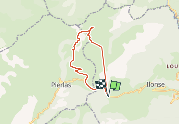
Ruta Raquetas de nieve de 11,7 km a descubrir en Provenza-Alpes-Costa Azul, Alpes Marítimos, Ilonse. Esta ruta ha sido propuesta por bozo1970.
Descripción
Départ du col de la Sinne, vers le col des Fourches
Beaucoup de pins écroulés au milieu du sentier !
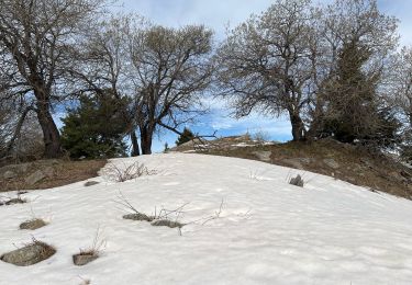
Pas mal de neige à 1500m
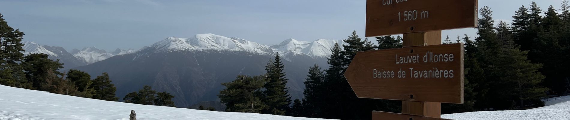
Col des Fourches en 39’ D 137 et 1km700
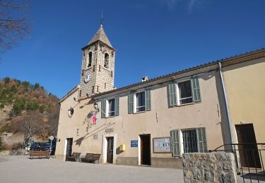
Lauvet d’Ilonse en 2h50’ D 581 et 5km300
Descente par le Pra Nègre Soutran
A/R en 5h06’ D 722 et 12km600
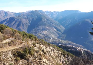
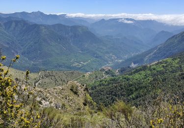
Jolie vue mais peu interessant
Localización
Comentarios
Excursiones cerca
![Excursión A pie Bairols - Tour du mont Falourde - Photo](https://media.geolcdn.com/t/375/260/72458cd6-de82-448d-8f0e-f50b00abdc54.jpeg&format=jpg&maxdim=2)
![A pie A pie](https://static1.geolcdn.com/sitytour/trail-icons/100.png)
A pie
![](/images/other/stat-length.png)
![](https://static1.geolcdn.com/siteimages/upload/files/16400158638029165_repeat_loop_refresh_sync_direction_icon.png)
![Excursión A pie Pierlas - Tour du Mont de Lieuche - Photo](https://media.geolcdn.com/t/375/260/21b88e85-708c-4489-9ada-9348a7269087.jpeg&format=jpg&maxdim=2)
![A pie A pie](https://static1.geolcdn.com/sitytour/trail-icons/100.png)
A pie
![](/images/other/stat-length.png)
![](https://static1.geolcdn.com/siteimages/upload/files/16400158638029165_repeat_loop_refresh_sync_direction_icon.png)
![Excursión Senderismo Bairols - Pointe des 4 Cantons - Photo](https://media.geolcdn.com/t/375/260/a7a9d005-3907-43b9-a75f-ead216069129.jpg&format=jpg&maxdim=2)
![Senderismo Senderismo](https://static1.geolcdn.com/sitytour/trail-icons/101.png)
Senderismo
![](/images/other/stat-length.png)
![](https://static1.geolcdn.com/siteimages/upload/files/16400158638029165_repeat_loop_refresh_sync_direction_icon.png)
![Excursión Senderismo Bairols - Mont Falourde depuis Bairoldmd - Photo](https://media.geolcdn.com/t/375/260/ee8fbd45-d346-4d87-a199-f1064cf2e4bd.jpg&format=jpg&maxdim=2)
![Senderismo Senderismo](https://static1.geolcdn.com/sitytour/trail-icons/101.png)
Senderismo
![](/images/other/stat-length.png)
![](https://static1.geolcdn.com/siteimages/upload/files/16400158638029165_repeat_loop_refresh_sync_direction_icon.png)
![Excursión Senderismo Bairols - Pointe des 4 cantons de Bairols retour col de l'espella - Photo](https://media.geolcdn.com/t/375/260/f66efb90-77ab-4307-b314-11309c7279a0.jpg&format=jpg&maxdim=2)
![Senderismo Senderismo](https://static1.geolcdn.com/sitytour/trail-icons/101.png)
Senderismo
![](/images/other/stat-length.png)
![](https://static1.geolcdn.com/siteimages/upload/files/16400158638029165_repeat_loop_refresh_sync_direction_icon.png)
![Excursión Senderismo Lieuche - Lieuche brec d ilonse - Photo](https://media.geolcdn.com/t/375/260/b5e77ab5-d74f-4c03-aaca-8053a1eeae4f.jpg&format=jpg&maxdim=2)
![Senderismo Senderismo](https://static1.geolcdn.com/sitytour/trail-icons/101.png)
Senderismo
![](/images/other/stat-length.png)
![](https://static1.geolcdn.com/siteimages/upload/files/16400158638029165_repeat_loop_refresh_sync_direction_icon.png)
![Excursión A pie Lieuche - Circuit du Grand Palier - Photo](https://media.geolcdn.com/t/375/260/ff9d586d-b475-49ad-bbbf-1f7650136d4d.jpeg&format=jpg&maxdim=2)
![A pie A pie](https://static1.geolcdn.com/sitytour/trail-icons/100.png)
A pie
![](/images/other/stat-length.png)
![](https://static1.geolcdn.com/siteimages/upload/files/16400158638029165_repeat_loop_refresh_sync_direction_icon.png)
![Excursión Senderismo Pierlas - PIERĹAS FFRS - Photo](https://media.geolcdn.com/t/375/260/bfe703a2-e5fd-4b20-ae55-bd8e7f0d4ef9.jpg&format=jpg&maxdim=2)
![Senderismo Senderismo](https://static1.geolcdn.com/sitytour/trail-icons/101.png)
Senderismo
![](/images/other/stat-length.png)
![](https://static1.geolcdn.com/siteimages/upload/files/16400158638029165_repeat_loop_refresh_sync_direction_icon.png)
![Excursión Senderismo Bairols - BAIROLS - Photo](https://media.geolcdn.com/t/375/260/10a24faf-c5c8-4a7d-a97d-0ea209336051.jpg&format=jpg&maxdim=2)
![Senderismo Senderismo](https://static1.geolcdn.com/sitytour/trail-icons/101.png)
Senderismo
![](/images/other/stat-length.png)
![](https://static1.geolcdn.com/siteimages/upload/files/16400158638029165_repeat_loop_refresh_sync_direction_icon.png)