![](/images/other/stat-length.png)
![Excursión Senderismo Viols-en-Laval - Viols-en-Laval - Cazarils - Montagne de Labat - Paillas - Photo](https://media.geolcdn.com/t/1900/400/ext.pjpeg?maxdim=2&url=https%3A%2F%2Fstatic1.geolcdn.com%2Fsiteimages%2Fupload%2Ffiles%2F1553511878bg_sport_marche.png)
Viols-en-Laval - Cazarils - Montagne de Labat - Paillas
vertygo
Usuario
![Longitud](/images/other/stat-length.png)
![Altitud máxima](https://static1.geolcdn.com/siteimages/upload/files/1508320355ic_sort_altitude_max_24dp.png)
![Desnivel positivo](https://static1.geolcdn.com/siteimages/upload/files/1508320355ic_sort_den_pos_24dp.png)
![Km-Effort](/images/other/stat-length.png)
![Altitud mínima](https://static1.geolcdn.com/siteimages/upload/files/1508320355ic_sort_altitude_min_24dp.png)
![Desnivel negativo](https://static1.geolcdn.com/siteimages/upload/files/1508320355ic_sort_den_neg_24dp.png)
![Boucle](https://static1.geolcdn.com/siteimages/upload/files/16400158638029165_repeat_loop_refresh_sync_direction_icon.png)
![Senderismo](https://static1.geolcdn.com/sitytour/trail-icons/101.png)
4h08
Dificultad : Medio
![Escanee este código QR para abrir la excursión en la aplicación SityTrail](https://capi.geolives.com/qq0zvz2zws4bq2lad0pu/sitytour/trails/398424/qr.png?size=200)
Aplicación GPS de excursión GRATIS
A propósito
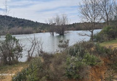
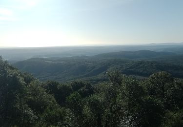
Ruta Senderismo de 15,7 km a descubrir en Occitania, Hérault, Viols-en-Laval. Esta ruta ha sido propuesta por vertygo.
Descripción
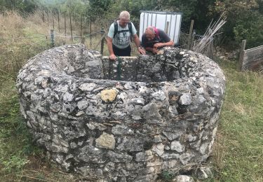
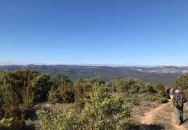
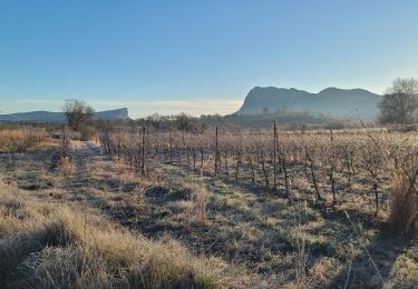
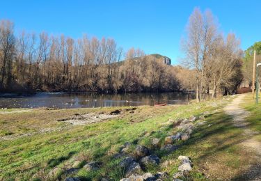
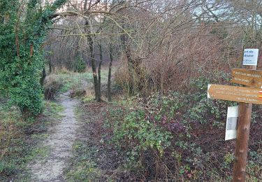
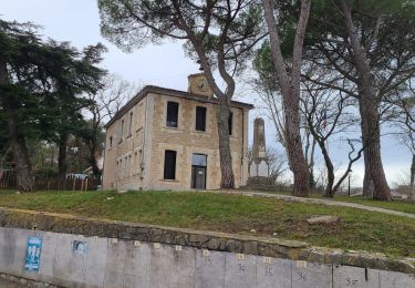
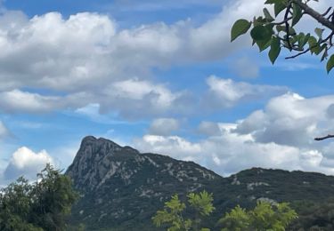
Parking devant le château - Première petite boucle sur le site de Cambous - Rejoindre le PR dit Chemin des Drailles depuis le domaine départemental de Roussières - Tombes et dolmen restaurés - boucle Cazarils - Montagne de Labat Paillas et retour
voir des photos et d'autres randonnées sur www.vertygo.org
https://goo.gl/photos/WmggVWSxTgamMAYq7
Puntos de interés
Localización
Comentarios
Excursiones cerca
![Excursión Senderismo Viols-en-Laval - Fontaine Terou - Photo](https://media.geolcdn.com/t/375/260/893d4ed9-6474-41c2-a5cc-5fad7e67044e.jpg&format=jpg&maxdim=2)
![Senderismo Senderismo](https://static1.geolcdn.com/sitytour/trail-icons/101.png)
Senderismo
![](/images/other/stat-length.png)
![](https://static1.geolcdn.com/siteimages/upload/files/16400158638029165_repeat_loop_refresh_sync_direction_icon.png)
![Excursión Senderismo Saint-Martin-de-Londres - l'ouradou - Photo](https://media.geolcdn.com/t/375/260/ext.jpg?maxdim=2&url=https%3A%2F%2Fservices.sitytrail.com%2FGeolivesWS%2FDownloadMedia.ashx%3FTrailID%3D860187%26Media%3D20171107114231.jpg)
![Senderismo Senderismo](https://static1.geolcdn.com/sitytour/trail-icons/101.png)
Senderismo
![](/images/other/stat-length.png)
![](https://static1.geolcdn.com/siteimages/upload/files/16400158638029165_repeat_loop_refresh_sync_direction_icon.png)
![Excursión Senderismo Mas-de-Londres - 2 Mas de Londres par la Jasse du 18-01-2025 - Photo](https://media.geolcdn.com/t/375/260/192185da-9693-40df-bfdc-9922ac5fb37b.jpg&format=jpg&maxdim=2)
![Senderismo Senderismo](https://static1.geolcdn.com/sitytour/trail-icons/101.png)
Senderismo
![](/images/other/stat-length.png)
![](https://static1.geolcdn.com/siteimages/upload/files/16400158638029165_repeat_loop_refresh_sync_direction_icon.png)
![Excursión Senderismo Mas-de-Londres - A Mas de Londres à Saint Bauzille de Putois par le GR 60 du 17-01-2025 - Photo](https://media.geolcdn.com/t/375/260/b8a71293-24db-4889-bcb9-e61559e24369.jpg&format=jpg&maxdim=2)
![Senderismo Senderismo](https://static1.geolcdn.com/sitytour/trail-icons/101.png)
Senderismo
![](/images/other/stat-length.png)
![](https://static1.geolcdn.com/siteimages/upload/files/16400158638029165_repeat_loop_refresh_sync_direction_icon.png)
![Excursión Senderismo Mas-de-Londres - 4 Mas de Londres - La Liquière - La Borie du 23-01-2025 - Photo](https://media.geolcdn.com/t/375/260/05102a87-29f6-4667-8235-12dc17719fa1.jpg&format=jpg&maxdim=2)
![Senderismo Senderismo](https://static1.geolcdn.com/sitytour/trail-icons/101.png)
Senderismo
![](/images/other/stat-length.png)
![](https://static1.geolcdn.com/siteimages/upload/files/16400158638029165_repeat_loop_refresh_sync_direction_icon.png)
![Excursión Senderismo Mas-de-Londres - 1 Mas de Londres par la Borie du 14/01/2025 - Photo](https://media.geolcdn.com/t/375/260/9f35497f-19ee-4dfe-a684-9fc067c1b5db.jpg&format=jpg&maxdim=2)
![Senderismo Senderismo](https://static1.geolcdn.com/sitytour/trail-icons/101.png)
Senderismo
![](/images/other/stat-length.png)
![](https://static1.geolcdn.com/siteimages/upload/files/16400158638029165_repeat_loop_refresh_sync_direction_icon.png)
![Excursión Senderismo Mas-de-Londres - La Jasse Cazevieille par l’ubac - Photo](https://media.geolcdn.com/t/375/260/9a13e1f3-2499-4387-bf75-45d970603d81.jpg&format=jpg&maxdim=2)
![Senderismo Senderismo](https://static1.geolcdn.com/sitytour/trail-icons/101.png)
Senderismo
![](/images/other/stat-length.png)
![](https://static1.geolcdn.com/siteimages/upload/files/16400158638029165_repeat_loop_refresh_sync_direction_icon.png)
![Excursión Senderismo Saint-Martin-de-Londres - Saint-Martin-de-Londres-la-jasse - Photo](https://media.geolcdn.com/t/375/260/42714f9a-1fe4-412e-91c6-2e130dc1d617.jpg&format=jpg&maxdim=2)
![Senderismo Senderismo](https://static1.geolcdn.com/sitytour/trail-icons/101.png)
Senderismo
![](/images/other/stat-length.png)
![](https://static1.geolcdn.com/siteimages/upload/files/16400158638029165_repeat_loop_refresh_sync_direction_icon.png)
![Excursión Senderismo Mas-de-Londres - Mas de Londres - le Pic St Loup du 05-02-2024 - Photo](https://media.geolcdn.com/t/375/260/90f4b040-789d-4f87-a4f4-7259fa742c13.jpg&format=jpg&maxdim=2)
![Senderismo Senderismo](https://static1.geolcdn.com/sitytour/trail-icons/101.png)
Senderismo
![](/images/other/stat-length.png)
![](https://static1.geolcdn.com/siteimages/upload/files/16400158638029165_repeat_loop_refresh_sync_direction_icon.png)