![](/images/other/stat-length.png)
![Excursión Senderismo Vérignon - Crêtes et chapelles de Verignont - Photo](https://media.geolcdn.com/t/1900/400/ext.pjpeg?maxdim=2&url=https%3A%2F%2Fstatic1.geolcdn.com%2Fsiteimages%2Fupload%2Ffiles%2F1553511878bg_sport_marche.png)
Crêtes et chapelles de Verignont
Migueldefrance
Usuario
![Longitud](/images/other/stat-length.png)
Longitud
11,4 km
![Altitud máxima](https://static1.geolcdn.com/siteimages/upload/files/1508320355ic_sort_altitude_max_24dp.png)
Altitud máxima
1074 m
![Desnivel positivo](https://static1.geolcdn.com/siteimages/upload/files/1508320355ic_sort_den_pos_24dp.png)
Desnivel positivo
360 m
![Km-Effort](/images/other/stat-length.png)
Km-Effort
16,2 km
![Altitud mínima](https://static1.geolcdn.com/siteimages/upload/files/1508320355ic_sort_altitude_min_24dp.png)
Altitud mínima
844 m
![Desnivel negativo](https://static1.geolcdn.com/siteimages/upload/files/1508320355ic_sort_den_neg_24dp.png)
Desnivel negativo
358 m
![Boucle](https://static1.geolcdn.com/siteimages/upload/files/16400158638029165_repeat_loop_refresh_sync_direction_icon.png)
Boucle
Sí
Fecha de creación :
2024-03-05 09:49:04.545
Última modificación :
2024-03-05 14:31:27.542
![Senderismo](https://static1.geolcdn.com/sitytour/trail-icons/101.png)
4h41
Dificultad : Fácil
![Escanee este código QR para abrir la excursión en la aplicación SityTrail](https://capi.geolives.com/qq0zvz2zws4bq2lad0pu/sitytour/trails/3970870/qr.png?size=200)
Aplicación GPS de excursión GRATIS
A propósito
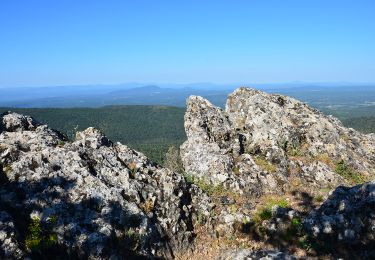
Ruta Senderismo de 11,4 km a descubrir en Provenza-Alpes-Costa Azul, Var, Vérignon. Esta ruta ha sido propuesta por Migueldefrance.
Descripción
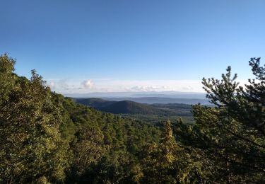
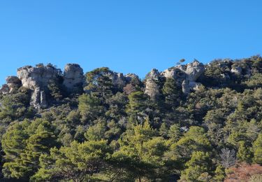
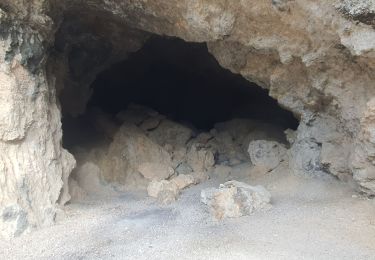
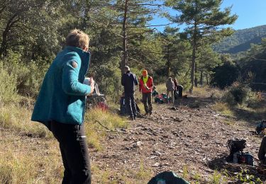
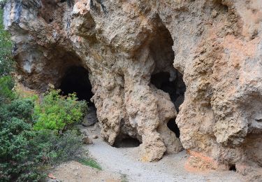
Beau parcours en forêt. Au retour, petite remontée pour éviter la route par un joli sentier.
Localización
País:
France
Región :
Provenza-Alpes-Costa Azul
Departamento/provincia :
Var
Municipio :
Vérignon
Localidad:
Unknown
Salida:(Dec)
Salida:(UTM)
280153 ; 4837008 (32T) N.
Comentarios
Excursiones cerca
![Excursión Senderismo Aups - Tour de la montagne des Espiguières - Photo](https://media.geolcdn.com/t/375/260/431b4009-bb72-41ce-bf82-1eb70c111177.jpg&format=jpg&maxdim=2)
![Senderismo Senderismo](https://static1.geolcdn.com/sitytour/trail-icons/101.png)
Tour de la montagne des Espiguières
Senderismo
Difícil
(1)
Aups,
Provenza-Alpes-Costa Azul,
Var,
France
![](/images/other/stat-length.png)
11 km | 15,4 km-effort
3h 30min
![](https://static1.geolcdn.com/siteimages/upload/files/16400158638029165_repeat_loop_refresh_sync_direction_icon.png)
Sí
![Excursión Senderismo Vérignon - 2024-01-30 Vérignon - Chapelle Saint Priest - Photo](https://media.geolcdn.com/t/375/260/bc33279d-e419-4c1d-b671-4cabd4fbe480.jpg&format=jpg&maxdim=2)
![Senderismo Senderismo](https://static1.geolcdn.com/sitytour/trail-icons/101.png)
2024-01-30 Vérignon - Chapelle Saint Priest
Senderismo
Difícil
Vérignon,
Provenza-Alpes-Costa Azul,
Var,
France
![](/images/other/stat-length.png)
10,5 km | 14,6 km-effort
3h 19min
![](https://static1.geolcdn.com/siteimages/upload/files/16400158638029165_repeat_loop_refresh_sync_direction_icon.png)
Sí
![Excursión Senderismo Aups - 2023-01-31 Col de la Bigue - Les Eyssariades - Photo](https://media.geolcdn.com/t/375/260/039bb7ef-09c0-4f59-a7b3-09433c82c531.jpg&format=jpg&maxdim=2)
![Senderismo Senderismo](https://static1.geolcdn.com/sitytour/trail-icons/101.png)
2023-01-31 Col de la Bigue - Les Eyssariades
Senderismo
Medio
Aups,
Provenza-Alpes-Costa Azul,
Var,
France
![](/images/other/stat-length.png)
16,3 km | 23 km-effort
4h 41min
![](https://static1.geolcdn.com/siteimages/upload/files/16400158638029165_repeat_loop_refresh_sync_direction_icon.png)
Sí
![Excursión Senderismo Aups - 30-10-2022 Aups Sentier des Crêtes - Photo](https://media.geolcdn.com/t/375/260/032d8805-e093-4b3d-aca0-89dc5544919a.jpg&format=jpg&maxdim=2)
![Senderismo Senderismo](https://static1.geolcdn.com/sitytour/trail-icons/101.png)
30-10-2022 Aups Sentier des Crêtes
Senderismo
Medio
Aups,
Provenza-Alpes-Costa Azul,
Var,
France
![](/images/other/stat-length.png)
20 km | 31 km-effort
5h 0min
![](https://static1.geolcdn.com/siteimages/upload/files/16400158638029165_repeat_loop_refresh_sync_direction_icon.png)
Sí
![Excursión Senderismo Aups - 2025-01-21 Montagne des Espiguières - Photo](https://media.geolcdn.com/t/375/260/1e29026a-5d46-486c-967e-572a0d99d84f.jpg&format=jpg&maxdim=2)
![Senderismo Senderismo](https://static1.geolcdn.com/sitytour/trail-icons/101.png)
2025-01-21 Montagne des Espiguières
Senderismo
Difícil
Aups,
Provenza-Alpes-Costa Azul,
Var,
France
![](/images/other/stat-length.png)
11,6 km | 17,9 km-effort
4h 3min
![](https://static1.geolcdn.com/siteimages/upload/files/16400158638029165_repeat_loop_refresh_sync_direction_icon.png)
Sí
![Excursión Senderismo Vérignon - Verignon Notre Dame de Liesse Chapelle Saint Priest trace réelle - Photo](https://media.geolcdn.com/t/375/260/06e1804b-1eee-444e-ab93-f67bc999bfbe.jpg&format=jpg&maxdim=2)
![Senderismo Senderismo](https://static1.geolcdn.com/sitytour/trail-icons/101.png)
Verignon Notre Dame de Liesse Chapelle Saint Priest trace réelle
Senderismo
Muy difícil
Vérignon,
Provenza-Alpes-Costa Azul,
Var,
France
![](/images/other/stat-length.png)
19,2 km | 29 km-effort
6h 30min
![](https://static1.geolcdn.com/siteimages/upload/files/16400158638029165_repeat_loop_refresh_sync_direction_icon.png)
Sí
![Senderismo Senderismo](https://static1.geolcdn.com/sitytour/trail-icons/101.png)
Vérignon - ND Liesse - Moure de Cuiller - Chapelle St Priest
Senderismo
Difícil
Vérignon,
Provenza-Alpes-Costa Azul,
Var,
France
![](/images/other/stat-length.png)
18 km | 27 km-effort
4h 26min
![](https://static1.geolcdn.com/siteimages/upload/files/16400158638029165_repeat_loop_refresh_sync_direction_icon.png)
Sí
![Senderismo Senderismo](https://static1.geolcdn.com/sitytour/trail-icons/101.png)
Aups - Grottes - Croix des Pins - Col de Besc
Senderismo
Fácil
Aups,
Provenza-Alpes-Costa Azul,
Var,
France
![](/images/other/stat-length.png)
15,2 km | 21 km-effort
4h 21min
![](https://static1.geolcdn.com/siteimages/upload/files/16400158638029165_repeat_loop_refresh_sync_direction_icon.png)
Sí
![Excursión Senderismo Aups - AUPS - GROTTES ET CHAPELLES - Photo](https://media.geolcdn.com/t/375/260/ffc0fac0-d36b-49b3-8114-499090cbd5ce.jpg&format=jpg&maxdim=2)
![Senderismo Senderismo](https://static1.geolcdn.com/sitytour/trail-icons/101.png)
AUPS - GROTTES ET CHAPELLES
Senderismo
Fácil
Aups,
Provenza-Alpes-Costa Azul,
Var,
France
![](/images/other/stat-length.png)
11,6 km | 16,5 km-effort
4h 55min
![](https://static1.geolcdn.com/siteimages/upload/files/16400158638029165_repeat_loop_refresh_sync_direction_icon.png)
Sí