![](/images/other/stat-length.png)
![Excursión Senderismo Vianden - 2024-02-26_18h54m22_circuit-ourdall-promenade - Photo](https://media.geolcdn.com/t/1900/400/ext.pjpeg?maxdim=2&url=https%3A%2F%2Fstatic1.geolcdn.com%2Fsiteimages%2Fupload%2Ffiles%2F1553511878bg_sport_marche.png)
2024-02-26_18h54m22_circuit-ourdall-promenade
mumu.larandonneuse
Usuario GUIDE
![Longitud](/images/other/stat-length.png)
![Altitud máxima](https://static1.geolcdn.com/siteimages/upload/files/1508320355ic_sort_altitude_max_24dp.png)
![Desnivel positivo](https://static1.geolcdn.com/siteimages/upload/files/1508320355ic_sort_den_pos_24dp.png)
![Km-Effort](/images/other/stat-length.png)
![Altitud mínima](https://static1.geolcdn.com/siteimages/upload/files/1508320355ic_sort_altitude_min_24dp.png)
![Desnivel negativo](https://static1.geolcdn.com/siteimages/upload/files/1508320355ic_sort_den_neg_24dp.png)
![Boucle](https://static1.geolcdn.com/siteimages/upload/files/16400158638029165_repeat_loop_refresh_sync_direction_icon.png)
![Senderismo](https://static1.geolcdn.com/sitytour/trail-icons/101.png)
2h34
Dificultad : Medio
![Escanee este código QR para abrir la excursión en la aplicación SityTrail](https://capi.geolives.com/qq0zvz2zws4bq2lad0pu/sitytour/trails/3962992/qr.png?size=200)
Aplicación GPS de excursión GRATIS
A propósito
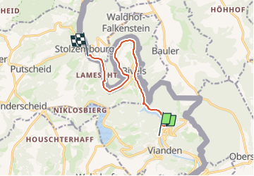
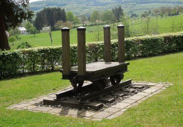
Ruta Senderismo de 8,8 km a descubrir en Desconocido, Canton Vianden, Vianden. Esta ruta ha sido propuesta por mumu.larandonneuse.
Descripción
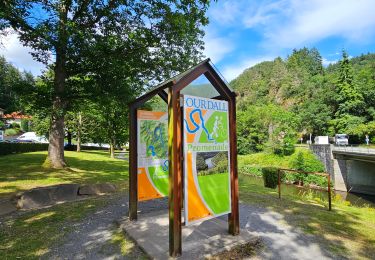
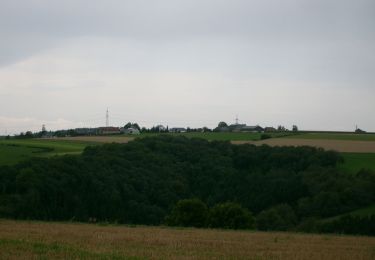
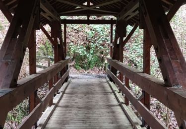
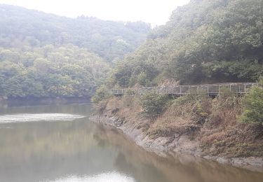
La Promenade de l'Our invite à découvrir la vallée de l'Our entre Vianden et Stolzembourg. En partant de Vianden, vous montez tout de suite une petite colline où vous traversez le barrage de l'Our. Ce chemin très particulier passe en partie par des passerelles en bois qui longent directement la roche. N'oubliez pas de vous retourner pour profiter de la vue sur le château de Vianden et la chapelle Bildchen. Le chemin passe par Bivels jusqu'à Stolzembourg, où vous pouvez prendre le bus pour retourner à Vianden.
ℹ️ www visit-eislek.lu
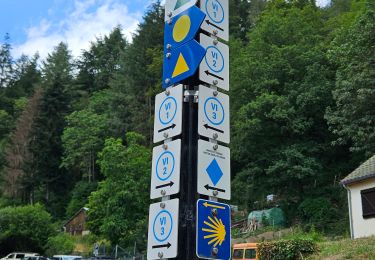
Localización
Comentarios
Excursiones cerca
![Excursión Senderismo Vianden - Vianden : Télésiège & Château - Photo](https://media.geolcdn.com/t/375/260/d79592ef-5b36-4bc2-ad1d-709da52cc00f.jpg&format=jpg&maxdim=2)
![Senderismo Senderismo](https://static1.geolcdn.com/sitytour/trail-icons/101.png)
Senderismo
![](/images/other/stat-length.png)
![](https://static1.geolcdn.com/siteimages/upload/files/16400158638029165_repeat_loop_refresh_sync_direction_icon.png)
![Excursión Senderismo Vianden - 2023-06-19_15h21m20_eislek-pad-vianden-1 - Photo](https://media.geolcdn.com/t/375/260/33ae7762-fc23-4c7a-b8ae-83734bad05ea.jpg&format=jpg&maxdim=2)
![Senderismo Senderismo](https://static1.geolcdn.com/sitytour/trail-icons/101.png)
Senderismo
![](/images/other/stat-length.png)
![](https://static1.geolcdn.com/siteimages/upload/files/16400158638029165_repeat_loop_refresh_sync_direction_icon.png)
![Excursión Senderismo Vianden - Itinérant Luxembourg Jour 7: Vianden -Ettelbruck - Photo](https://media.geolcdn.com/t/375/260/928dee80-2005-4eae-8761-66de6a052544.jpg&format=jpg&maxdim=2)
![Senderismo Senderismo](https://static1.geolcdn.com/sitytour/trail-icons/101.png)
Senderismo
![](/images/other/stat-length.png)
![](https://static1.geolcdn.com/siteimages/upload/files/16400158638029165_repeat_loop_refresh_sync_direction_icon.png)
![Excursión Senderismo Vianden - Itinérant Luxembourg Jour 6 : Boucle autour de Vianden - Photo](https://media.geolcdn.com/t/375/260/5b9141dd-6e04-4494-b5cf-8eec4ef7e8b3.jpg&format=jpg&maxdim=2)
![Senderismo Senderismo](https://static1.geolcdn.com/sitytour/trail-icons/101.png)
Senderismo
![](/images/other/stat-length.png)
![](https://static1.geolcdn.com/siteimages/upload/files/16400158638029165_repeat_loop_refresh_sync_direction_icon.png)
![Excursión Senderismo Tandel - 2024-07-11_16h37m44_local-hiking-trail-ta-2 - Photo](https://media.geolcdn.com/t/375/260/8c005037-a9f4-4acb-88bc-4e713f695a2c.jpg&format=jpg&maxdim=2)
![Senderismo Senderismo](https://static1.geolcdn.com/sitytour/trail-icons/101.png)
Senderismo
![](/images/other/stat-length.png)
![](https://static1.geolcdn.com/siteimages/upload/files/16400158638029165_repeat_loop_refresh_sync_direction_icon.png)
![Excursión A pie Vianden - Autopedestre Bettel - Photo](https://media.geolcdn.com/t/375/260/02b2f00a-75a6-48f2-b6f0-c11bc4a34d36.jpeg&format=jpg&maxdim=2)
![A pie A pie](https://static1.geolcdn.com/sitytour/trail-icons/100.png)
A pie
![](/images/other/stat-length.png)
![](https://static1.geolcdn.com/siteimages/upload/files/16400158638029165_repeat_loop_refresh_sync_direction_icon.png)
![Excursión A pie Tandel - Autopedestre Brandenbourg - Photo](https://media.geolcdn.com/t/375/260/f773c6ce-1e62-48fa-9c88-bf2c6a499187.jpeg&format=jpg&maxdim=2)
![A pie A pie](https://static1.geolcdn.com/sitytour/trail-icons/100.png)
A pie
![](/images/other/stat-length.png)
![](https://static1.geolcdn.com/siteimages/upload/files/16400158638029165_repeat_loop_refresh_sync_direction_icon.png)
![Excursión Senderismo Vianden - Les panoramas de Vianden - Photo](https://media.geolcdn.com/t/375/260/eea14bf8-62f0-4367-9ed4-8f55cee74d56.jpg&format=jpg&maxdim=2)
![Senderismo Senderismo](https://static1.geolcdn.com/sitytour/trail-icons/101.png)
Senderismo
![](/images/other/stat-length.png)
![](https://static1.geolcdn.com/siteimages/upload/files/16400158638029165_repeat_loop_refresh_sync_direction_icon.png)
![Excursión Senderismo Vianden - vianden . stolzemmbour - Photo](https://media.geolcdn.com/t/375/260/04cc6bc0-b9f3-4b97-a33c-e613e3b69f69.jpg&format=jpg&maxdim=2)
![Senderismo Senderismo](https://static1.geolcdn.com/sitytour/trail-icons/101.png)
Senderismo
![](/images/other/stat-length.png)
![](https://static1.geolcdn.com/siteimages/upload/files/16400158638029165_repeat_loop_refresh_sync_direction_icon.png)