![](/images/other/stat-length.png)
![Excursión Bicicleta Malataverne - au depart de Malataverne entre Drôme et Ardeche - Photo](https://media.geolcdn.com/t/1900/400/ext.pjpeg?maxdim=2&url=https%3A%2F%2Fstatic1.geolcdn.com%2Fsiteimages%2Fupload%2Ffiles%2F1524743154velo.jpg)
au depart de Malataverne entre Drôme et Ardeche
martoche
Usuario
![Longitud](/images/other/stat-length.png)
Longitud
61 km
![Altitud máxima](https://static1.geolcdn.com/siteimages/upload/files/1508320355ic_sort_altitude_max_24dp.png)
Altitud máxima
436 m
![Desnivel positivo](https://static1.geolcdn.com/siteimages/upload/files/1508320355ic_sort_den_pos_24dp.png)
Desnivel positivo
1049 m
![Km-Effort](/images/other/stat-length.png)
Km-Effort
75 km
![Altitud mínima](https://static1.geolcdn.com/siteimages/upload/files/1508320355ic_sort_altitude_min_24dp.png)
Altitud mínima
54 m
![Desnivel negativo](https://static1.geolcdn.com/siteimages/upload/files/1508320355ic_sort_den_neg_24dp.png)
Desnivel negativo
1049 m
![Boucle](https://static1.geolcdn.com/siteimages/upload/files/16400158638029165_repeat_loop_refresh_sync_direction_icon.png)
Boucle
Sí
Fecha de creación :
2024-02-23 17:33:18.372
Última modificación :
2024-02-23 17:38:54.302
![Bicicleta](https://static1.geolcdn.com/sitytour/trail-icons/200.png)
0m
Dificultad : Difícil
![Escanee este código QR para abrir la excursión en la aplicación SityTrail](https://capi.geolives.com/qq0zvz2zws4bq2lad0pu/sitytour/trails/3959717/qr.png?size=200)
Aplicación GPS de excursión GRATIS
A propósito
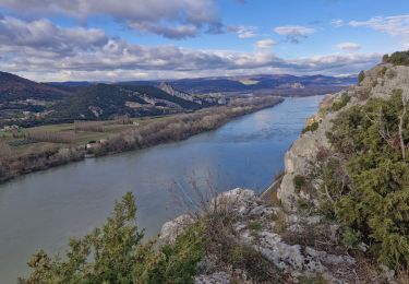
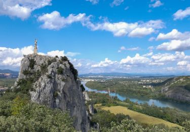
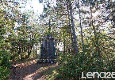
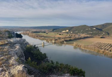
Ruta Bicicleta de 61 km a descubrir en Auvergne-Rhône-Alpes, Drôme, Malataverne. Esta ruta ha sido propuesta por martoche.
Descripción
Magnifique boucle sur petites routes tranquilles, villages pittoresques à travers une végétation méditerranéennes.
Localización
País:
France
Región :
Auvergne-Rhône-Alpes
Departamento/provincia :
Drôme
Municipio :
Malataverne
Localidad:
Unknown
Salida:(Dec)
Salida:(UTM)
639208 ; 4927559 (31T) N.
Comentarios
Excursiones cerca
![Excursión Senderismo Donzère - Donzère et le défilé de Donzère 8km. - Photo](https://media.geolcdn.com/t/375/260/29640f3c-57e6-45f5-8c80-02a608564184.jpg&format=jpg&maxdim=2)
![Senderismo Senderismo](https://static1.geolcdn.com/sitytour/trail-icons/101.png)
Donzère et le défilé de Donzère 8km.
Senderismo
Medio
(1)
Donzère,
Auvergne-Rhône-Alpes,
Drôme,
France
![](/images/other/stat-length.png)
8,1 km | 10,4 km-effort
2h 21min
![](https://static1.geolcdn.com/siteimages/upload/files/16400158638029165_repeat_loop_refresh_sync_direction_icon.png)
Sí
![Excursión Senderismo Viviers - 2024-08-09_18h31m30_t123518200_wanderung veviers erzengel - Photo](https://media.geolcdn.com/t/375/260/cf389799-c859-43e5-9cc2-efd706a42e44.jpg&format=jpg&maxdim=2)
![Senderismo Senderismo](https://static1.geolcdn.com/sitytour/trail-icons/101.png)
2024-08-09_18h31m30_t123518200_wanderung veviers erzengel
Senderismo
Medio
(2)
Viviers,
Auvergne-Rhône-Alpes,
Ardecha,
France
![](/images/other/stat-length.png)
8,4 km | 11,5 km-effort
2h 36min
![](https://static1.geolcdn.com/siteimages/upload/files/16400158638029165_repeat_loop_refresh_sync_direction_icon.png)
Sí
![Excursión Senderismo Viviers - 2022-07-02_18h53m13_Viviers 6km.gpx.xml - Photo](https://media.geolcdn.com/t/375/260/2c7b7c3a-9657-4643-bedd-c867c3e314f0.jpg&format=jpg&maxdim=2)
![Senderismo Senderismo](https://static1.geolcdn.com/sitytour/trail-icons/101.png)
2022-07-02_18h53m13_Viviers 6km.gpx.xml
Senderismo
Fácil
(1)
Viviers,
Auvergne-Rhône-Alpes,
Ardecha,
France
![](/images/other/stat-length.png)
5,7 km | 7,4 km-effort
1h 47min
![](https://static1.geolcdn.com/siteimages/upload/files/16400158638029165_repeat_loop_refresh_sync_direction_icon.png)
Sí
![Excursión Senderismo Allan - allan transclavienne rac - Photo](https://media.geolcdn.com/t/375/260/ext.jpg?maxdim=2&url=https%3A%2F%2Fservices.sitytrail.com%2FGeolivesWS%2FDownloadMedia.ashx%3FTrailID%3D649381%26Media%3Dfix__20161022171755.jpg)
![Senderismo Senderismo](https://static1.geolcdn.com/sitytour/trail-icons/101.png)
allan transclavienne rac
Senderismo
Muy fácil
(1)
Allan,
Auvergne-Rhône-Alpes,
Drôme,
France
![](/images/other/stat-length.png)
19,1 km | 26 km-effort
5h 11min
![](https://static1.geolcdn.com/siteimages/upload/files/16400158638029165_repeat_loop_refresh_sync_direction_icon.png)
Sí
![Excursión Senderismo Malataverne - Malataverne : Le Rac Le Navon 7km5. - Photo](https://media.geolcdn.com/t/375/260/0561eb90-e5f9-49cc-981c-c2636eb681f5.jpg&format=jpg&maxdim=2)
![Senderismo Senderismo](https://static1.geolcdn.com/sitytour/trail-icons/101.png)
Malataverne : Le Rac Le Navon 7km5.
Senderismo
Medio
(1)
Malataverne,
Auvergne-Rhône-Alpes,
Drôme,
France
![](/images/other/stat-length.png)
7,6 km | 10,7 km-effort
2h 25min
![](https://static1.geolcdn.com/siteimages/upload/files/16400158638029165_repeat_loop_refresh_sync_direction_icon.png)
Sí
![Excursión Senderismo Châteauneuf-du-Rhône - 26 Châteauneuf du Rhône Navon Rac - Photo](https://media.geolcdn.com/t/375/260/ext.jpg?maxdim=2&url=https%3A%2F%2Fstatic1.geolcdn.com%2Fsiteimages%2Fupload%2Ffiles%2F1553511878bg_sport_marche.png)
![Senderismo Senderismo](https://static1.geolcdn.com/sitytour/trail-icons/101.png)
26 Châteauneuf du Rhône Navon Rac
Senderismo
Medio
(1)
Châteauneuf-du-Rhône,
Auvergne-Rhône-Alpes,
Drôme,
France
![](/images/other/stat-length.png)
9,8 km | 14 km-effort
3h 10min
![](https://static1.geolcdn.com/siteimages/upload/files/16400158638029165_repeat_loop_refresh_sync_direction_icon.png)
Sí
![Senderismo Senderismo](https://static1.geolcdn.com/sitytour/trail-icons/101.png)
2022-10-10_11h21m09_tmpWriteApidae_259847_fr
Senderismo
Medio
Allan,
Auvergne-Rhône-Alpes,
Drôme,
France
![](/images/other/stat-length.png)
10,7 km | 15,2 km-effort
3h 27min
![](https://static1.geolcdn.com/siteimages/upload/files/16400158638029165_repeat_loop_refresh_sync_direction_icon.png)
Sí
![Excursión Senderismo Donzère - Donzère -falaises-Navon-ruines 15km - Photo](https://media.geolcdn.com/t/375/260/43689114-f291-44a7-938f-e31d16f56bb8.jpg&format=jpg&maxdim=2)
![Senderismo Senderismo](https://static1.geolcdn.com/sitytour/trail-icons/101.png)
Donzère -falaises-Navon-ruines 15km
Senderismo
Medio
Donzère,
Auvergne-Rhône-Alpes,
Drôme,
France
![](/images/other/stat-length.png)
15,4 km | 19,7 km-effort
4h 10min
![](https://static1.geolcdn.com/siteimages/upload/files/16400158638029165_repeat_loop_refresh_sync_direction_icon.png)
Sí
![Excursión Senderismo Donzère - Donzère les falaises 6km - Photo](https://media.geolcdn.com/t/375/260/ext.jpg?maxdim=2&url=https%3A%2F%2Fstatic1.geolcdn.com%2Fsiteimages%2Fupload%2Ffiles%2F1553511878bg_sport_marche.png)
![Senderismo Senderismo](https://static1.geolcdn.com/sitytour/trail-icons/101.png)
Donzère les falaises 6km
Senderismo
Fácil
(1)
Donzère,
Auvergne-Rhône-Alpes,
Drôme,
France
![](/images/other/stat-length.png)
5,4 km | 7,2 km-effort
2h 0min
![](https://static1.geolcdn.com/siteimages/upload/files/16400158638029165_repeat_loop_refresh_sync_direction_icon.png)
Sí