


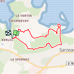


16,6 km | 17,6 km-effort


Usuario


Aplicación GPS de excursión GRATIS
 SityTrail
IGN / Institutos geográficos
SityTrail World
El mundo es suyo
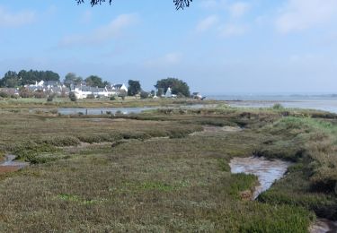
Ruta Senderismo de 7,4 km a descubrir en Bretaña, Morbihan, Sarzeau. Esta ruta ha sido propuesta por corsinou.
Circuit au départ de KERBIBOUL au bout de la rue HENT AR VIHAN, vous emmène vers Le MEGLIO, KERVOSSEN et le CHATEAU DE TRUSCAT la Laverie de SARZEAU pour un retour à KERBIBOUL
Senderismo

Senderismo
Senderismo
Senderismo

Otra actividad
Senderismo
Senderismo
Senderismo
Senderismo
Fermetures intempestives de l appli sinon super !!!