![](/images/other/stat-length.png)
![Excursión Raquetas de nieve Moulinet - Baisse Cavaline - Photo](https://media.geolcdn.com/t/1900/400/b5a21962-1dcd-409b-822e-6e34602431de.jpg&format=pjpeg&maxdim=2)
Baisse Cavaline
bozo1970
Usuario
![Longitud](/images/other/stat-length.png)
![Altitud máxima](https://static1.geolcdn.com/siteimages/upload/files/1508320355ic_sort_altitude_max_24dp.png)
![Desnivel positivo](https://static1.geolcdn.com/siteimages/upload/files/1508320355ic_sort_den_pos_24dp.png)
![Km-Effort](/images/other/stat-length.png)
![Altitud mínima](https://static1.geolcdn.com/siteimages/upload/files/1508320355ic_sort_altitude_min_24dp.png)
![Desnivel negativo](https://static1.geolcdn.com/siteimages/upload/files/1508320355ic_sort_den_neg_24dp.png)
![Boucle](https://static1.geolcdn.com/siteimages/upload/files/16400158638029165_repeat_loop_refresh_sync_direction_icon.png)
![Raquetas de nieve](https://static1.geolcdn.com/sitytour/trail-icons/504.png)
6h44
Dificultad : Muy difícil
![Escanee este código QR para abrir la excursión en la aplicación SityTrail](https://capi.geolives.com/qq0zvz2zws4bq2lad0pu/sitytour/trails/3950981/qr.png?size=200)
Aplicación GPS de excursión GRATIS
A propósito
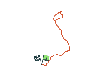
Ruta Raquetas de nieve de 16,5 km a descubrir en Provenza-Alpes-Costa Azul, Alpes Marítimos, Moulinet. Esta ruta ha sido propuesta por bozo1970.
Descripción
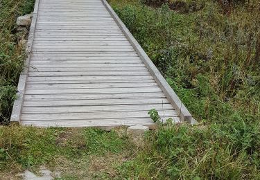
Départ du Camp d’Argent
L’Authion en 1h D 332 et 3km500
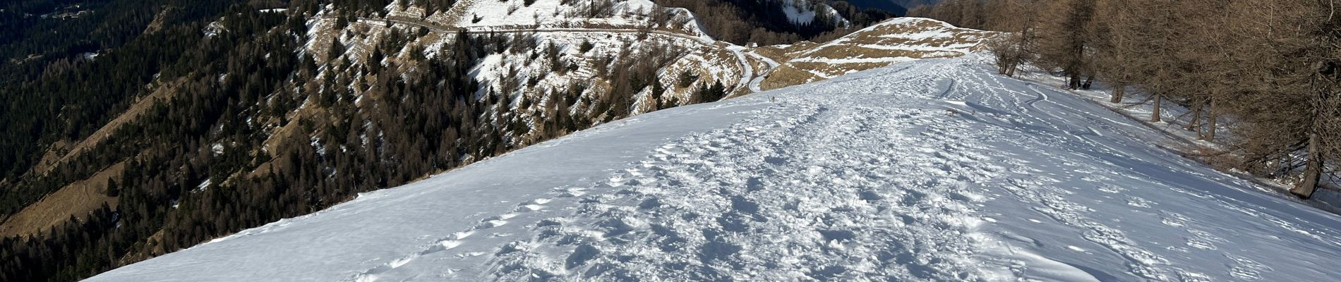
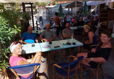
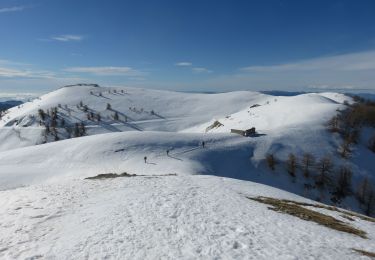
Beaucoup de neige
Baisse de Véran en 1h42’ D 346 et 5km900
Col de Raus en 2h23’ D 520 et 7km
Poursuite du GR tout en dévers jusqu’à la Baisse Cavaline
3h18’ D 647 et 8km500
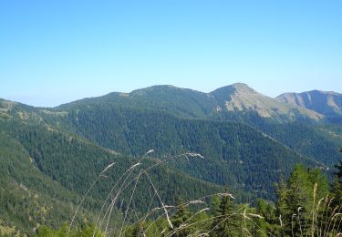
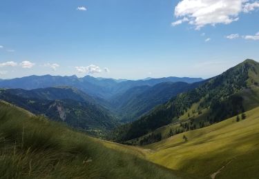
Jolie Vue sur la Corse !!
Boucle autour de la Cîme de Raus
Récupération du GR en sens inverse
A/R en 6h47’ D 942 et 17km
Chamois
Localización
Comentarios
Excursiones cerca
![Excursión A pie Moulinet - Crêtes de l'Arpiha - Photo](https://media.geolcdn.com/t/375/260/c07cc7b3-d5b2-4e51-bdf4-03929243643c.jpeg&format=jpg&maxdim=2)
![A pie A pie](https://static1.geolcdn.com/sitytour/trail-icons/100.png)
A pie
![](/images/other/stat-length.png)
![](https://static1.geolcdn.com/siteimages/upload/files/16400158638029165_repeat_loop_refresh_sync_direction_icon.png)
![Excursión A pie Moulinet - Tour de la Calmette - Photo](https://media.geolcdn.com/t/375/260/f1319e6f-f58e-4543-ba7d-7f850f27f51a.jpeg&format=jpg&maxdim=2)
![A pie A pie](https://static1.geolcdn.com/sitytour/trail-icons/100.png)
A pie
![](/images/other/stat-length.png)
![](https://static1.geolcdn.com/siteimages/upload/files/16400158638029165_repeat_loop_refresh_sync_direction_icon.png)
![Excursión A pie Moulinet - Cime du Diable - Photo](https://media.geolcdn.com/t/375/260/94134920-c5fc-4b95-a9f6-aeabb0ba95c2.jpeg&format=jpg&maxdim=2)
![A pie A pie](https://static1.geolcdn.com/sitytour/trail-icons/100.png)
A pie
![](/images/other/stat-length.png)
![](https://static1.geolcdn.com/siteimages/upload/files/16400158638029165_repeat_loop_refresh_sync_direction_icon.png)
![Excursión Senderismo Moulinet - Grand Tour de Lauthion - Photo](https://media.geolcdn.com/t/375/260/fc421b10-23aa-4b7a-b4cf-80322f7edc29.jpg&format=jpg&maxdim=2)
![Senderismo Senderismo](https://static1.geolcdn.com/sitytour/trail-icons/101.png)
Senderismo
![](/images/other/stat-length.png)
![](https://static1.geolcdn.com/siteimages/upload/files/16400158638029165_repeat_loop_refresh_sync_direction_icon.png)
![Excursión Senderismo Moulinet - Turini- tour de la Calmette - Photo](https://media.geolcdn.com/t/375/260/65c623cf-7185-4ec8-a258-6191b868284a.jpg&format=jpg&maxdim=2)
![Senderismo Senderismo](https://static1.geolcdn.com/sitytour/trail-icons/101.png)
Senderismo
![](/images/other/stat-length.png)
![](https://static1.geolcdn.com/siteimages/upload/files/16400158638029165_repeat_loop_refresh_sync_direction_icon.png)
![Excursión Senderismo Moulinet - Bois Noir au départ de Cabanes Vieilles - Photo](https://media.geolcdn.com/t/375/260/3a606a47-7a05-442f-9077-9afb776dfe03.jpg&format=jpg&maxdim=2)
![Senderismo Senderismo](https://static1.geolcdn.com/sitytour/trail-icons/101.png)
Senderismo
![](/images/other/stat-length.png)
![](https://static1.geolcdn.com/siteimages/upload/files/16400158638029165_repeat_loop_refresh_sync_direction_icon.png)
![Excursión Senderismo Moulinet - Camp d'Argent - Photo](https://media.geolcdn.com/t/375/260/e33506c7-cd4b-4efa-978e-dc05b0057075.jpg&format=jpg&maxdim=2)
![Senderismo Senderismo](https://static1.geolcdn.com/sitytour/trail-icons/101.png)
Senderismo
![](/images/other/stat-length.png)
![](https://static1.geolcdn.com/siteimages/upload/files/16400158638029165_repeat_loop_refresh_sync_direction_icon.png)
![Excursión Senderismo Moulinet - Cime du Diable au départ de l'Authion. - Photo](https://media.geolcdn.com/t/375/260/f7e6558f-f2a9-4f12-a9b5-2599765e0627.jpg&format=jpg&maxdim=2)
![Senderismo Senderismo](https://static1.geolcdn.com/sitytour/trail-icons/101.png)
Senderismo
![](/images/other/stat-length.png)
![](https://static1.geolcdn.com/siteimages/upload/files/16400158638029165_repeat_loop_refresh_sync_direction_icon.png)
![Raquetas de nieve Raquetas de nieve](https://static1.geolcdn.com/sitytour/trail-icons/504.png)
Raquetas de nieve
![](/images/other/stat-length.png)
![](https://static1.geolcdn.com/siteimages/upload/files/16400158638029165_repeat_loop_refresh_sync_direction_icon.png)