![](/images/other/stat-length.png)
![Excursión Senderismo Lentegí - Poza de las animas - Photo](https://media.geolcdn.com/t/1900/400/138d79bf-c8e6-4959-ad11-fb1767b7d5eb.jpg&format=pjpeg&maxdim=2)
Poza de las animas
jpipacific
Usuario
![Longitud](/images/other/stat-length.png)
![Altitud máxima](https://static1.geolcdn.com/siteimages/upload/files/1508320355ic_sort_altitude_max_24dp.png)
![Desnivel positivo](https://static1.geolcdn.com/siteimages/upload/files/1508320355ic_sort_den_pos_24dp.png)
![Km-Effort](/images/other/stat-length.png)
![Altitud mínima](https://static1.geolcdn.com/siteimages/upload/files/1508320355ic_sort_altitude_min_24dp.png)
![Desnivel negativo](https://static1.geolcdn.com/siteimages/upload/files/1508320355ic_sort_den_neg_24dp.png)
![Boucle](https://static1.geolcdn.com/siteimages/upload/files/16400158638029165_repeat_loop_refresh_sync_direction_icon.png)
![Senderismo](https://static1.geolcdn.com/sitytour/trail-icons/101.png)
2h42
Dificultad : Medio
![Escanee este código QR para abrir la excursión en la aplicación SityTrail](https://capi.geolives.com/qq0zvz2zws4bq2lad0pu/sitytour/trails/3948619/qr.png?size=200)
Aplicación GPS de excursión GRATIS
A propósito
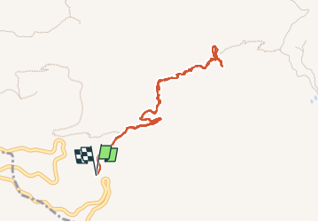
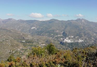
Ruta Senderismo de 5,4 km a descubrir en Andalucía, Granada, Lentegí. Esta ruta ha sido propuesta por jpipacific.
Descripción
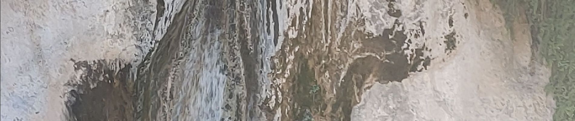
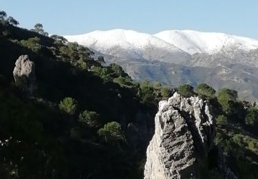
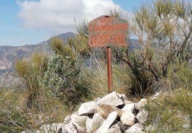
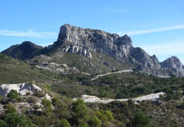
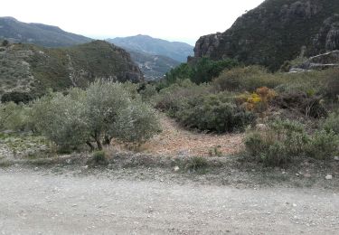
Chemin qui descend à la cascade de los Animas.
Joli cadre très sauvage pour aller voir la petite cascade.
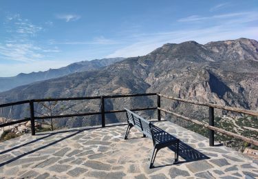
Les vues sont très belles . Sur le chemin du départ et de l'arrivée on voit jusqu'à la mer.
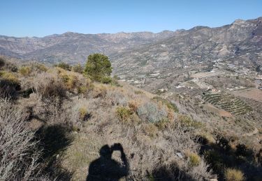
Attention 2,5 kms et 310 m de dénivelé ça monte au retour.
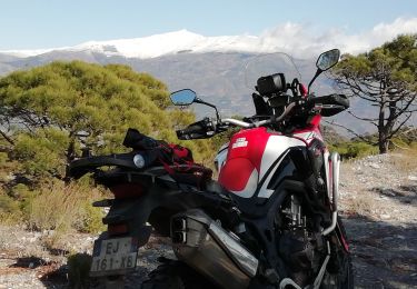
Pas facile de se garer. Nous étions en moto alors pas de problème mais avec une voiture c'est plus compliqué.
Camino que baja hasta la poza de las Ánimas.
Entorno precioso y muy salvaje para ir a ver la pequeña cascada.
Las vistas son muy bonitas. En el camino hacia la salida y la meta se puede ver todo el camino hasta el mar.
Cuidado, 2,5 km y 310 m de desnivel, sube a la vuelta.
No es fácil aparcar. Íbamos en moto así que no hay problema pero con coche es más complicado.
Localización
Comentarios
Excursiones cerca
![Excursión Senderismo Lentegí - Lentegi Las Bizarras - Photo](https://media.geolcdn.com/t/375/260/6e3b7bc9-1a0d-4a1d-bbbf-2f25e6bc75de.jpg&format=jpg&maxdim=2)
![Senderismo Senderismo](https://static1.geolcdn.com/sitytour/trail-icons/101.png)
Senderismo
![](/images/other/stat-length.png)
![](https://static1.geolcdn.com/siteimages/upload/files/16400158638029165_repeat_loop_refresh_sync_direction_icon.png)
![Excursión Senderismo Albuñuelas - pico Lopera - Photo](https://media.geolcdn.com/t/375/260/35cc272b-f47d-4f9b-80d4-f6141b4e6d16.jpg&format=jpg&maxdim=2)
![Senderismo Senderismo](https://static1.geolcdn.com/sitytour/trail-icons/101.png)
![Excursión Senderismo Otívar - OTIVAR Castillo Moscaril - Photo](https://media.geolcdn.com/t/375/260/0f691502-7702-4e97-b4a7-20ff68f93bf9.jpg&format=jpg&maxdim=2)
![Senderismo Senderismo](https://static1.geolcdn.com/sitytour/trail-icons/101.png)
Senderismo
![](/images/other/stat-length.png)
![](https://static1.geolcdn.com/siteimages/upload/files/16400158638029165_repeat_loop_refresh_sync_direction_icon.png)
![Excursión Senderismo Lentegí - les arbres petrifies - Photo](https://media.geolcdn.com/t/375/260/0b9d6321-13d8-4551-a0f4-c4e1d276d87a.jpg&format=jpg&maxdim=2)
![Senderismo Senderismo](https://static1.geolcdn.com/sitytour/trail-icons/101.png)
Senderismo
![](/images/other/stat-length.png)
![](https://static1.geolcdn.com/siteimages/upload/files/16400158638029165_repeat_loop_refresh_sync_direction_icon.png)
![Excursión Motocross Lentegí - Lentegi Vélez de Benaudalla - Photo](https://media.geolcdn.com/t/375/260/82f69f2a-fa53-4f07-aef5-63c3aeaa5dc3.jpg&format=jpg&maxdim=2)
![Motocross Motocross](https://static1.geolcdn.com/sitytour/trail-icons/406.png)
Motocross
![](/images/other/stat-length.png)
![](https://static1.geolcdn.com/siteimages/upload/files/16400158638029165_repeat_loop_refresh_sync_direction_icon.png)
![Excursión Senderismo Ítrabo - Cerro de Itrabo et del Aquila - Photo](https://media.geolcdn.com/t/375/260/4be84b38-1c0d-4979-ae22-e6ac0cc7ce58.jpg&format=jpg&maxdim=2)
![Senderismo Senderismo](https://static1.geolcdn.com/sitytour/trail-icons/101.png)
Senderismo
![](/images/other/stat-length.png)
![](https://static1.geolcdn.com/siteimages/upload/files/16400158638029165_repeat_loop_refresh_sync_direction_icon.png)
![Excursión A pie Almuñécar - OTIVAR castillo Moscaril tour 2 - Photo](https://media.geolcdn.com/t/375/260/9f70cda7-72e7-4555-909c-15377c7c2dd6.jpg&format=jpg&maxdim=2)
![A pie A pie](https://static1.geolcdn.com/sitytour/trail-icons/100.png)
A pie
![](/images/other/stat-length.png)
![](https://static1.geolcdn.com/siteimages/upload/files/16400158638029165_repeat_loop_refresh_sync_direction_icon.png)
![Senderismo Senderismo](https://static1.geolcdn.com/sitytour/trail-icons/101.png)
Senderismo
![](/images/other/stat-length.png)
![](https://static1.geolcdn.com/siteimages/upload/files/16400158638029165_repeat_loop_refresh_sync_direction_icon.png)
![Excursión Senderismo Lentegí - Lentegi 2019 - Photo](https://media.geolcdn.com/t/375/260/a924e236-f249-4f5e-ad92-4ffdbc7fba71.jpg&format=jpg&maxdim=2)
![Senderismo Senderismo](https://static1.geolcdn.com/sitytour/trail-icons/101.png)
Senderismo
![](/images/other/stat-length.png)
![](https://static1.geolcdn.com/siteimages/upload/files/16400158638029165_repeat_loop_refresh_sync_direction_icon.png)