![](/images/other/stat-length.png)
![Excursión Senderismo Treffléan - PR_56_Trefflean_AA_01_Circuit1b_De-La-Chapelle-De-Bizole_20240111 - Photo](https://media.geolcdn.com/t/1900/400/33cdd34a-a9e1-478f-975c-2bd4facddb06.jpg&format=pjpeg&maxdim=2)
PR_56_Trefflean_AA_01_Circuit1b_De-La-Chapelle-De-Bizole_20240111
patrickdanilo
Usuario
![Longitud](/images/other/stat-length.png)
Longitud
6,4 km
![Altitud máxima](https://static1.geolcdn.com/siteimages/upload/files/1508320355ic_sort_altitude_max_24dp.png)
Altitud máxima
113 m
![Desnivel positivo](https://static1.geolcdn.com/siteimages/upload/files/1508320355ic_sort_den_pos_24dp.png)
Desnivel positivo
130 m
![Km-Effort](/images/other/stat-length.png)
Km-Effort
8,2 km
![Altitud mínima](https://static1.geolcdn.com/siteimages/upload/files/1508320355ic_sort_altitude_min_24dp.png)
Altitud mínima
47 m
![Desnivel negativo](https://static1.geolcdn.com/siteimages/upload/files/1508320355ic_sort_den_neg_24dp.png)
Desnivel negativo
130 m
![Boucle](https://static1.geolcdn.com/siteimages/upload/files/16400158638029165_repeat_loop_refresh_sync_direction_icon.png)
Boucle
Sí
Fecha de creación :
2024-01-11 09:21:02.758
Última modificación :
2024-01-13 13:29:26.677
![Senderismo](https://static1.geolcdn.com/sitytour/trail-icons/101.png)
1h20
Dificultad : Medio
![Escanee este código QR para abrir la excursión en la aplicación SityTrail](https://capi.geolives.com/qq0zvz2zws4bq2lad0pu/sitytour/trails/3913197/qr.png?size=200)
Aplicación GPS de excursión GRATIS
A propósito
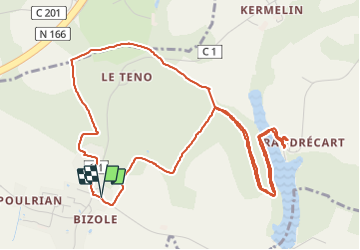
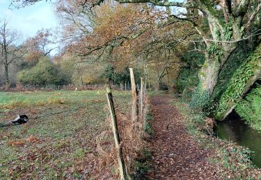
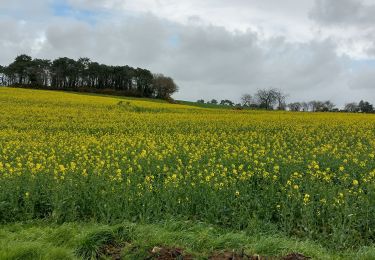
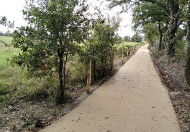
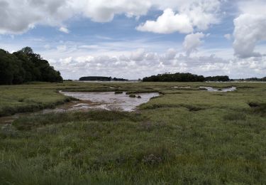
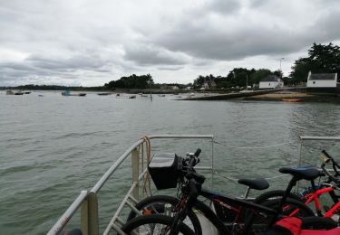
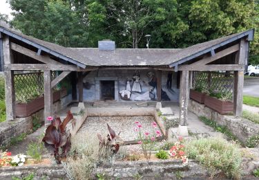
Ruta Senderismo de 6,4 km a descubrir en Bretaña, Morbihan, Treffléan. Esta ruta ha sido propuesta por patrickdanilo.
Descripción
Randonnée Marche de 6,4 km à découvrir à Bretagne, Morbihan, Treffléan. Cette randonnée est proposée par patrickdanilo.
Localización
País:
France
Región :
Bretaña
Departamento/provincia :
Morbihan
Municipio :
Treffléan
Localidad:
Unknown
Salida:(Dec)
Salida:(UTM)
526373 ; 5279715 (30T) N.
Comentarios
Excursiones cerca
![Excursión Senderismo Treffléan - Bizole - Photo](https://media.geolcdn.com/t/375/260/ext.jpg?maxdim=2&url=https%3A%2F%2Fservices.sitytrail.com%2FGeolivesWS%2FDownloadMedia.ashx%3FTrailID%3D191920%26Media%3Dfb5fe928-9f5d-4af5-aad3-ccb04a0144c1.JPG)
![Senderismo Senderismo](https://static1.geolcdn.com/sitytour/trail-icons/101.png)
![Excursión Senderismo Treffléan - PR_56_Trefflean_BA_02_Circuit1b_Chemin-De-Cran_20240507 - Photo](https://media.geolcdn.com/t/375/260/b832eb83-9ae2-4127-a1d1-f2e6e6666b1a.jpg&format=jpg&maxdim=2)
![Senderismo Senderismo](https://static1.geolcdn.com/sitytour/trail-icons/101.png)
PR_56_Trefflean_BA_02_Circuit1b_Chemin-De-Cran_20240507
Senderismo
Fácil
Treffléan,
Bretaña,
Morbihan,
France
![](/images/other/stat-length.png)
5,4 km | 6,5 km-effort
1h 12min
![](https://static1.geolcdn.com/siteimages/upload/files/16400158638029165_repeat_loop_refresh_sync_direction_icon.png)
Sí
![Excursión Senderismo Saint-Nolff - PR_56_St-Nolf_AB_02_Circuit1b_De-La-Vallee-Du-Condat_20240119 - Photo](https://media.geolcdn.com/t/375/260/0e42b6aa-72a8-47c5-a4ef-d03dd001716a.jpg&format=jpg&maxdim=2)
![Senderismo Senderismo](https://static1.geolcdn.com/sitytour/trail-icons/101.png)
PR_56_St-Nolf_AB_02_Circuit1b_De-La-Vallee-Du-Condat_20240119
Senderismo
Fácil
Saint-Nolff,
Bretaña,
Morbihan,
France
![](/images/other/stat-length.png)
12,4 km | 15,1 km-effort
2h 31min
![](https://static1.geolcdn.com/siteimages/upload/files/16400158638029165_repeat_loop_refresh_sync_direction_icon.png)
Sí
![Excursión Senderismo Saint-Nolff - PR_56_St-Nolf_AA_01_Circuit1b-Court_De-La-Vallee-Du-Condat_20231119 - Photo](https://media.geolcdn.com/t/375/260/2b53e2b9-cdcb-4572-9474-136823668337.jpg&format=jpg&maxdim=2)
![Senderismo Senderismo](https://static1.geolcdn.com/sitytour/trail-icons/101.png)
PR_56_St-Nolf_AA_01_Circuit1b-Court_De-La-Vallee-Du-Condat_20231119
Senderismo
Medio
Saint-Nolff,
Bretaña,
Morbihan,
France
![](/images/other/stat-length.png)
7,6 km | 9 km-effort
1h 31min
![](https://static1.geolcdn.com/siteimages/upload/files/16400158638029165_repeat_loop_refresh_sync_direction_icon.png)
Sí
![Excursión Senderismo Theix-Noyalo - PR_56_Theix-Noyalo_AA_01_Circuit3b_Vers-Corn-Er-Hoet_20230401 - Photo](https://media.geolcdn.com/t/375/260/53a27219-59ef-468a-9654-2c8ca963d998.jpg&format=jpg&maxdim=2)
![Senderismo Senderismo](https://static1.geolcdn.com/sitytour/trail-icons/101.png)
PR_56_Theix-Noyalo_AA_01_Circuit3b_Vers-Corn-Er-Hoet_20230401
Senderismo
Medio
Theix-Noyalo,
Bretaña,
Morbihan,
France
![](/images/other/stat-length.png)
8,3 km | 9,9 km-effort
1h 40min
![](https://static1.geolcdn.com/siteimages/upload/files/16400158638029165_repeat_loop_refresh_sync_direction_icon.png)
Sí
![Excursión Bici de montaña Theix-Noyalo - 56-vtt-theix-ambon-26km - Photo](https://media.geolcdn.com/t/375/260/eaaae4e6-3ad5-4e2c-842f-c8c95c871393.jpg&format=jpg&maxdim=2)
![Bici de montaña Bici de montaña](https://static1.geolcdn.com/sitytour/trail-icons/202.png)
56-vtt-theix-ambon-26km
Bici de montaña
Fácil
(1)
Theix-Noyalo,
Bretaña,
Morbihan,
France
![](/images/other/stat-length.png)
27 km | 29 km-effort
1h 51min
![](https://static1.geolcdn.com/siteimages/upload/files/16400158638029165_repeat_loop_refresh_sync_direction_icon.png)
Sí
![Excursión Bici de montaña Theix-Noyalo - 56-vtt-theix-le-hezo-le-passage-28km - Photo](https://media.geolcdn.com/t/375/260/8557ccb4-2e17-4c47-addf-23d7458c9c8a.jpg&format=jpg&maxdim=2)
![Bici de montaña Bici de montaña](https://static1.geolcdn.com/sitytour/trail-icons/202.png)
56-vtt-theix-le-hezo-le-passage-28km
Bici de montaña
Fácil
(1)
Theix-Noyalo,
Bretaña,
Morbihan,
France
![](/images/other/stat-length.png)
28 km | 31 km-effort
2h 41min
![](https://static1.geolcdn.com/siteimages/upload/files/16400158638029165_repeat_loop_refresh_sync_direction_icon.png)
Sí
![Excursión Bici de montaña Theix-Noyalo - 56-vtt-Theix-Séné-St-Armel-34km - Photo](https://media.geolcdn.com/t/375/260/381b67cb-3370-4df9-ba80-427f77016130.jpg&format=jpg&maxdim=2)
![Bici de montaña Bici de montaña](https://static1.geolcdn.com/sitytour/trail-icons/202.png)
56-vtt-Theix-Séné-St-Armel-34km
Bici de montaña
Fácil
Theix-Noyalo,
Bretaña,
Morbihan,
France
![](/images/other/stat-length.png)
32 km | 35 km-effort
3h 1min
![](https://static1.geolcdn.com/siteimages/upload/files/16400158638029165_repeat_loop_refresh_sync_direction_icon.png)
Sí
![Excursión Senderismo Saint-Nolff - GRP_Lanvaux_AL_12_St-Nolf_St-Ave_20210627 - Photo](https://media.geolcdn.com/t/375/260/742b317f-3a6e-4528-b1dc-6036edd78f26.jpg&format=jpg&maxdim=2)
![Senderismo Senderismo](https://static1.geolcdn.com/sitytour/trail-icons/101.png)
GRP_Lanvaux_AL_12_St-Nolf_St-Ave_20210627
Senderismo
Fácil
Saint-Nolff,
Bretaña,
Morbihan,
France
![](/images/other/stat-length.png)
14,5 km | 17,1 km-effort
3h 34min
![](https://static1.geolcdn.com/siteimages/upload/files/16400158638029165_repeat_loop_refresh_sync_direction_icon.png)
No