![](/images/other/stat-length.png)
![Excursión Senderismo De Panne - sgr kust (gr régional côte) day 1/4 - Photo](https://media.geolcdn.com/t/1900/400/aaa2f88c-b432-496b-9e73-3678850a8b83.jpg&format=pjpeg&maxdim=2)
sgr kust (gr régional côte) day 1/4
Charles Lemaire
Usuario GUIDE
![Longitud](/images/other/stat-length.png)
![Altitud máxima](https://static1.geolcdn.com/siteimages/upload/files/1508320355ic_sort_altitude_max_24dp.png)
![Desnivel positivo](https://static1.geolcdn.com/siteimages/upload/files/1508320355ic_sort_den_pos_24dp.png)
![Km-Effort](/images/other/stat-length.png)
![Altitud mínima](https://static1.geolcdn.com/siteimages/upload/files/1508320355ic_sort_altitude_min_24dp.png)
![Desnivel negativo](https://static1.geolcdn.com/siteimages/upload/files/1508320355ic_sort_den_neg_24dp.png)
![Boucle](https://static1.geolcdn.com/siteimages/upload/files/16400158638029165_repeat_loop_refresh_sync_direction_icon.png)
![Senderismo](https://static1.geolcdn.com/sitytour/trail-icons/101.png)
6h32
Dificultad : Muy difícil
![Escanee este código QR para abrir la excursión en la aplicación SityTrail](https://capi.geolives.com/qq0zvz2zws4bq2lad0pu/sitytour/trails/3887090/qr.png?size=200)
Aplicación GPS de excursión GRATIS
A propósito
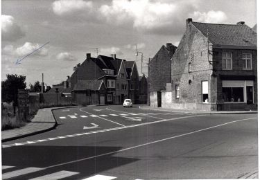
Ruta Senderismo de 27 km a descubrir en Flandes, Flandes Occidental, De Panne. Esta ruta ha sido propuesta por Charles Lemaire.
Descripción
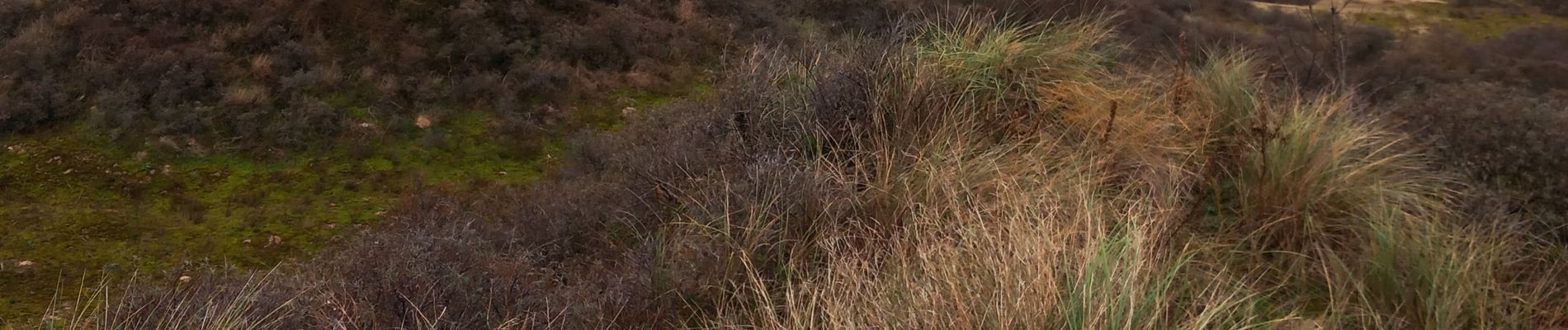
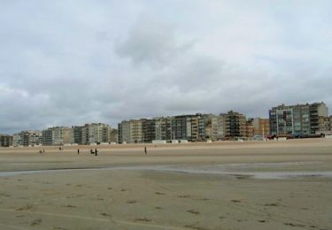
Une journée pour se persuader que la côte belge, ce n'est pas que du béton et le front de mer.
Une étape exigeante. Des franchissements de dunes dans du sable mou mettent les jambes à dure épreuve.
Les moins vaillants pourront la raccourcir. Par exemple en arrivant la veille et en faisant la boucle initiale du Westhoek pour loger à La Panne ; ou bien en prenant le tram de la côte lorsque la fatigue se fait sentir.
Logement facile à Nieuport.
Localización
Comentarios
Excursiones cerca
![Excursión Senderismo Koksijde - St. Idesbald et Noorduinen - Photo](https://media.geolcdn.com/t/375/260/ext.jpg?maxdim=2&url=https%3A%2F%2Fservices.sitytrail.com%2FGeolivesWS%2FDownloadMedia.ashx%3FTrailID%3D168018%26Media%3D20121231143948.jpg)
![Senderismo Senderismo](https://static1.geolcdn.com/sitytour/trail-icons/101.png)
Senderismo
![](/images/other/stat-length.png)
![](https://static1.geolcdn.com/siteimages/upload/files/16400158638029165_repeat_loop_refresh_sync_direction_icon.png)
![Excursión Bici de montaña De Panne - 20240613 - TOTEMUS partiel - DE PANNE 16 Km - Photo](https://media.geolcdn.com/t/375/260/e6db3c74-8cd0-422d-a16f-519e8aed2213.jpg&format=jpg&maxdim=2)
![Bici de montaña Bici de montaña](https://static1.geolcdn.com/sitytour/trail-icons/202.png)
Bici de montaña
![](/images/other/stat-length.png)
![](https://static1.geolcdn.com/siteimages/upload/files/16400158638029165_repeat_loop_refresh_sync_direction_icon.png)
![Excursión Senderismo De Panne - 20240612 - TOTEMUS De Panne - 6.7 Km - Photo](https://media.geolcdn.com/t/375/260/c5970009-e40d-4347-b90a-1006eb79b5f8.jpg&format=jpg&maxdim=2)
![Senderismo Senderismo](https://static1.geolcdn.com/sitytour/trail-icons/101.png)
Senderismo
![](/images/other/stat-length.png)
![](https://static1.geolcdn.com/siteimages/upload/files/16400158638029165_repeat_loop_refresh_sync_direction_icon.png)
![Excursión A pie Koksijde - IJslandvaarders - Photo](https://media.geolcdn.com/t/375/260/ff0167a3-9414-481c-8a7c-f8f5e15aac2c.jpeg&format=jpg&maxdim=2)
![A pie A pie](https://static1.geolcdn.com/sitytour/trail-icons/100.png)
A pie
![](/images/other/stat-length.png)
![](https://static1.geolcdn.com/siteimages/upload/files/16400158638029165_repeat_loop_refresh_sync_direction_icon.png)
![Excursión A pie Veurne - Stadswandelroute Veurne - Photo](https://media.geolcdn.com/t/375/260/2a68b391-176c-49be-94c2-5b4152bca163.jpeg&format=jpg&maxdim=2)
![A pie A pie](https://static1.geolcdn.com/sitytour/trail-icons/100.png)
A pie
![](/images/other/stat-length.png)
![](https://static1.geolcdn.com/siteimages/upload/files/16400158638029165_repeat_loop_refresh_sync_direction_icon.png)
![Excursión A pie Koksijde - Artiestenwandelroute - Photo](https://media.geolcdn.com/t/375/260/54053886-9eaa-4fd8-b3ef-a405e8574e3d.jpeg&format=jpg&maxdim=2)
![A pie A pie](https://static1.geolcdn.com/sitytour/trail-icons/100.png)
A pie
![](/images/other/stat-length.png)
![](https://static1.geolcdn.com/siteimages/upload/files/16400158638029165_repeat_loop_refresh_sync_direction_icon.png)
![Excursión A pie De Panne - Westhoek wandelroute - Photo](https://media.geolcdn.com/t/375/260/6b99b450-f354-4687-ac8b-ac4e098bbfb2.jpeg&format=jpg&maxdim=2)
![A pie A pie](https://static1.geolcdn.com/sitytour/trail-icons/100.png)
A pie
![](/images/other/stat-length.png)
![](https://static1.geolcdn.com/siteimages/upload/files/16400158638029165_repeat_loop_refresh_sync_direction_icon.png)
![Excursión A pie Koksijde - Doornpanne wandelroute - Photo](https://media.geolcdn.com/t/375/260/0863c493-c589-422a-b163-aa86b420f67c.jpeg&format=jpg&maxdim=2)
![A pie A pie](https://static1.geolcdn.com/sitytour/trail-icons/100.png)
A pie
![](/images/other/stat-length.png)
![](https://static1.geolcdn.com/siteimages/upload/files/16400158638029165_repeat_loop_refresh_sync_direction_icon.png)
![Excursión Senderismo De Panne - w-belgie-westhoekreservaat - Photo](https://media.geolcdn.com/t/375/260/ext.jpg?maxdim=2&url=https%3A%2F%2Fstatic1.geolcdn.com%2Fsiteimages%2Fupload%2Ffiles%2F1553511878bg_sport_marche.png)
![Senderismo Senderismo](https://static1.geolcdn.com/sitytour/trail-icons/101.png)
Senderismo
![](/images/other/stat-length.png)
![](https://static1.geolcdn.com/siteimages/upload/files/16400158638029165_repeat_loop_refresh_sync_direction_icon.png)