![](/images/other/stat-length.png)
![Excursión Senderismo Nancray - Nancray-danse - Photo](https://media.geolcdn.com/t/1900/400/8f480ddf-1fd3-4568-9b1d-9c27b999fa3d.jpg&format=pjpeg&maxdim=2)
Nancray-danse
eltonnermou
Usuario
![Longitud](/images/other/stat-length.png)
![Altitud máxima](https://static1.geolcdn.com/siteimages/upload/files/1508320355ic_sort_altitude_max_24dp.png)
![Desnivel positivo](https://static1.geolcdn.com/siteimages/upload/files/1508320355ic_sort_den_pos_24dp.png)
![Km-Effort](/images/other/stat-length.png)
![Altitud mínima](https://static1.geolcdn.com/siteimages/upload/files/1508320355ic_sort_altitude_min_24dp.png)
![Desnivel negativo](https://static1.geolcdn.com/siteimages/upload/files/1508320355ic_sort_den_neg_24dp.png)
![Boucle](https://static1.geolcdn.com/siteimages/upload/files/16400158638029165_repeat_loop_refresh_sync_direction_icon.png)
![Senderismo](https://static1.geolcdn.com/sitytour/trail-icons/101.png)
4h09
Dificultad : Fácil
![Escanee este código QR para abrir la excursión en la aplicación SityTrail](https://capi.geolives.com/qq0zvz2zws4bq2lad0pu/sitytour/trails/3879778/qr.png?size=200)
Aplicación GPS de excursión GRATIS
A propósito
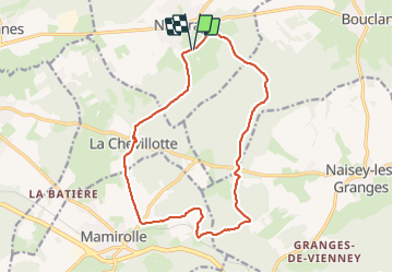
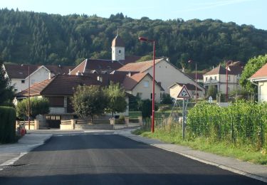
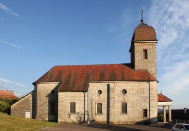
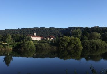
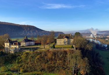
Ruta Senderismo de 15,5 km a descubrir en Borgoña-Franco Condado, Doubs, Nancray. Esta ruta ha sido propuesta por eltonnermou.
Descripción
parking des maisons comtoises.
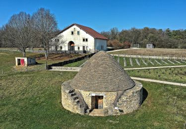
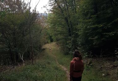
randonnée (4/5ième pieds propres) agréable, à faire en période hivernale ; en très grande partie dans la forêt avoisinante qui apporte un grand bol de calme et son lot d'air pur.
Laissez vous surprendre par la flore (suivant la saison) et par le passage d’un ou plusieurs chevreuils au détour d'un sentier.
Localización
Comentarios
Excursiones cerca
![Excursión A pie Nancray - Circuit du Chêne Président - Photo](https://media.geolcdn.com/t/375/260/dc9e89f0-7636-4693-8413-5b50fbfab35e.jpeg&format=jpg&maxdim=2)
![A pie A pie](https://static1.geolcdn.com/sitytour/trail-icons/100.png)
A pie
![](/images/other/stat-length.png)
![](https://static1.geolcdn.com/siteimages/upload/files/16400158638029165_repeat_loop_refresh_sync_direction_icon.png)
![Excursión A pie Nancray - Sentier du Fonteny - Photo](https://media.geolcdn.com/t/375/260/fd4c251e-f96c-43e9-888d-c44f200ccc2c.jpeg&format=jpg&maxdim=2)
![A pie A pie](https://static1.geolcdn.com/sitytour/trail-icons/100.png)
A pie
![](/images/other/stat-length.png)
![](https://static1.geolcdn.com/siteimages/upload/files/16400158638029165_repeat_loop_refresh_sync_direction_icon.png)
![Excursión A pie Mamirolle - Sentier du Golf - Photo](https://media.geolcdn.com/t/375/260/1f7de4bc-7375-47d0-9cee-908ac1e1a2bd.jpeg&format=jpg&maxdim=2)
![A pie A pie](https://static1.geolcdn.com/sitytour/trail-icons/100.png)
A pie
![](/images/other/stat-length.png)
![](https://static1.geolcdn.com/siteimages/upload/files/16400158638029165_repeat_loop_refresh_sync_direction_icon.png)
![Excursión A pie Nancray - Sentier du Moulin - Photo](https://media.geolcdn.com/t/375/260/fd4c251e-f96c-43e9-888d-c44f200ccc2c.jpeg&format=jpg&maxdim=2)
![A pie A pie](https://static1.geolcdn.com/sitytour/trail-icons/100.png)
A pie
![](/images/other/stat-length.png)
![](https://static1.geolcdn.com/siteimages/upload/files/16400158638029165_repeat_loop_refresh_sync_direction_icon.png)
![Excursión A pie Nancray - Sentier du Tour des Landes - Photo](https://media.geolcdn.com/t/375/260/dca2d2cb-2448-41ff-970e-c18701afcb22.jpeg&format=jpg&maxdim=2)
![A pie A pie](https://static1.geolcdn.com/sitytour/trail-icons/100.png)
A pie
![](/images/other/stat-length.png)
![](https://static1.geolcdn.com/siteimages/upload/files/16400158638029165_repeat_loop_refresh_sync_direction_icon.png)
![Excursión A pie Gennes - Sentier du Fort des Epesses - Photo](https://media.geolcdn.com/t/375/260/2fa8fbf5-c0df-4124-9465-bd35fd5b8500.jpeg&format=jpg&maxdim=2)
![A pie A pie](https://static1.geolcdn.com/sitytour/trail-icons/100.png)
A pie
![](/images/other/stat-length.png)
![](https://static1.geolcdn.com/siteimages/upload/files/16400158638029165_repeat_loop_refresh_sync_direction_icon.png)
![Excursión A pie Vaire - Sentier des Sources 2 - Photo](https://media.geolcdn.com/t/375/260/0ecedb62-3c33-4251-8982-81e9743d8322.jpeg&format=jpg&maxdim=2)
![A pie A pie](https://static1.geolcdn.com/sitytour/trail-icons/100.png)
A pie
![](/images/other/stat-length.png)
![](https://static1.geolcdn.com/siteimages/upload/files/16400158638029165_repeat_loop_refresh_sync_direction_icon.png)
![Excursión A pie Vaire - Sentier des Sources 1 - Photo](https://media.geolcdn.com/t/375/260/3b895425-3268-42d6-8ef6-757959f26627.jpeg&format=jpg&maxdim=2)
![A pie A pie](https://static1.geolcdn.com/sitytour/trail-icons/100.png)
A pie
![](/images/other/stat-length.png)
![](https://static1.geolcdn.com/siteimages/upload/files/16400158638029165_repeat_loop_refresh_sync_direction_icon.png)
![Excursión Senderismo Gennes - Source d'Arcier - Photo](https://media.geolcdn.com/t/375/260/ccadba48-d083-43f7-8a9d-9b2ad3b4bf3c.jpg&format=jpg&maxdim=2)
![Senderismo Senderismo](https://static1.geolcdn.com/sitytour/trail-icons/101.png)
Senderismo
![](/images/other/stat-length.png)
![](https://static1.geolcdn.com/siteimages/upload/files/16400158638029165_repeat_loop_refresh_sync_direction_icon.png)