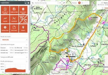
![](/images/other/stat-length.png)
![Excursión Senderismo Sumène - 30 les crêtes des cagnasses,a la fage 15/11/23 - Photo](https://media.geolcdn.com/t/1900/400/327f6ae4-95a4-43dc-ae64-f238198e92ec.jpg&format=pjpeg&maxdim=2)
30 les crêtes des cagnasses,a la fage 15/11/23
silvestreclaudine
Usuario
![Longitud](/images/other/stat-length.png)
![Altitud máxima](https://static1.geolcdn.com/siteimages/upload/files/1508320355ic_sort_altitude_max_24dp.png)
![Desnivel positivo](https://static1.geolcdn.com/siteimages/upload/files/1508320355ic_sort_den_pos_24dp.png)
![Km-Effort](/images/other/stat-length.png)
![Altitud mínima](https://static1.geolcdn.com/siteimages/upload/files/1508320355ic_sort_altitude_min_24dp.png)
![Desnivel negativo](https://static1.geolcdn.com/siteimages/upload/files/1508320355ic_sort_den_neg_24dp.png)
![Boucle](https://static1.geolcdn.com/siteimages/upload/files/16400158638029165_repeat_loop_refresh_sync_direction_icon.png)
![Senderismo](https://static1.geolcdn.com/sitytour/trail-icons/101.png)
5h13
Dificultad : Muy difícil
![Escanee este código QR para abrir la excursión en la aplicación SityTrail](https://capi.geolives.com/qq0zvz2zws4bq2lad0pu/sitytour/trails/3875708/qr.png?size=200)
Aplicación GPS de excursión GRATIS
A propósito
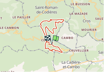
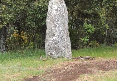
Ruta Senderismo de 17 km a descubrir en Occitania, Gard, Sumène. Esta ruta ha sido propuesta por silvestreclaudine.
Descripción
départ du prieuré de Cezas. ,commencez en
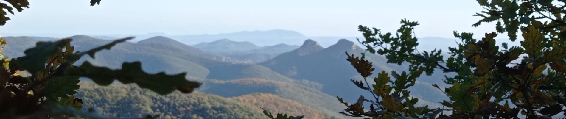
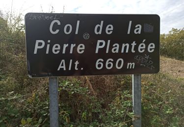
descendant par le le sentier,(balisage jaune) en direction de Védille . traversez la route, le sentier va monter sur le massif des cagnasses, longer la crête. points de vue : la séranne Redescendre sur le village de Cézas .
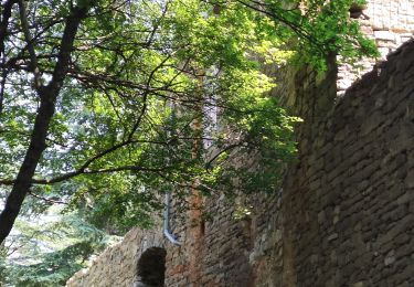
Partir en face de la croix en suivant le chemin qui contourne le village ; il est balisé en jaune. Ignorez les sentiers qui arrivent à gauche , on traverse une forêt de sapin, après un petit mas à notre gauche au dessus du DFCI nous allons croiser un autre sentier à notre droite. Poursuivre le sentier en partant à gauche .Attention il faut partir à gauche par un petit sentier qui monte sur la collette,( abandonner le balisage jaune)ne pas rester sur le DFCI qui descend de l'autre côté de la crête vers St Roman de Codières. La montée est un peu raide. Continuez tout droit au niveau du réservoir d'eau , le sentier remonte de nouveau. Après avoir traversez la forêt , au sommet de la FAGE ,vous trouverez à votre gauche une barrière et une échelle. Le sentier n'existe pas ! partir un peu sur votre droite mais pas trop! descendre en longeant une haie et des barbelés qui se trouve à notre gauche , attention !beaucoup d'arbustes épineux au départ . le sentier devient plus évident en descendant . traverser le village de Cézas . Au niveau de la citerne face à la croix descendre par le sentier balisé jusqu'au prieuré, parking .
Localización
Comentarios
Excursiones cerca
![Excursión Senderismo La Cadière-et-Cambo - CAMBO - MONTAGNE DE LA FAGE - 7.6Km - 02h20 - Dénivelé 285 m - Photo](https://media.geolcdn.com/t/375/260/ext.jpg?maxdim=2&url=https%3A%2F%2Fstatic1.geolcdn.com%2Fsiteimages%2Fupload%2Ffiles%2F1553511878bg_sport_marche.png)
![Senderismo Senderismo](https://static1.geolcdn.com/sitytour/trail-icons/101.png)
Senderismo
![](/images/other/stat-length.png)
![](https://static1.geolcdn.com/siteimages/upload/files/16400158638029165_repeat_loop_refresh_sync_direction_icon.png)
![Excursión Senderismo Saint-Roman-de-Codières - st roman de codieres - Photo](https://media.geolcdn.com/t/375/260/20d79857-0660-4ad5-8bfa-f1464b2570fb.jpg&format=jpg&maxdim=2)
![Senderismo Senderismo](https://static1.geolcdn.com/sitytour/trail-icons/101.png)
Senderismo
![](/images/other/stat-length.png)
![](https://static1.geolcdn.com/siteimages/upload/files/16400158638029165_repeat_loop_refresh_sync_direction_icon.png)
![Excursión Senderismo Saint-Hippolyte-du-Fort - 30 Roquefourcade 16-03_23 - Photo](https://media.geolcdn.com/t/375/260/8923796a-cfdc-4ce7-92ba-22653b18afc1.jpg&format=jpg&maxdim=2)
![Senderismo Senderismo](https://static1.geolcdn.com/sitytour/trail-icons/101.png)
Senderismo
![](/images/other/stat-length.png)
![](https://static1.geolcdn.com/siteimages/upload/files/16400158638029165_repeat_loop_refresh_sync_direction_icon.png)
![Excursión Senderismo Saint-Roman-de-Codières - St Roman de Codiere 2 - Photo](https://media.geolcdn.com/t/375/260/eecdea35-1ea5-474d-b466-cf9b8758dea8.jpg&format=jpg&maxdim=2)
![Senderismo Senderismo](https://static1.geolcdn.com/sitytour/trail-icons/101.png)
Senderismo
![](/images/other/stat-length.png)
![](https://static1.geolcdn.com/siteimages/upload/files/16400158638029165_repeat_loop_refresh_sync_direction_icon.png)
![Excursión Senderismo Sumène - Cézas Prieuré St Martin - Photo](https://media.geolcdn.com/t/375/260/dfff80b7-8e5e-4059-89ec-0caf5a49dd9b.jpg&format=jpg&maxdim=2)
![Senderismo Senderismo](https://static1.geolcdn.com/sitytour/trail-icons/101.png)
Senderismo
![](/images/other/stat-length.png)
![](https://static1.geolcdn.com/siteimages/upload/files/16400158638029165_repeat_loop_refresh_sync_direction_icon.png)
![Excursión Senderismo Saint-Roman-de-Codières - St Roman de Codiere - Photo](https://media.geolcdn.com/t/375/260/a15ccfea-a4ed-409a-afe0-88f149361477.jpg&format=jpg&maxdim=2)
![Senderismo Senderismo](https://static1.geolcdn.com/sitytour/trail-icons/101.png)
Senderismo
![](/images/other/stat-length.png)
![](https://static1.geolcdn.com/siteimages/upload/files/16400158638029165_repeat_loop_refresh_sync_direction_icon.png)
![Excursión Senderismo Sumène - de cezas au prieuré aux cagnasse aux mont la fage - Photo](https://media.geolcdn.com/t/375/260/d675b562-e616-4ca1-9cb9-3371c11ceb1e.jpg&format=jpg&maxdim=2)
![Senderismo Senderismo](https://static1.geolcdn.com/sitytour/trail-icons/101.png)
Senderismo
![](/images/other/stat-length.png)
![](https://static1.geolcdn.com/siteimages/upload/files/16400158638029165_repeat_loop_refresh_sync_direction_icon.png)
![Excursión A pie Montoulieu - montoulieu-7km-2h30 - Photo](https://media.geolcdn.com/t/375/260/0982a00c-452f-4249-819b-ca4306277078.jpg&format=jpg&maxdim=2)
![A pie A pie](https://static1.geolcdn.com/sitytour/trail-icons/100.png)
A pie
![](/images/other/stat-length.png)
![](https://static1.geolcdn.com/siteimages/upload/files/16400158638029165_repeat_loop_refresh_sync_direction_icon.png)
![Excursión Senderismo Moulès-et-Baucels - Moules Ranc de bane - Photo](https://media.geolcdn.com/t/375/260/ext.jpg?maxdim=2&url=https%3A%2F%2Fstatic1.geolcdn.com%2Fsiteimages%2Fupload%2Ffiles%2F1553511878bg_sport_marche.png)
![Senderismo Senderismo](https://static1.geolcdn.com/sitytour/trail-icons/101.png)
Senderismo
![](/images/other/stat-length.png)
![](https://static1.geolcdn.com/siteimages/upload/files/16400158638029165_repeat_loop_refresh_sync_direction_icon.png)