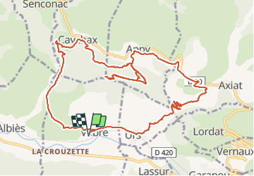
![](/images/other/stat-length.png)
![Excursión Senderismo Vèbre - rocher de Courbas - Photo](https://media.geolcdn.com/t/1900/400/78ac6878-cdb8-4ec7-b32a-125e834666e2.jpg&format=pjpeg&maxdim=2)
rocher de Courbas
chrisgps
Usuario
![Longitud](/images/other/stat-length.png)
![Altitud máxima](https://static1.geolcdn.com/siteimages/upload/files/1508320355ic_sort_altitude_max_24dp.png)
![Desnivel positivo](https://static1.geolcdn.com/siteimages/upload/files/1508320355ic_sort_den_pos_24dp.png)
![Km-Effort](/images/other/stat-length.png)
![Altitud mínima](https://static1.geolcdn.com/siteimages/upload/files/1508320355ic_sort_altitude_min_24dp.png)
![Desnivel negativo](https://static1.geolcdn.com/siteimages/upload/files/1508320355ic_sort_den_neg_24dp.png)
![Boucle](https://static1.geolcdn.com/siteimages/upload/files/16400158638029165_repeat_loop_refresh_sync_direction_icon.png)
![Senderismo](https://static1.geolcdn.com/sitytour/trail-icons/101.png)
5h44
Dificultad : Fácil
![Escanee este código QR para abrir la excursión en la aplicación SityTrail](https://capi.geolives.com/qq0zvz2zws4bq2lad0pu/sitytour/trails/3874893/qr.png?size=200)
Aplicación GPS de excursión GRATIS
A propósito
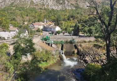
Ruta Senderismo de 14,8 km a descubrir en Occitania, Ariège, Vèbre. Esta ruta ha sido propuesta por chrisgps.
Descripción
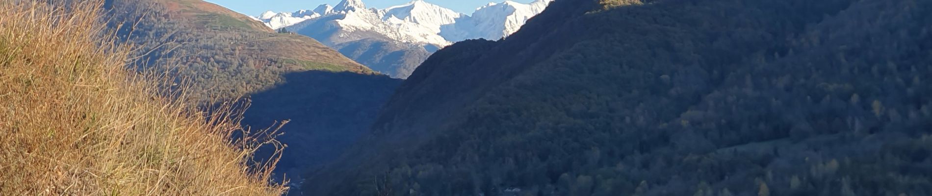
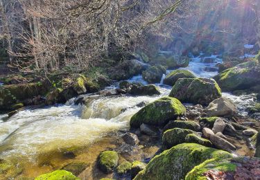
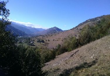
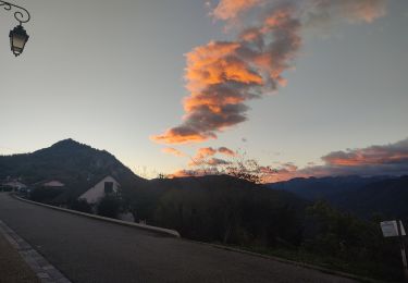
Belle boucle et beau belvédère.
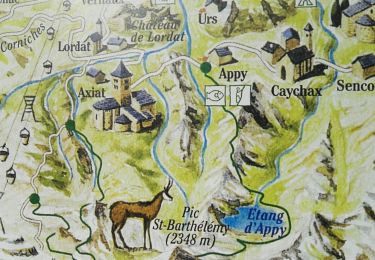
A la descente du rocher en direction de Caychax, la bifurcation a gauche devra se faire un peu plus haut sur une sente qu'on n'a pas vu = vers 960m ou km 8,5.
Dans la descente de Caychax l'embranchement vers Vébre est bien signalé : chemin de Bouicharras et évite d'aller à Albies.
Localización
Comentarios
Excursiones cerca
![Excursión Senderismo Garanou - Camina De Luzenac à Ax les thermes - Photo](https://media.geolcdn.com/t/375/260/3bc37f44-7055-4b43-adbc-7a36afdb8cab.jpg&format=jpg&maxdim=2)
![Senderismo Senderismo](https://static1.geolcdn.com/sitytour/trail-icons/101.png)
Senderismo
![](/images/other/stat-length.png)
![](https://static1.geolcdn.com/siteimages/upload/files/16400158638029165_repeat_loop_refresh_sync_direction_icon.png)
![Excursión Senderismo Luzenac - cabane coumels - Photo](https://media.geolcdn.com/t/375/260/5e22dc37-96f9-490d-94d3-4b0d5f0aba2b.jpg&format=jpg&maxdim=2)
![Senderismo Senderismo](https://static1.geolcdn.com/sitytour/trail-icons/101.png)
Senderismo
![](/images/other/stat-length.png)
![](https://static1.geolcdn.com/siteimages/upload/files/16400158638029165_repeat_loop_refresh_sync_direction_icon.png)
![Excursión Senderismo Verdun - Verdun, Albies, Vebre - Photo](https://media.geolcdn.com/t/375/260/09d31640-9aa3-44e2-9378-d3fce780c5e7.jpg&format=jpg&maxdim=2)
![Senderismo Senderismo](https://static1.geolcdn.com/sitytour/trail-icons/101.png)
Senderismo
![](/images/other/stat-length.png)
![](https://static1.geolcdn.com/siteimages/upload/files/16400158638029165_repeat_loop_refresh_sync_direction_icon.png)
![Excursión Senderismo Vèbre - Vebre, Lassure, La Remise, Vebre - Photo](https://media.geolcdn.com/t/375/260/cf162537-37a8-4720-813f-495781f6b81b.jpg&format=jpg&maxdim=2)
![Senderismo Senderismo](https://static1.geolcdn.com/sitytour/trail-icons/101.png)
Senderismo
![](/images/other/stat-length.png)
![](https://static1.geolcdn.com/siteimages/upload/files/16400158638029165_repeat_loop_refresh_sync_direction_icon.png)
![Excursión Senderismo Vèbre - Vebre, Caychax. Alliés, Vebre - Photo](https://media.geolcdn.com/t/375/260/f0774cf6-f888-497f-b6e0-9780e9ab44f4.jpg&format=jpg&maxdim=2)
![Senderismo Senderismo](https://static1.geolcdn.com/sitytour/trail-icons/101.png)
Senderismo
![](/images/other/stat-length.png)
![](https://static1.geolcdn.com/siteimages/upload/files/16400158638029165_repeat_loop_refresh_sync_direction_icon.png)
![Excursión Senderismo Unac - Vallée de Caussou - Photo](https://media.geolcdn.com/t/375/260/ext.jpg?maxdim=2&url=https%3A%2F%2Fservices.sitytrail.com%2FGeolivesWS%2FDownloadMedia.ashx%3FTrailID%3D642964%26Media%3Dfix__20161008153717.jpg)
![Senderismo Senderismo](https://static1.geolcdn.com/sitytour/trail-icons/101.png)
Senderismo
![](/images/other/stat-length.png)
![](https://static1.geolcdn.com/siteimages/upload/files/16400158638029165_repeat_loop_refresh_sync_direction_icon.png)
![Excursión Senderismo Lordat - Le tour du rocher du Courbas - Photo](https://media.geolcdn.com/t/375/260/232cfd43-5ea0-4abb-9fbc-7d823bef0df4.jpg&format=jpg&maxdim=2)
![Senderismo Senderismo](https://static1.geolcdn.com/sitytour/trail-icons/101.png)
Senderismo
![](/images/other/stat-length.png)
![](https://static1.geolcdn.com/siteimages/upload/files/16400158638029165_repeat_loop_refresh_sync_direction_icon.png)
![Excursión Senderismo Les Cabannes - Camina des Cabannes à Luzenac - Photo](https://media.geolcdn.com/t/375/260/769278fe-4b2d-46e7-8dc9-a102db4840ed.jpg&format=jpg&maxdim=2)
![Senderismo Senderismo](https://static1.geolcdn.com/sitytour/trail-icons/101.png)
Senderismo
![](/images/other/stat-length.png)
![](https://static1.geolcdn.com/siteimages/upload/files/16400158638029165_repeat_loop_refresh_sync_direction_icon.png)
![Excursión Senderismo Garanou - Garanou - Photo](https://media.geolcdn.com/t/375/260/800b2c6d-ca8c-41b1-9486-9bb9ce8921c8.jpg&format=jpg&maxdim=2)
![Senderismo Senderismo](https://static1.geolcdn.com/sitytour/trail-icons/101.png)