![](/images/other/stat-length.png)
![Excursión Senderismo Vassieux-en-Vercors - Vassieux-en-Vercors - Le Puy de la Gagère - Photo](https://media.geolcdn.com/t/1900/400/1aad13f5-10ee-4304-b0fb-5635099ff701.jpg&format=pjpeg&maxdim=2)
Vassieux-en-Vercors - Le Puy de la Gagère
Philindy26
Usuario
![Longitud](/images/other/stat-length.png)
![Altitud máxima](https://static1.geolcdn.com/siteimages/upload/files/1508320355ic_sort_altitude_max_24dp.png)
![Desnivel positivo](https://static1.geolcdn.com/siteimages/upload/files/1508320355ic_sort_den_pos_24dp.png)
![Km-Effort](/images/other/stat-length.png)
![Altitud mínima](https://static1.geolcdn.com/siteimages/upload/files/1508320355ic_sort_altitude_min_24dp.png)
![Desnivel negativo](https://static1.geolcdn.com/siteimages/upload/files/1508320355ic_sort_den_neg_24dp.png)
![Boucle](https://static1.geolcdn.com/siteimages/upload/files/16400158638029165_repeat_loop_refresh_sync_direction_icon.png)
![Senderismo](https://static1.geolcdn.com/sitytour/trail-icons/101.png)
3h45
Dificultad : Fácil
![Escanee este código QR para abrir la excursión en la aplicación SityTrail](https://capi.geolives.com/qq0zvz2zws4bq2lad0pu/sitytour/trails/3852394/qr.png?size=200)
Aplicación GPS de excursión GRATIS
A propósito
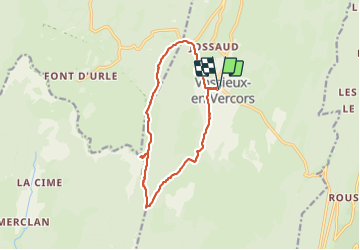
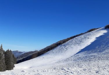
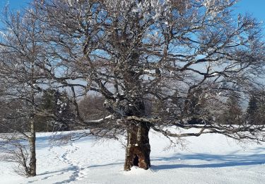
Ruta Senderismo de 13,1 km a descubrir en Auvergne-Rhône-Alpes, Drôme, Vassieux-en-Vercors. Esta ruta ha sido propuesta por Philindy26.
Descripción
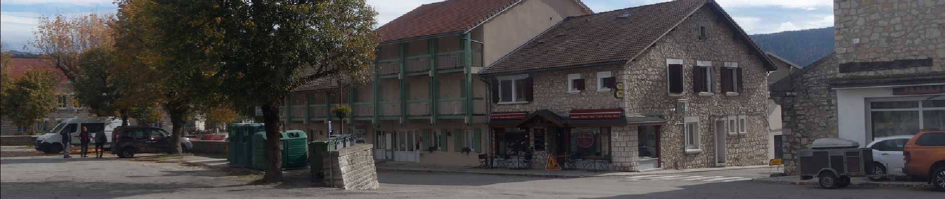
Départ du village de Vassieux-en-Vercors (1055 m).
Géolocalisation (Google Maps) : https://maps.app.goo.gl/fSBQxks8YcuectBg8
Monter au Col de la Chau (1337 m) par les Chenaux (1055 m), Moulin Allard (1066 m) et le Mémorial de la Résistance (1300 m).
Continuer sur le Pot de la Croix (1544 m) en passant par la Prairie de la Chau (1325 m) et en suivant la piste toujours tout droit.
Là vous récupérez le GR 93 que vous suivrez jusqu'à Font Payanne (1412 m) et en passant par les Gagères (1450 m).
À Font Payanne (1412 m), suivre le GR de Pays du Tour du Vercors Drômois (Jaune/Rouge) pour descendre sur les Cerisiers (1116 m) et rejoindre le village de Vassieux-en-Vercors.
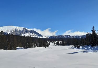
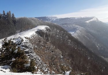
Randonnée un peu sportive, mais aussi historique avec ce lieu du Vercors où des hommes et des femmes se sont battus pour notre liberté... Un lieu de mémoire...
Localización
Comentarios
Excursiones cerca
![Excursión Raquetas de nieve Bouvante - Les gagères en raquettes - Photo](https://media.geolcdn.com/t/375/260/2981cf80-2281-48d0-9011-dd17ca071224.jpg&format=jpg&maxdim=2)
![Raquetas de nieve Raquetas de nieve](https://static1.geolcdn.com/sitytour/trail-icons/504.png)
Raquetas de nieve
![](/images/other/stat-length.png)
![](https://static1.geolcdn.com/siteimages/upload/files/16400158638029165_repeat_loop_refresh_sync_direction_icon.png)
![Excursión Senderismo Saint-Agnan-en-Vercors - 26 st Agnan champ gros de la vache - Photo](https://media.geolcdn.com/t/375/260/3e876886-71b3-45d3-bba1-ada65af3bf18.jpg&format=jpg&maxdim=2)
![Senderismo Senderismo](https://static1.geolcdn.com/sitytour/trail-icons/101.png)
Senderismo
![](/images/other/stat-length.png)
![](https://static1.geolcdn.com/siteimages/upload/files/16400158638029165_repeat_loop_refresh_sync_direction_icon.png)
![Excursión Senderismo Bouvante - Boucle du Plateau de Font d'Urle - Photo](https://media.geolcdn.com/t/375/260/50aac9f1-41c9-480c-904d-17b530d5dbff.jpg&format=jpg&maxdim=2)
![Senderismo Senderismo](https://static1.geolcdn.com/sitytour/trail-icons/101.png)
Senderismo
![](/images/other/stat-length.png)
![](https://static1.geolcdn.com/siteimages/upload/files/16400158638029165_repeat_loop_refresh_sync_direction_icon.png)
![Excursión Senderismo Bouvante - Font d’Urle les Trois cloches Glacières les Gagères - Photo](https://media.geolcdn.com/t/375/260/d811593c-e678-4b00-a285-b7dce29eecce.jpg&format=jpg&maxdim=2)
![Senderismo Senderismo](https://static1.geolcdn.com/sitytour/trail-icons/101.png)
Senderismo
![](/images/other/stat-length.png)
![](https://static1.geolcdn.com/siteimages/upload/files/16400158638029165_repeat_loop_refresh_sync_direction_icon.png)
![Excursión Senderismo Vassieux-en-Vercors - But St Genis - Photo](https://media.geolcdn.com/t/375/260/7dc5994c-58ff-4977-a518-836cfc09796c.jpg&format=jpg&maxdim=2)
![Senderismo Senderismo](https://static1.geolcdn.com/sitytour/trail-icons/101.png)
Senderismo
![](/images/other/stat-length.png)
![](https://static1.geolcdn.com/siteimages/upload/files/16400158638029165_repeat_loop_refresh_sync_direction_icon.png)
![Excursión Senderismo Saint-Agnan-en-Vercors - Les Hauts Plateaux du Vercors - Photo](https://media.geolcdn.com/t/375/260/ec115f7c-48d5-47de-819e-7d8cda136852.jpg&format=jpg&maxdim=2)
![Senderismo Senderismo](https://static1.geolcdn.com/sitytour/trail-icons/101.png)
Senderismo
![](/images/other/stat-length.png)
![](https://static1.geolcdn.com/siteimages/upload/files/16400158638029165_repeat_loop_refresh_sync_direction_icon.png)
![Excursión Senderismo Vassieux-en-Vercors - Forêt communale de Dié - Photo](https://media.geolcdn.com/t/375/260/81a065f0-a659-4198-8cfc-a4d3daa2067f.jpg&format=jpg&maxdim=2)
![Senderismo Senderismo](https://static1.geolcdn.com/sitytour/trail-icons/101.png)
Senderismo
![](/images/other/stat-length.png)
![](https://static1.geolcdn.com/siteimages/upload/files/16400158638029165_repeat_loop_refresh_sync_direction_icon.png)
![Excursión Senderismo Bouvante - Crête des Gagères - Photo](https://media.geolcdn.com/t/375/260/238839e4-2c7b-463c-a8a4-13f730b00e0a.jpg&format=jpg&maxdim=2)
![Senderismo Senderismo](https://static1.geolcdn.com/sitytour/trail-icons/101.png)
Senderismo
![](/images/other/stat-length.png)
![](https://static1.geolcdn.com/siteimages/upload/files/16400158638029165_repeat_loop_refresh_sync_direction_icon.png)
![Excursión Marcha nórdica Bouvante - 202201fontdurle2 - Photo](https://media.geolcdn.com/t/375/260/148c551f-c1f7-4a77-89d2-b6cfec149cab.jpg&format=jpg&maxdim=2)
![Marcha nórdica Marcha nórdica](https://static1.geolcdn.com/sitytour/trail-icons/102.png)
Marcha nórdica
![](/images/other/stat-length.png)
![](https://static1.geolcdn.com/siteimages/upload/files/16400158638029165_repeat_loop_refresh_sync_direction_icon.png)