![](/images/other/stat-length.png)
![Excursión Senderismo Lussault-sur-Loire - Lussault-sur-Loire - Grille Dorée Pagode de Chanteloup - 15.1km 160m 3h15 - 2023 10 11 - Photo](https://media.geolcdn.com/t/1900/400/49886bf8-2556-4f8b-ac9a-489bf75e23bb.jpg&format=pjpeg&maxdim=2)
Lussault-sur-Loire - Grille Dorée Pagode de Chanteloup - 15.1km 160m 3h15 - 2023 10 11
Orcal37
Usuario GUIDE
![Longitud](/images/other/stat-length.png)
Longitud
15,1 km
![Altitud máxima](https://static1.geolcdn.com/siteimages/upload/files/1508320355ic_sort_altitude_max_24dp.png)
Altitud máxima
120 m
![Desnivel positivo](https://static1.geolcdn.com/siteimages/upload/files/1508320355ic_sort_den_pos_24dp.png)
Desnivel positivo
157 m
![Km-Effort](/images/other/stat-length.png)
Km-Effort
17,2 km
![Altitud mínima](https://static1.geolcdn.com/siteimages/upload/files/1508320355ic_sort_altitude_min_24dp.png)
Altitud mínima
55 m
![Desnivel negativo](https://static1.geolcdn.com/siteimages/upload/files/1508320355ic_sort_den_neg_24dp.png)
Desnivel negativo
159 m
![Boucle](https://static1.geolcdn.com/siteimages/upload/files/16400158638029165_repeat_loop_refresh_sync_direction_icon.png)
Boucle
Sí
Fecha de creación :
2023-10-11 12:21:42.39
Última modificación :
2023-10-11 19:52:08.203
![Senderismo](https://static1.geolcdn.com/sitytour/trail-icons/101.png)
3h15
Dificultad : Fácil
![Escanee este código QR para abrir la excursión en la aplicación SityTrail](https://capi.geolives.com/qq0zvz2zws4bq2lad0pu/sitytour/trails/3837023/qr.png?size=200)
Aplicación GPS de excursión GRATIS
A propósito
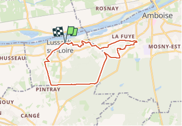
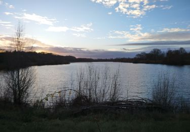
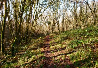
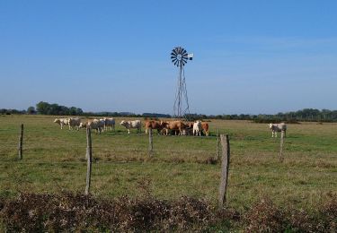
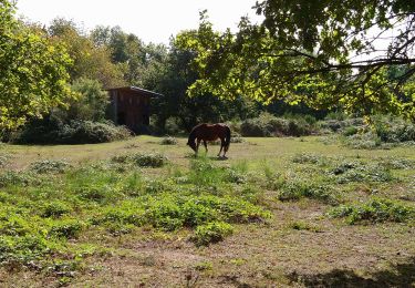
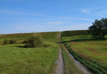
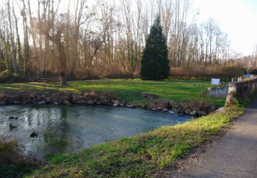
Ruta Senderismo de 15,1 km a descubrir en Centro, Indre y Loira, Lussault-sur-Loire. Esta ruta ha sido propuesta por Orcal37.
Descripción
Lussault-sur-Loire - La Grille Dorée de la Pagode de Chanteloup à Amboise - GR3 GR655est - 15.1km 160m 3h15 - 2023 10 11
Localización
País:
France
Región :
Centro
Departamento/provincia :
Indre y Loira
Municipio :
Lussault-sur-Loire
Localidad:
Unknown
Salida:(Dec)
Salida:(UTM)
343126 ; 5251520 (31T) N.
Comentarios
Excursiones cerca
![Excursión Senderismo Vernou-sur-Brenne - Vernou-sur-Brenne la Coudraie - Zig Zag Vaubrault Noizay - 27.1km 385m 5h55 (55mn) - 2024 11 03 - Photo](https://media.geolcdn.com/t/375/260/9c945cd3-c4f0-44b2-b00c-aa0430042429.jpg&format=jpg&maxdim=2)
![Senderismo Senderismo](https://static1.geolcdn.com/sitytour/trail-icons/101.png)
Vernou-sur-Brenne la Coudraie - Zig Zag Vaubrault Noizay - 27.1km 385m 5h55 (...
Senderismo
Fácil
Vernou-sur-Brenne,
Centro,
Indre y Loira,
France
![](/images/other/stat-length.png)
27 km | 32 km-effort
5h 55min
![](https://static1.geolcdn.com/siteimages/upload/files/16400158638029165_repeat_loop_refresh_sync_direction_icon.png)
Sí
![Excursión Senderismo Nazelles-Négron - Nazelles-Négron - Zig zag autour de Nazelles et de Pocé-sur-Cisse - 18.1km 340m 4h05 - 2024 03 24 - Photo](https://media.geolcdn.com/t/375/260/b4c80bca-e974-478d-aff9-0771f417e572.jpg&format=jpg&maxdim=2)
![Senderismo Senderismo](https://static1.geolcdn.com/sitytour/trail-icons/101.png)
Nazelles-Négron - Zig zag autour de Nazelles et de Pocé-sur-Cisse - 18.1km 34...
Senderismo
Medio
Nazelles-Négron,
Centro,
Indre y Loira,
France
![](/images/other/stat-length.png)
18,1 km | 23 km-effort
4h 5min
![](https://static1.geolcdn.com/siteimages/upload/files/16400158638029165_repeat_loop_refresh_sync_direction_icon.png)
Sí
![Excursión Senderismo Noizay - Noizay - Zig zag autour des Coteaux à l'est de Noizay - 21.3km 370m 5h00 (40mn) - 2024 03 20 - Photo](https://media.geolcdn.com/t/375/260/6f5cee46-8120-45a7-a457-5ad832f22807.jpg&format=jpg&maxdim=2)
![Senderismo Senderismo](https://static1.geolcdn.com/sitytour/trail-icons/101.png)
Noizay - Zig zag autour des Coteaux à l'est de Noizay - 21.3km 370m 5h00 (40m...
Senderismo
Medio
Noizay,
Centro,
Indre y Loira,
France
![](/images/other/stat-length.png)
21 km | 26 km-effort
5h 0min
![](https://static1.geolcdn.com/siteimages/upload/files/16400158638029165_repeat_loop_refresh_sync_direction_icon.png)
Sí
![Excursión Senderismo Amboise - Amboise - variante PR Hors des sentiers battus - 13.2km 125m 2h45 - 2023 12 20 - Photo](https://media.geolcdn.com/t/375/260/eaedd70a-7314-4305-8a66-377c6d47d376.jpg&format=jpg&maxdim=2)
![Senderismo Senderismo](https://static1.geolcdn.com/sitytour/trail-icons/101.png)
Amboise - variante PR Hors des sentiers battus - 13.2km 125m 2h45 - 2023 12 20
Senderismo
Fácil
Amboise,
Centro,
Indre y Loira,
France
![](/images/other/stat-length.png)
13,2 km | 14,9 km-effort
2h 45min
![](https://static1.geolcdn.com/siteimages/upload/files/16400158638029165_repeat_loop_refresh_sync_direction_icon.png)
Sí
![Excursión Senderismo Nazelles-Négron - Nazelles-Négron - variante PR Circuit Val Plateau - 10.6km 125m 2h25 (40mn) - 2023 12 20 - Photo](https://media.geolcdn.com/t/375/260/db197c9d-ca81-4840-908b-9a2fe7566a1d.jpg&format=jpg&maxdim=2)
![Senderismo Senderismo](https://static1.geolcdn.com/sitytour/trail-icons/101.png)
Nazelles-Négron - variante PR Circuit Val Plateau - 10.6km 125m 2h25 (40mn) -...
Senderismo
Fácil
Nazelles-Négron,
Centro,
Indre y Loira,
France
![](/images/other/stat-length.png)
10,6 km | 12,3 km-effort
2h 25min
![](https://static1.geolcdn.com/siteimages/upload/files/16400158638029165_repeat_loop_refresh_sync_direction_icon.png)
Sí
![Excursión Senderismo Nazelles-Négron - Nazelles-Négron - variante PR Circuit Val Village de Négron - 8.3km 40m 1h50 (40mn) - 2023 10 11 - Photo](https://media.geolcdn.com/t/375/260/a8cef7b4-e79b-4337-9586-e14374732695.jpg&format=jpg&maxdim=2)
![Senderismo Senderismo](https://static1.geolcdn.com/sitytour/trail-icons/101.png)
Nazelles-Négron - variante PR Circuit Val Village de Négron - 8.3km 40m 1h50 ...
Senderismo
Fácil
Nazelles-Négron,
Centro,
Indre y Loira,
France
![](/images/other/stat-length.png)
8,3 km | 8,8 km-effort
1h 50min
![](https://static1.geolcdn.com/siteimages/upload/files/16400158638029165_repeat_loop_refresh_sync_direction_icon.png)
Sí
![Excursión Senderismo Saint-Martin-le-Beau - Saint-Martin-le-Beau - PR Entre Vignes et Forêts - 11.8km 120m 2h45 (45mn) - 2023 10 07 - Photo](https://media.geolcdn.com/t/375/260/24ce2aa4-4932-408c-a436-3f83b6744ce9.jpg&format=jpg&maxdim=2)
![Senderismo Senderismo](https://static1.geolcdn.com/sitytour/trail-icons/101.png)
Saint-Martin-le-Beau - PR Entre Vignes et Forêts - 11.8km 120m 2h45 (45mn) - ...
Senderismo
Medio
Saint-Martin-le-Beau,
Centro,
Indre y Loira,
France
![](/images/other/stat-length.png)
11,8 km | 13,4 km-effort
2h 45min
![](https://static1.geolcdn.com/siteimages/upload/files/16400158638029165_repeat_loop_refresh_sync_direction_icon.png)
Sí
![Excursión Senderismo Saint-Martin-le-Beau - Saint-Martin-le-Beau - Nitray GR41 Azay-sur-Cher - 23.2km 185m 5h15 (40mn) - 2023 10 04 - Photo](https://media.geolcdn.com/t/375/260/4b768c7a-d65d-4d1c-bb56-1d0e8b4c83bb.jpg&format=jpg&maxdim=2)
![Senderismo Senderismo](https://static1.geolcdn.com/sitytour/trail-icons/101.png)
Saint-Martin-le-Beau - Nitray GR41 Azay-sur-Cher - 23.2km 185m 5h15 (40mn) - ...
Senderismo
Fácil
Saint-Martin-le-Beau,
Centro,
Indre y Loira,
France
![](/images/other/stat-length.png)
23 km | 26 km-effort
5h 15min
![](https://static1.geolcdn.com/siteimages/upload/files/16400158638029165_repeat_loop_refresh_sync_direction_icon.png)
Sí
![Excursión Senderismo Noizay - la Bousserie - Noizay - 14km 100m 3h00 - 2023 02 12 - Photo](https://media.geolcdn.com/t/375/260/e82473dd-70b3-426f-8e44-9d257c621d06.jpg&format=jpg&maxdim=2)
![Senderismo Senderismo](https://static1.geolcdn.com/sitytour/trail-icons/101.png)
la Bousserie - Noizay - 14km 100m 3h00 - 2023 02 12
Senderismo
Muy fácil
Noizay,
Centro,
Indre y Loira,
France
![](/images/other/stat-length.png)
14 km | 15,4 km-effort
3h 0min
![](https://static1.geolcdn.com/siteimages/upload/files/16400158638029165_repeat_loop_refresh_sync_direction_icon.png)
Sí