![](/images/other/stat-length.png)
![Excursión Senderismo Saint-Rimay - Saint-Rimay - Photo](https://media.geolcdn.com/t/1900/400/4102077f-f972-4a74-9982-90e370a0028d.jpg&format=pjpeg&maxdim=2)
Saint-Rimay
guydu41
Usuario
![Longitud](/images/other/stat-length.png)
![Altitud máxima](https://static1.geolcdn.com/siteimages/upload/files/1508320355ic_sort_altitude_max_24dp.png)
![Desnivel positivo](https://static1.geolcdn.com/siteimages/upload/files/1508320355ic_sort_den_pos_24dp.png)
![Km-Effort](/images/other/stat-length.png)
![Altitud mínima](https://static1.geolcdn.com/siteimages/upload/files/1508320355ic_sort_altitude_min_24dp.png)
![Desnivel negativo](https://static1.geolcdn.com/siteimages/upload/files/1508320355ic_sort_den_neg_24dp.png)
![Boucle](https://static1.geolcdn.com/siteimages/upload/files/16400158638029165_repeat_loop_refresh_sync_direction_icon.png)
![Senderismo](https://static1.geolcdn.com/sitytour/trail-icons/101.png)
3h14
Dificultad : Medio
![Escanee este código QR para abrir la excursión en la aplicación SityTrail](https://capi.geolives.com/qq0zvz2zws4bq2lad0pu/sitytour/trails/3833487/qr.png?size=200)
Aplicación GPS de excursión GRATIS
A propósito
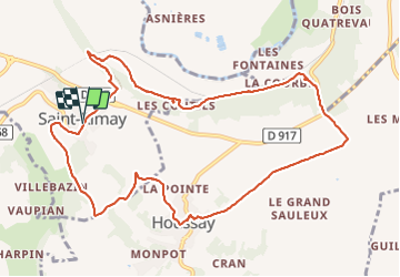
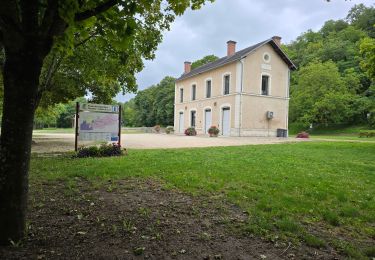
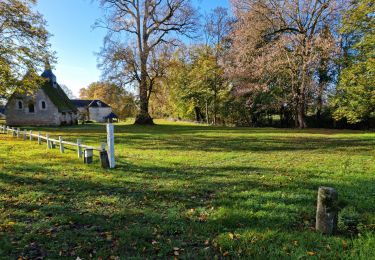
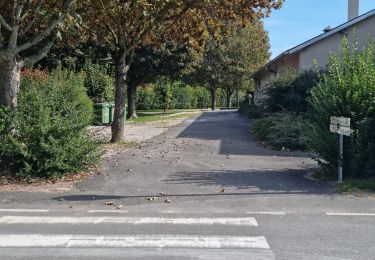
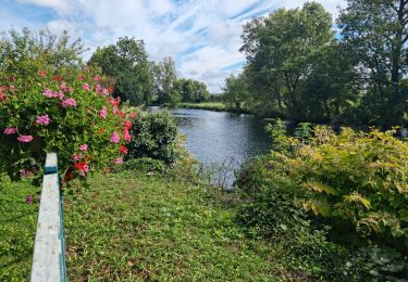
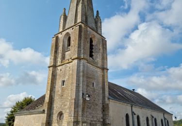
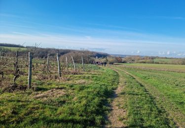
Ruta Senderismo de 11,3 km a descubrir en Centro, Loir y Cher, Saint-Rimay. Esta ruta ha sido propuesta por guydu41.
Descripción
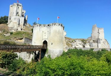
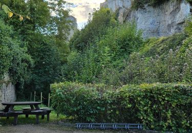
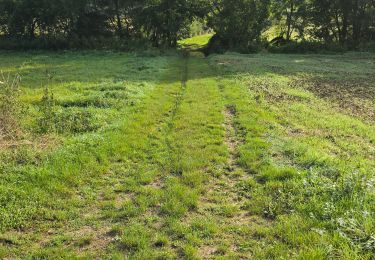
Ce circuit depuis le parking en face de la mairie de Saint-Rimay permet d'emprunter plusieurs petits sentiers boisés et tortueux à flancs de coteaux, de surplomber l'ancienne voie ferrée entrant dans un tunnel, de voir plusieurs blockhaus dont un très grand de la seconde guerre mondiale, d'admirer plusieurs points de vue sur des vallées, etc.
Localización
Comentarios
Excursiones cerca
![Excursión Senderismo - Lavardin - Vallée du Loir - 2015 08 22 - Photo](https://media.geolcdn.com/t/375/260/9217c5be-6f6a-4a6f-89e4-63f2df152ec7.jpg&format=jpg&maxdim=2)
![Senderismo Senderismo](https://static1.geolcdn.com/sitytour/trail-icons/101.png)
Senderismo
![](/images/other/stat-length.png)
![](https://static1.geolcdn.com/siteimages/upload/files/16400158638029165_repeat_loop_refresh_sync_direction_icon.png)
![Excursión Senderismo - Lavardin - Chemin de la roue des Carriers - Photo](https://media.geolcdn.com/t/375/260/e44cda87-93d4-4d06-b6ec-b3c61a83f120.jpg&format=jpg&maxdim=2)
![Senderismo Senderismo](https://static1.geolcdn.com/sitytour/trail-icons/101.png)
Senderismo
![](/images/other/stat-length.png)
![](https://static1.geolcdn.com/siteimages/upload/files/16400158638029165_repeat_loop_refresh_sync_direction_icon.png)
![Excursión Senderismo Villavard - Villavard - Bois et champs - Photo](https://media.geolcdn.com/t/375/260/4d475905-90ac-4961-b085-7edf726aaef9.jpg&format=jpg&maxdim=2)
![Senderismo Senderismo](https://static1.geolcdn.com/sitytour/trail-icons/101.png)
Senderismo
![](/images/other/stat-length.png)
![](https://static1.geolcdn.com/siteimages/upload/files/16400158638029165_repeat_loop_refresh_sync_direction_icon.png)
![Excursión Senderismo Thoré-la-Rochette - Thoré-la-Rochette - Vallée et Coteaux du Loir - Photo](https://media.geolcdn.com/t/375/260/3f4c80d2-3437-4e69-84de-30a02f464543.jpg&format=jpg&maxdim=2)
![Senderismo Senderismo](https://static1.geolcdn.com/sitytour/trail-icons/101.png)
Senderismo
![](/images/other/stat-length.png)
![](https://static1.geolcdn.com/siteimages/upload/files/16400158638029165_repeat_loop_refresh_sync_direction_icon.png)
![Excursión Senderismo Lunay - Château de la Mézière - Asnières - Photo](https://media.geolcdn.com/t/375/260/7020eb26-114b-4b8b-93d9-05c4bb72eb01.jpg&format=jpg&maxdim=2)
![Senderismo Senderismo](https://static1.geolcdn.com/sitytour/trail-icons/101.png)
Senderismo
![](/images/other/stat-length.png)
![](https://static1.geolcdn.com/siteimages/upload/files/16400158638029165_repeat_loop_refresh_sync_direction_icon.png)
![Excursión Senderismo Houssay - Houssay - Photo](https://media.geolcdn.com/t/375/260/3bd1239e-bd99-41e7-b552-6fe8c8fd81df.jpg&format=jpg&maxdim=2)
![Senderismo Senderismo](https://static1.geolcdn.com/sitytour/trail-icons/101.png)
![Excursión Senderismo Les Roches-l'Évêque - Les Roches-l'Evêque - Photo](https://media.geolcdn.com/t/375/260/dca20853-d794-4c8a-9c81-2319f41b2890.jpg&format=jpg&maxdim=2)
![Senderismo Senderismo](https://static1.geolcdn.com/sitytour/trail-icons/101.png)
Senderismo
![](/images/other/stat-length.png)
![](https://static1.geolcdn.com/siteimages/upload/files/16400158638029165_repeat_loop_refresh_sync_direction_icon.png)
![Excursión Senderismo Thoré-la-Rochette - Thoré-la-Rochette - Vallée et Coteaux du Loir - Photo](https://media.geolcdn.com/t/375/260/344cfef8-5ffd-42a8-843d-f0a9586064a7.jpg&format=jpg&maxdim=2)
![Senderismo Senderismo](https://static1.geolcdn.com/sitytour/trail-icons/101.png)
Senderismo
![](/images/other/stat-length.png)
![](https://static1.geolcdn.com/siteimages/upload/files/16400158638029165_repeat_loop_refresh_sync_direction_icon.png)
![Excursión Senderismo Houssay - Circuit Promenades et Randonnées (PR)](https://media.geolcdn.com/t/375/260/5ea570ff-f61f-453e-a15a-2af4ead43e67.jpg&format=jpg&maxdim=2)
![Senderismo Senderismo](https://static1.geolcdn.com/sitytour/trail-icons/101.png)
Senderismo
![](/images/other/stat-length.png)
![](https://static1.geolcdn.com/siteimages/upload/files/16400158638029165_repeat_loop_refresh_sync_direction_icon.png)