![](/images/other/stat-length.png)
![Excursión Senderismo L'Albère - de Saint Martin au Neoulous - Photo](https://media.geolcdn.com/t/1900/400/ext.pjpeg?maxdim=2&url=https%3A%2F%2Fstatic1.geolcdn.com%2Fsiteimages%2Fupload%2Ffiles%2F1553511878bg_sport_marche.png)
de Saint Martin au Neoulous
Denis Delay
Usuario
![Longitud](/images/other/stat-length.png)
Longitud
13,2 km
![Altitud máxima](https://static1.geolcdn.com/siteimages/upload/files/1508320355ic_sort_altitude_max_24dp.png)
Altitud máxima
1243 m
![Desnivel positivo](https://static1.geolcdn.com/siteimages/upload/files/1508320355ic_sort_den_pos_24dp.png)
Desnivel positivo
666 m
![Km-Effort](/images/other/stat-length.png)
Km-Effort
22 km
![Altitud mínima](https://static1.geolcdn.com/siteimages/upload/files/1508320355ic_sort_altitude_min_24dp.png)
Altitud mínima
626 m
![Desnivel negativo](https://static1.geolcdn.com/siteimages/upload/files/1508320355ic_sort_den_neg_24dp.png)
Desnivel negativo
665 m
![Boucle](https://static1.geolcdn.com/siteimages/upload/files/16400158638029165_repeat_loop_refresh_sync_direction_icon.png)
Boucle
Sí
Fecha de creación :
2023-09-12 09:40:27.535
Última modificación :
2023-09-12 09:40:28.661
![Senderismo](https://static1.geolcdn.com/sitytour/trail-icons/101.png)
5h01
Dificultad : Medio
![Escanee este código QR para abrir la excursión en la aplicación SityTrail](https://capi.geolives.com/qq0zvz2zws4bq2lad0pu/sitytour/trails/3803789/qr.png?size=200)
Aplicación GPS de excursión GRATIS
A propósito
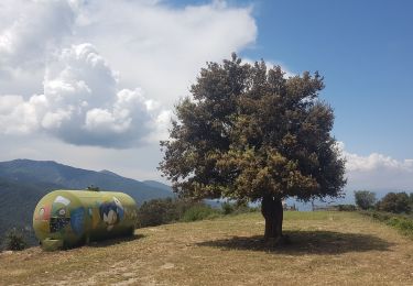
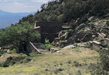
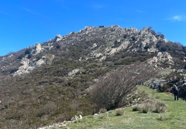
Ruta Senderismo de 13,2 km a descubrir en Occitania, Pirineos Orientales, L'Albère. Esta ruta ha sido propuesta por Denis Delay.
Descripción
saint Martin, coll forçat, roc des trois termes, puits à neige, Neoulous, col de l'Ouillat, roca corba, saint Martin.
Localización
País:
France
Región :
Occitania
Departamento/provincia :
Pirineos Orientales
Municipio :
L'Albère
Localidad:
Unknown
Salida:(Dec)
Salida:(UTM)
492467 ; 4701635 (31T) N.
Comentarios
Excursiones cerca
![Excursión Senderismo L'Albère - SAINT-JEAN-D'ALBERE 66 - PUIG de Sant Christau par le coll de Sant Joan - Photo](https://media.geolcdn.com/t/375/260/ext.jpg?maxdim=2&url=https%3A%2F%2Fservices.sitytrail.com%2FGeolivesWS%2FDownloadMedia.ashx%3FTrailID%3D452444%26Media%3D20150731170134.jpg)
![Senderismo Senderismo](https://static1.geolcdn.com/sitytour/trail-icons/101.png)
SAINT-JEAN-D'ALBERE 66 - PUIG de Sant Christau par le coll de Sant Joan
Senderismo
Difícil
(1)
L'Albère,
Occitania,
Pirineos Orientales,
France
![](/images/other/stat-length.png)
10,1 km | 17 km-effort
2h 46min
![](https://static1.geolcdn.com/siteimages/upload/files/16400158638029165_repeat_loop_refresh_sync_direction_icon.png)
Sí
![Excursión Senderismo Sorède - Utrera Font Miracles T - Photo](https://media.geolcdn.com/t/375/260/ext.jpg?maxdim=2&url=https%3A%2F%2Fservices.sitytrail.com%2FGeolivesWS%2FDownloadMedia.ashx%3FTrailID%3D419352%26Media%3Dfix__20150510145313.jpg)
![Senderismo Senderismo](https://static1.geolcdn.com/sitytour/trail-icons/101.png)
Utrera Font Miracles T
Senderismo
Medio
(1)
Sorède,
Occitania,
Pirineos Orientales,
France
![](/images/other/stat-length.png)
10,7 km | 17,6 km-effort
3h 50min
![](https://static1.geolcdn.com/siteimages/upload/files/16400158638029165_repeat_loop_refresh_sync_direction_icon.png)
Sí
![Excursión Senderismo Sorède - 577. 11km sorede roc des medes - Photo](https://media.geolcdn.com/t/375/260/ext.jpg?maxdim=2&url=https%3A%2F%2Fmedia.geolcdn.com%2Ff%2F61f4e75a-7c25-4df1-b192-fc8eca3c7acc.jpg)
![Senderismo Senderismo](https://static1.geolcdn.com/sitytour/trail-icons/101.png)
577. 11km sorede roc des medes
Senderismo
Medio
(1)
Sorède,
Occitania,
Pirineos Orientales,
France
![](/images/other/stat-length.png)
10,5 km | 18,2 km-effort
3h 42min
![](https://static1.geolcdn.com/siteimages/upload/files/16400158638029165_repeat_loop_refresh_sync_direction_icon.png)
Sí
![Excursión A pie Sorède - Vallée Heureuse - Château d'Ultrera - Photo](https://media.geolcdn.com/t/375/260/ext.jpg?maxdim=2&url=https%3A%2F%2Fmedia.geolcdn.com%2Ff%2F1088733c-d3dc-4898-8e8b-7d7fa684abd6.jpeg)
![A pie A pie](https://static1.geolcdn.com/sitytour/trail-icons/100.png)
Vallée Heureuse - Château d'Ultrera
A pie
Fácil
Sorède,
Occitania,
Pirineos Orientales,
France
![](/images/other/stat-length.png)
10,9 km | 19,4 km-effort
4h 23min
![](https://static1.geolcdn.com/siteimages/upload/files/16400158638029165_repeat_loop_refresh_sync_direction_icon.png)
Sí
![Excursión Senderismo Sorède - RP66 SOREDE VALLÉE HEUREUSE - COL DES 4 TERMES - LE 17.11.2016 - Photo](https://media.geolcdn.com/t/375/260/ext.jpg?maxdim=2&url=https%3A%2F%2Fstatic1.geolcdn.com%2Fsiteimages%2Fupload%2Ffiles%2F1553511878bg_sport_marche.png)
![Senderismo Senderismo](https://static1.geolcdn.com/sitytour/trail-icons/101.png)
RP66 SOREDE VALLÉE HEUREUSE - COL DES 4 TERMES - LE 17.11.2016
Senderismo
Difícil
(2)
Sorède,
Occitania,
Pirineos Orientales,
France
![](/images/other/stat-length.png)
19,4 km | 33 km-effort
5h 26min
![](https://static1.geolcdn.com/siteimages/upload/files/16400158638029165_repeat_loop_refresh_sync_direction_icon.png)
Sí
![Excursión Senderismo L'Albère - Le Pic Neulos (1256m) - Photo](https://media.geolcdn.com/t/375/260/ext.jpg?maxdim=2&url=https%3A%2F%2Fstatic1.geolcdn.com%2Fsiteimages%2Fupload%2Ffiles%2F1553511878bg_sport_marche.png)
![Senderismo Senderismo](https://static1.geolcdn.com/sitytour/trail-icons/101.png)
Le Pic Neulos (1256m)
Senderismo
Fácil
(1)
L'Albère,
Occitania,
Pirineos Orientales,
France
![](/images/other/stat-length.png)
7,7 km | 12,2 km-effort
2h 46min
![](https://static1.geolcdn.com/siteimages/upload/files/16400158638029165_repeat_loop_refresh_sync_direction_icon.png)
Sí
![Excursión Senderismo La Junquera - 20230427 au départ du Perthus-crash DC6 1986 - Photo](https://media.geolcdn.com/t/375/260/ext.jpg?maxdim=2&url=https%3A%2F%2Fmedia.geolcdn.com%2Ff%2Fc1fe57ed-124b-4cbe-9732-771cc398fda1.jpg)
![Senderismo Senderismo](https://static1.geolcdn.com/sitytour/trail-icons/101.png)
20230427 au départ du Perthus-crash DC6 1986
Senderismo
Difícil
La Junquera,
Cataluña,
Gerona,
Spain
![](/images/other/stat-length.png)
13,9 km | 21 km-effort
3h 54min
![](https://static1.geolcdn.com/siteimages/upload/files/16400158638029165_repeat_loop_refresh_sync_direction_icon.png)
Sí
![Excursión Senderismo L'Albère - Col de l’outillage - Photo](https://media.geolcdn.com/t/375/260/ext.jpg?maxdim=2&url=https%3A%2F%2Fmedia.geolcdn.com%2Ff%2Fcd5547a1-117f-4ebd-b697-ad94045b8e34.jpg)
![Senderismo Senderismo](https://static1.geolcdn.com/sitytour/trail-icons/101.png)
Col de l’outillage
Senderismo
Fácil
L'Albère,
Occitania,
Pirineos Orientales,
France
![](/images/other/stat-length.png)
11,5 km | 17,2 km-effort
3h 23min
![](https://static1.geolcdn.com/siteimages/upload/files/16400158638029165_repeat_loop_refresh_sync_direction_icon.png)
Sí
![Excursión Senderismo Sorède - Vallee-heureuse-Ermitage-Chateau-ultrera_T - Photo](https://media.geolcdn.com/t/375/260/ext.jpg?maxdim=2&url=https%3A%2F%2Fmedia.geolcdn.com%2Ff%2F076be64b-32b3-4127-a857-5d7dd07784a1.jpg)
![Senderismo Senderismo](https://static1.geolcdn.com/sitytour/trail-icons/101.png)
Vallee-heureuse-Ermitage-Chateau-ultrera_T
Senderismo
Difícil
Sorède,
Occitania,
Pirineos Orientales,
France
![](/images/other/stat-length.png)
10,6 km | 18,7 km-effort
3h 43min
![](https://static1.geolcdn.com/siteimages/upload/files/16400158638029165_repeat_loop_refresh_sync_direction_icon.png)
Sí