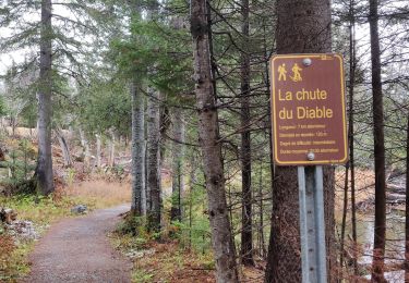

Mont Albert

aldaus
Usuario

Longitud
13,5 km

Altitud máxima
1061 m

Desnivel positivo
880 m

Km-Effort
25 km

Altitud mínima
207 m

Desnivel negativo
879 m
Boucle
Sí
Fecha de creación :
2023-09-08 10:47:08.352
Última modificación :
2023-09-08 20:46:46.442
3h43
Dificultad : Medio

Aplicación GPS de excursión GRATIS
A propósito
Ruta Senderismo de 13,5 km a descubrir en Quebec, La Haute-Gaspésie, Mont-Albert. Esta ruta ha sido propuesta por aldaus.
Descripción
pour nous alpin...c est une rando sympa en moyenne montagne mais nous sommes au Québec à 1000 m alors tout change
Localización
País:
Canada
Región :
Quebec
Departamento/provincia :
La Haute-Gaspésie
Municipio :
Mont-Albert
Localidad:
Unknown
Salida:(Dec)
Salida:(UTM)
710764 ; 5425555 (19U) N.
Comentarios
Excursiones cerca

2014-08-10 18:36:31


Senderismo
Fácil
(1)
Mont-Albert,
Quebec,
La Haute-Gaspésie,
Canada

4,5 km | 7 km-effort
1h 50min
Sí

Chutes du diable - sentier du Mont Albert


Senderismo
Medio
Mont-Albert,
Quebec,
La Haute-Gaspésie,
Canada

6,9 km | 8,6 km-effort
1h 48min
Sí

2014-08-11 15:45:09


Senderismo
Muy difícil
Mont-Albert,
Quebec,
La Haute-Gaspésie,
Canada

16,8 km | 29 km-effort
7h 0min
Sí

Wikiloc - Mont Olivine et Abri de la Serpentine


Senderismo
Muy difícil
Mont-Albert,
Quebec,
La Haute-Gaspésie,
Canada

17 km | 26 km-effort
5h 19min
Sí

Wikiloc - Chute du diable


Senderismo
Medio
Mont-Albert,
Quebec,
La Haute-Gaspésie,
Canada

7,1 km | 9,1 km-effort
1h 56min
Sí

Wikiloc - Parc National de la Gaspésie - Mont Ernest Laforce


Senderismo
Medio
Mont-Albert,
Quebec,
La Haute-Gaspésie,
Canada

5,5 km | 8,6 km-effort
1h 46min
Sí

Wikiloc - Parc National de la Gaspesie. Tour du Mont Albert


Senderismo
Muy difícil
Mont-Albert,
Quebec,
La Haute-Gaspésie,
Canada

17 km | 29 km-effort
5h 53min
Sí

mont Albert


Senderismo
Muy difícil
Mont-Albert,
Quebec,
La Haute-Gaspésie,
Canada

18,5 km | 30 km-effort
7h 2min
Sí

Tour du mont Ernest Laforce


Senderismo
Muy fácil
Mont-Albert,
Quebec,
La Haute-Gaspésie,
Canada

7,8 km | 11,1 km-effort
1h 15min
No


 SityTrail


