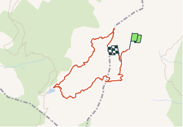
![](/images/other/stat-length.png)
![Excursión Senderismo La Léchère - lac de Clartan et grande muraille - Photo](https://media.geolcdn.com/t/1900/400/4b4bb2ac-ceed-47da-944d-e4142550d609.jpg&format=pjpeg&maxdim=2)
lac de Clartan et grande muraille
nadd73
Usuario GUIDE
![Longitud](/images/other/stat-length.png)
![Altitud máxima](https://static1.geolcdn.com/siteimages/upload/files/1508320355ic_sort_altitude_max_24dp.png)
![Desnivel positivo](https://static1.geolcdn.com/siteimages/upload/files/1508320355ic_sort_den_pos_24dp.png)
![Km-Effort](/images/other/stat-length.png)
![Altitud mínima](https://static1.geolcdn.com/siteimages/upload/files/1508320355ic_sort_altitude_min_24dp.png)
![Desnivel negativo](https://static1.geolcdn.com/siteimages/upload/files/1508320355ic_sort_den_neg_24dp.png)
![Boucle](https://static1.geolcdn.com/siteimages/upload/files/16400158638029165_repeat_loop_refresh_sync_direction_icon.png)
![Senderismo](https://static1.geolcdn.com/sitytour/trail-icons/101.png)
3h07
Dificultad : Difícil
![Escanee este código QR para abrir la excursión en la aplicación SityTrail](https://capi.geolives.com/qq0zvz2zws4bq2lad0pu/sitytour/trails/3798297/qr.png?size=200)
Aplicación GPS de excursión GRATIS
A propósito
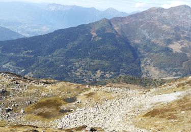
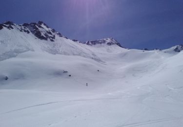
Ruta Senderismo de 4,6 km a descubrir en Auvergne-Rhône-Alpes, Saboya, La Léchère. Esta ruta ha sido propuesta por nadd73.
Descripción
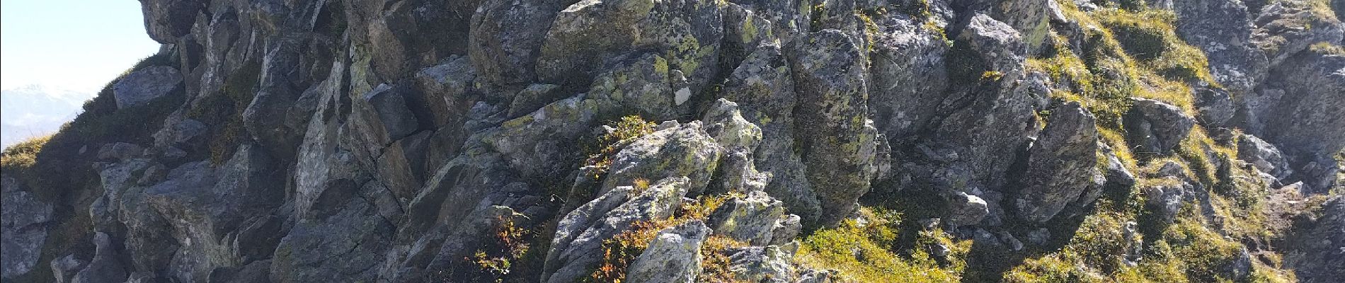
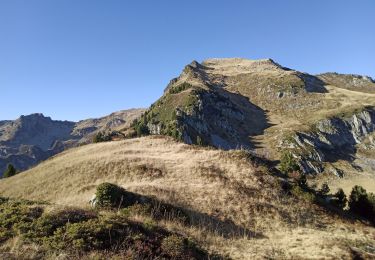
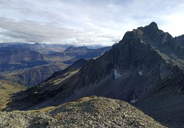
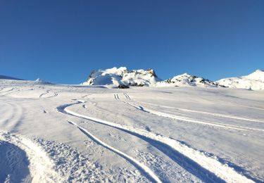
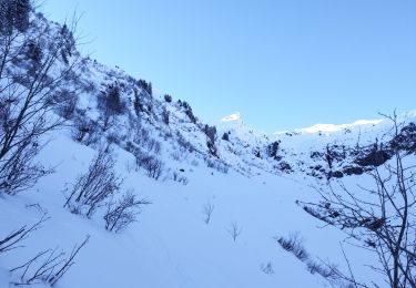
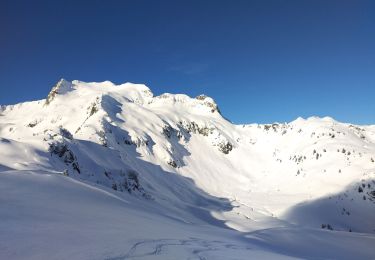
Attention cette randonnée est hors sentiers et aérienne.
La descente sous la pointe de Freydon est difficile. Un piolet peut être utile.
On peut poursuivre l'arête mais j'étais seule ce jour donc je n'ai pas tenté car il y a 2 passages alpins.
Le départ s'est fait d'un bivouac.
Localización
Comentarios
Excursiones cerca
![Excursión Esquí de fondo La Léchère - grand pic - Photo](https://media.geolcdn.com/t/375/260/9cfac439-c6a9-45dc-854a-66e0fdb870fb.jpg&format=jpg&maxdim=2)
![Esquí de fondo Esquí de fondo](https://static1.geolcdn.com/sitytour/trail-icons/503.png)
Esquí de fondo
![](/images/other/stat-length.png)
![](https://static1.geolcdn.com/siteimages/upload/files/16400158638029165_repeat_loop_refresh_sync_direction_icon.png)
![Excursión Senderismo La Léchère - pte de Glais rouge, des Arangles et Roche brisée - Photo](https://media.geolcdn.com/t/375/260/1baaaa90-37a8-4237-b92e-53be672474e7.jpg&format=jpg&maxdim=2)
![Senderismo Senderismo](https://static1.geolcdn.com/sitytour/trail-icons/101.png)
Senderismo
![](/images/other/stat-length.png)
![](https://static1.geolcdn.com/siteimages/upload/files/16400158638029165_repeat_loop_refresh_sync_direction_icon.png)
![Excursión Senderismo Montsapey - Lac Clartan et plus - Photo](https://media.geolcdn.com/t/375/260/a3945484-2742-42e9-b6c0-fb5c4b25df2b.jpg&format=jpg&maxdim=2)
![Senderismo Senderismo](https://static1.geolcdn.com/sitytour/trail-icons/101.png)
Senderismo
![](/images/other/stat-length.png)
![](https://static1.geolcdn.com/siteimages/upload/files/16400158638029165_repeat_loop_refresh_sync_direction_icon.png)
![Excursión Esquí de fondo La Léchère - Aiguille de la Balme - Photo](https://media.geolcdn.com/t/375/260/a3d2e41a-1caa-427e-9d80-b714bd5aac52.jpg&format=jpg&maxdim=2)
![Esquí de fondo Esquí de fondo](https://static1.geolcdn.com/sitytour/trail-icons/503.png)
Esquí de fondo
![](/images/other/stat-length.png)
![](https://static1.geolcdn.com/siteimages/upload/files/16400158638029165_repeat_loop_refresh_sync_direction_icon.png)
![Excursión Esquí de fondo La Léchère - tricotage vers Les Teurs. - Photo](https://media.geolcdn.com/t/375/260/00642df7-11bb-44cc-a75b-471b0d819f21.jpg&format=jpg&maxdim=2)
![Esquí de fondo Esquí de fondo](https://static1.geolcdn.com/sitytour/trail-icons/503.png)
Esquí de fondo
![](/images/other/stat-length.png)
![](https://static1.geolcdn.com/siteimages/upload/files/16400158638029165_repeat_loop_refresh_sync_direction_icon.png)
![Excursión Esquí de fondo La Léchère - Les marmottes noires - Photo](https://media.geolcdn.com/t/375/260/b231a722-c719-4ca9-8520-60ac6ec172da.jpg&format=jpg&maxdim=2)
![Esquí de fondo Esquí de fondo](https://static1.geolcdn.com/sitytour/trail-icons/503.png)
Esquí de fondo
![](/images/other/stat-length.png)
![](https://static1.geolcdn.com/siteimages/upload/files/16400158638029165_repeat_loop_refresh_sync_direction_icon.png)
![Excursión Esquí de fondo La Léchère - le. chalet de Colomban - Photo](https://media.geolcdn.com/t/375/260/8594f6fb-22c5-4295-85ac-3463a33ec2ed.jpg&format=jpg&maxdim=2)
![Esquí de fondo Esquí de fondo](https://static1.geolcdn.com/sitytour/trail-icons/503.png)
Esquí de fondo
![](/images/other/stat-length.png)
![](https://static1.geolcdn.com/siteimages/upload/files/16400158638029165_repeat_loop_refresh_sync_direction_icon.png)
![Excursión Senderismo La Léchère - les marmottes noires et Bellacha - Photo](https://media.geolcdn.com/t/375/260/2e4efe3f-cf03-4e44-8f86-163d48b8b315.jpg&format=jpg&maxdim=2)
![Senderismo Senderismo](https://static1.geolcdn.com/sitytour/trail-icons/101.png)
Senderismo
![](/images/other/stat-length.png)
![](https://static1.geolcdn.com/siteimages/upload/files/16400158638029165_repeat_loop_refresh_sync_direction_icon.png)
![Excursión Esquí de fondo Montsapey - Combe bronsin collu au Nord 2400 - Photo](https://media.geolcdn.com/t/375/260/075f145a-4ea4-41d5-a1b1-7236cce549f1.jpg&format=jpg&maxdim=2)
![Esquí de fondo Esquí de fondo](https://static1.geolcdn.com/sitytour/trail-icons/503.png)
Esquí de fondo
![](/images/other/stat-length.png)
![](https://static1.geolcdn.com/siteimages/upload/files/16400158638029165_repeat_loop_refresh_sync_direction_icon.png)