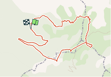
![](/images/other/stat-length.png)
![Excursión Senderismo Saint-Julien-en-Beauchêne - tour des 4 cols - Photo](https://media.geolcdn.com/t/1900/400/8527f1e3-99e4-45a7-995d-0319f3af7da7.jpg&format=pjpeg&maxdim=2)
tour des 4 cols
GuyVachet
Usuario
![Longitud](/images/other/stat-length.png)
![Altitud máxima](https://static1.geolcdn.com/siteimages/upload/files/1508320355ic_sort_altitude_max_24dp.png)
![Desnivel positivo](https://static1.geolcdn.com/siteimages/upload/files/1508320355ic_sort_den_pos_24dp.png)
![Km-Effort](/images/other/stat-length.png)
![Altitud mínima](https://static1.geolcdn.com/siteimages/upload/files/1508320355ic_sort_altitude_min_24dp.png)
![Desnivel negativo](https://static1.geolcdn.com/siteimages/upload/files/1508320355ic_sort_den_neg_24dp.png)
![Boucle](https://static1.geolcdn.com/siteimages/upload/files/16400158638029165_repeat_loop_refresh_sync_direction_icon.png)
![Senderismo](https://static1.geolcdn.com/sitytour/trail-icons/101.png)
5h25
Dificultad : Muy difícil
![Escanee este código QR para abrir la excursión en la aplicación SityTrail](https://capi.geolives.com/qq0zvz2zws4bq2lad0pu/sitytour/trails/3795776/qr.png?size=200)
Aplicación GPS de excursión GRATIS
A propósito
Ruta Senderismo de 13,2 km a descubrir en Provenza-Alpes-Costa Azul, Altos Alpes, Saint-Julien-en-Beauchêne. Esta ruta ha sido propuesta por GuyVachet.
Descripción
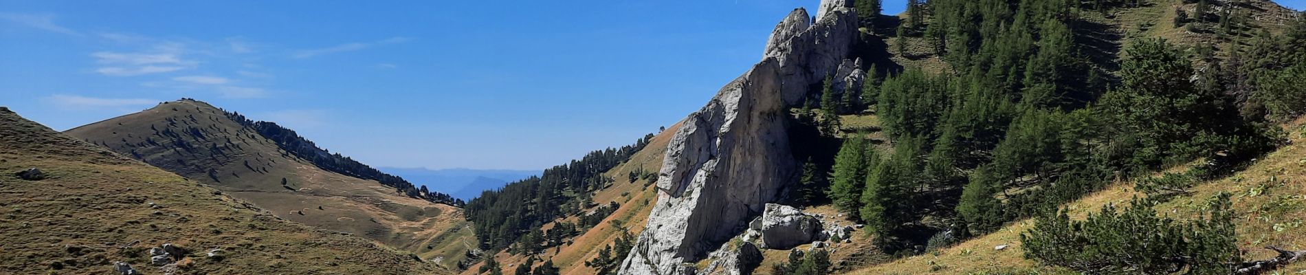
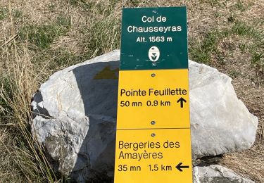
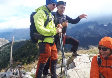
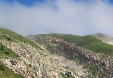
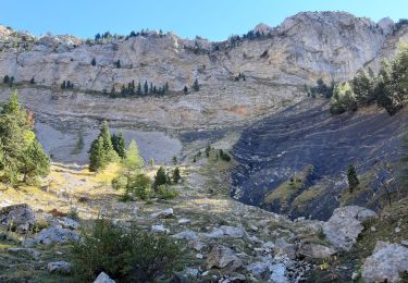
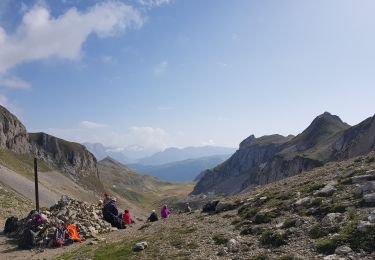
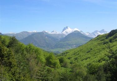
Belle boucle parcourant 4 cols : Plate Contier, Lauteret (avec une petite extension à la Tête du Rif de Lauze pour le fun), Vallon de Laup et des Tours. Entre forêt de mélèzes et vallons, ce circuit offre de beaux points de vues sur la Tête de Garnesier, et celles des Ormans et sur la Tour Carrée au retour
Localización
Comentarios
Excursiones cerca
![Excursión Senderismo Saint-Julien-en-Beauchêne - Chamousset - Photo](https://media.geolcdn.com/t/375/260/3de74403-25a3-49ab-9973-c51b370cf75f.jpg&format=jpg&maxdim=2)
![Senderismo Senderismo](https://static1.geolcdn.com/sitytour/trail-icons/101.png)
Senderismo
![](/images/other/stat-length.png)
![](https://static1.geolcdn.com/siteimages/upload/files/16400158638029165_repeat_loop_refresh_sync_direction_icon.png)
![Excursión Senderismo Lus-la-Croix-Haute - R38 Col des Aiguilles depuis Lus - Photo](https://media.geolcdn.com/t/375/260/ext.jpg?maxdim=2&url=https%3A%2F%2Fservices.sitytrail.com%2FGeolivesWS%2FDownloadMedia.ashx%3FTrailID%3D890897%26Media%3D48008b69-5aeb-41cb-8dd0-25fe44b6160d.jpg)
![Senderismo Senderismo](https://static1.geolcdn.com/sitytour/trail-icons/101.png)
Senderismo
![](/images/other/stat-length.png)
![](https://static1.geolcdn.com/siteimages/upload/files/16400158638029165_repeat_loop_refresh_sync_direction_icon.png)
![Excursión Senderismo Lus-la-Croix-Haute - MAS REBUFAT - POINTE FEUILLETTE - Photo](https://media.geolcdn.com/t/375/260/be45961d-bf40-4ff8-a175-81f334e503f2.jpg&format=jpg&maxdim=2)
![Senderismo Senderismo](https://static1.geolcdn.com/sitytour/trail-icons/101.png)
Senderismo
![](/images/other/stat-length.png)
![](https://static1.geolcdn.com/siteimages/upload/files/16400158638029165_repeat_loop_refresh_sync_direction_icon.png)
![Excursión Senderismo Lus-la-Croix-Haute - Pic de l'Aigle en circuit - Photo](https://media.geolcdn.com/t/375/260/fb19d13d-3ab9-48a3-a5da-9be1a34f7b83.jpg&format=jpg&maxdim=2)
![Senderismo Senderismo](https://static1.geolcdn.com/sitytour/trail-icons/101.png)
Senderismo
![](/images/other/stat-length.png)
![](https://static1.geolcdn.com/siteimages/upload/files/16400158638029165_repeat_loop_refresh_sync_direction_icon.png)
![Excursión Senderismo Saint-Julien-en-Beauchêne - Chamousset (Lus-La-Croix-Haute) - Photo](https://media.geolcdn.com/t/375/260/966b2179-144e-432e-8e8e-7af282119d0a.jpg&format=jpg&maxdim=2)
![Senderismo Senderismo](https://static1.geolcdn.com/sitytour/trail-icons/101.png)
Senderismo
![](/images/other/stat-length.png)
![](https://static1.geolcdn.com/siteimages/upload/files/16400158638029165_repeat_loop_refresh_sync_direction_icon.png)
![Excursión Senderismo Saint-Julien-en-Beauchêne - les 4 cols - Photo](https://media.geolcdn.com/t/375/260/e39c8686-8c1b-4b9f-afed-0d27c8d037de.jpg&format=jpg&maxdim=2)
![Senderismo Senderismo](https://static1.geolcdn.com/sitytour/trail-icons/101.png)
Senderismo
![](/images/other/stat-length.png)
![](https://static1.geolcdn.com/siteimages/upload/files/16400158638029165_repeat_loop_refresh_sync_direction_icon.png)
![Excursión Senderismo Lus-la-Croix-Haute - 26 jarjate cascade - Photo](https://media.geolcdn.com/t/375/260/ext.jpg?maxdim=2&url=https%3A%2F%2Fstatic1.geolcdn.com%2Fsiteimages%2Fupload%2Ffiles%2F1553511878bg_sport_marche.png)
![Senderismo Senderismo](https://static1.geolcdn.com/sitytour/trail-icons/101.png)
Senderismo
![](/images/other/stat-length.png)
![](https://static1.geolcdn.com/siteimages/upload/files/16400158638029165_repeat_loop_refresh_sync_direction_icon.png)
![Excursión Senderismo Lus-la-Croix-Haute - L Aiguille ou Le Haut Bouffet - Photo](https://media.geolcdn.com/t/375/260/22e6541b-4331-4f68-8875-cb0ffa9f2b0d.jpg&format=jpg&maxdim=2)
![Senderismo Senderismo](https://static1.geolcdn.com/sitytour/trail-icons/101.png)
Senderismo
![](/images/other/stat-length.png)
![](https://static1.geolcdn.com/siteimages/upload/files/16400158638029165_repeat_loop_refresh_sync_direction_icon.png)
![Excursión Senderismo Lus-la-Croix-Haute - Tour du Dévoluy - de La Jarjatte à Vaunières - Photo](https://media.geolcdn.com/t/375/260/ext.jpg?maxdim=2&url=https%3A%2F%2Fservices.sitytrail.com%2FGeolivesWS%2FDownloadMedia.ashx%3FTrailID%3D105031%26Media%3D8591_6.jpg)
![Senderismo Senderismo](https://static1.geolcdn.com/sitytour/trail-icons/101.png)
Senderismo
![](/images/other/stat-length.png)
![](https://static1.geolcdn.com/siteimages/upload/files/16400158638029165_repeat_loop_refresh_sync_direction_icon.png)