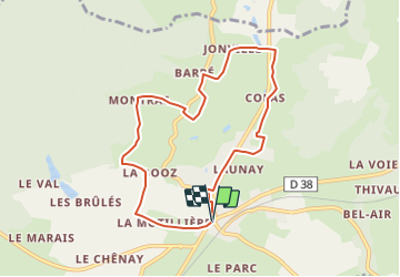
![](/images/other/stat-length.png)
![Excursión Senderismo Bretoncelles - BRETONCELLES ET SES HAMEAUX - Photo](https://media.geolcdn.com/t/1900/400/1ac05758-9066-478d-9efc-58a133a29698.jpg&format=pjpeg&maxdim=2)
BRETONCELLES ET SES HAMEAUX
jeannine grandjean
Usuario
![Longitud](/images/other/stat-length.png)
![Altitud máxima](https://static1.geolcdn.com/siteimages/upload/files/1508320355ic_sort_altitude_max_24dp.png)
![Desnivel positivo](https://static1.geolcdn.com/siteimages/upload/files/1508320355ic_sort_den_pos_24dp.png)
![Km-Effort](/images/other/stat-length.png)
![Altitud mínima](https://static1.geolcdn.com/siteimages/upload/files/1508320355ic_sort_altitude_min_24dp.png)
![Desnivel negativo](https://static1.geolcdn.com/siteimages/upload/files/1508320355ic_sort_den_neg_24dp.png)
![Boucle](https://static1.geolcdn.com/siteimages/upload/files/16400158638029165_repeat_loop_refresh_sync_direction_icon.png)
![Senderismo](https://static1.geolcdn.com/sitytour/trail-icons/101.png)
2h05
Dificultad : Medio
![Escanee este código QR para abrir la excursión en la aplicación SityTrail](https://capi.geolives.com/qq0zvz2zws4bq2lad0pu/sitytour/trails/3779821/qr.png?size=200)
Aplicación GPS de excursión GRATIS
A propósito
Ruta Senderismo de 7,6 km a descubrir en Normandía, Orne, Bretoncelles. Esta ruta ha sido propuesta por jeannine grandjean.
Descripción
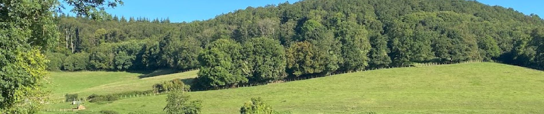
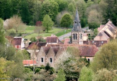
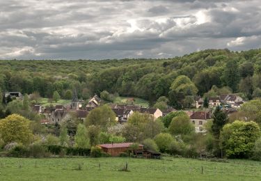
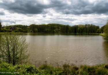
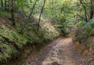
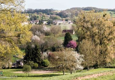
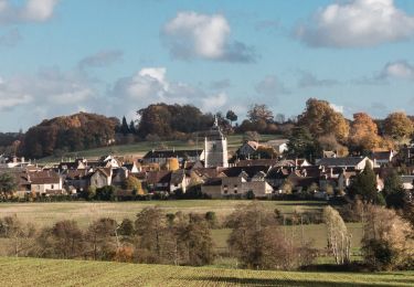
superbe itinéraire pour découvrir la campagne vallonnée du PERCHE sur des sentiers parfaitement balisés et très bien entretenus ; belle diversité de paysages : pairies, bois, ruisseaux et nombreux hameaux aux anciennes bâtisses pittoresques superbement restaurées ; de très jolis panoramas sur la vallée de la Corbionne.
Localización
Comentarios
Excursiones cerca
![Excursión Senderismo La Madeleine-Bouvet - Les belles vues de Saint-Laumer et de la Madeleine Variante 10 Km - Photo](https://media.geolcdn.com/t/375/260/87362449-0ee3-40df-8df0-c17fd7220994.jpg&format=jpg&maxdim=2)
![Senderismo Senderismo](https://static1.geolcdn.com/sitytour/trail-icons/101.png)
Senderismo
![](/images/other/stat-length.png)
![](https://static1.geolcdn.com/siteimages/upload/files/16400158638029165_repeat_loop_refresh_sync_direction_icon.png)
![Excursión Senderismo La Madeleine-Bouvet - Les belles vues de Saint-Laumer et de la Madeleine 11 Km - Photo](https://media.geolcdn.com/t/375/260/3ee85883-b7ae-45a3-90c4-8bb6a4479600.jpg&format=jpg&maxdim=2)
![Senderismo Senderismo](https://static1.geolcdn.com/sitytour/trail-icons/101.png)
Senderismo
![](/images/other/stat-length.png)
![](https://static1.geolcdn.com/siteimages/upload/files/16400158638029165_repeat_loop_refresh_sync_direction_icon.png)
![Excursión Senderismo La Madeleine-Bouvet - Bretoncelles - La Madeleine-Bouvet 5,3 km - Photo](https://media.geolcdn.com/t/375/260/573e294c-51f9-41fe-8907-e8f30e9f4bad.jpg&format=jpg&maxdim=2)
![Senderismo Senderismo](https://static1.geolcdn.com/sitytour/trail-icons/101.png)
Senderismo
![](/images/other/stat-length.png)
![](https://static1.geolcdn.com/siteimages/upload/files/16400158638029165_repeat_loop_refresh_sync_direction_icon.png)
![Excursión Senderismo Bretoncelles - SityTrail - Les Douves du Grand Cumont Bretoncelles V2 15 Km - Photo](https://media.geolcdn.com/t/375/260/d3f7aac7-ac8c-46dc-96d3-852253cb1421.jpg&format=jpg&maxdim=2)
![Senderismo Senderismo](https://static1.geolcdn.com/sitytour/trail-icons/101.png)
Senderismo
![](/images/other/stat-length.png)
![](https://static1.geolcdn.com/siteimages/upload/files/16400158638029165_repeat_loop_refresh_sync_direction_icon.png)
![Excursión Senderismo Bretoncelles - SityTrail - Le Petit Houx du Parc - Bretoncelles 5,1 Km - Photo](https://media.geolcdn.com/t/375/260/7bdb7e04-5754-4fe7-8144-30a332f42ad5.jpg&format=jpg&maxdim=2)
![Senderismo Senderismo](https://static1.geolcdn.com/sitytour/trail-icons/101.png)
Senderismo
![](/images/other/stat-length.png)
![](https://static1.geolcdn.com/siteimages/upload/files/16400158638029165_repeat_loop_refresh_sync_direction_icon.png)
![Excursión Senderismo Bretoncelles - SityTrail - La boucle des Trois Moulins Bretoncelles 27,0 Km - Photo](https://media.geolcdn.com/t/375/260/5529bff9-ebf0-4b36-a1dd-763157d3177d.jpg&format=jpg&maxdim=2)
![Senderismo Senderismo](https://static1.geolcdn.com/sitytour/trail-icons/101.png)
Senderismo
![](/images/other/stat-length.png)
![](https://static1.geolcdn.com/siteimages/upload/files/16400158638029165_repeat_loop_refresh_sync_direction_icon.png)
![Excursión Senderismo Bretoncelles - SityTrail - La butte du château Bretoncelles 15,0 Km - Photo](https://media.geolcdn.com/t/375/260/8a4df6ff-d1ea-4423-a025-4761f0dd639a.jpg&format=jpg&maxdim=2)
![Senderismo Senderismo](https://static1.geolcdn.com/sitytour/trail-icons/101.png)
Senderismo
![](/images/other/stat-length.png)
![](https://static1.geolcdn.com/siteimages/upload/files/16400158638029165_repeat_loop_refresh_sync_direction_icon.png)
![Excursión Senderismo Bretoncelles - SityTrail - Les ponts de la Corbionne Bretoncelles 7,7 Km - Photo](https://media.geolcdn.com/t/375/260/410ed619-cc75-498e-a27f-9446ae3b62c0.jpg&format=jpg&maxdim=2)
![Senderismo Senderismo](https://static1.geolcdn.com/sitytour/trail-icons/101.png)
Senderismo
![](/images/other/stat-length.png)
![](https://static1.geolcdn.com/siteimages/upload/files/16400158638029165_repeat_loop_refresh_sync_direction_icon.png)
![Excursión Senderismo Bretoncelles - SityTrail - Les chaudrons de la Dourdannerie Bretoncelles 7,8 Km - Photo](https://media.geolcdn.com/t/375/260/33832808-3ade-47a2-83e4-74d2c6faf2b7.jpg&format=jpg&maxdim=2)
![Senderismo Senderismo](https://static1.geolcdn.com/sitytour/trail-icons/101.png)
Senderismo
![](/images/other/stat-length.png)
![](https://static1.geolcdn.com/siteimages/upload/files/16400158638029165_repeat_loop_refresh_sync_direction_icon.png)