![](/images/other/stat-length.png)
![Excursión Senderismo Randa - La Haute Route : J11 - Photo](https://media.geolcdn.com/t/1900/400/ca2b9245-3c92-4c39-abdf-4dbc47e8067d.jpg&format=pjpeg&maxdim=2)
La Haute Route : J11
Greg813
Usuario
![Longitud](/images/other/stat-length.png)
Longitud
18,8 km
![Altitud máxima](https://static1.geolcdn.com/siteimages/upload/files/1508320355ic_sort_altitude_max_24dp.png)
Altitud máxima
2372 m
![Desnivel positivo](https://static1.geolcdn.com/siteimages/upload/files/1508320355ic_sort_den_pos_24dp.png)
Desnivel positivo
964 m
![Km-Effort](/images/other/stat-length.png)
Km-Effort
34 km
![Altitud mínima](https://static1.geolcdn.com/siteimages/upload/files/1508320355ic_sort_altitude_min_24dp.png)
Altitud mínima
1598 m
![Desnivel negativo](https://static1.geolcdn.com/siteimages/upload/files/1508320355ic_sort_den_neg_24dp.png)
Desnivel negativo
1622 m
![Boucle](https://static1.geolcdn.com/siteimages/upload/files/16400158638029165_repeat_loop_refresh_sync_direction_icon.png)
Boucle
No
Fecha de creación :
2023-08-17 06:01:44.132
Última modificación :
2024-09-15 07:25:10.778
![Senderismo](https://static1.geolcdn.com/sitytour/trail-icons/101.png)
5h07
Dificultad : Difícil
![Escanee este código QR para abrir la excursión en la aplicación SityTrail](https://capi.geolives.com/qq0zvz2zws4bq2lad0pu/sitytour/trails/3775060/qr.png?size=200)
Aplicación GPS de excursión GRATIS
A propósito
Ruta Senderismo de 18,8 km a descubrir en Vallés, Visp, Randa. Esta ruta ha sido propuesta por Greg813.
Descripción
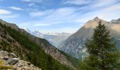
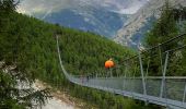
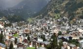
Trek de 10 jours dans le Valais suisse avec Mettons le Monde en Marche. Parcours de la Haute Route Chamonix-Zermatt avec nuits en refuge.
Etape 10 : Europahutte - Zermatt
Pour d'autres photos, voir le site de l'association :
https://mmm-rando.org/la-presque-haute-route-chable-zermatt/
Localización
País:
Switzerland
Región :
Vallés
Departamento/provincia :
Visp
Municipio :
Randa
Localidad:
Unknown
Salida:(Dec)
Salida:(UTM)
407722 ; 5106487 (32T) N.
Comentarios
Excursiones cerca
![Excursión Senderismo Randa - CHX ZRMT Étape 10 de Rwanda à Zermatt - Photo](https://media.geolcdn.com/t/375/260/ext.jpg?maxdim=2&url=https%3A%2F%2Fservices.sitytrail.com%2FGeolivesWS%2FDownloadMedia.ashx%3FTrailID%3D635939%26Media%3Dfix__20160922142019.jpg)
![Senderismo Senderismo](https://static1.geolcdn.com/sitytour/trail-icons/101.png)
CHX ZRMT Étape 10 de Rwanda à Zermatt
Senderismo
Medio
Randa,
Vallés,
Visp,
Switzerland
![](/images/other/stat-length.png)
18,5 km | 37 km-effort
6h 9min
![](https://static1.geolcdn.com/siteimages/upload/files/16400158638029165_repeat_loop_refresh_sync_direction_icon.png)
No
![Excursión Senderismo Randa - st_ny0915 - Photo](https://media.geolcdn.com/t/375/260/ext.jpg?maxdim=2&url=https%3A%2F%2Fstatic1.geolcdn.com%2Fsiteimages%2Fupload%2Ffiles%2F1553511878bg_sport_marche.png)
![Senderismo Senderismo](https://static1.geolcdn.com/sitytour/trail-icons/101.png)
![Excursión Senderismo Randa - randa - Photo](https://media.geolcdn.com/t/375/260/ext.jpg?maxdim=2&url=https%3A%2F%2Fstatic1.geolcdn.com%2Fsiteimages%2Fupload%2Ffiles%2F1553511878bg_sport_marche.png)
![Senderismo Senderismo](https://static1.geolcdn.com/sitytour/trail-icons/101.png)
![Excursión Otra actividad Randa - Dom - Photo](https://media.geolcdn.com/t/375/260/ext.jpg?maxdim=2&url=https%3A%2F%2Fstatic1.geolcdn.com%2Fsiteimages%2Fupload%2Ffiles%2F1545311037marcheuse_200dpi.jpg)
![Otra actividad Otra actividad](https://static1.geolcdn.com/sitytour/trail-icons/900.png)
![Excursión sport Täsch - 2024-09-03_14h09m17_t8979743_arigscheis (nr. 41) - Photo](https://media.geolcdn.com/t/375/260/ext.jpg?maxdim=2&url=https%3A%2F%2Fsecurestorage.geolives.com%2Fsitytour%2Ftrail-bg%2Fdefault.jpg)
2024-09-03_14h09m17_t8979743_arigscheis (nr. 41)
sport
Muy fácil
Täsch,
Vallés,
Visp,
Switzerland
![](/images/other/stat-length.png)
9,4 km | 21 km-effort
Desconocido
![](https://static1.geolcdn.com/siteimages/upload/files/16400158638029165_repeat_loop_refresh_sync_direction_icon.png)
Sí
![Excursión Senderismo Randa - Randa - Pont suspendu Charles Kuonen - Photo](https://media.geolcdn.com/t/375/260/ext.jpg?maxdim=2&url=https%3A%2F%2Fstatic1.geolcdn.com%2Fsiteimages%2Fupload%2Ffiles%2F1553511878bg_sport_marche.png)
![Senderismo Senderismo](https://static1.geolcdn.com/sitytour/trail-icons/101.png)
Randa - Pont suspendu Charles Kuonen
Senderismo
Difícil
Randa,
Vallés,
Visp,
Switzerland
![](/images/other/stat-length.png)
8,4 km | 19,2 km-effort
5h 21min
![](https://static1.geolcdn.com/siteimages/upload/files/16400158638029165_repeat_loop_refresh_sync_direction_icon.png)
Sí
![Excursión Senderismo Randa - Zermatt - stelisee sans télécabines - Photo](https://media.geolcdn.com/t/375/260/ext.jpg?maxdim=2&url=https%3A%2F%2Fstatic1.geolcdn.com%2Fsiteimages%2Fupload%2Ffiles%2F1553511878bg_sport_marche.png)
![Senderismo Senderismo](https://static1.geolcdn.com/sitytour/trail-icons/101.png)
Zermatt - stelisee sans télécabines
Senderismo
Muy difícil
Randa,
Vallés,
Visp,
Switzerland
![](/images/other/stat-length.png)
28 km | 46 km-effort
10h 31min
![](https://static1.geolcdn.com/siteimages/upload/files/16400158638029165_repeat_loop_refresh_sync_direction_icon.png)
Sí
![Excursión Senderismo Randa - Pont Suspendu Randa - Photo](https://media.geolcdn.com/t/375/260/ext.jpg?maxdim=2&url=https%3A%2F%2Fstatic1.geolcdn.com%2Fsiteimages%2Fupload%2Ffiles%2F1553511878bg_sport_marche.png)
![Senderismo Senderismo](https://static1.geolcdn.com/sitytour/trail-icons/101.png)
Pont Suspendu Randa
Senderismo
Muy difícil
Randa,
Vallés,
Visp,
Switzerland
![](/images/other/stat-length.png)
9,1 km | 23 km-effort
5h 8min
![](https://static1.geolcdn.com/siteimages/upload/files/16400158638029165_repeat_loop_refresh_sync_direction_icon.png)
No