![](/images/other/stat-length.png)
![Excursión Senderismo Entrevaux - Circuit de la Citadelle d'Entrevaux - Photo](https://media.geolcdn.com/t/1900/400/ext.pjpeg?maxdim=2&url=https%3A%2F%2Fstatic1.geolcdn.com%2Fsiteimages%2Fupload%2Ffiles%2F1553511878bg_sport_marche.png)
Circuit de la Citadelle d'Entrevaux
santaflor
Usuario
![Longitud](/images/other/stat-length.png)
![Altitud máxima](https://static1.geolcdn.com/siteimages/upload/files/1508320355ic_sort_altitude_max_24dp.png)
![Desnivel positivo](https://static1.geolcdn.com/siteimages/upload/files/1508320355ic_sort_den_pos_24dp.png)
![Km-Effort](/images/other/stat-length.png)
![Altitud mínima](https://static1.geolcdn.com/siteimages/upload/files/1508320355ic_sort_altitude_min_24dp.png)
![Desnivel negativo](https://static1.geolcdn.com/siteimages/upload/files/1508320355ic_sort_den_neg_24dp.png)
![Boucle](https://static1.geolcdn.com/siteimages/upload/files/16400158638029165_repeat_loop_refresh_sync_direction_icon.png)
![Senderismo](https://static1.geolcdn.com/sitytour/trail-icons/101.png)
2h51
Dificultad : Difícil
![Escanee este código QR para abrir la excursión en la aplicación SityTrail](https://capi.geolives.com/qq0zvz2zws4bq2lad0pu/sitytour/trails/3774379/qr.png?size=200)
Aplicación GPS de excursión GRATIS
A propósito
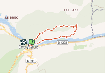
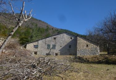
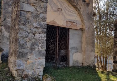
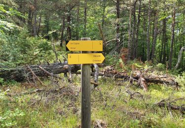
Ruta Senderismo de 7 km a descubrir en Provenza-Alpes-Costa Azul, Alpes de Alta Provenza, Entrevaux. Esta ruta ha sido propuesta por santaflor.
Descripción
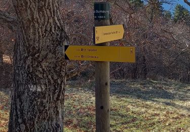
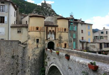
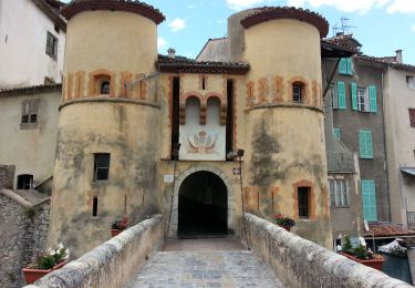
Aprés la montée de la Porte Royale ,prendre par la droite le Chemin des Oliviers
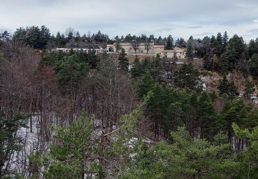
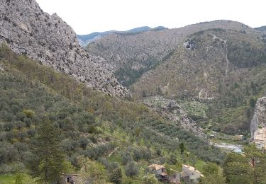
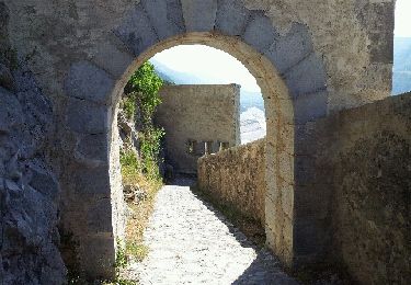
qui longe le fleuve.Remonter en direction du lieu-dit Les Lacs.A l'intersection,partir sur la gauche jusqu'à la citadelle,d'où la vue panoramique sur la vallée est magnifique.Puis redescendre vers le village médiéval .Visite de la Citadelle et du village .
Localización
Comentarios
Excursiones cerca
![Excursión Senderismo Entrevaux - Rando Le PlanPontStJoseph - Photo](https://media.geolcdn.com/t/375/260/20344992-8936-4126-a262-4bc193c84e38.jpg&format=jpg&maxdim=2)
![Senderismo Senderismo](https://static1.geolcdn.com/sitytour/trail-icons/101.png)
Senderismo
![](/images/other/stat-length.png)
![](https://static1.geolcdn.com/siteimages/upload/files/16400158638029165_repeat_loop_refresh_sync_direction_icon.png)
![Excursión Senderismo Entrevaux - Bas-Agnerc Le Pelau - Photo](https://media.geolcdn.com/t/375/260/b41cf4e2-6f50-4f00-856c-4750147829e0.jpg&format=jpg&maxdim=2)
![Senderismo Senderismo](https://static1.geolcdn.com/sitytour/trail-icons/101.png)
Senderismo
![](/images/other/stat-length.png)
![](https://static1.geolcdn.com/siteimages/upload/files/16400158638029165_repeat_loop_refresh_sync_direction_icon.png)
![Excursión Senderismo Entrevaux - Bay - Photo](https://media.geolcdn.com/t/375/260/4fd33f3d-23b3-4c81-82fe-d21dbf8d640f.jpg&format=jpg&maxdim=2)
![Senderismo Senderismo](https://static1.geolcdn.com/sitytour/trail-icons/101.png)
Senderismo
![](/images/other/stat-length.png)
![](https://static1.geolcdn.com/siteimages/upload/files/16400158638029165_repeat_loop_refresh_sync_direction_icon.png)
![Senderismo Senderismo](https://static1.geolcdn.com/sitytour/trail-icons/101.png)
Senderismo
![](/images/other/stat-length.png)
![](https://static1.geolcdn.com/siteimages/upload/files/16400158638029165_repeat_loop_refresh_sync_direction_icon.png)
![Excursión Senderismo Entrevaux - Entrevaux - vers Le Brec 2 - AR - 2016 06 18 - Photo](https://media.geolcdn.com/t/375/260/ext.jpg?maxdim=2&url=https%3A%2F%2Fservices.sitytrail.com%2FGeolivesWS%2FDownloadMedia.ashx%3FTrailID%3D595474%26Media%3Dfix__20160618131210.jpg)
![Senderismo Senderismo](https://static1.geolcdn.com/sitytour/trail-icons/101.png)
Senderismo
![](/images/other/stat-length.png)
![](https://static1.geolcdn.com/siteimages/upload/files/16400158638029165_repeat_loop_refresh_sync_direction_icon.png)
![Excursión Senderismo Entrevaux - Entrevaux - 2016 06 16 - Photo](https://media.geolcdn.com/t/375/260/5bf76320-9c47-4bb3-9e5f-1a576855cda4.jpg&format=jpg&maxdim=2)
![Senderismo Senderismo](https://static1.geolcdn.com/sitytour/trail-icons/101.png)
Senderismo
![](/images/other/stat-length.png)
![](https://static1.geolcdn.com/siteimages/upload/files/16400158638029165_repeat_loop_refresh_sync_direction_icon.png)
![Excursión Senderismo Entrevaux - le coins - Photo](https://media.geolcdn.com/t/375/260/ext.jpg?maxdim=2&url=https%3A%2F%2Fservices.sitytrail.com%2FGeolivesWS%2FDownloadMedia.ashx%3FTrailID%3D137198%26Media%3D20120703103159.jpeg)
![Senderismo Senderismo](https://static1.geolcdn.com/sitytour/trail-icons/101.png)
Senderismo
![](/images/other/stat-length.png)
![](https://static1.geolcdn.com/siteimages/upload/files/16400158638029165_repeat_loop_refresh_sync_direction_icon.png)
![Excursión Senderismo Entrevaux - Chapelle St-Pierre Bas Sumaure - Photo](https://media.geolcdn.com/t/375/260/ed361a4c-5098-4d6f-9ee7-5e85f3748d6b.jpg&format=jpg&maxdim=2)
![Senderismo Senderismo](https://static1.geolcdn.com/sitytour/trail-icons/101.png)
Senderismo
![](/images/other/stat-length.png)
![](https://static1.geolcdn.com/siteimages/upload/files/16400158638029165_repeat_loop_refresh_sync_direction_icon.png)
![Excursión Senderismo Val-de-Chalvagne - Val de Chalvagne - Photo](https://media.geolcdn.com/t/375/260/01463d89-d5df-4ec6-bd05-edcd75259644.jpg&format=jpg&maxdim=2)
![Senderismo Senderismo](https://static1.geolcdn.com/sitytour/trail-icons/101.png)
Senderismo
![](/images/other/stat-length.png)
![](https://static1.geolcdn.com/siteimages/upload/files/16400158638029165_repeat_loop_refresh_sync_direction_icon.png)