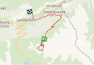
![](/images/other/stat-length.png)
![Excursión Senderismo Val-Cenis - Col de la Met et Lac de l'Arcelle au départ du télésiège de Solert - Photo](https://media.geolcdn.com/t/1900/400/fc51f4c9-cabd-4b7a-83d2-604413b6e3fa.jpg&format=pjpeg&maxdim=2)
Col de la Met et Lac de l'Arcelle au départ du télésiège de Solert
lpratz
Usuario
![Longitud](/images/other/stat-length.png)
![Altitud máxima](https://static1.geolcdn.com/siteimages/upload/files/1508320355ic_sort_altitude_max_24dp.png)
![Desnivel positivo](https://static1.geolcdn.com/siteimages/upload/files/1508320355ic_sort_den_pos_24dp.png)
![Km-Effort](/images/other/stat-length.png)
![Altitud mínima](https://static1.geolcdn.com/siteimages/upload/files/1508320355ic_sort_altitude_min_24dp.png)
![Desnivel negativo](https://static1.geolcdn.com/siteimages/upload/files/1508320355ic_sort_den_neg_24dp.png)
![Boucle](https://static1.geolcdn.com/siteimages/upload/files/16400158638029165_repeat_loop_refresh_sync_direction_icon.png)
![Senderismo](https://static1.geolcdn.com/sitytour/trail-icons/101.png)
4h58
Dificultad : Difícil
![Escanee este código QR para abrir la excursión en la aplicación SityTrail](https://capi.geolives.com/qq0zvz2zws4bq2lad0pu/sitytour/trails/3770426/qr.png?size=200)
Aplicación GPS de excursión GRATIS
A propósito
Ruta Senderismo de 13,4 km a descubrir en Auvergne-Rhône-Alpes, Saboya, Val-Cenis. Esta ruta ha sido propuesta por lpratz.
Descripción
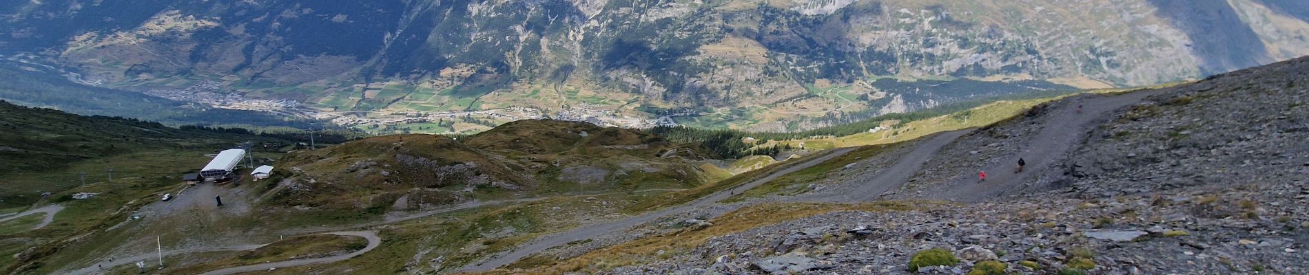
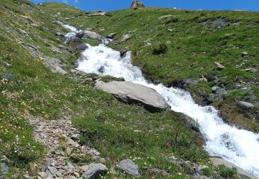
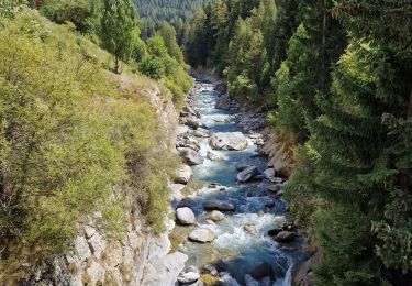
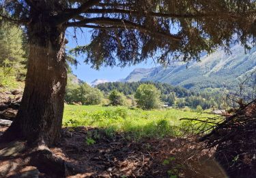
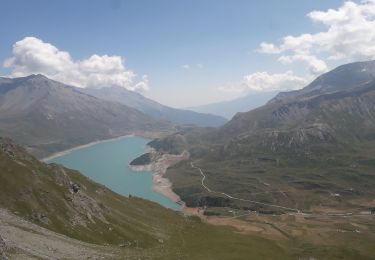
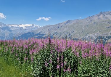
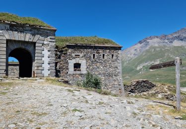
Pour ceux qui apprécient la descente, cette randonnée démarre après avoir pris la télécabine du vieux Moulin puis le télésiège du Solert (environ 7€ par personne). Montée au col de la Met pour admirer la vue coté lac du Mont Cenis, puis descente vers le lac de l'Arcelle (la partie haute est rocailleuse, puis s'améliore nettement après le télésiège de l'Arcelle). Le passage du Single est un peu technique mais se fait sans réelle difficulté.
Localización
Comentarios
Excursiones cerca
![Excursión Senderismo Val-Cenis - Le Collet - refuge de Vallombrun - la pierre aux pieds - Photo](https://media.geolcdn.com/t/375/260/f1c2cfa5-00f5-4e2e-8013-953500d02eea.jpg&format=jpg&maxdim=2)
![Senderismo Senderismo](https://static1.geolcdn.com/sitytour/trail-icons/101.png)
Senderismo
![](/images/other/stat-length.png)
![](https://static1.geolcdn.com/siteimages/upload/files/16400158638029165_repeat_loop_refresh_sync_direction_icon.png)
![Excursión sport Val-Cenis - L’ancien fort de la Turra - Photo](https://media.geolcdn.com/t/375/260/2f372af5-3d13-4f3d-be22-d2d73efaca61.jpg&format=jpg&maxdim=2)
sport
![](/images/other/stat-length.png)
![](https://static1.geolcdn.com/siteimages/upload/files/16400158638029165_repeat_loop_refresh_sync_direction_icon.png)
![Excursión Senderismo Val-Cenis - Montcenis lac fort de la Tura - Photo](https://media.geolcdn.com/t/375/260/03903eba-f11b-41f0-bc93-d99cacc6c53d.jpg&format=jpg&maxdim=2)
![Senderismo Senderismo](https://static1.geolcdn.com/sitytour/trail-icons/101.png)
Senderismo
![](/images/other/stat-length.png)
![](https://static1.geolcdn.com/siteimages/upload/files/16400158638029165_repeat_loop_refresh_sync_direction_icon.png)
![Excursión Senderismo Val-Cenis - La randonnée aux milles cascades - Photo](https://media.geolcdn.com/t/375/260/35052577-9dcd-467e-8718-4651b93ef3fb.jpg&format=jpg&maxdim=2)
![Senderismo Senderismo](https://static1.geolcdn.com/sitytour/trail-icons/101.png)
Senderismo
![](/images/other/stat-length.png)
![](https://static1.geolcdn.com/siteimages/upload/files/16400158638029165_repeat_loop_refresh_sync_direction_icon.png)
![Excursión Senderismo Val-Cenis - Le Fort de la Turra - Photo](https://media.geolcdn.com/t/375/260/fb7e4b15-499e-46a6-93e3-9848cd5c0804.jpg&format=jpg&maxdim=2)
![Senderismo Senderismo](https://static1.geolcdn.com/sitytour/trail-icons/101.png)
Senderismo
![](/images/other/stat-length.png)
![](https://static1.geolcdn.com/siteimages/upload/files/16400158638029165_repeat_loop_refresh_sync_direction_icon.png)
![Excursión Senderismo Val-Cenis - Les Corbaères - Photo](https://media.geolcdn.com/t/375/260/9162f738-609c-4472-a5d2-1cfa6bc710a0.jpg&format=jpg&maxdim=2)
![Senderismo Senderismo](https://static1.geolcdn.com/sitytour/trail-icons/101.png)
Senderismo
![](/images/other/stat-length.png)
![](https://static1.geolcdn.com/siteimages/upload/files/16400158638029165_repeat_loop_refresh_sync_direction_icon.png)
![Excursión Senderismo Val-Cenis - fort de la Turra - col de la Beccia - Photo](https://media.geolcdn.com/t/375/260/519bc2cf-9575-4c95-8b89-a32fb03a43b6.jpg&format=jpg&maxdim=2)
![Senderismo Senderismo](https://static1.geolcdn.com/sitytour/trail-icons/101.png)
Senderismo
![](/images/other/stat-length.png)
![](https://static1.geolcdn.com/siteimages/upload/files/16400158638029165_repeat_loop_refresh_sync_direction_icon.png)
![Excursión Senderismo Val-Cenis - Savoie_Val-Cenis_Lac de l'Arcelle - Photo](https://media.geolcdn.com/t/375/260/94347fc6-b8c5-42c0-a18f-2fed8afa226d.jpg&format=jpg&maxdim=2)
![Senderismo Senderismo](https://static1.geolcdn.com/sitytour/trail-icons/101.png)
Senderismo
![](/images/other/stat-length.png)
![](https://static1.geolcdn.com/siteimages/upload/files/16400158638029165_repeat_loop_refresh_sync_direction_icon.png)
![Excursión Senderismo Val-Cenis - Savoie_Barrage-du-Mont-Cenis=>Fort-de-Variselle - Photo](https://media.geolcdn.com/t/375/260/36826a87-c81d-464b-bf46-c61bb879976c.jpg&format=jpg&maxdim=2)
![Senderismo Senderismo](https://static1.geolcdn.com/sitytour/trail-icons/101.png)
Senderismo
![](/images/other/stat-length.png)
![](https://static1.geolcdn.com/siteimages/upload/files/16400158638029165_repeat_loop_refresh_sync_direction_icon.png)